In many ways, this Yorkshire Dales walk is a classic geology lesson, with a number of dramatic limestone features, including the forbidding Gordale Scar and hugely impressive Malham Cove.
In recent years, Malham Cove's fame has grown even more thanks to Harry Potter – the incredible limestone pavements that sit at the top of the valley were used as a filming location for one of the movies.
- Pennine Way: your ultimate guide to the trail
- Yorkshire Dales guide: things to do, places to stay and great walks
- The Yorkshire Dales’ prettiest villages to visit
Malham Cove walk
4.8 miles/7.7km | 3.5 hours | moderate | 195m ascent
1. Start
From the national park car park turn left and walk into the village, soon walking parallel with Malham Beck. Approaching The Forge on the right-hand side, turn right over Malham Beck on a small clapper bridge and then turn right to walk with Malham Beck on your right.
2. Janet’s Foss
Approaching a barn, turn left through a pair of kissing gates and follow a good path alongside a drystone wall on the left. Through another gate the path continues past a barn on the left and now with Gordale Beck on the right.
Continue into Wedber Wood and you soon reach the cascade of Janet’s Foss with its tufa lip where the water cascades over the waterfall.
Climb with the path to the left of the waterfall and the path levels out to run on to a gate onto a lane. Turn right to Gordale Bridge. There is sometimes a snack van here.
- Yorkshire Dales hotels: five heavenly stays
- Yorkshire Dales camping: five gorgeous campsites
- Yorkshire Dales cottages: five beautiful places to stay
3. Gordale Scar
The lane bends right. Take the first gate on the left and follow the good path alongside Gordale Beck into the wonder of Gordale Scar. Once you’ve marvelled at the waterfall cascading down through the dramatic scar.
4. Gordale Bridge
Retrace steps to Gordale Lane. Turn right and round the left-hand bend to Gordale Bridge and take the gate on the right. A grassy path climbs away with a drystone wall on the right. On reaching a gate, go left with the path with a drystone wall now on your left. This leads to a gate on to a lane.
5. Sheriff Hill
Cross straight over to another gate and head away with the path across Sheriff Hill. Take a left-hand fork to descend to a dry valley above Malham Cove. To your right is the impressive Watlowes Dry Valley.
Your route continues ahead across the limestone pavements at the top of Malham Cove. Take care here, they can be slippery when wet or when boots have left deposits of mud. If you don’t fancy working your way across the clints and grikes of the limestone pavements, you can climb a little to the right of the pavements onto grassy high ground and you will reach the same point.
- Malham Tarn walk, Yorkshire Dales
- Yordas Cave walk, Yorkshire Dales
- Smardale Gill Viaduct walk, Yorkshire Dales
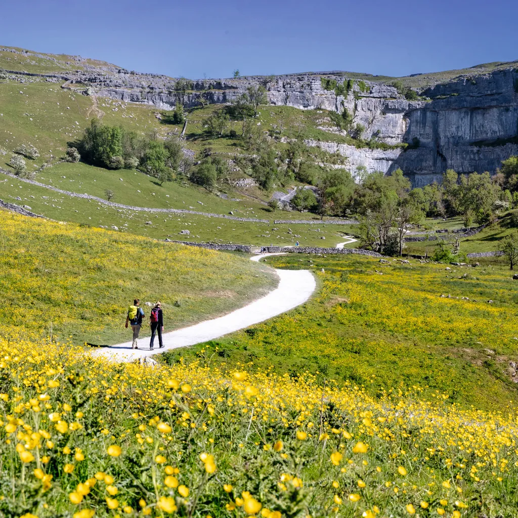
6. Malham Cove
On reaching the far side of the top of Malham Cove, head left and down through a gate for a stepped route down to the base of the cove. It’s worth a short detour to the left once you’ve reached the bottom of the steps to have a look at the base of Malham Cove.
Return to the main route and walk south alongside Malham Beck on a good path to Cove Road. Turn left here to stroll back into Malham.
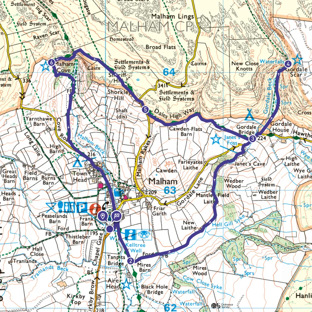
Malham Cove map
Malham Cove walking route and map
Useful information
Starting point
There’s a large National Park car park with toilets and a visitor centre, post code for sat nav is BD23 4DA.
Terrain
The terrain is mainly paths and tracks which can be muddy after rain and some very short sections of country lane. Some of the limestone rocks and pavements can be slippery after rain. The route is not suitable for pushchairs of wheelchairs.
Map
OS Explorer OL2
Eat/drink/stay
Try either the Lister Arms or The Bull for food and drink. Both cater for walkers.