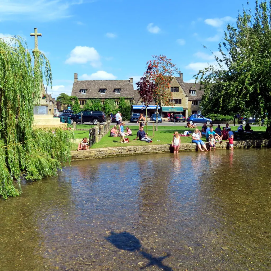
Pretty Bourton-on-the-Water is a classic visitor honeypot, with the River Windrush burbling through its centre and a steady supply of snap-happy tourists drawn by its bridges and tearooms.
This circular walk begins and ends in the heart of the village, letting you sample the so-called Venice of the Cotswolds, but the bulk of the route takes you through the lovely surrounding countryside. Over some 4.5 miles, you’ll head through Greystones Nature Reserve before reaching the peaceful hamlet of Wyck Rissington and looping back to the start point.
Bourton-on-the-Water to Wyck Rissington walk
4.5 miles / 7.25 km | 2.5 hours | easy/ moderate | 44 metres ascent
1. Start
From the cross-topped village war memorial, follow the High Street with the river on your right. At the first bridge, turn left to cross the road, picking up a footpath that runs down the side of The Dial House Hotel. Stay on this high-walled path until it bends to the right and meets Station Road. Turn left to pass the Co-Op garage. Take next right, signed ‘Greystones Nature Reserve’, and straight away bear left at the fork.
2. Greystones
The path swings right, then left, before arriving at Greystones Farm. Keep straight ahead, with barn on right, to meet the first of many self-closing pedestrian gates. For the next few fields, bear straight ahead on the path, passing under an ancient oak then tracing a mature hedgerow on your left. After crossing a wooded track and a further field, you’ll cross the clear-flowing River Eye.
3. River Dikler
Stay straight ahead, soon reaching the little River Dikler, then diagonally cross next field to a further bridge. Stick on bridleway, skirting arable fields, before reaching road. Turn right to wander through the sedate hamlet of Wyck Rissington, passing grand houses, tall horse-chestnuts, a lily-covered pond and the squat St Laurence’s Church. Where road angles left at the very end of the village, after Lawrence House, stay ahead on stony track.
4. Bridleway walk
The path snakes right then left. Stick on bridleway. After two gates, follow path with row of trees on your left and brambles on right. Turn right at the end, with stream among trees to your left. Reaching a metal seven-bar gate, turn left, heading for an obvious gap in the hedging. Stay on bridleway until reaching a road.
5. Bridges over water
Head right along oak-lined drive, before diverting left through a gap among large evergreen hedging, following footpath signage. Stick with path, heading over two stone bridges then crossing a field to a third bridge. Stay straight ahead, soon arriving at a fishing lake. Follow path clockwise around lake until reaching a road.
6. Cemetery Lane
Turn left and follow the road, which merges with Cemetery Lane. Stay on this for half a mile, passing handsome churchyard on right, to reach the fork at end of Route Direction 1. From here, retrace your steps to the village centre.
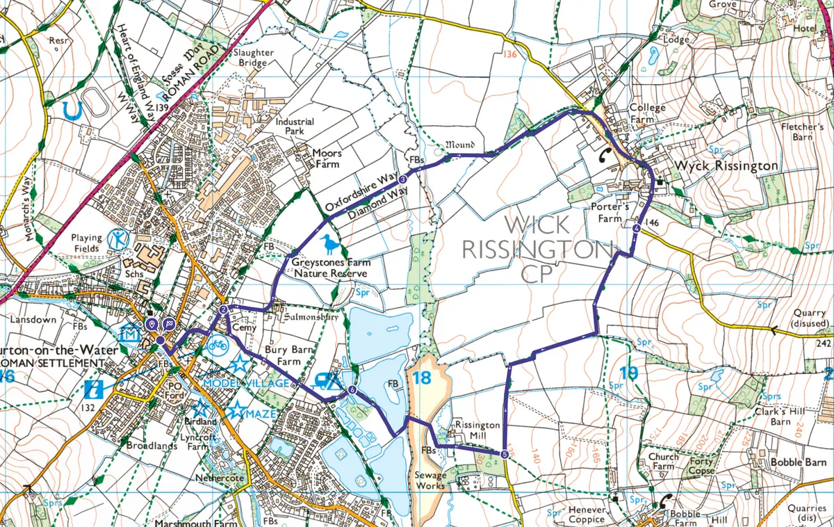
Bourton-on-the-Water map
Bourton-on-the-Water walking route and map
Useful information
Terrain
Flat throughout, but in poor weather often soggy or muddy underfoot. Some on-road sections – take care when passing through Wyck Rissington.
Starting point
War memorial, High Street, Bourton-on-the-Water GL54 2AN. Park nearby in the large Bourton Vale Car Park, Station Road GL54 2LU (3 hours £5, 4 hours £6).
Eat/drink
The family-run Mousetrap Inn, a few minutes’ walk from the war memorial, is a consistently popular Bourton pub.