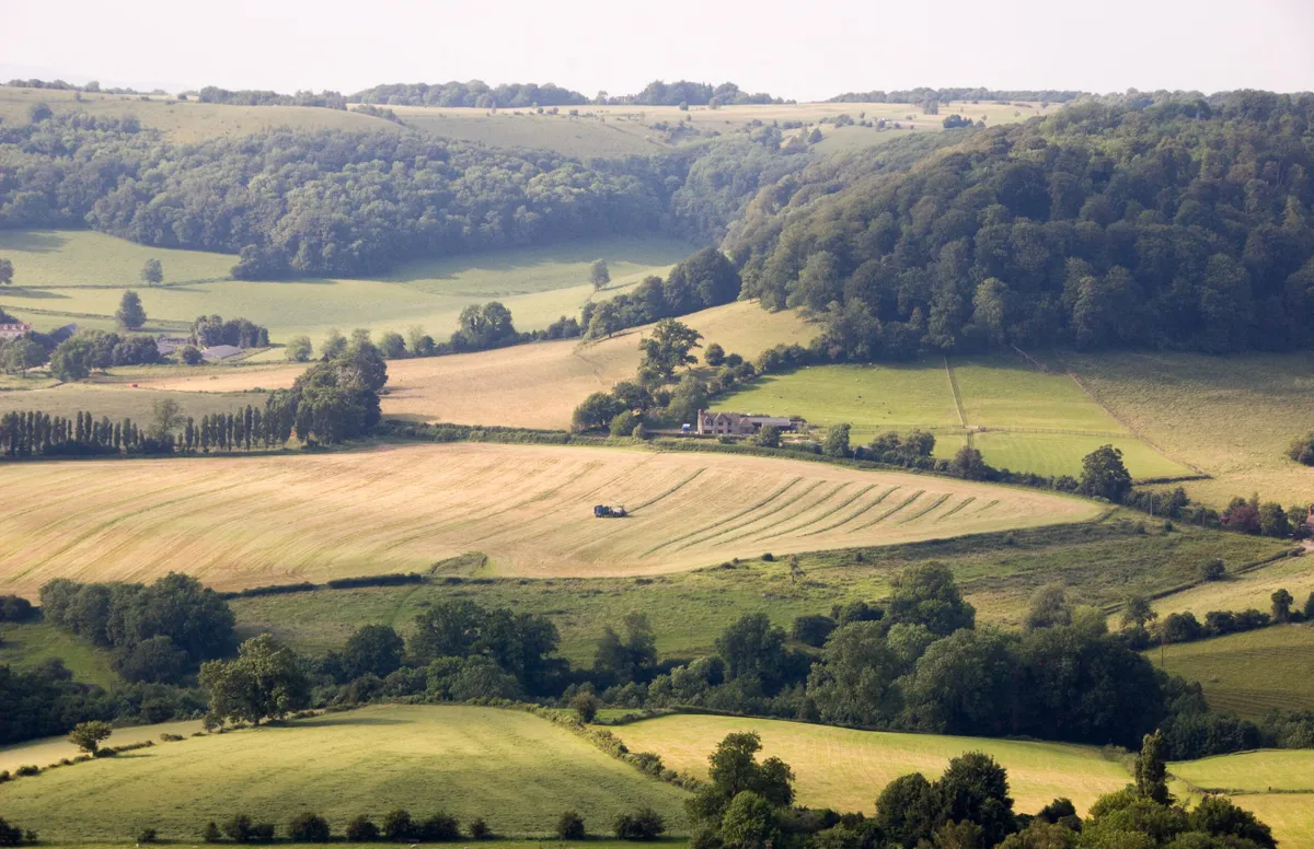
This varied hike gives a good overview of what makes the Cotswolds so enticing, with hilltop views, woodland trails and – as an added cultural bonus – a walk through a classic market town. Your goal on this out-and-back trail is the lofty Tyndale Monument, looking out across the distant Severn Estuary since 1866.
The route sticks to the Cotswold Way throughout, so navigation is straightforward and the paths are generally well maintained. The start and end point of Wotton-under-Edge, meanwhile, is one of the region’s more unsung settlements but has bags of wonky historical appeal. And dog-owners take note – the wide open spaces at the high-point of the route are perfect for a four-legged frolic.

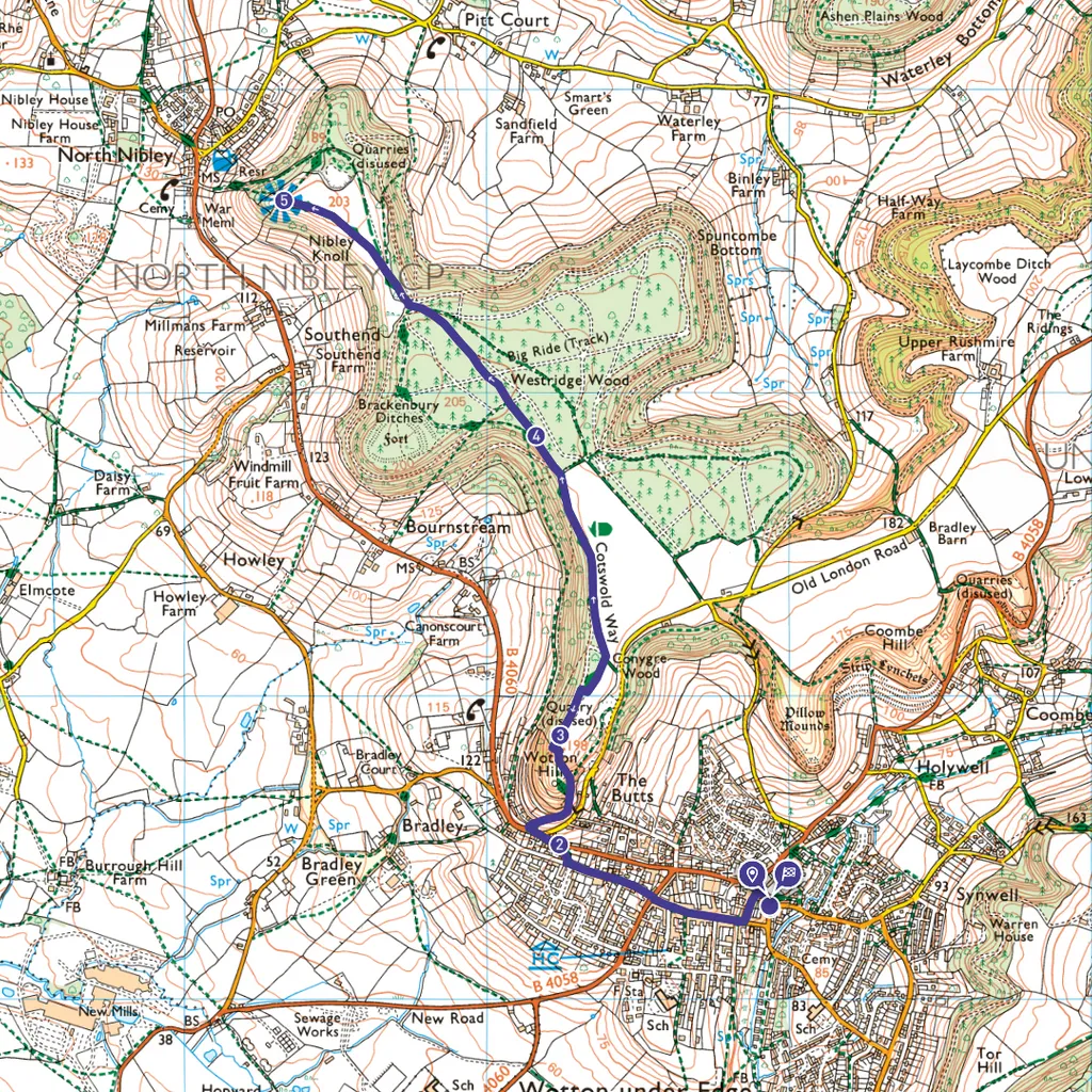
Tyndale Monument walk
4.6 miles / 7.3 km | 2.5 hours | moderate | 175 metres ascent
1. Start
Leaving Potters Pond Car Park, turn left uphill. Cross School Road, noting Cotswold Way (CW) signage to the right, then turn left up Church Street. At the end, turn right up the aptly named Long Street, with its charming hotchpotch of jumbled rooftops. Look out for the large, wall-mounted Tolsey Clock, erected for Queen Victoria’s Diamond Jubilee. Continue across Bear Street, then follow Bradley Street as it veers and rises to the right of Number 42.
2. Jubilee Clump
Reaching the B-road, turn left and take great care as you negotiate a tricky 50-metre section. Look out for a signed turn-off to the right, up a flight of steps. The route then climbs around the hillside, granting views across town. Cross the access road and continue up until path opens out at Jubilee Clump. This circular walled copse was planted to mark victory at Waterloo and now offers a stunning countryside panorama.
3. Beechwoods
From here, look for the uphill path, diagonally off to the right. You’ll soon notice CW signage alongside other trail markers. Follow the left-hand edge of the open field, turning left at the end to pick up a footpath running just inside the woods. After a further 0.4 miles, at junction of paths, head straight on along CW, heading further into the beechwoods.
4. Open common
At a fork, head to the right of the brambles and continue along the most obvious path. After a further 0.4 miles, where the path narrows and heads downhill, stick to the broader path that bends left through the woods. It’s well signed. You’ll reach an open common, where the Tyndale Monument – which you may have earlier glimpsed through the trees – soon appears in all its glory.
5. Tyndale Monument
On reaching the monument, the door of which is usually open 24 hours a day, you’ll have the option to climb its 121 spiral stairs. In truth, the escarpment-edge views are sensational enough from its base. The monument remembers William Tyndale, who was executed for heresy in 1536 after translating the Bible. When you’re ready, retrace your steps back to Wotton-under-Edge.
Tyndale Monument map
Tyndale Monument walking route and map
Useful information
Terrain
Some steep sections, and woodland stretches can become muddy.
Starting point
Potters Pond Car Park (free, maximum stay 23 hours), 8 Potters Pond, Wotton-under-Edge GL12 7HF.
Eat/drink
The Royal Oak is a traditional country pub in the heart of Wotton-under-Edge, serving lunch and dinner.