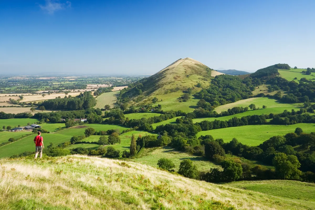
Capping the summit of one of Shropshire’s most iconic hills is a 20-acre Iron Age hill fort, once home to the Cornovii tribe. This ancient stronghold, built around 400BC, crowns the summit of The Wrekin.
On a clear day, you can see 17 counties from The Wrekin's 407m (1,335ft) summit, and other hill forts, on the Malvern Hills (40 miles away) and in West Wales, would have been visible, too, in their heyday.
This route explores the earth rampart remains of Hell and Heaven’s Gates, while treading on volcanic rock millions of years older than Mount Everest.
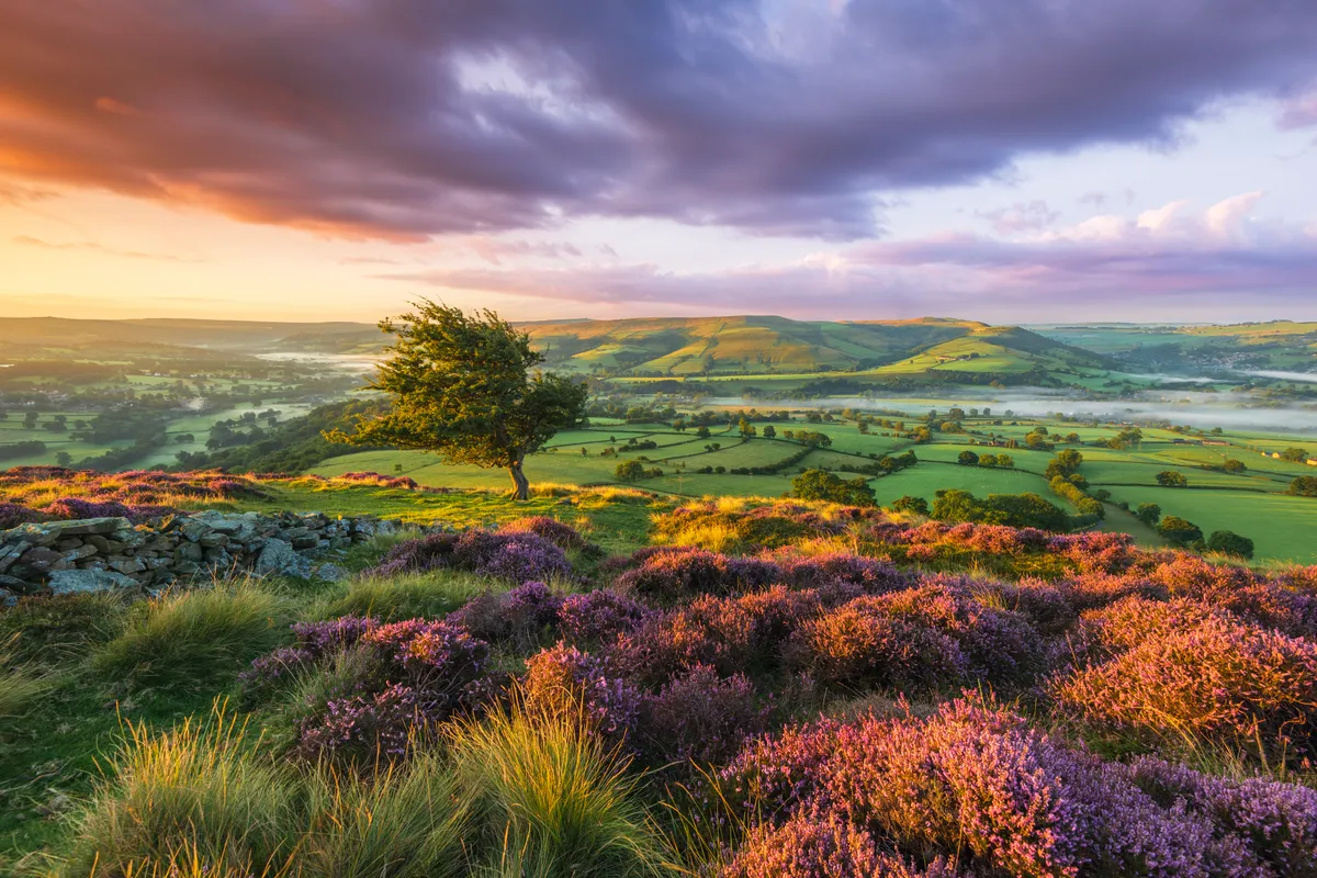
This is one of the best hill walks in Shropshire, but there are plenty more. Step out on an eight-mile walk along the charming Long Mynd near Church Stretton, or make your way to the summit of Caer Caradoc and its ancient hill fort – thought to date from either the Iron Age or Late Bronze Age.

Walk The Wrekin
3.8 miles/6.1km | 2.5 hours | moderate | 312m ascent
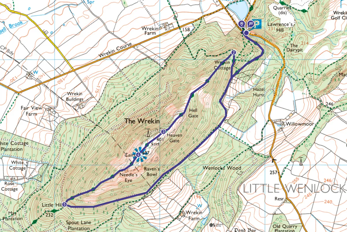
1. Shropshire Wildlife Trust car park
From the Shropshire Wildlife Trust car park, turn right on to the road signed to Shrewsbury, then immediately turn left on to a wide track, which climbs up through the trees.
Follow the track around to the right, to reach a junction. Turn sharp right to remain on this wide track, climbing up to a dwelling on the right. Known as Halfway House, this is occasionally open for light refreshments. Pass through a gate and continue ahead, climbing gently, before turning sharp left.
Shropshire walks
2. Hell’s Gate
The track breaks out from the trees to reach the outer earthwork ramparts of the hillfort, known as Hell’s Gate. This was the tribe’s first defensive barrier, probably only an earth bank, built sometime during the first millennium BC.
The route up here was busy with local people from surrounding farmsteads, who came to the hillfort to trade their wares and gather for community activities and festivals. Later, during the 18th century, summer fairs were held here, with boat rides, gingerbread and ale stalls.
Follow the path as it levels briefly before climbing again. Pause to consider the views behind you over the local town of Wellington as you climb.
3. Heaven’s Gate
Shortly after, the path climbs steeply again, rising through the inner earth ramparts, known as Heaven’s Gate. Constructed around 400BC, this earth rampart was topped with tall wooden fencing, while guardhouses protected the main entrance to the Cornovii community, where today’s track passes through the embankment. During excavations in 1939 and 1973, fragments of Iron Age pottery and remains from Cornovii tribe’s wooden huts were uncovered.
At the summit, take time to savour the 360-degree panoramic views, with the help of the toposcope to pinpoint key landmarks, hills and the Welsh mountains. Listen out for ravens, buzzards and the occasional peregrine falcon, too.
Discover more walks near you
4. Needle’s Eye
Ahead, you’ll see a rocky outcrop. Bear left here (take care, there are steep drops) to glimpse the Needle’s Eye, a cleft in the rockface that, according to local folklore, was created when two giant brothers were having an argument and one pushed his spade into ground here. Another local tradition suggests lovers who could scramble through the gap together, thus “threading the needle” would later enjoy a trouble-free marriage.
Return to the main path and continue south-west, descending on a narrower path. This continues to offer good views of Shropshire before dropping below the tree line again. Take care, as this whale-back ridged section is steep in places.
5. Lower slopes
At a crossing track, turn left on to a permissive path that climbs gently, briefly, before undulating through the wooded lower slopes, to reach a junction with a footpath.
Turn left and follow this for about a mile, along the edge of the wood, eventually reaching a junction, which you should recognise from earlier. Turn right here and retrace your steps back to the car park.
Shropshire fidget pie is one of the county’s best-known regional dishes and is commonly made using apples, bacon or gammon, and Shropshire potatoes. Rustle up this tasty pie for a warming meal in autumn and winter.

The Wrekin map
The Wrekin walking route and map
Useful Information about The Wrekin
How to get there
The Wrekin lies south-west of the ancient market town of Wellington, and east of Telford. Take the M54 to J7, and then the minor road south, signed towards Little Wenlock. The nearest train station is Wellington, under two miles away.
Find out more
Shropshire Tourism www.shropshiretourism.co.uk
Where to eat/stay near The Wrekin
The Huntsman of Little Wenlock
This modern but cosy inn still offers a real log fire, local ales, a range of food to satisfy all appetites, and is only minutes away from The Wrekin. www.thehuntsmanoflittlewenlock.co.uk
To visit
Ironbridge Gorge Museum www.ironbridge.org.uk
In need of some new kit for the hills? Read our expert reviews of the best walking shoes.