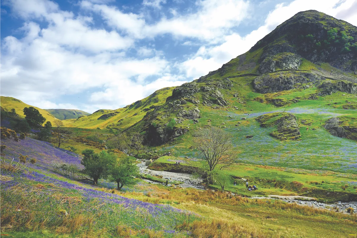
Climb to the summit of British Camp and Worcestershire Beacon on this five-mile route through the Malvern Hills, stopping midway for a picnic lunch as you gaze across the surrounding countryside.
The walk ends in the busy town of Great Malvern, the perfect place to unwind after a day in the hills.

Malvern Hills walk
5.3 miles/8.6km | 3.5 hours | moderate
1. Early detour
Start at British Camp car park opposite the Malvern Hills Hotel near Little Malvern. You can get here by bus from Great Malvern – take the 44B or 481 towards Ledbury from Church Street, getting off opposite the kiosk (you’ll see the hotel on the right). Or, if you don’t mind adding some miles to the route, it takes about an hour to walk here from Great Malvern train station.
The first part of the walk is a loop of British Camp, or Herefordshire Beacon. Go through the wooden gate halfway down the car park and follow the path along the eastern side of the hill. Ignore the trail and steps to the right, sticking with the lower path as it emerges from the trees with lovely views of British Camp Reservoir to your left.
Related articles
About 500m beyond the reservoir, take a path to the right linking the lower trail with the main ridge path and follow signs for British Camp (Herefordshire Beacon).
2. British Camp
British Camp is an Iron Age hill fort, thought to have been built in the 2nd century BC and you can still see the man-made nature of the hill. The path takes you up some steps on a zigzagging route to the top. Take a moment to enjoy the view, then continue back down to the car park.
To carry on with the walk, cross the main road and follow Jubilee Drive behind the hotel. A footpath leads off to the right and emerges soon after at Black Hill car park.

3. Along the ridge
Carry on along the main path towards the top of the next hill. Continue on the ridge until you get to Wyche Cutting, with Great Malvern visible to the right and Worcestershire Beacon up ahead. There are some steep climbs – including 357m-high Pinnacle Hill. It’s quite a slog when it’s hot, but it’s well worth taking a picnic to eat while you enjoy the views.
On a clear day, look west to the Herefordshire hills and the rugged Black Mountains. And keep an eye out for grayling and small heath butterflies, adders, green woodpeckers, harvest mice, meadow pipits and, in spring, marsh orchids.
At Wych Cutting, the path descends to the road. Turn right and, just before The Wych Inn, take a second right on to Old Wyche Road. This soon turns into Lower Wyche Road, which takes you into Great Malvern.

4. Down town
Great Malvern is a lovely place to spend an afternoon, with its shops, cafés and galleries. That’s if you can resist the call of the signs saying ‘To the Hills’, tempting you to tackle the next, more strenuous section.
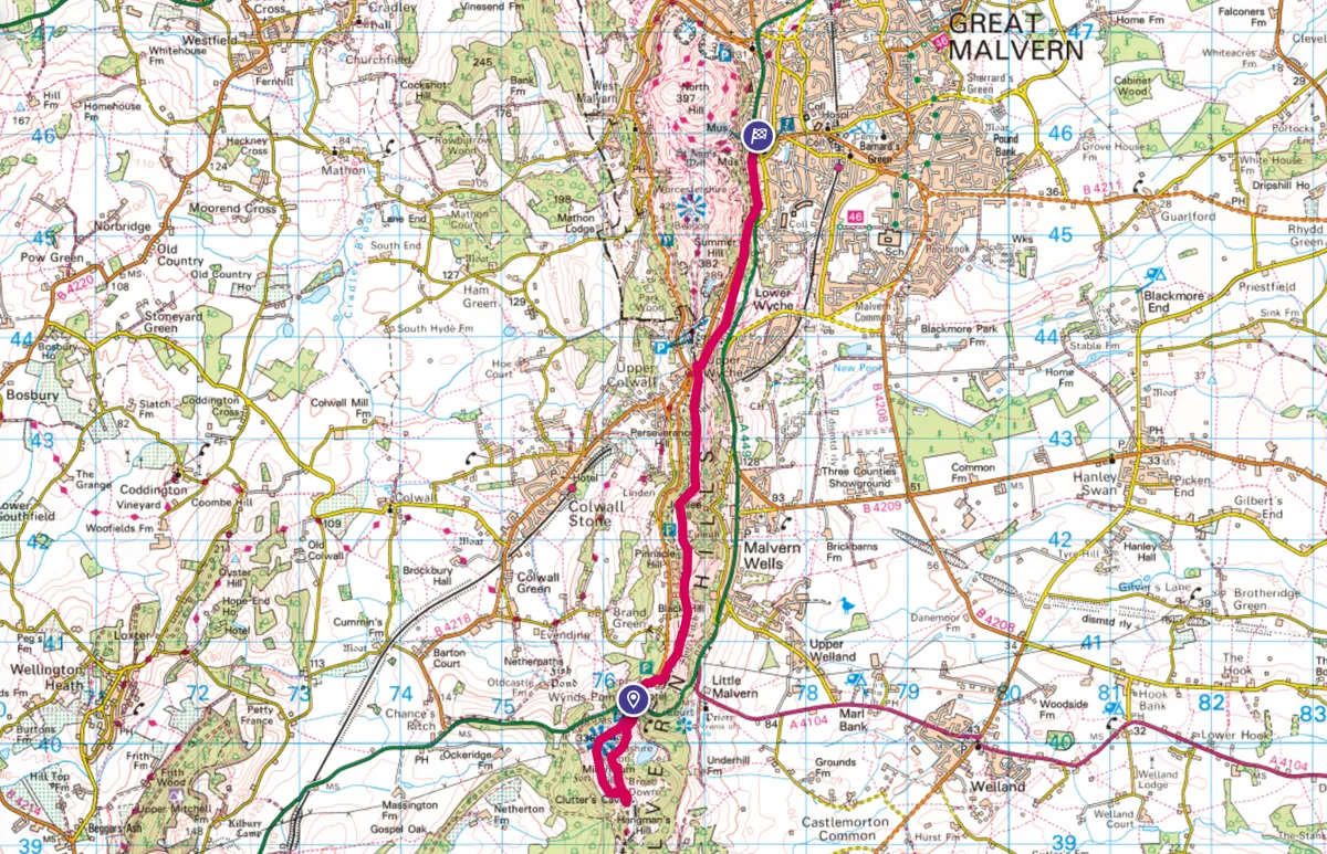
Malvern Hills map
Malvern Hills walking route and map