This Elizabethan Renaissance marvel housed Tudor types as recently as 2015 – it was Henry VIII’s Greenwich Palace in the BBC adaption of Hilary Mantel’s Wolf Hall. Built more than 400 years ago, the towering walls and sweet-scented gardens of Montacute, now in the care of the National Trust, still feel fit for a king.
The house was completed in 1601 for Sir Edward Phelips, Master of the Rolls, a senior judge who later prosecuted the 1605 gunpowder plotters. The honey-hued hamstone house is a swagger of Tudor architecture: Dutch gables, Renaissance statuary and an abundance of mullioned windows. It also has a 52m Long Gallery, now an outpost of the National Portrait Gallery. A who’s who of Tudor and Jacobean figures hang here, including Elizabeth I and Sir Walter Raleigh. Meanwhile, downstairs in the dining room, there is a painting of Mary, Queen of Scots.

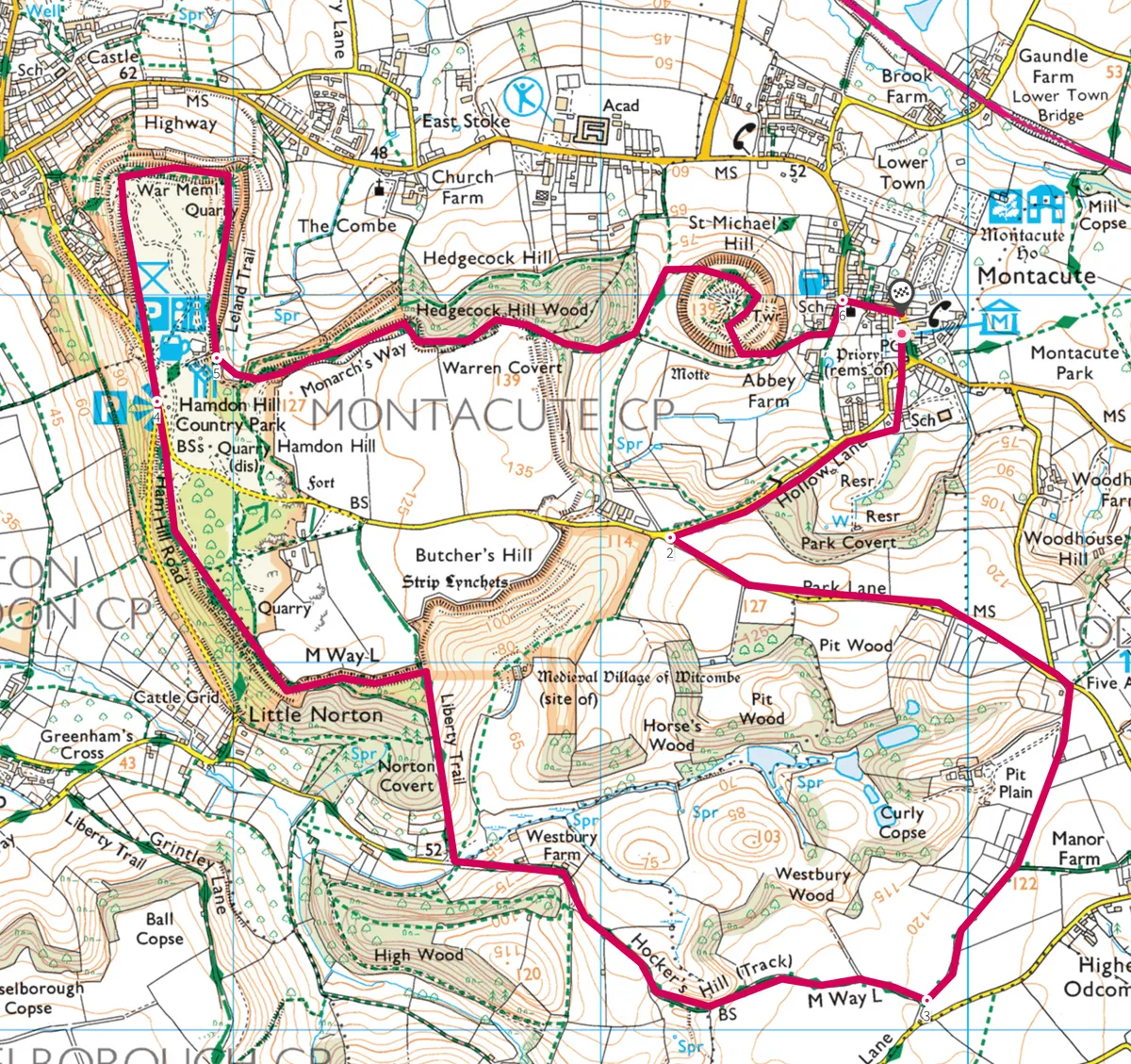
The house is flanked on its south side by the charming Montacute village and, beyond that, sweeping countryside where Iron Age, Roman and medieval forbears have left their mark. To explore this history-laced landscape, including and an old quarry, try this six-mile loop walk, starting at the Tudor mansion’s gates.
Walk
1
Street stroll
Veer left down South Street, passing the soft glow of the village’s golden cottages, the Phelips Arms pub and quirky TV Radio Toy Museum. Turn right on Townsend Lane, which turns into Hollow Lane, climbing out of the village. After a lay-by, take a footpath on the right, stepping into a field. Walk parallel to the road, looking back at views of the Church of St Catherine, home to the Phelips’ family tombs.
2
Into the trees
A kissing gate brings you back to the road. Take the second left down Park Lane. After passing Woodhouse Lane on the left, turn right down a track.
3
Ham Hill highs
When the track splits, take the right-hand fork to join Hockers Hill track. A mile later, two footpaths jut off to the right. The first leads to the deserted medieval village of Witcombe (though little remains). Take the second – the Liberty Trail – climbing through trees. At a carved stone, turn left, and then fork right on to a wide track beneath Ham Hill. Built around 600 BC and spanning 5km in length, these Iron Age ramparts mark one of the largest hill forts in Britain.
4
Quarry quest
A mile later you reach a viewpoint that looks west over stripy fields, village rooftops and distant hills. Exit the car park, cross the road and take the left-hand path hidden behind trees. It descends steeply before emerging amid the grassy mounds of Ham Hill quarry. Continue north over a road to the war memorial, before skirting back south.
You will pass a stone circle, erected in 2000 to remember those who have quarried at Ham Hill through the centuries. The deeper pits here are the result of Victorian innovation – at one time, there were more than 200 families working
the hillside.
5
Woodland wiggle
At the signpost in front of the Prince of Wales pub, take the first left through a gate down some steps, picking up the Monarch’s Way. Continue straight on, taking a very steep path into the woods where numerous trails wiggle amid the trees. Follow your nose (or compass) eastwards.
Enter a field via a stile – St Michaels’ Hill is ahead. This mound was once topped by a motte and bailey castle. Now a 15m-high folly tower, built by Edward Phelips V in 1760, marks the spot and can be climbed for panoramic views across the countryside.
6
Back to the manor
Emerge from the field by the old priory’s impressive gatehouse (now a private home). Turn left down the road and pass an old church. At the Kings Arms, turn right on to Middle Street to return to Montacute House.
Map
Click on the map below for an interactive version of the route.
Learn more about Montacute House here.
Main image ©Alamy