Snowdonia National Park covers 823 square miles of north-west Wales and contains the country's highest peak, Snowdon.
The region, designated as a national park in 1951, was sculpted by glaciers, leaving behind a spectacular landscape of craggy mountains and hills, deep valleys and over 100 lakes.
There are numerous ways to explore the park – mountain biking routes, driving tours and even by canoe – but for a truly immersive experience, why not take on one of Snowdonia's best walks?
From a classic Snowdon ascent to a less-gruelling riverside amble along the Afon Artro, here is our guide to the best walks in Snowdonia. Each route includes walking directions and a map.
Snowdonia walks
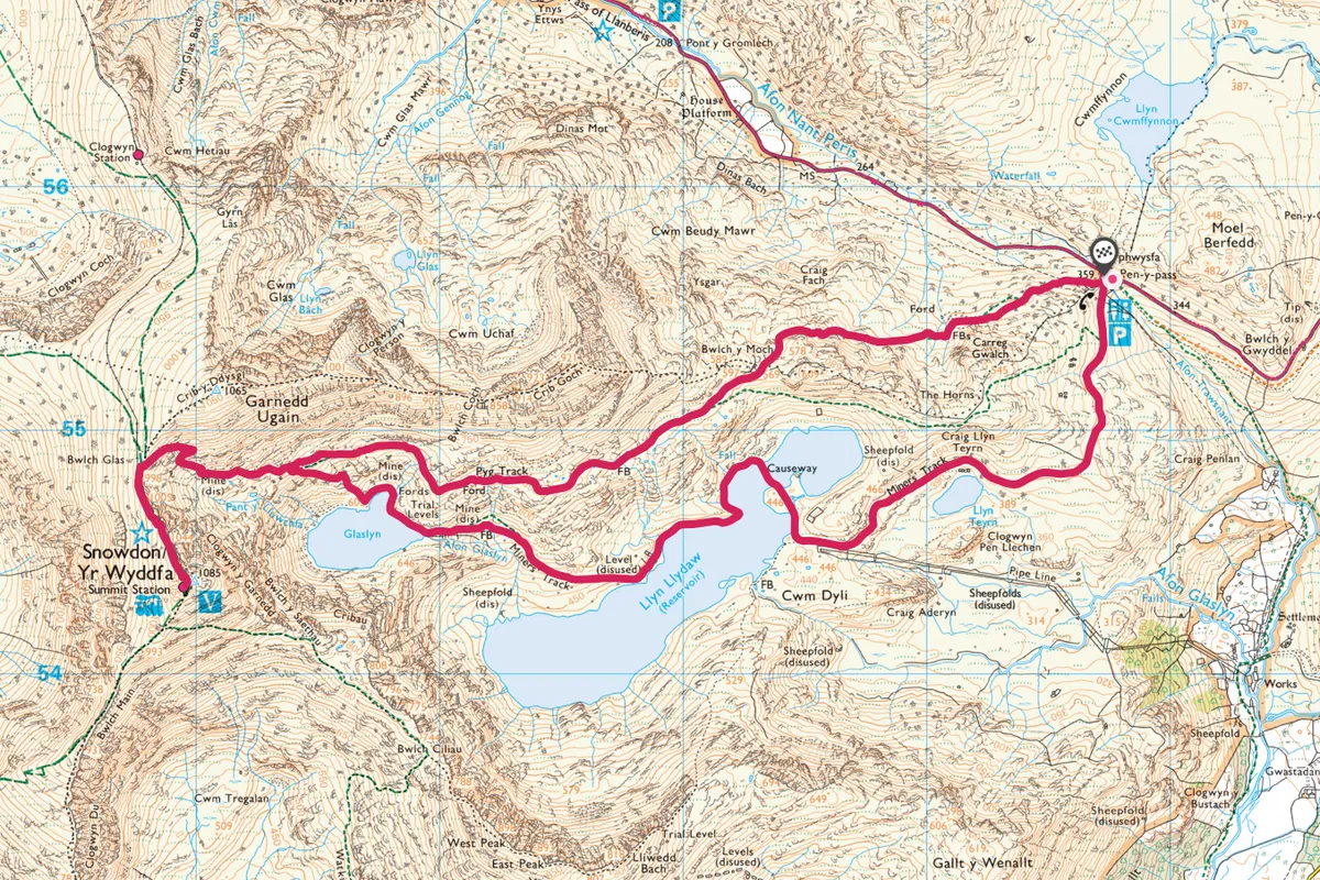
Snowdon, Gwynedd
7.5 miles/12km | 5-6 hours | challenging
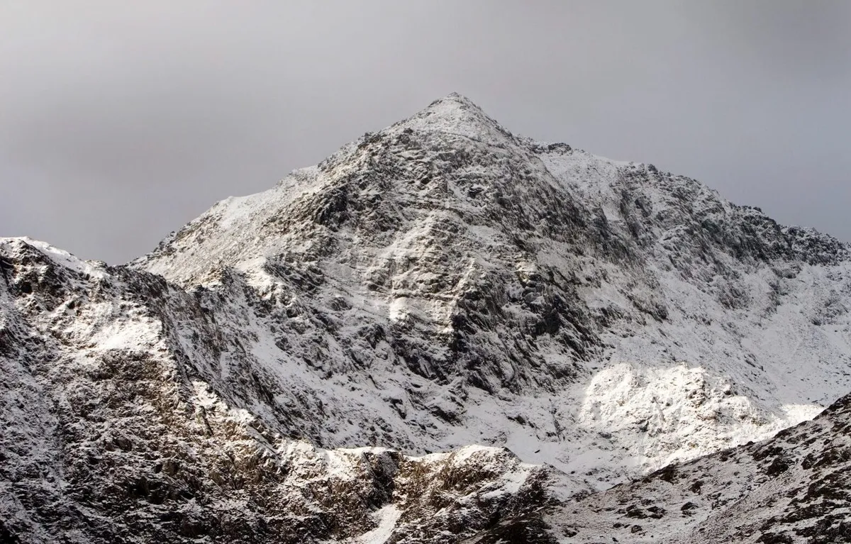
Snowdon (Yr Wyddfa in Welsh) is the highest mountain in England and Wales at 1,085m (3,560ft). The Snowdon range covers 16 square miles and gave birth to Welsh rock climbing in the 19th century. Today the tracks are bustling all year round and there are plenty of varied routes to the top.
This circular route, takes in the Miners’ Track and the Pyg Track, offers the chance of panoramic views and a varied terrain to and from the summit.
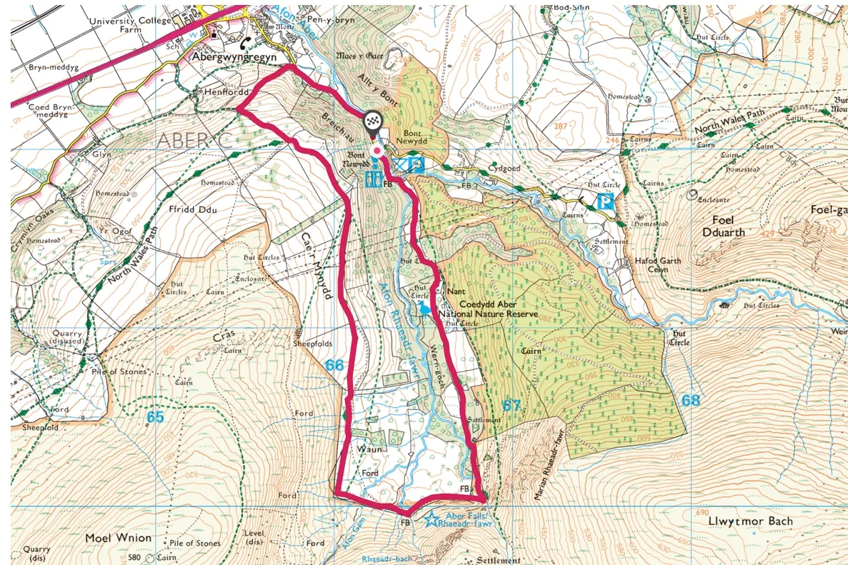
Aber Falls, Gwynedd
4.2miles/6.7km | 3 hours | moderate
This 4-mile circular walk starts from Bont Newydd car park near the village of Abergwyngregyn on the north coast of Wales.
Follow a quiet country lane before crossing the Afon Rhaeadr Fawr river, then take a track alongside some beautiful ancient oak woodland up a verdant valley to the spectacular Aber Falls (Rhaeadr Fawr).
Explore the falls then turn right along the foothills of the Carneddau mountains for incredible views over the Menai Strait towards the Great Orme, Puffin Island and Anglesey before heading back, above the tree line, towards the village.
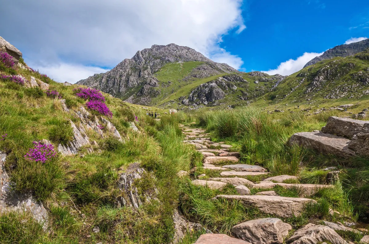
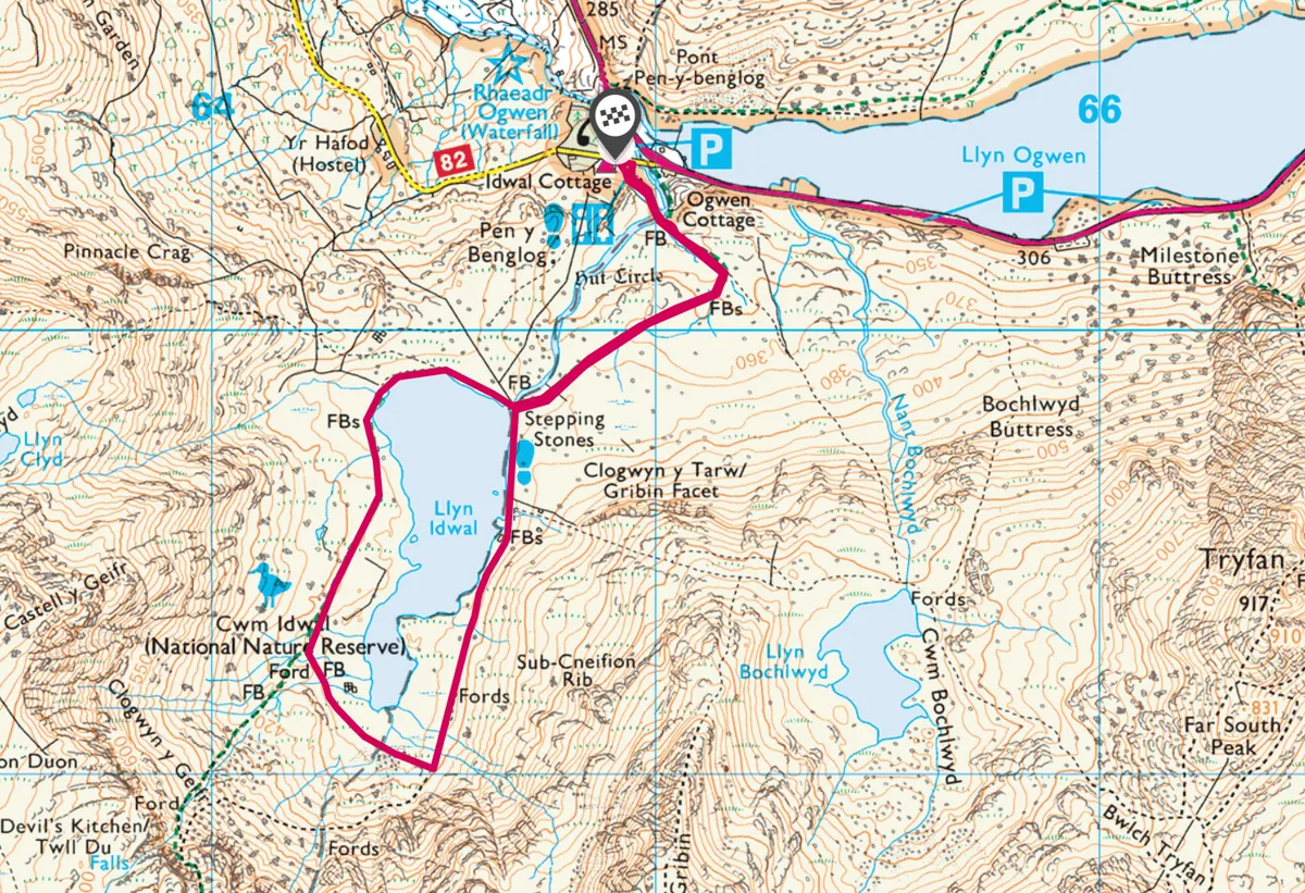
Cwm Idwal, Gwynedd
2.5 miles/4km | 1.5 hours | easy-moderate
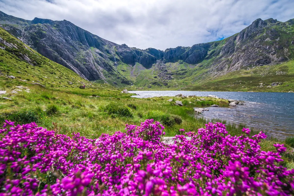
The jagged peaks that soar over Cwm Idwal dwarf the Arctic-alpine plants that grow on the slopes around its waters. To appreciate them fully, you have to crouch down or dangle over them to see their colourful petals hunkered on ledges or in crevices – it’s here that they thrive, feeding on minerals that leach through the rock.
The first to flower is purple saxifrage. Even when snow lies late into the season, Saxifraga oppositifolia prospers, growing in fragrant cushions on the basalt rocks around the streams that flow into the llyn.
A 2.5-mile valley walk through Cwm Idwal National Nature Reserve offers the chance to see these flowers, along with many other natural delights.
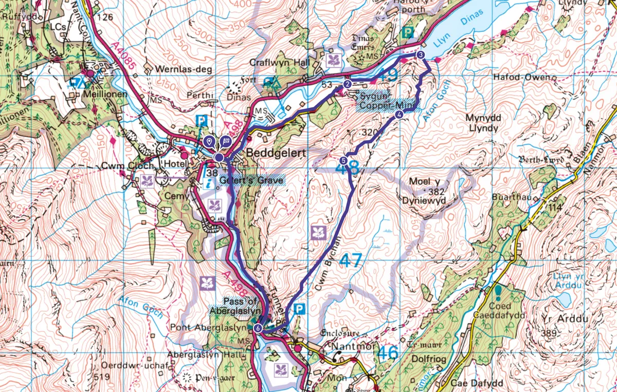
Beddgelert, Llyn Dinas and Aberglaslyn Pass, Gwynedd
5.5 miles/8.8km | 3.5 hours | moderate-challenging
Right in the heart of Snowdonia, surrounded by craggy, frost-cracked mountains, is the cosy village of Beddgelert. This spectacular circular walk starts and ends at the village, taking in Llyn Dinas, the remnants of Sygun Copperworks, Bwlch y Sygun, Cwm Bychan and the gorgeous Afon Glaslyn.
The route
- 5.5 miles/8.8km
- 3.5 hours
- moderate-challenging
Beddgelert, Llyn Dinas and Aberglaslyn Pass walking route and map
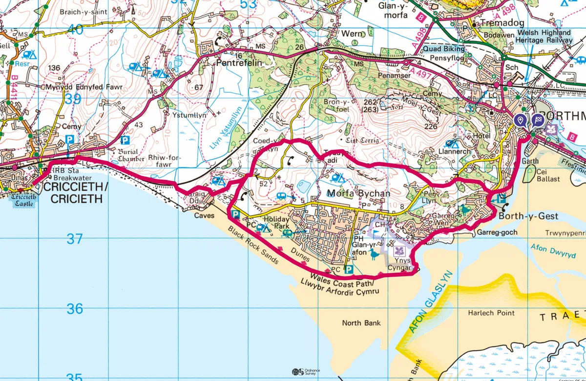
Porthmadog to Criccieth, Gwynedd
11.8miles/19km | 5–6 hours | moderate
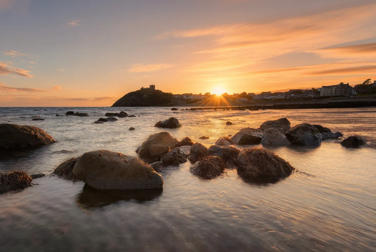
Wales is west-facing and sunset embracing. From the coastal headlands and clifftops of Ynys Môn (Anglesey) and Sir Benfro (Pembrokeshire) to the marshes of Cors Fochno (Borth Bog), the estuaries of Sir Caerfyrddin (Carmarthenshire) and a multitude of beaches and coves, Welsh sunsets can be gorgeously apocalyptic.
This walk is an excellent one for gently lyrical winter light – although it's a rewarding walk no matter you time of year it is.
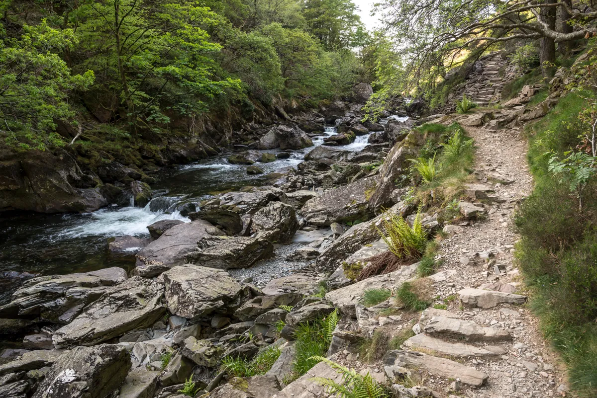
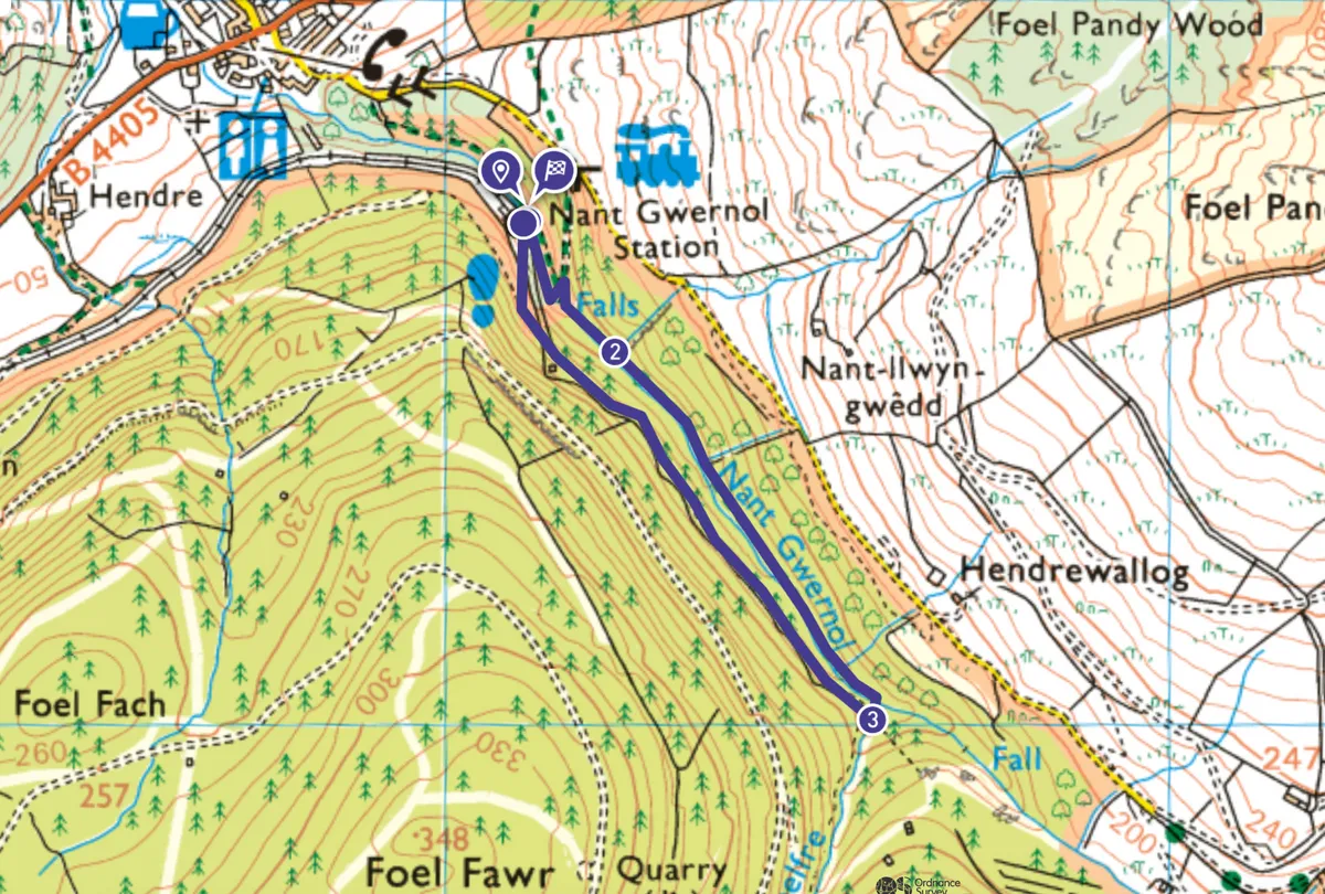
Nant Gwernol, Gwynedd
1.1 miles/1.8km | 45 minutes | easy–moderate
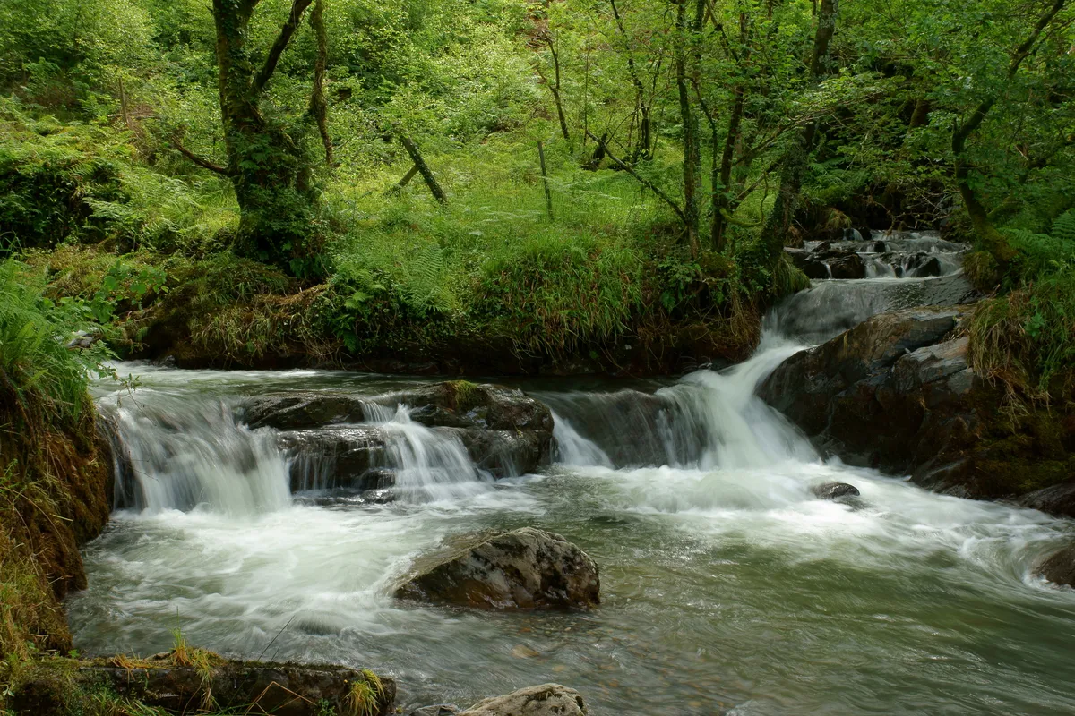
There are numerous station walks along the historic Talyllyn Railway line, including the Quarryman’s Trail around Bryn Eglwys, and the Dolgoch Falls loop. But perhaps the most rewarding is the Cascade Trail from Nant Gwernol Station.
To alight here after rain is to enter a sparkling world, and this short trail alongside a chattering stream – where the woodland is luminous, and the air lucid – makes the very most of it.
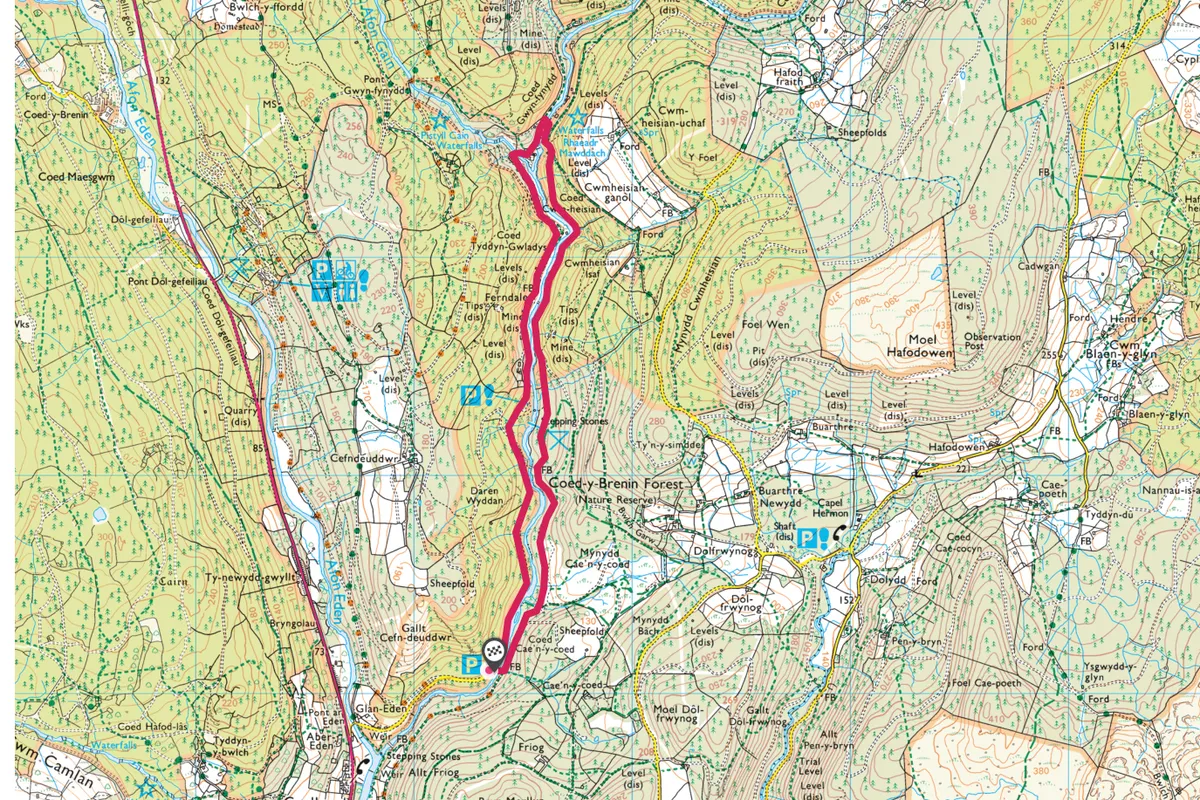
Coed y Brenin, Gwynedd
3.5 miles/5.6km | 2 hours | easy-moderate
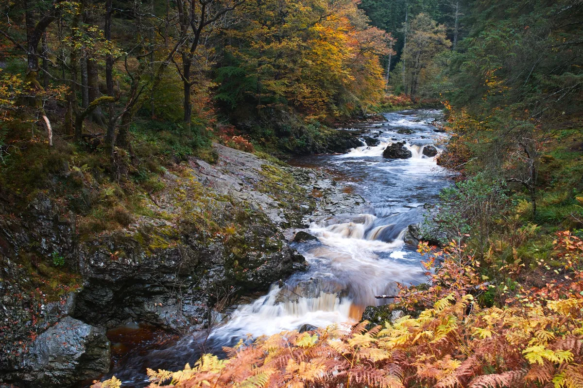
In Snowdonia’s rain-soaked forests, everything is clean and wet. Mist rises, trees transpire, moisture kisses your skin and wets your lips. Oxygen-rich air lifts your spirits and the sound of water fills your ears as it trickles down tracks, bubbles through moss, and crashes in creeks.
Coed y Brenin Forest Park covers 9,000 acres of woodland and river valleys. Its 500-million-year-old rocks with their deposits of copper and gold once made it a centre for mining. Now it’s managed for timber and recreation, with well-marked mountain-bike, walking and running trails.
This walk begins at Cae’n y Coed carpark – there’s also a bus stop nearby at Ganllwyd. It follows the Mawddach upriver, passing Pistyll Cain (the Cain Falls) and Pistyll Mawddach (the Mawddach Falls), before returning via the opposite bank.
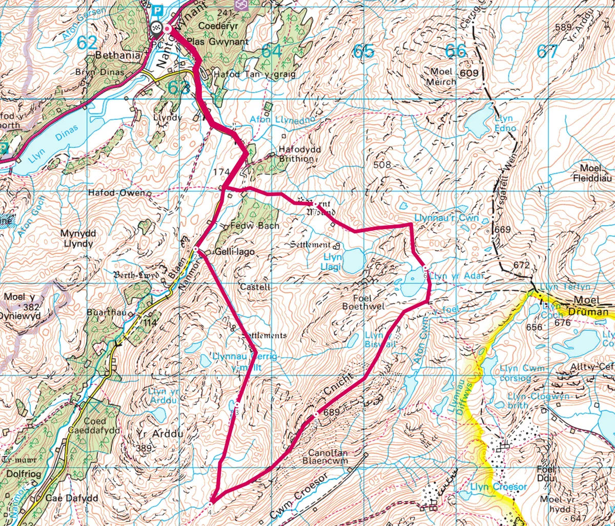
Cnicht, Gwynedd
9.1 miles/14.7km | 789m accent | 6 hours | challenging
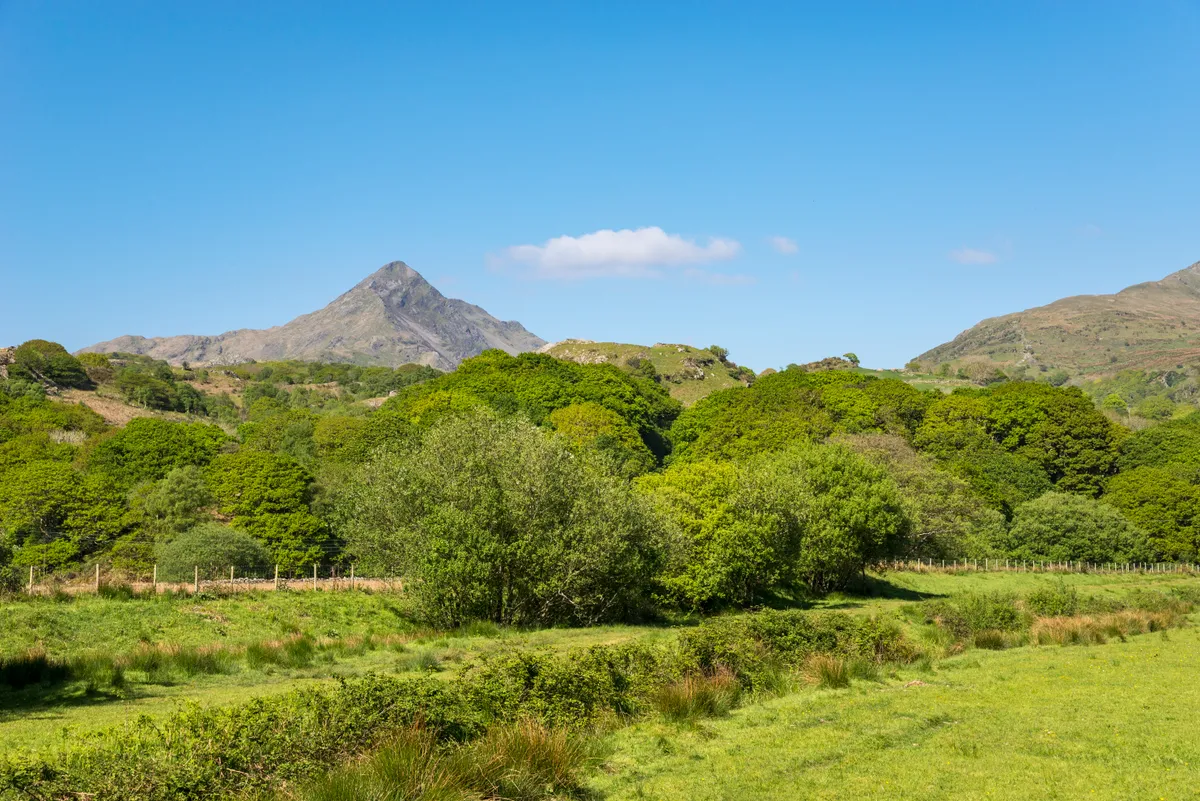
Soaring in poetic isolation among Snowdonia’s famed mountains – Tryfan, Glyder Fawr and Carnedd Gwenllian – is Cnicht. Its name, the Anglo Saxon word for ‘knight’, was bestowed on it not by local Welsh people, but by medieval sailors who noted its resemblance when viewed from the sea to a 14th-century bassinet helmet.
Cnicht is so perilous and pointy among the meringue-like swoops and crests that surround it, that it is also known as ‘The Welsh Matterhorn’. At a sixth of the alpine peak’s height, it is rather more easy to climb.
Explore the Moelwynion mountain range in Wales, climbing through a prehistoric landscape to the pyramidal zenith of mighty Cnicht with this 9-mile circular route starting and ending at Nantgwynant.
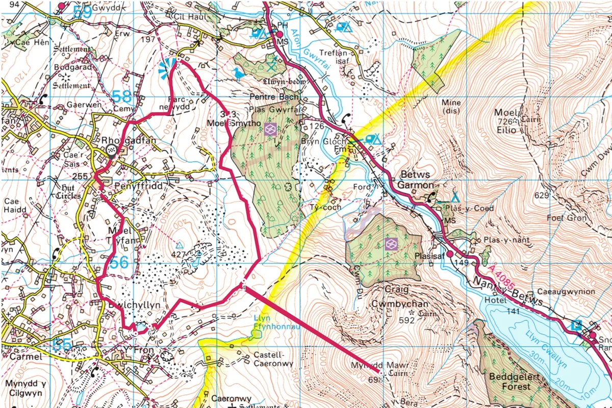
Moel Tryfan and Mynydd Mawr, Gwynedd
8.3 miles/13.3km | 6 hours | challenging
A cold cloud swirls down from the hills and cloaks the chapel, the slagheaps, the brightly coloured playground and the grey stone and pebbledash houses.
This is Rhosgadfan, where author Kate Roberts spent her childhood on the slopes of Moel Tryfan and Moel Smytho, and which is the setting for her early novels including Feet in Chains and Tea in the Heather.
Discover the landscape – both its bleakness and its light – that inspired Kate Roberts with this nine-mile walk.
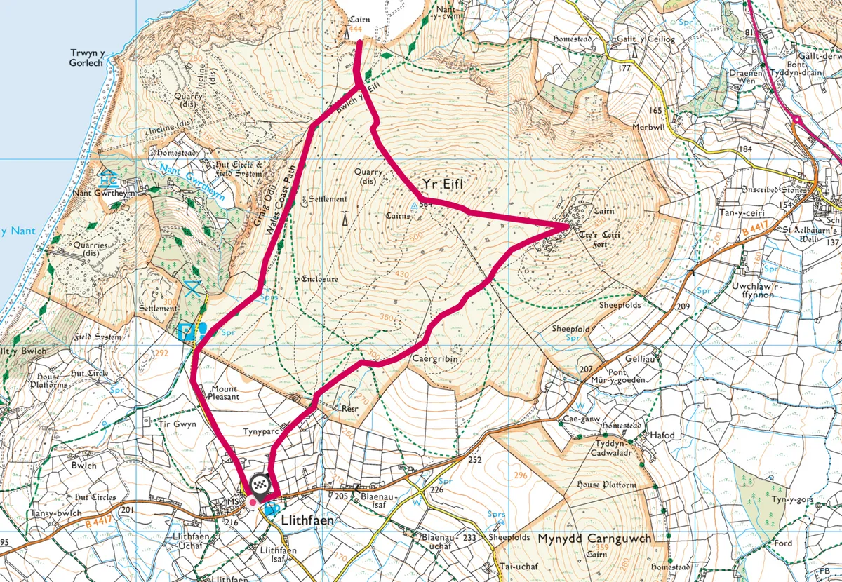
Yr Eifl, Llyn Peninsula, Gwynedd
4.5 miles | 3 hours | challenging
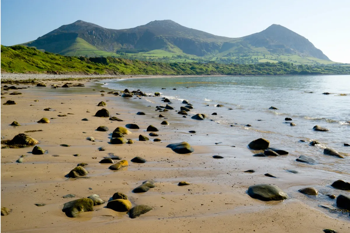
Mountainous in spirit if not in height, Yr Eifl is a hill of vertiginous vistas and igneous granite intrusions. Its craggy summits have various names but are referred to here as Garn For, Garn Ganol, and Tre’r Ceiri, and this walk scales all three.
The first two peaks are a bit of a scramble – for an alternative, lower route, a valley path skirts the valley to the north and east of the mountains.
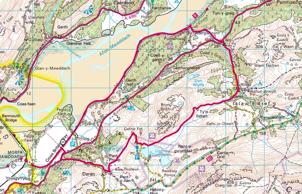
Mawddach Estuary, Gwynedd
9.5 miles/15.3km | 5-6 hours | moderate–challenging

Surrounded by mountains, the Mawddach Estuary must be one of the most beautiful in Europe.
Wooden ships were built in its creeks before the arrival of the Great Western Railway, which connected with the Cambrian Coast at Morfa Mawddach. After operating for 100 years the line closed in the 1960s. Nowadays the former railway track between Morfa Mawddach and Dolgellau is used for walking and cycling and it provides a delightful walk on a crisp winter day.
Savour the beautiful scenery on this 10-mile walk to the stunning Cregennen Lakes in the foothills of Cader Idris in Snowdonia National Park.
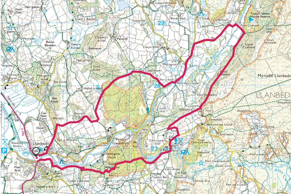
Llanbedr Woods, Gwynedd
6.3 miles/10.2km | 4 hours | moderate
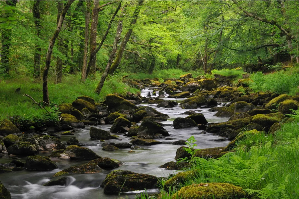
Pass through this ancient woodland teeming with wildlife in north-west Wales. This walk is especially glorious in late summer and autumn when the woods are filled with colour and foraging creatures.
Tŷ Hyll, Betws-y-Coed, Conwy
4.4 miles/7.1km | 2.5 hours | easy-moderate
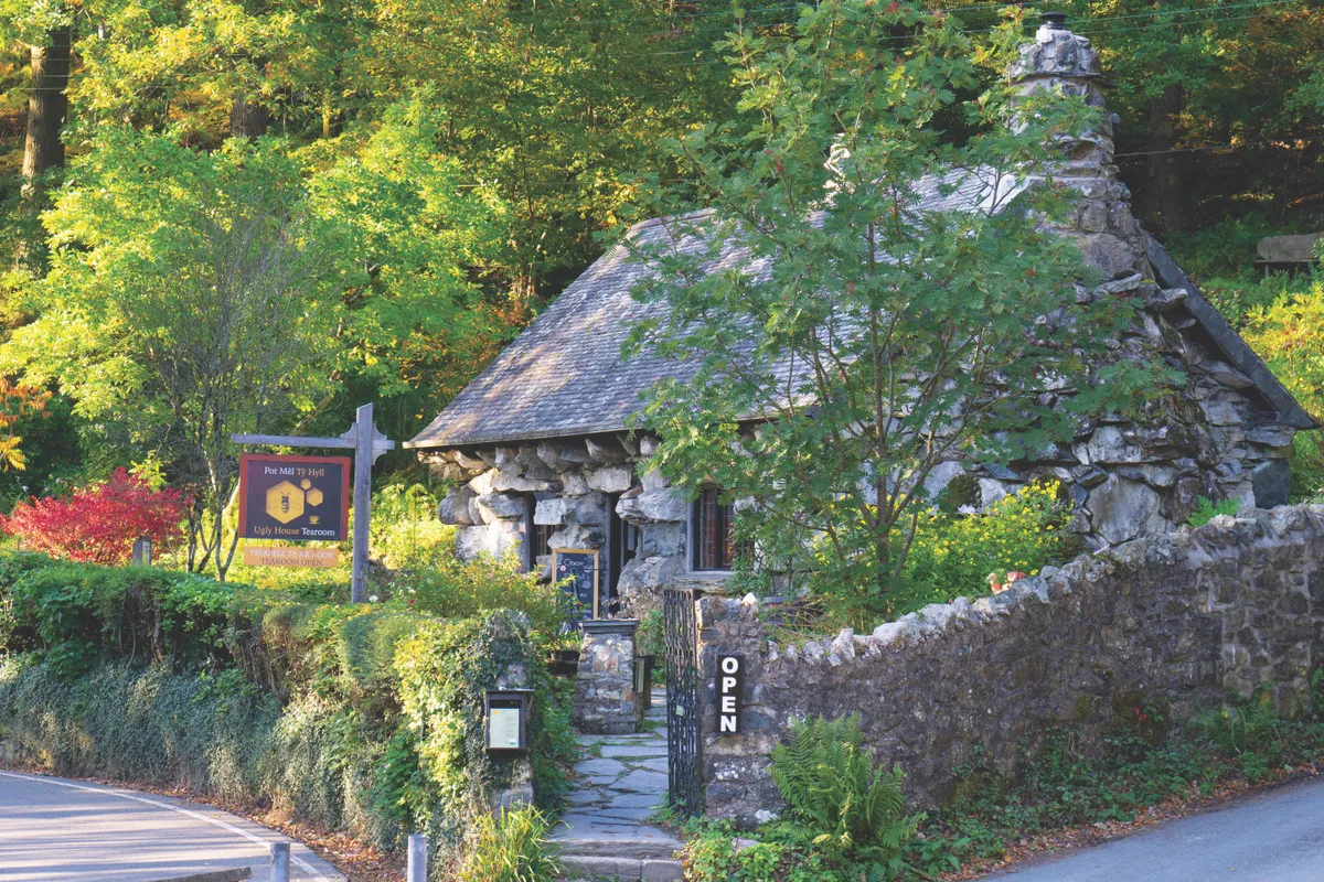
Tŷ Hyll, or ‘the Ugly House’, is named for its colossal, crudely cut yet lovely stones. It’s a place of uncertain origin – a brigand’s hide-out, duke’s folly, or maybe a tŷ unnos (a home built in a day to secure ownership of land). What is certain is that it’s now a cosy tearoom selling fresh-baked delights and very, very good tea.
If somewhat sluggish after a lunch of succulent ‘secret recipe’ Welsh rarebit, a stroll may be required. Explore the garden – which dissolves beguilingly into the surrounding song-swelled oakwoods (watch out for spring migrants, such as pied flycatchers and wood warblers) – or go in search of Swallow Falls along the Llugwy. But if you’re planning an afternoon tea of sandwiches, bara brith, Welsh cakes, scones or cakes, then a heartier hike is likely to be in order.

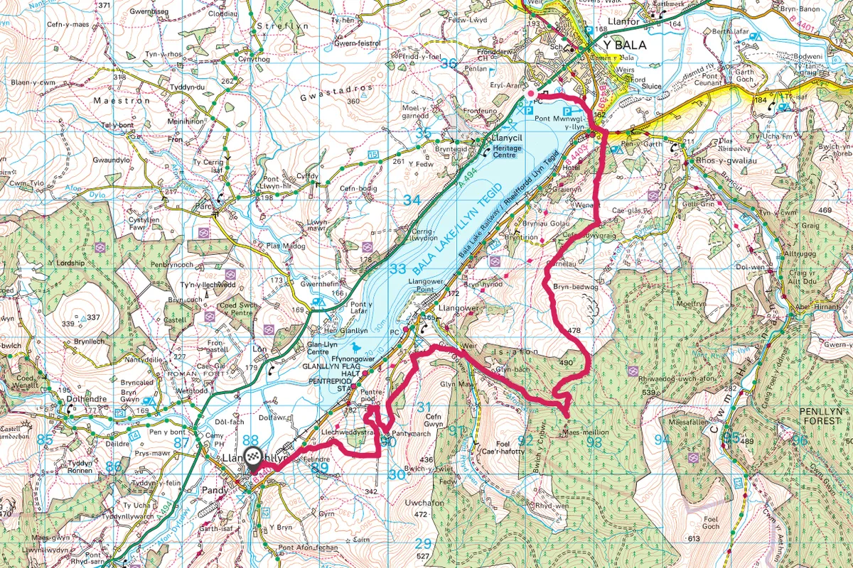
Llyn Tegid, Gwynedd
8.9 miles/14.3km | 5-6 hours | challenging
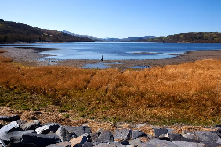
Known in English as Lake Bala, Llyn Tegid is the largest natural lake in Wales – explore its banks and surrounding forests in the east of Snowdonia National Park with this 8.5-mile hike.
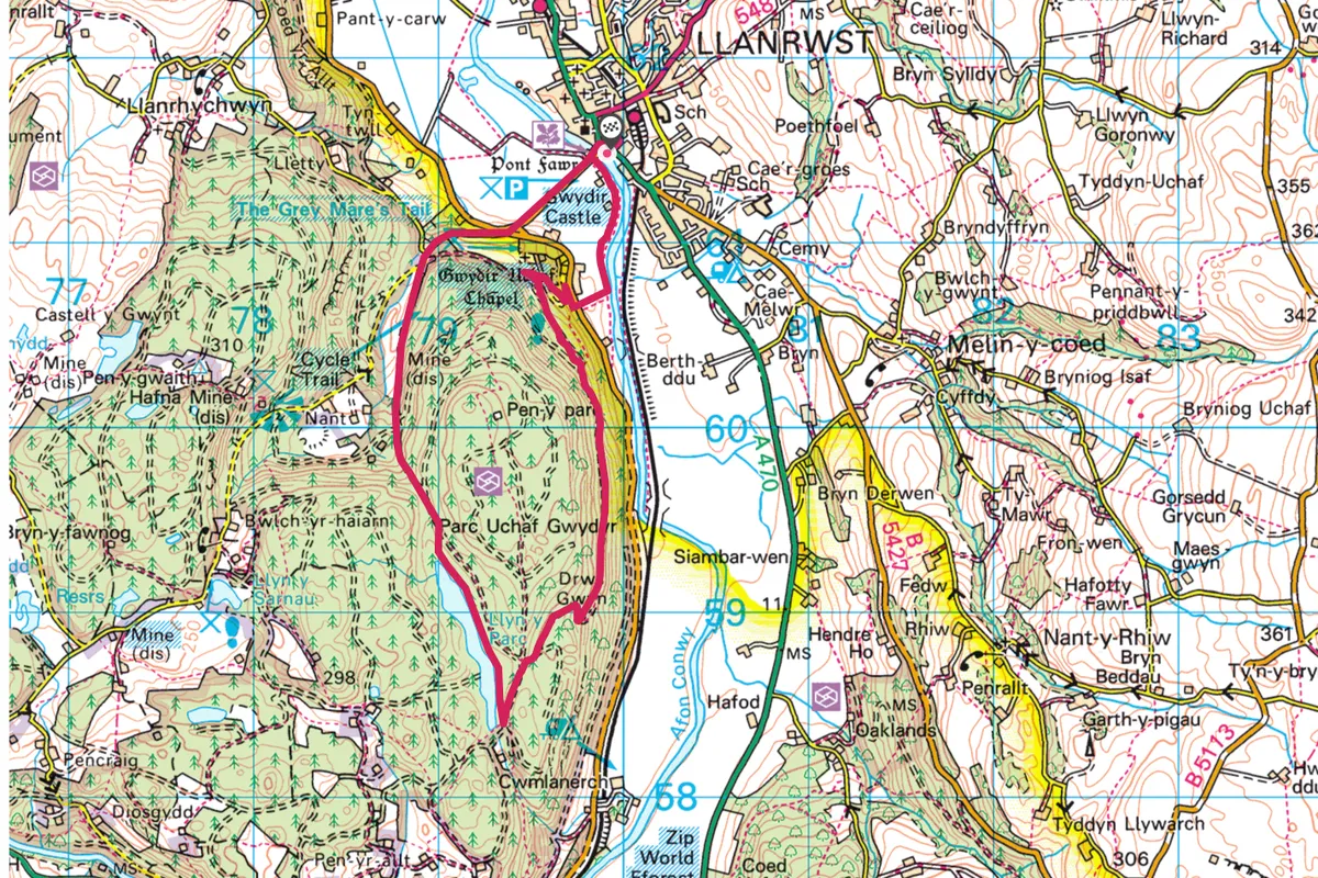
Gwydir Castle, Llanrwst, Conwy
5.3 miles/8.5km | 3 hours | moderate
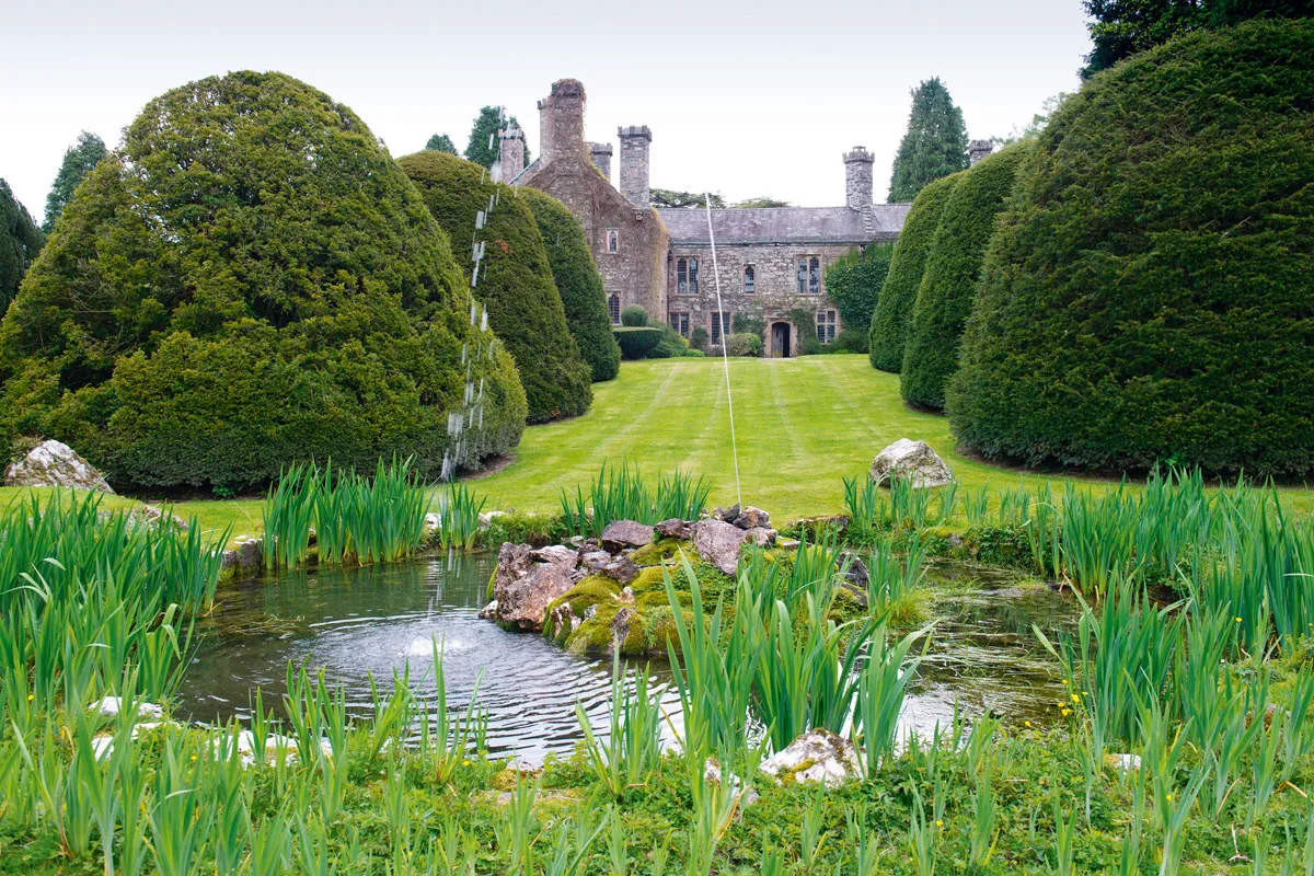
Gwydir Castle stands beside an old road connecting the market town of Llanrwst with the village of Betws-y-Coed in the lush Conwy Valley. It’s a peaceful place – but it hasn’t always been that way.
Back in the late 15th century, this lawless, wasted land was occupied by bandits. But it was soon brought under control by Meredith ap Ieuan – leading regional supporter of King Henry VII – and his bowmen. Meredith and his men rebuilt the castle around 1490 and it became the ancestral home of the powerful Wynn dynasty. Towards the end of the Tudor period, Meredith’s great grandson Sir John Wynn was the most powerful landowner in north Wales.Explore a Tudor mansion and its former estate on the edge of the Snowdonia National Park in Wales with our easy walking route of Gwydir Castle, Llanrwst, Conwy.
There’s lots more to explore too – try this pretty amble from Llanrwst to Llyn y Parc.
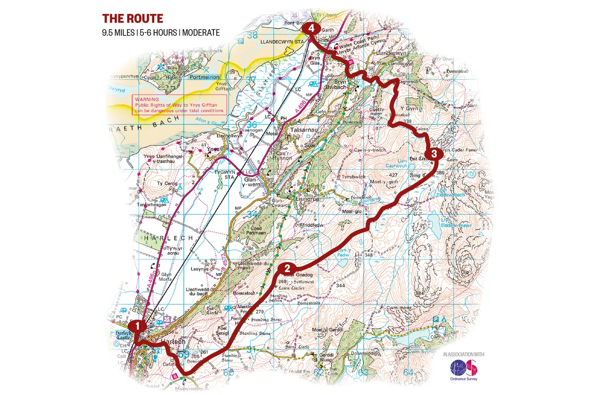
Harlech to Llandecwyn, Gwynedd
9.5 miles | 5-6 hours | moderate
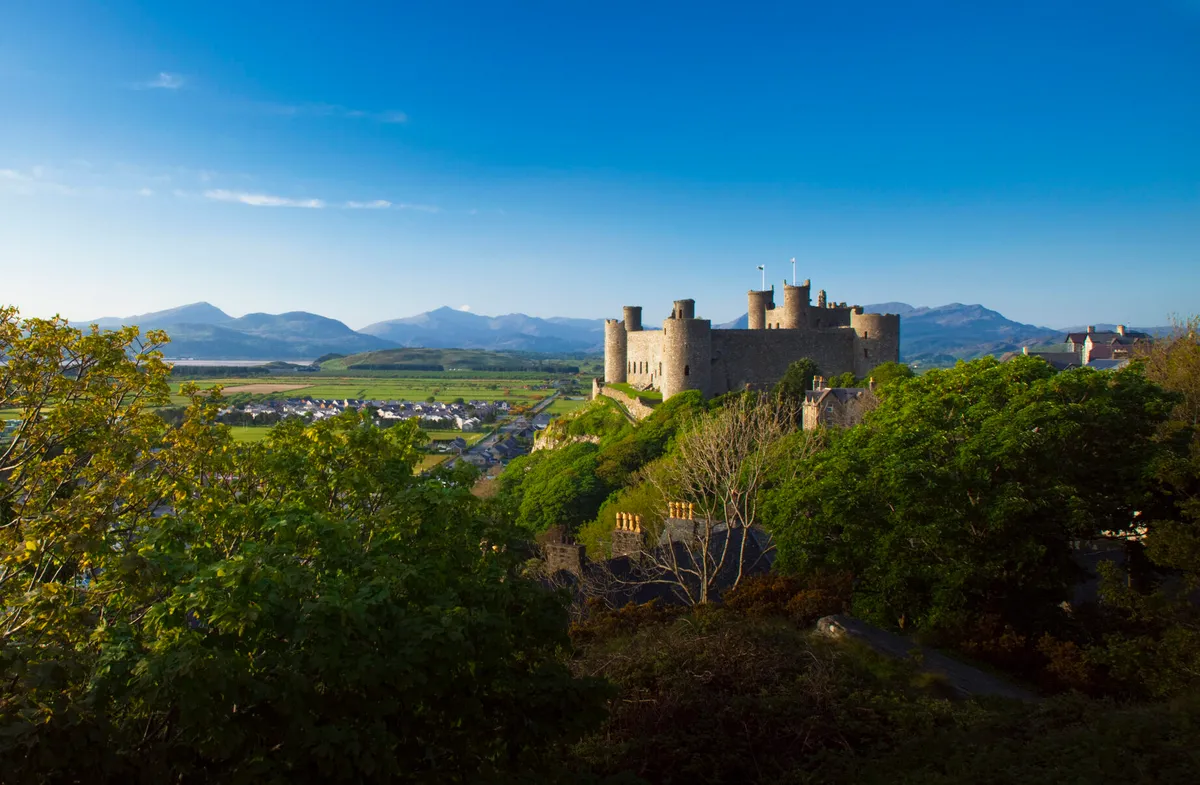
Located in the ancient district of Ardudwy, between the stunning estuaries of the Mawddach and Glaslyn, is the town of Harlech, famed for its dramatically positioned castle on a rock.
High above the castle and town, a Bronze Age trackway runs through a magical landscape, disturbed only by the mewing of buzzards and the song of the skylark. Choose a fine, clear day during a dry spell and follow this peaceful, linear walk towards Bryn Cader Faner, a striking Bronze Age cairn set in the wild foothills of the Rhinog mountains.
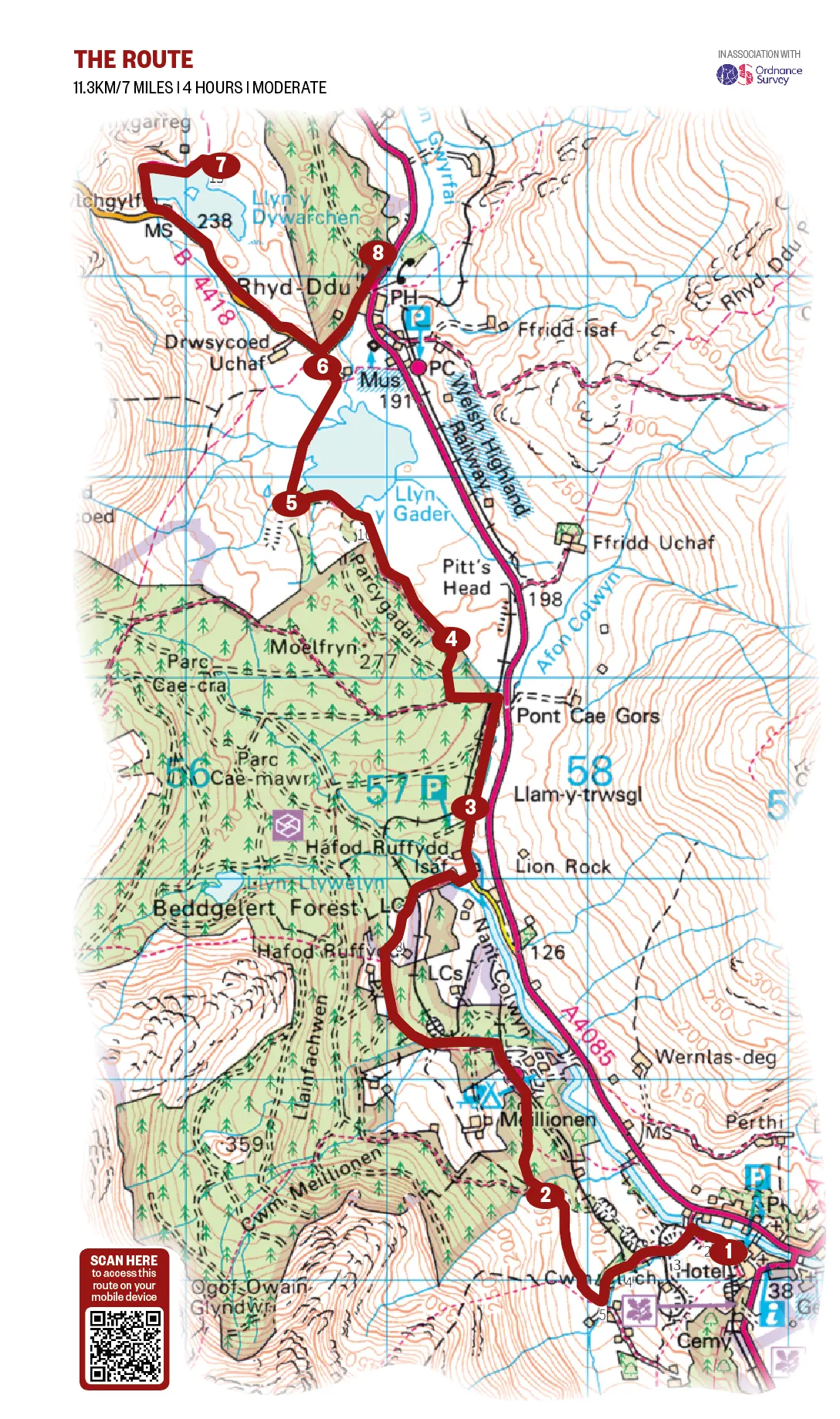
Llyn y Dywarchen, Gwynedd
7 miles/11.3km | 4 hours | moderate
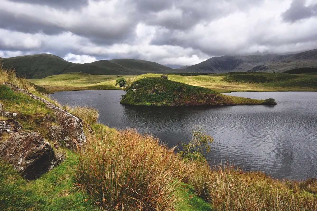
Deep in Snowdonia lies a lake across which an island once floated. In folklore, this is not unusual. St Brendan’s Isles drifted around the globe for centuries, and seven of Britain’s canonised saints apparently floated to our shores on a sod.
Hike through deep valleys, along meandering forest paths and beside an old mountain railway to this mysterious lake.