Snowdon (Yr Wyddfa in Welsh) is the highest mountain in England and Wales at 1,085m (3,560ft). The Snowdon range covers 16 square miles and gave birth to Welsh rock climbing in the 19th century. Today the tracks are bustling all year round and there are plenty of varied routes to the top.
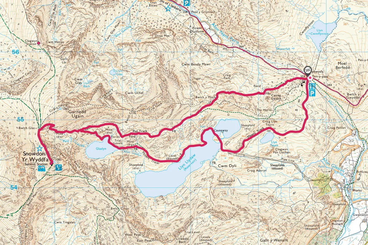
This circular route from Pen-y-Pass combines two of Snowdon's best trails: the Miners’ Track and the Pyg Track. Those looking for a more gradual ascent to the Snowdon summit should consider the 9-mile Llanberis Path.
Find out more about Snowdon
This BBC Countryfile Magazine guide includes details on what weather you're likely to experience, which route to walk and what you need to take with you.
Snowdon walk
7.5 miles/12km | 5-6 hours | challenging
1. Into the mountains
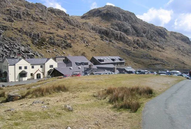
Park, or alight the Sherpa Bus, at the Pen-y-Pass car park off the A4086.
This is the highest road access point to the mountain, so the views are epic right from the start. Even if the fog is hanging low you can still see the outlines of the peaks as you wind up the road to the pass. Begin by taking the Miners’ Track, which is clearly signposted to the left of the car park. As the path begins to tuck around to the right Llyn Teyrn comes into view.
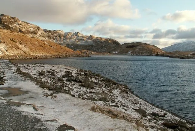
2. Between waters
The path climbs towards Llyn Llydaw reservoir via a stone causeway. Craggy black rock encircles the lake and in wet weather a number of waterfalls burst out of the cliffs.
Over the bridge there are two disused mines, once thriving hubs for miners in the range but now eerily dilapidated. Your second and final lake is Llyn Glaslyn, and it is here that the climb to the summit begins.
3. Track to track
The Miners’ Track can become a little indistinct here, but if you look closely there is a path of sorts carved between the large boulders and scatterings of quartz. You may need to scramble a bit but that can be fun in the right shoes. The path quickly becomes a clear track again and starts to climb more steeply until it meets the Pyg Track and forms a single path to the summit. It’s made of some large rock steps, so hands or poles definitely come into play here.
Looking for another Snowdon route?
The 9-mile Llanberis Path is the most gradual of the six routes up Snowdon (Yr Wyddfa) in north-west Snowdonia.
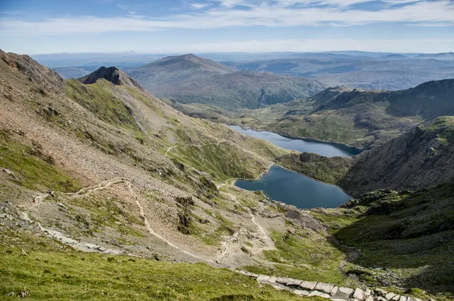
4. The roof of Wales
At the summit you can enjoy fabulous views east of Crib Goch and Y Lliwedd towering over Llyn Llydaw and the remote Yr Aran. The high and remote feeling is only slightly tainted by the mountain railway terminus perched on the summit, which has been part of the landscape since 1896. The small trains carry visitors up the mountain for 957m (3139ft) from Llanberis, offering those unable to climb a small slice of the raw and desolate landscape of Snowdon. A brand new summit café, currently under construction, will mean you can grab a coffee if you forgot your flask.
5. Back to the pass
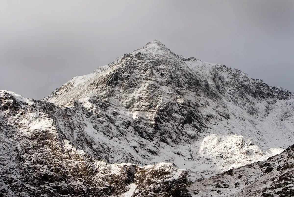
Descending on the popular Pyg Track can feel more challenging than the ascent. You’re higher up and it’s a lot bumpier, but you get a slightly different perspective of the mountain so it's worth experiencing. Below you can see parts of the Miners' Track, the two Llyns and towering to your left, the mighty Crib Goch. A small stile and signpost to Crib Goch all but marks the end of your journey as the car park and civilisation slowly come into view.
Pyg Track and Miners' Track map
TERRAIN
Gravel paths, boulders, steep steps, some scrambling. Dress for mountain walking and check the weather forecast.
HOW TO GET THERE
By car: The A470 will lead you straight into Snowdonia, then head for the A498 and come off at the A4086 for the Pen-Y-Pass car park.
By public transport: Sherpa Buses S1 and S2 travel from Llanberis and Betws-y-coed to Pen-y-Pass every hour from 8am-6pm March-Nov (times vary depending on the day so check before you set off).
REFRESHMENTS
Pen-y-Pass café is situated in the car park next to Information centre and toilets.
ACCOMMODATION
Pen-y-Pass Youth Hostel, Pen-y-Pass, Nantgwynant, Caernarfon LL55 4NY. 0870 770 5990
MAP
Ordnance Survey Explorer Map OL17.
Grid ref: SH 647 556