In the 17th century, the tiny hamlet of Keld was so remote that the nearest consecrated burial ground was over three days walk away, along the valley-top ‘Corpse Road’.
Today, it is still feels like a far-flung escape worth exploring.
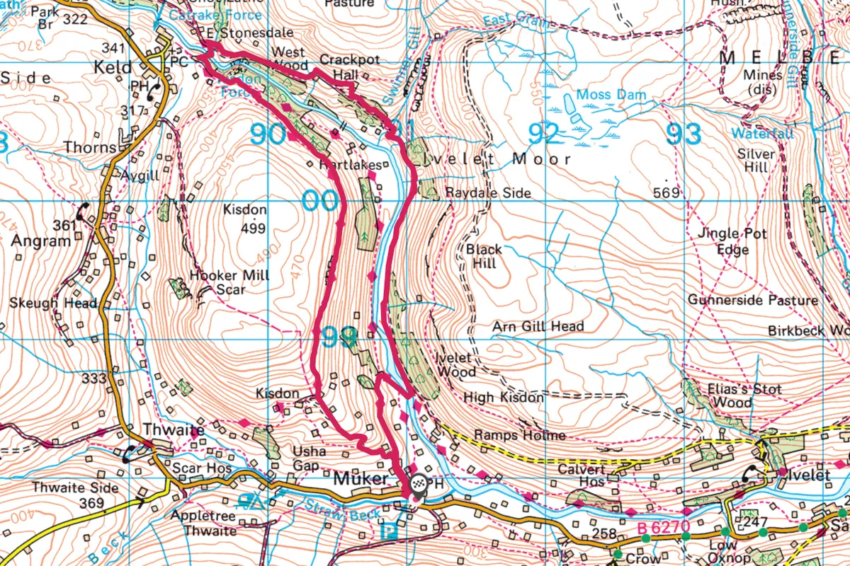
1. Chapel start
The walk starts from the chapel in Keld and follows this trackway. After 300m descend to the left to the footbridge over the River Swale. Those who love waterfalls should continue on 200m and detour to the huge double waterfalls at Kisdon – perfect for swimming and jumping. Climb up past pretty East Gill waterfall and then bear right and continue for three quarters of a mile, bearing left up to the mines and the ruins of the wonderfully named Crackpot Hall.

Perched high on the edge of the valley these evocative ruins provide glorious views over upper Swaledale, and the walk ahead. The name comes from the Old Norse ‘kráka’ for crow and Old English ‘pot’ for cave or ravine. In the 1930s, stories were told of untamed children who lived there like ‘spirits of the moors’.
2. Pools, Falls and Tunnels
The path continues, bending around and into deep canyon Swinner Gill to the north. After half a mile, the path arrives at the arched stone bridge and the ruins of several old lead mine buildings. Take time to explore as there are crystal pools and some exciting scrambling down the ravine, if you are a climber.
If you continue up the left arm of the (now dry) gill, you will reach the ‘kirk’ where there is a mossy waterfall and a deep cave tunnel. This spot was said to be used as a place of hidden worship in less tolerant times.
Return south, via the path on the other side the gill. Continue almost two miles, joining the River Swale again to reach Rampsholme bridge.

3. Wildflower power
Cross and turn left toward Muker (pronounced Moo-Ker), passing through five small meadows – some of the best traditional hay meadows in England. These rare flower-filled landscapes are glorious between May and July when, as in generations past, the hay is cut and stored in the stone barns ready for the winter ahead. Picnic here among the flowers, or refresh yourself at The Farmer’s Arms Muker. This traditional pub serves good value meals and real ales.

4. Valley vista
The route returns following the corpse road all the way back to Keld. Take the bridleway behind the pub. Bear left to climb Kisdon Hill, join the Pennine Way and it’s a three mile walk with superb views out over the valley.
Map
Click on the map below for an interactive version of the route.