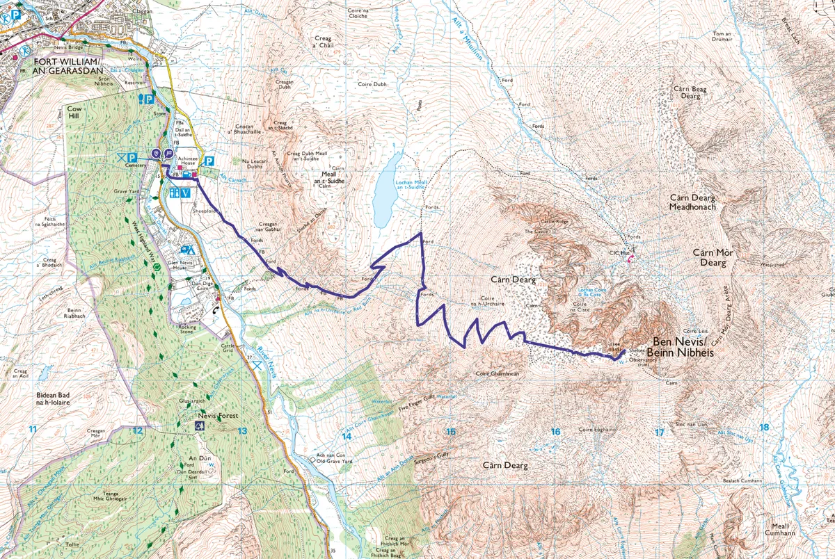
The path to Ben Nevis starts close to sea level and involves a huge vertical ascent to reach the summit at 1,345m (4,413ft). Initially a good, wide path ascends the lower slopes but this deteriorates on the higher, rougher, granite boulder-and-scree-strewn ground below the summit.
Experienced walkers should complete the return route in five to six hours, others may take up to ten hours. Competency in mountain navigation is essential.
During the winter months and into early summer, when snow still covers the upper part of the mountain, you may also need an ice axe and crampons – and know how to use them. Mid to late summer is the best time for an ascent.
Ben Nevis walk
9.7 miles/15.6km | 1351m accent | 6-10 hours | challenging
1. Over the river
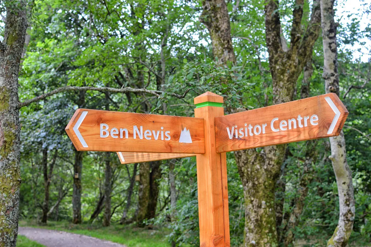
Start from the Ben Nevis Visitor Centre in Glen Nevis where there is a pay and display car park.
Cross the nearest bridge over the River Nevis to walk right before turning left, uphill, at a sign. Cross a track to join the path that leads from the nearby Ben Nevis Inn across the flanks of Meall an t-Suidhe.
2. Stob Bán view
Further on, the path hairpins before climbing steeper and rockier ground. From here you can see the sharply peaked Stob Bán among the Mamores above Glen Nevis.
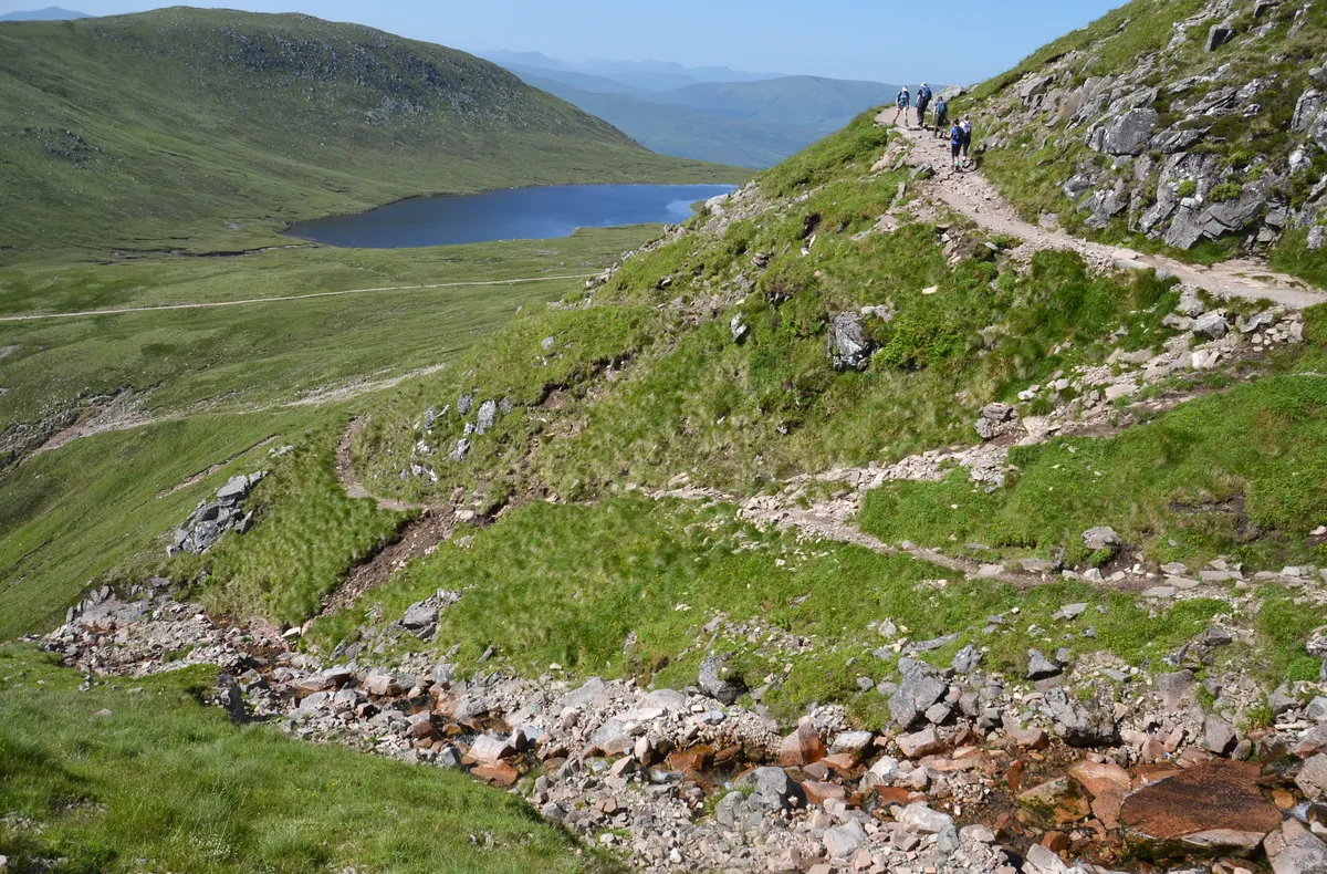
3. Past the lochan
Ascending by the river, known as the Red Burn, the path takes a sharp left turn. Walk on to reach the plateau that holds Loch Meall an t-Suidhe, erroneously called the Half Way Lochan.
Find out more about Ben Nevis
Where is Ben Nevis, how high is it and where are the best places to stay in the area? Our guide explores all this, as well the best Ben Nevis walk, how long it takes to climb the mountain, and what you need to take with you.
4. Big right
Keep heading north-east to reach a junction and go right. After 500m you cross a deep gully that holds the Red Burn. Stay on the path, to avoid erosion, which continues zig-zagging up increasingly rough boulder-and-scree-strewn ground.
Note that navigation in mist, or with snow underfoot, makes the ascent much more difficult. Keep track of your position on the map by counting the corners on the zigzags, backed up by GPS or timing and pacing.
5. Five Finger Gully
Care is needed to stay on the main path. Avoid veering south to the dangerous steep screes at the head of Five Finger Gully. In good conditions there are excellent views of Glen Nevis below.
6. Summit plateau
Hike on to McLean's Steep – a notable section of ascent – between 500 and 600 metres west of the top. Now on the summit plateau beware of perilous drops close to the path on the left at Tower Gully and then at Gardyloo Gully. There is a major change in direction once the latter has been passed – marked by a navigational cairn, the last in a series from Red Burn.
Walk on north-east to the summit, where there is a massive cairn, on top of which sits a concrete trig point.
7. Misty vista
The top also holds the remains of an observatory, a shelter, and several cairns. Just a few metres to the north, the cliffs drop vertically.
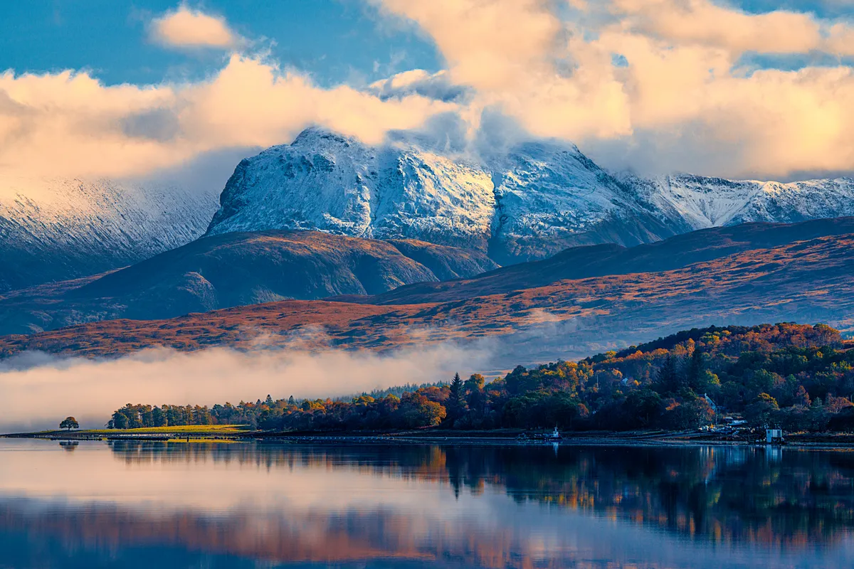
The panoramic view from the top is one of the Highland's best, with peaks in all directions and Fort William and Loch Linnhe to the west. Ben Nevis' mesmeric North Face draws the eye where you may spot rock climbers on Tower Ridge or on other classic climbs.
To retrace your steps you should always take a compass bearing as even in good conditions hill mist can shroud the mountain's upper slopes in minutes and it can be difficult to tell if you are following the main path.
From the summit cairn, walk for 150 metres on a bearing of 231 degrees (subtract magnetic variation), which will take you safely past Gardyloo Gully on your right. Then follow a bearing of 282 degrees (subtract magnetic variation), which will take you down to the zig-zags on the Mountain Track, avoiding Five Finger Gully with its deceivingly gentle upper slopes but which has been the scene of many accidents.
If the zig-zags are snow covered you must be careful to avoid drifting too close to the slopes above the Red Burn, which are avalanche prone.
Return to the car park the way you came, taking care of footing and navigation as you go.
Ben Nevis map
Ben Nevis walking route and map