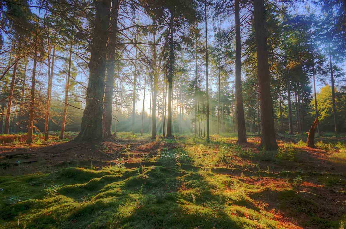
Not the usual manmade canal, the Itchen Navigation, which opened in 1710, is a straightening, controlling of the River Itchen, so doesn’t look like a conventional canal. The river winds along nearby, with many offshoots, and from time to time the two waterways run near each other and even reunite.
Despite its industrial heritage – using horse-drawn barges to transport coal, corn, iron and timber from Southampton to Winchester – essentially, the Navigation is still a rare chalk stream habitat.
It teems with life above and below the water: dragonflies and damselflies, kingfishers, grey wagtail, and swans, otters and water voles, salmon and trout. In his youth naturalist Chris Packham lived nearby. He filmed a walk here for the BBC, describing it as “where I really cut my teeth as a naturalist”.
This 7.5-mile walk heads upstream from Eastleigh to Winchester, the direction the navigation was created for, and is a well-waymarked route, with several swimming spots.
Hampshire walks
Explore Hampshire's countryside, coast and its two National Parks – the New Forest and South Downs – with our pick of the best walks in Hampshire.
Eastleigh to Winchester walk
7.5 miles/12km| 4.5 hours | moderate | 96m ascent (one way)
1. Eastleigh
The walk starts at Bishopstoke Road (The Hub) car park. Walk north on the left-hand side of the canal, past Stoke Lock, with a fish ladder for salmon and eels. Weeping willows stroke the reed-edged water, and steps lead into it. You can swim, but the current is quite strong.
Cross a couple of footbridges, with river and navigation repeatedly merging and parting. Pass twice under the London-Southampton railway line, which caused the Navigation’s demise.

2. Shawford
After 4.3 miles, the tree-shaded towpath delivers you to Shawford. Up to your left is the Bridge Inn and Shawford station (for Eastleigh trains). Pass behind pretty cottages to rejoin the towpath.
3. Compton Lock
At Compton Lock the waterway widens into a tempting pool, another popular swimming spot. To the right is Twyford Meads, managed as water meadows from the 17th century until the 1930s. Channels carried water from the Navigation, controlled by hatches and sluices, to flood the meadows to grow early spring grass for cattle.
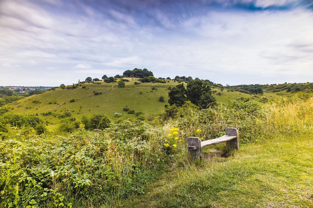
St Catherine’s Hill walk
Looking for another walk in the area? Climb to the crest of the tree-topped beacon of St Catherine's Hill in historic Winchester with this four-mile circular walk.
4. Hockley Meadows
Watch out for young kingfishers leaving the nest at Hockley Meadows nature reserve.
Beyond, the chalk downland of Twyford Down rises, where, in 1992, protesters camped, fighting against the M3 extension, which opened in 1995. Follow signs for the pedestrian crossing beneath it. The landscape becomes leafier, with the Navigation flowing on the left down a wooded slope.
5. St Catherine’s Hill
At a stone seat shaped like the 70-foot Navigation barges, look across to The Hospital of St Cross, a charity founded in the 1130s, which continues the ancient ‘wayfarer’s dole’ tradition, a small cup of beer and chunk of bread, which any traveller can request.
Through a gate a stepped path climbs St Catherine’s Hill, an Iron Age hill fort and Site of Special Scientific Interest. The slog to the top, just shy of 100m, yields great views of Winchester, plus butterflies and orchids, including autumn lady’s tresses (flowering in August despite its name). Descend to the Handlebar Café.

6. Winchester
Cross a road into pretty Palmer Fields, with Navigation-facing benches, which inspired John Keats to write his ode to autumn – season of mists and mellow fruitfulness – on walks here in 1819.
The route leaves the Navigation, rejoining it in The Weirs gardens. Spot Winchester Cathedral, where St Swithin, King Canute and Jane Austen are buried.
At City Bridge, with water-powered Winchester City Mill beyond, follow signs to the city centre and Winchester railway station for trains back to Eastleigh.

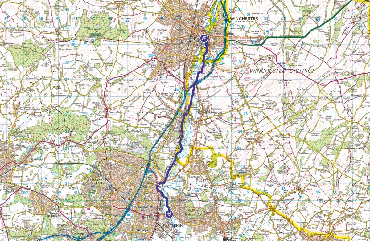
Eastleigh to Winchester map
Eastleigh to Winchester walking route and map
Useful information
Starting point
The walk starts at Bishopstoke Road (The Hub) car park, SO50 6LA (charges apply), a short walk from Eastleigh railway station. Bluestar and Xelabus bus services.
Terrain
Level going on mainly unpaved path, may be muddy, with the odd fallen tree branch. Not suitable for wheelchairs or pushchairs.
Map
OS Explorer 22 and 32
Eat/drink
Steam Town Brew Co, near start; Bridge Inn, Shawford, at halfway point; Handlebar Café, near the end.
Stay
Stay at the Winchester Royal Hotel, 16th-century former bishop’s house in the city centre.