This is a canal-side walk with a difference, in that it follows a waterway with no water. The Northern Reaches of the Lancaster Canal were abandoned in 1956, but the old towpath remains, tracing the route of the empty channel near Kendal.
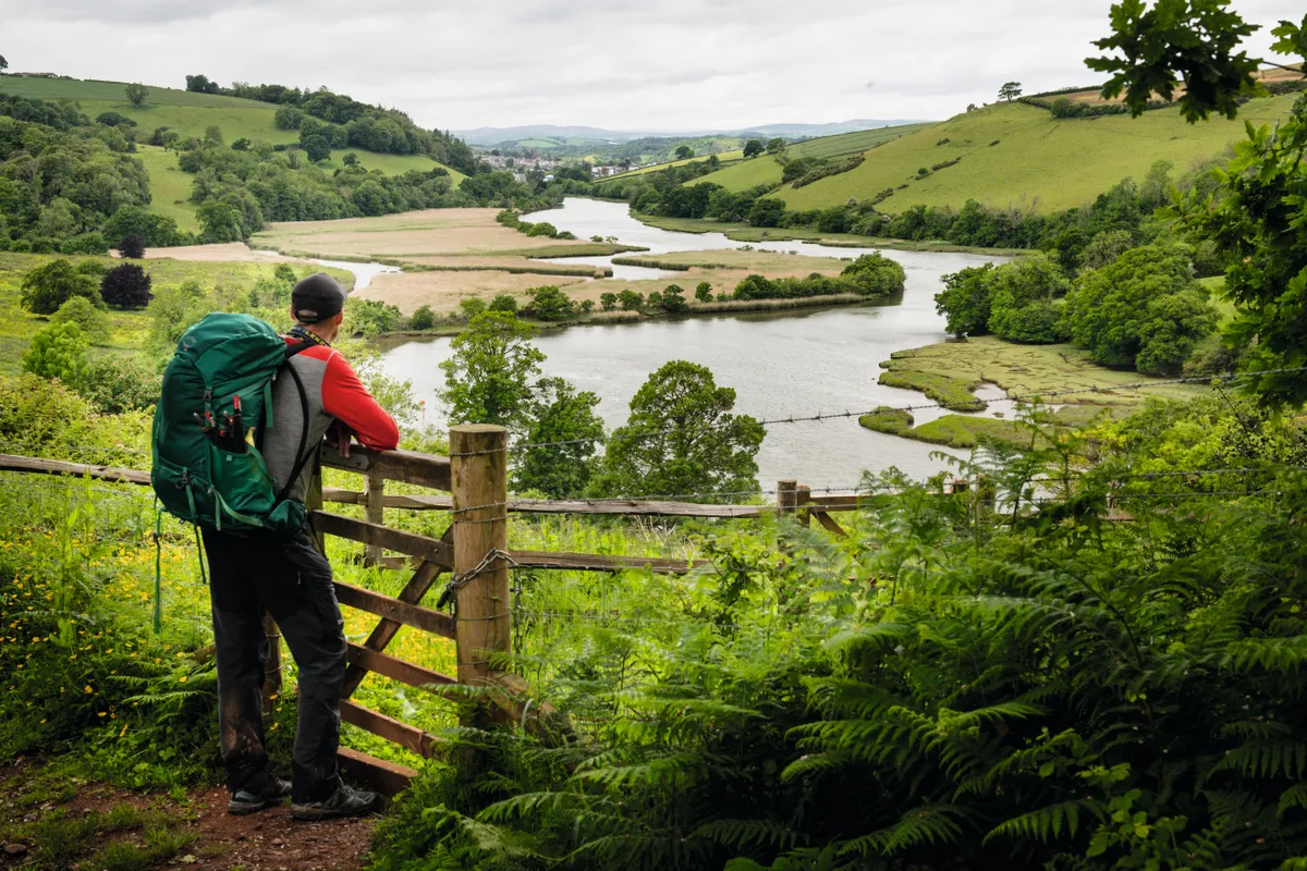
With views of the Lakeland fells in the distance, the route passes under several humpback bridges and crosses an aqueduct, all left high and dry by the cessation of traffic. The second half of the walk more than makes up for the lack of water in the canal though as it accompanies the tumultuous River Kent downstream, in and out of woodland.
Looking for more walks in the area? Check out our guides to the best walks in the Lake District and the Yorkshire Dales.
Britain’s most beautiful river walks
Explore Britain's tranquil waterways by taking a stroll along one of our favourite riverside trails.
Sedgwick and the Northern Reaches walk
3.7 miles/6km | 2 hours | easy | 54m ascent
1. Sedgwick Aqueduct
Turn left at the top of the steps on the western side of Sedgwick’s aqueduct, built in 1819 as part of the Lancaster Canal linking Preston with Kendal.
Entering a field, walk beside the fence on the left. After a kissing-gate, the route passes under Horse Park Bridge, the first of several redundant bridges encountered. The now dry ditch that once contained the canal – used to carry gunpowder, coal and limestone – is evident as the path enters woodland.

2. Larkrigg Hall Bridge
Beyond the trees, the towpath accompanies the green-bottomed ‘canal’ under Larkrigg Hall Bridge. It then crosses a farm track and continues to the right of field boundaries.
3. Crowpark Bridge
Soon after passing beneath Crowpark Bridge, go through the kissing-gate to the left and turn right along the lane. Just before the bridge over the River Kent (Hawes Bridge), climb the stile on the left to begin your riverside journey.
The wooded embankment soon gives way to open ground, allowing a better chance of spotting herons, dippers and even kingfishers on the water.
The river is then forced through a narrow gorge where birdsong in the surrounding woods is drowned out by the noise of the water. Because of its significant drop in height over a short distance, the Kent, which rises in the Lakeland fells, is one of England’s fastest flowing rivers, a feature that made it ideal for powering mills.

4. River Kent
Turn right at a junction with a broader path and then use the footbridge on the far side of the next field to cross the river. Go left along the lane.

5. Sedgwick House
Go left again at the T-junction. Immediately after the bridge, take the footpath signposted to Stainton. As you head uphill through the meadow, the building to the left is Sedgwick House, built in 1868.
After crossing a lane, continue uphill to another bridge.
6. Sedgwick
Pass under this to join the towpath beside the disused waterway, here a damp ditch maintained as a nature reserve. To return to Sedgwick, descend the steps after the aqueduct.
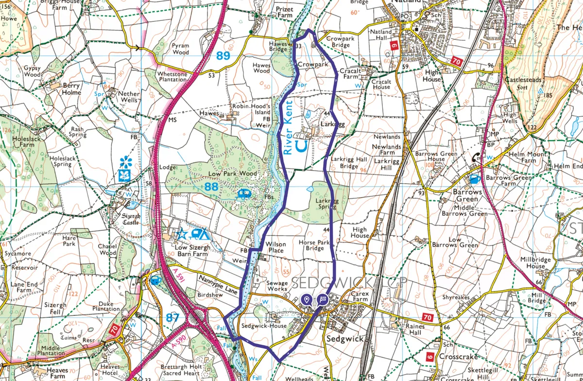
Sedgwick and the Northern Reaches map
Sedgwick and the Northern Reaches walking route and map
Useful information
Starting point
Aqueduct on Back Lane, Sedgwick (SD513 870). Park considerately in village or catch the 555 bus (Stagecoach) from Kendal to the A591/A590 roundabout at Brettargh Holt and then walk 200m to join the route at waypoint 5.
Terrain
Disused canal towpath, fields, quiet roads, riverside path, woodland. Several stiles and kissing-gates.
Map
OS Explorer OL7
Eat/drink
Low Sizergh Barn farm shop and café, 800m off route.
Stay
Low Sizergh Barn has a campsite with pods. Alternatively, try nearby Levens where there are hotels and B&Bs, including the Hare and Hounds (015395 60004).