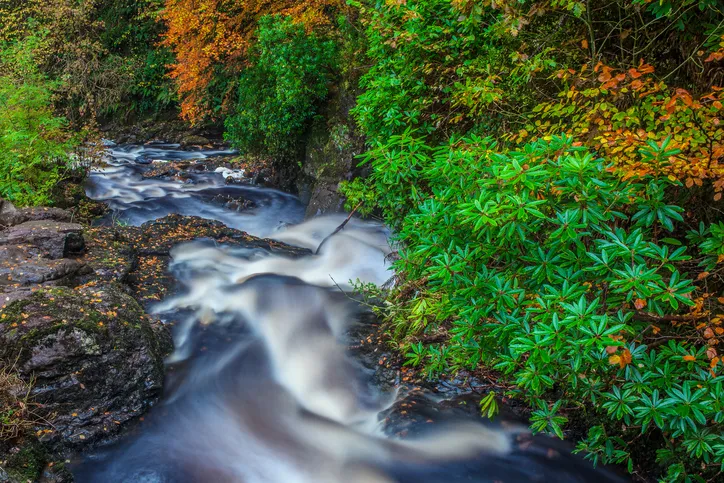
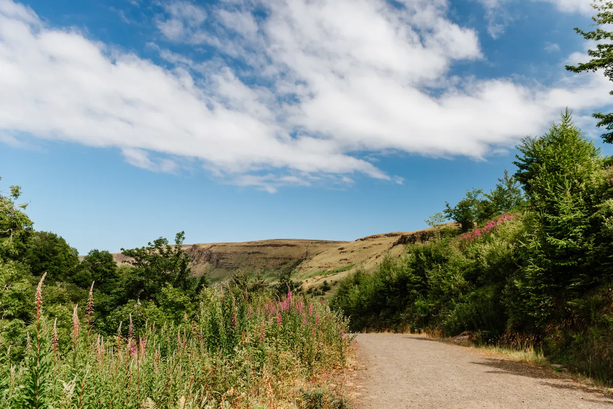
Known as the Queen of the Antrim Glens, Glenariff valley is defined by forests, rivers and glacial escarpments.
The rivers Glenariff and Inver have cut right through this spectacular steep-sided gorge.
These rivers can be lively and dramatic as they tumble over boulders and a series of impressive waterfalls. But then they become suddenly calm and tranquil, flowing lazily through oak and beech woodland, sunlight streaming through the fresh new leaves.
This humid and moist microclimate is home to rare ferns, mosses and liverworts, as well as spruce, fir, pine and larch.
The 4.6-mile² Glenariff Forest Park spans both sides of the valley, where there are a number of walking routes. Here, we've picked two of the best, one moderate route (5.2 miles) and one short route (1.5 miles).
Note that there is an admission charge for both cars (£5) and pedestrians (£2) entering the park.
Northern Ireland walks
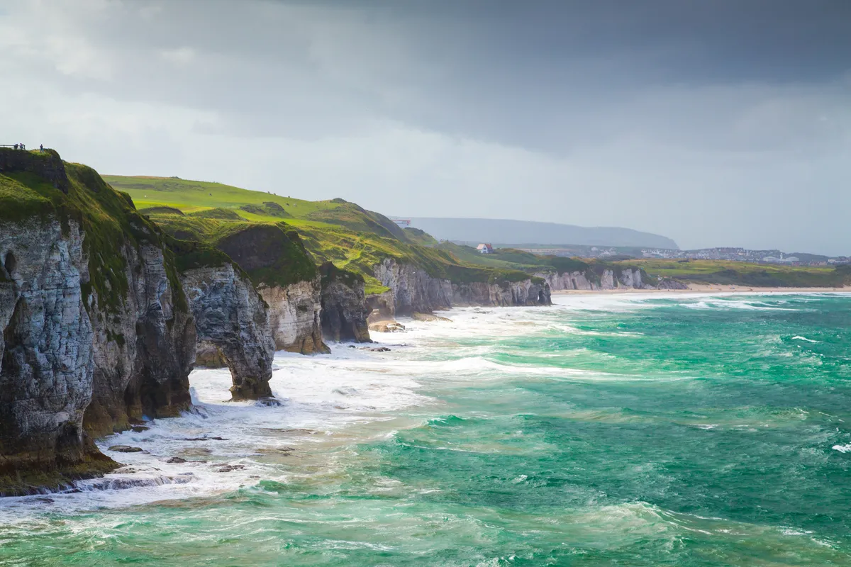
Northern Ireland's countryside is a walker's paradise. From the drama of the Causeway Coast and County Down's Mourne Mountains to the serenity of Glenariff Forest Park and Belfast Caslte, here are some of Northern Ireland's best walks.
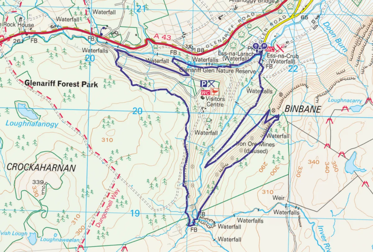
Glenariff Forest Park walk – moderate route
5.2 miles/8.4km | 3.5 hours | moderate
The rocky gorges and fast-flowing waters of the Inver and Glenariff rivers are the main focal points, with some 22 waterfalls passed in the first half-mile of the walk alone.
This route, starting and ending at Laragh Lodge, combines the red Waterfall Trail and the black Scenic Trail on a five-mile circuit, following maintained footpaths throughout.
1. Laragh Lodge
Walk around the back of Laragh Lodge and join a path beside the turbulent confluence of the Glenariff and Inver rivers.
Pay your dues at a park turnstile, then continue straight ahead. Ignore a bridge on the left; you will return this way at the end of the circuit. Follow the red waymarkers of the Waterfall Walk, heading upstream past numerous chutes and falls.
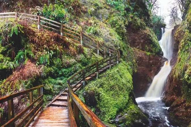
As the gorge walls draw closer, the path takes to a wooden walkway built into the cliff. Deep within the ravine, the drama culminates in the thundering double drop of Ess-na-Larach. Several smaller cascades then lead to Hermit’s Fall, the final big drop on the river.
2. Scenic Trail
As the path veers away from the river, join the black waymarkers of the Scenic Trail. A short detour left here brings you to the park café and visitor’s centre, where displays highlight the history and ecology of the area.
Back on the Scenic Trail, cross two tarmac roads and climb through pine trees to a large clearing with fine views down the length of Glenariff.
3. Inver River
Continue climbing to a wooden footbridge over the upper Inver River, the highest point of the route. The track begins to descend now, emerging from the trees to reveal the full grandeur of the escarpments that enclose the northern side of the glen.
4. Ess-na-Crub Waterfall
Wind down through several switchbacks to reach the line of an old narrow-gauge railway, constructed in 1873 to transport iron ore from mountain mines towards the sea.
At the bottom of the slope, cross a bridge over the Inver River, then turn right to admire Ess-na-Crub Waterfall. Cross another bridge over the Glenariff River, then turn right again to return to Laragh Lodge.
Glenariff Forest Park map - moderate walk
OS Maps: Glenariff Forest Park walking route
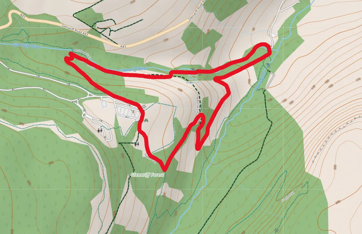
Glenariff Forest Park walk – easy route
1.5 miles | 1 hour | easy
1. Marking the way
Three waterfalls provide a spectacular focus for this woodland walk in one of Northern Ireland’s most panoramic landscapes. The walk is waymarked throughout and easy to follow from the Visitor Centre car park.
Descend steeply from the Visitor Centre car park to the bottom of the gorge and the first of the waterfalls.
2. The first fall
After one mile you will reach a waterfall. Glenariff is home to rare ferns, mosses and liverworts and the woodland will be alive with birdsong. Turn left. Special walkways cut into the sides of the gorge provide a spectacular route allowing close inspection of the plantlife that abounds in this National Nature Reserve.
3. Rainbow Bridge
A boardwalk continues along the valley bottom by Glenariff River to Rainbow Bridge. From here it’s a steep climb back to the starting point.
Glenariff Forest Park map - easy walk
Glenariff Forest Park visitor information
Car park
Laragh Lodge, signed from the A43 Ballymena-Cushendall road.
Terrain
Signed, constructed paths with 281m vertical ascent.
Map
OSNI sheet 9
Eat/drink
Laragh Lodge – at the start and finish of the route – dates from 1890. Open daily from 11am, it serves lunches and dinners right beside the river.
Stay
Perfectly located within the park boundaries, Glenariff Forest Touring Site provides serviced sites for caravans and campervans.