1
Ancient works
Starting in the Woodland Trust car park, walk down to a grassy crossroads and across a slope through a beech plantation. The 647-acre wood is a collection of diverse woodland acquired by the Trust in 2007. The area has been exploited for its iron ore since Roman times, and was once a source of charcoal for iron smelting. Much woodland archaeology exists, including pits, sunken lanes and trackways.
Exit the plantation on to a sunken lane and turn left after 100m, following the path. In spring, look for bluebells here.The path climbs to crossroads where there is a seat near a sawpit, once used for turning trunks into planks. You are now in ancient Coneyburrow Wood.
Turning right at these crossroads, follow the track down, then cross two bridges and continue ahead. The route goes right on to Goatham Lane and then Brede Lane. Enter Horn’s Wood through a gap in the fence.
2
Wood Anemones
Wood anemones pepper the ground here in spring. An estimated 55 important ancient woodland plants and trees grow in the woods, including bluebells, pignuts and primroses.Continue along this path on the western edge of the wood. Go through a squeeze gap and turn left over a road bridge. Continue on the road and then take the public footpath to the right, which leads into woodland.

The route winds downhill between towering Scots pines, where you may see buzzards, woodcocks, nightingales and warblers, plus brimstone and orange tip butterflies. Great crested newts, dormice, fallow deer, badgers and wild boar also call this wood home.
The route crosses a stream and leads to the bank of Powdermill Reservoir, built in 1930 for the expanding population of Hastings. In the 17th and 18th centuries, a furnace stood nearby, and this valley would have resounded with the sound of bellows. The site of the furnace is now submerged beneath the reservoir.
3
Valley View
At a T-junction, turn right, following the ancient trackway. At the top, turn right on to Sedlescombe Heath, a valuable habitat under restoration.
Head to Holman Wood, then uphill and right. From the main path, a left track leads to a bench perched high over Brede High Heath. Take a moment to admire the stunning view here.
After turning right, bear left along an ancient woodbank lined with coppiced hornbeams. Continue to a crossroads before turning right and following the path back to the car park.
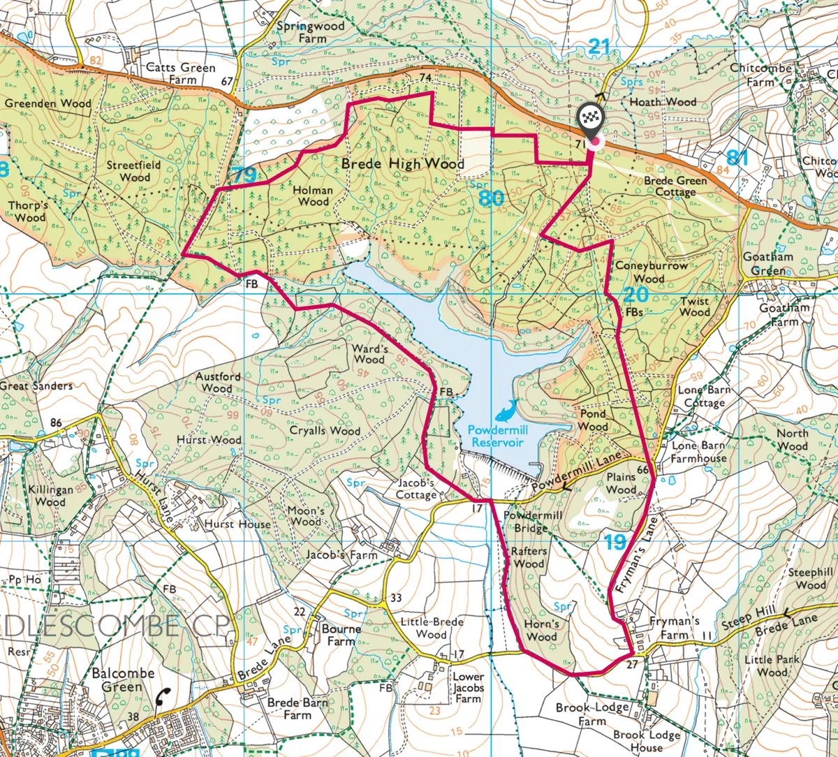
Map
Click on the map below for an interactive version of the route.
Useful Information
How to get there
The Woodland Trust car park is on the B2089, five miles north-west of Battle, between Cripps Corner and Broad Oak.
Find Out More
The Woodland Trust
01476 581111
www.woodlandtrust.org.uk
Stay
Hayden’s
108 High Street, Rye TN31 7JE
01797 224501
www.haydensinrye.co.uk
This small, family-run, eco-friendly B&B serves local and organic produce. Rooms start from £85 per night.
Eat
The Dining room
Claverton Country House, Bluemans Lane, Battle TN33 0SE
01424 751128
www.clavertonhouse.info
Nearby
Battle Abbey
High Street, Battle TN33 0AD
01424 775705
www.english-heritage.org.uk
Words: Linda Harrison
Main image ©Geograph

