Alfred Wainwright’s breathtaking Coast to Coast trail passes through three of England’s most spectacular National Parks. But more than that, it is a chance to slow down, live the simple life and absorb the stories of the land.
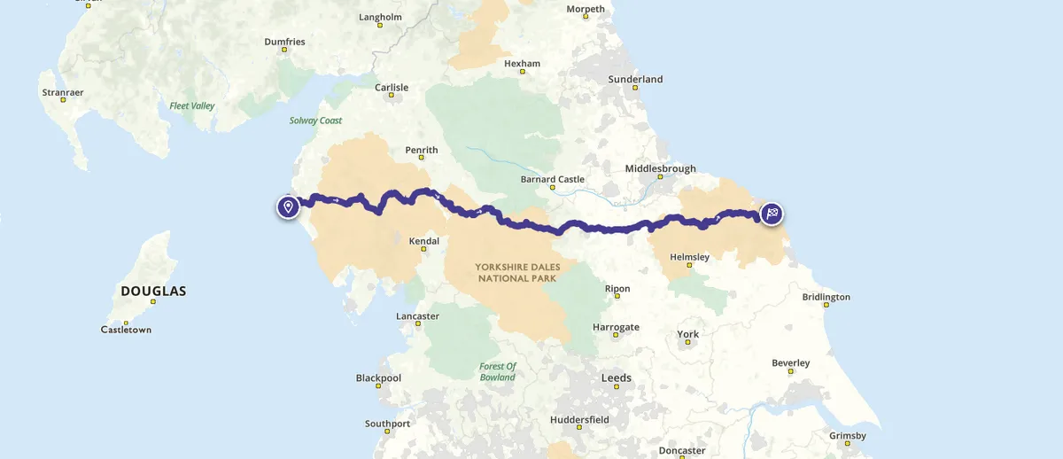
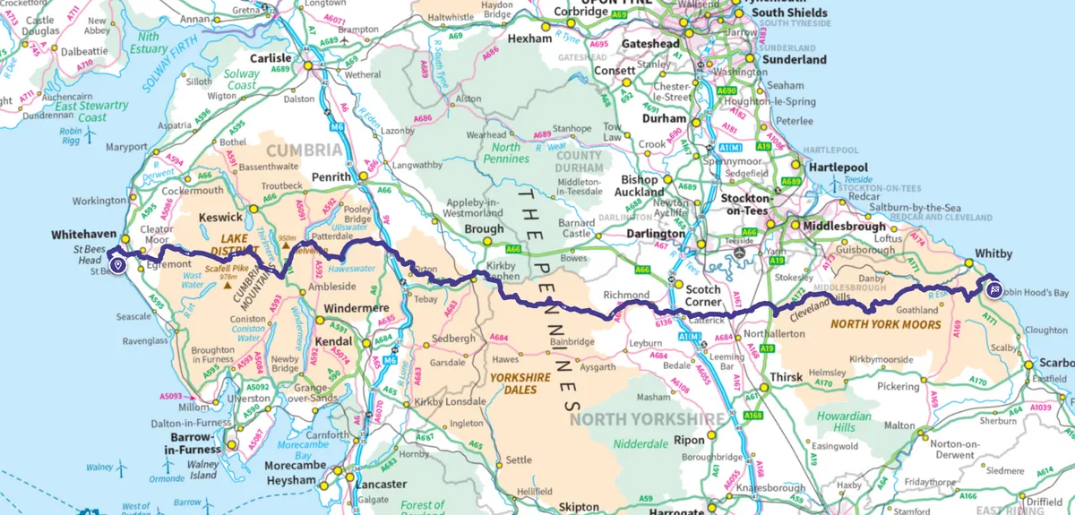
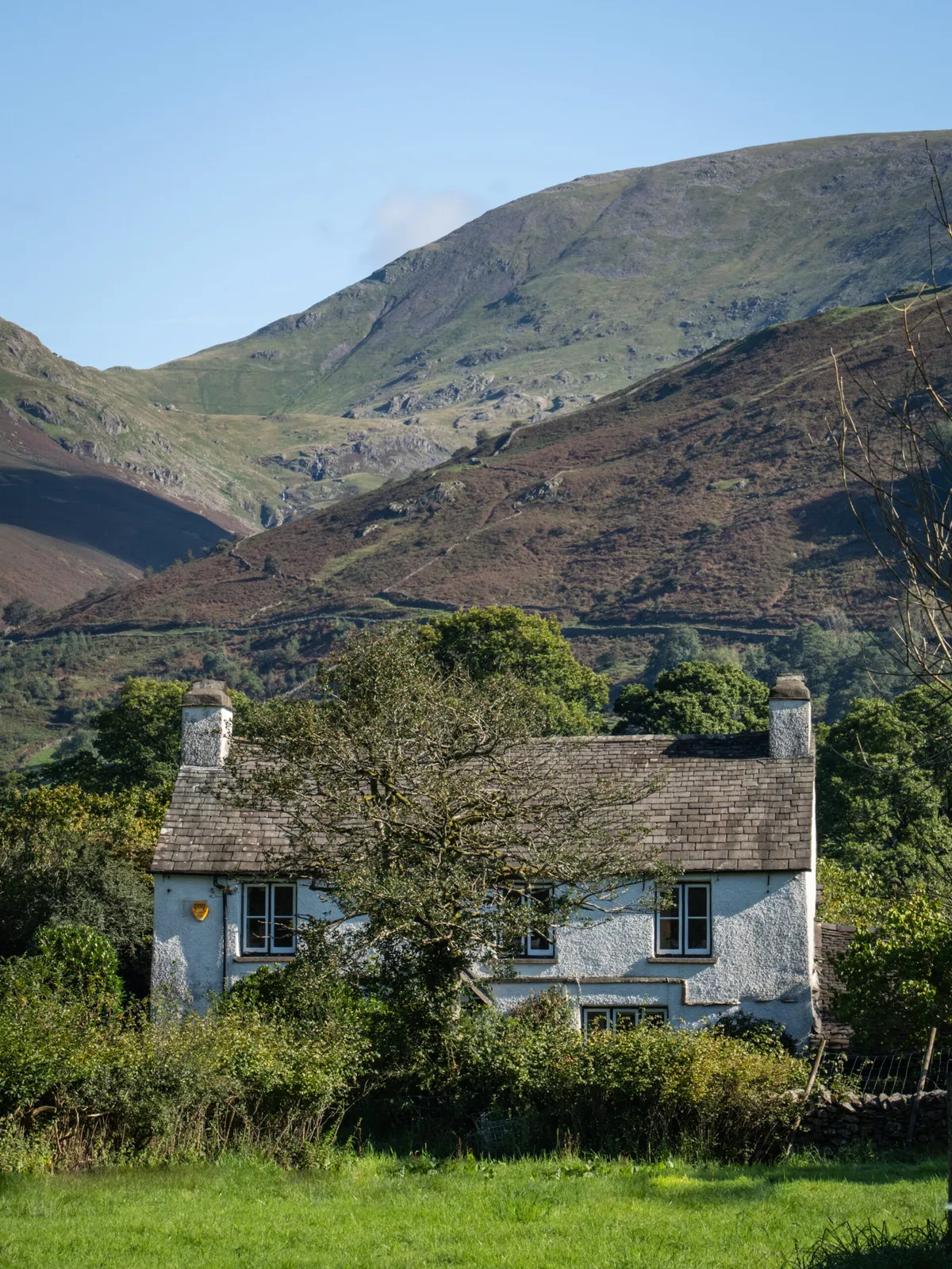
“Surely there cannot be a finer itinerary for a long-distance walk!” wrote guidebook author Alfred Wainwright when he devised the Coast to Coast in the early 1970s. It’s hard to disagree. For 192 miles, this route meanders across northern England’s three most spectacular National Parks: the Lake District, the Yorkshire Dales and the North York Moors.
We named it one of the toughest long-distance walking trails in the UK, thanks to its hilly inclines and varied weather.
- Classic routes in the Lake District by Britain’s greatest hill walker, Alfred Wainwright
- The best walks in the Lake District National Park
Where does the Coast to Coast route start and end?
The Coast to Coast route starts at St Bees, Lake District National Park. It ends at Robin Hood's Bay, North York Moors National Park.
What's the best way to walk the Coast to Coast?
Most people tackle the route from west to east, so they’ve got the prevailing weather, particularly the wind, at their backs.
How long is the Coast to Coast?
The Coast to Coast route is 192 miles (309m).
How long does it take to walk the Coast to Coast path?
By spreading it over 13 days, daily distances range from about eight to 23 miles. It’s a hilly route, so shouldn’t be underestimated. Even if you choose the low-level options, expect to clock up 8,500 metres of ascent. Only another 348 metres and you’ll have climbed the equivalent of Everest!
Ultra-runner Damian Hall completed the route in 39 hours and 18 minutes in 2021, but most people take a more relaxed approach.
What's the elevation gain?
The elevation gain of the Coast to Coast is 8,500 metres. The elevation gain per mile is 44.3m.
What's the highest point of the Coast to Coast path?
The highest point is Kidsty Pike in Cumbria, at 780m.
Coast to Coast map

What are the most beautiful parts of the Coast to Coast?
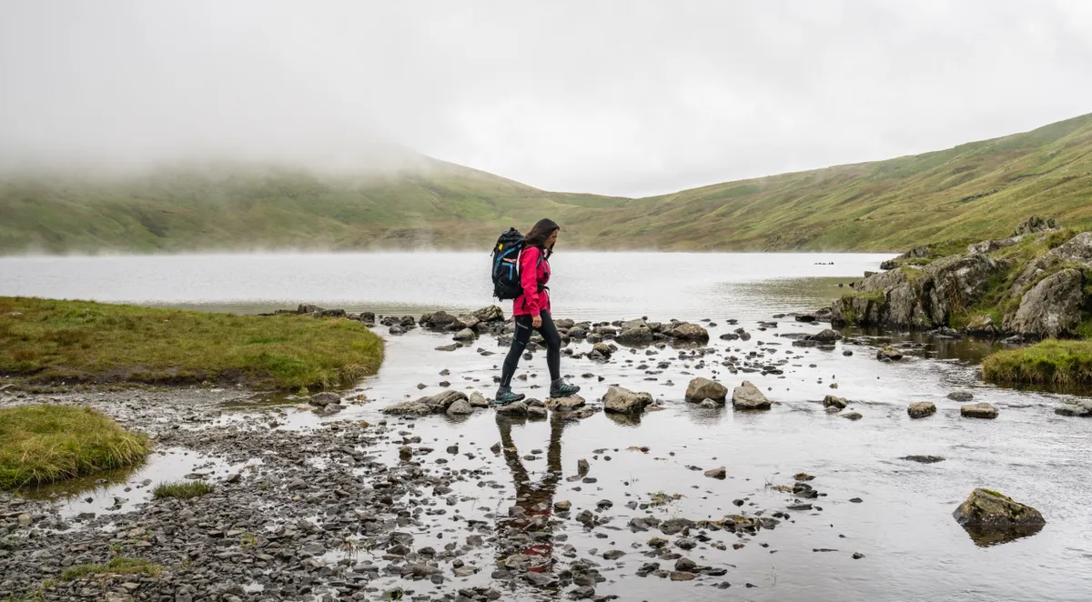
The Coast to Coast walk offers some of the finest and most varied scenery in the UK – from Lakeland’s gnarly mountains to the heather-clad moors of North Yorkshire. En route, you’ll encounter the medieval ruins of Shap Abbey and Richmond Castle, and walk through landscapes dotted with the fascinating remains of our industrial heritage. The market towns and villages used as overnight stops also form an integral part of the experience, as does the camaraderie that builds as walkers’ paths cross time and time again.
What's the toughest section of the Coast to Coast?
The hardest sections are through the Lake District, with daily altitude gains of up to 1,280m (4200ft) over demanding terrain if you choose high-level options. Using a luggage transfer company can help lighten the load.
When is the best time to walk the Coast to Coast?
The best time to walk the trail is from April to October, when northern England’s weather is at its best. Reduced daylight, potential snow and the winter closure of some accommodation providers make it difficult to cross between November and March.
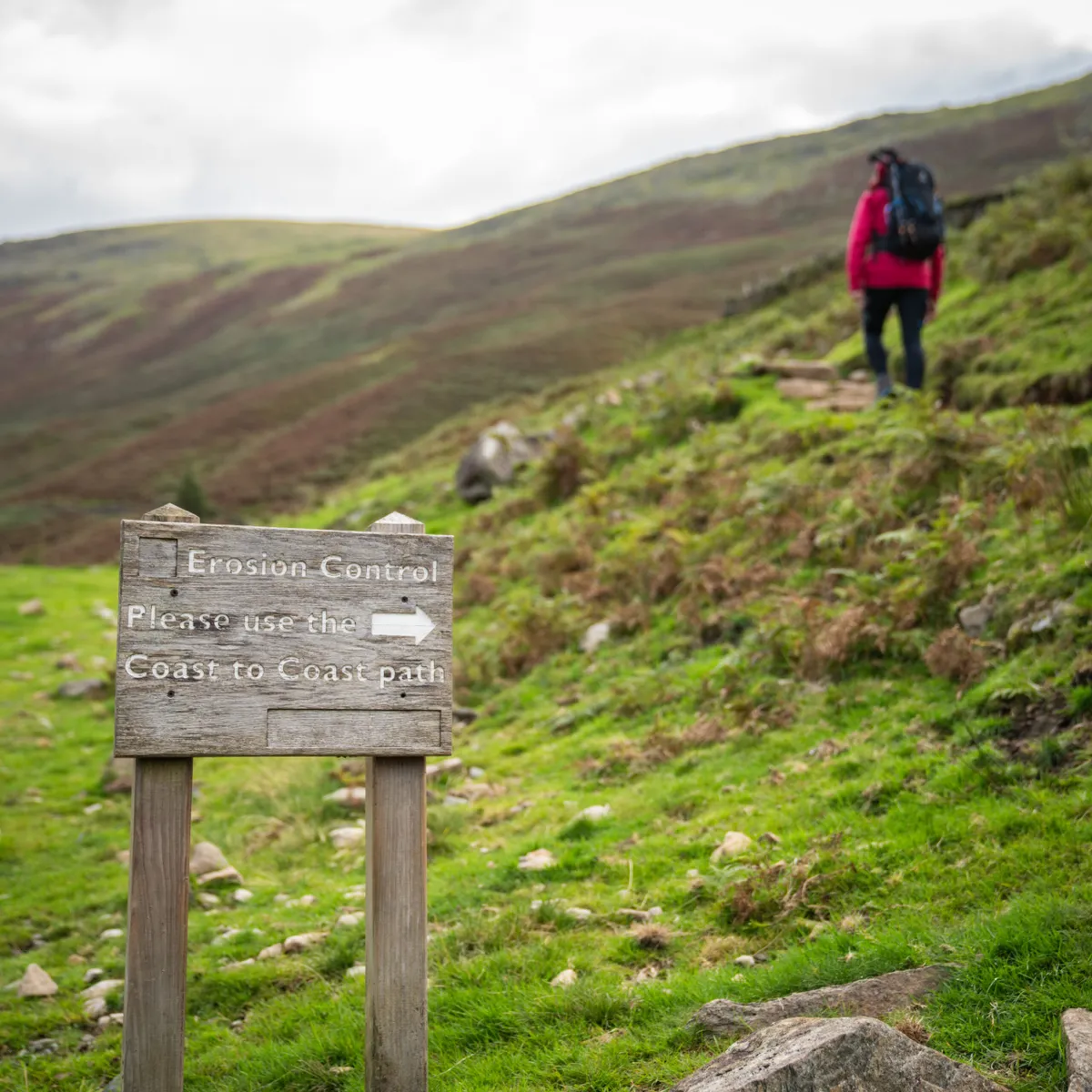
Is the Coast to Coast route marked?
The Coast to Coast route isn’t marked on Ordnance Survey maps – this will change when it officially becomes a National Trail – but Harvey Maps publishes two waterproof sheets that cover the entire route at the 1:40,000 scale. Limited signage exists in some towns or villages, but you'll need to be confident with navigation and reading a map.
How remote is the Coast to Coast?
There are remote sections in each of the National Parks across the Coast to Coast.
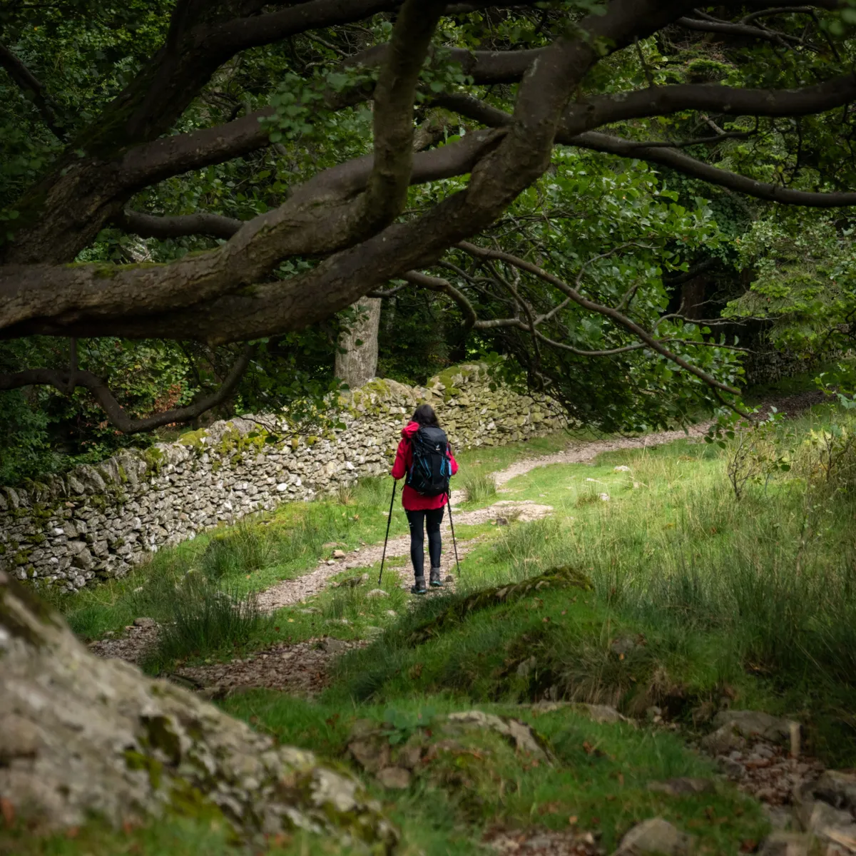
What's the terrain like?
The terrain on the Coast to Coast has rocky sections and muddy moorland trails.
What's the weather usually like?
In May, the average high temperature is 14°C and the average low temperature is 6°C (both taken in Kirkby Stephen). In May, average rainfall is 52mm on 10 days (taken in Kirkby Stephen).

Coast to Coast stages
Of course, you don’t have to do it in one go. It’s not uncommon for Coast to Coasters to split their journey in two at Kirkby Stephen – about 80 miles into the route – taking advantage of Pennine market town’s station on the Settle to Carlisle Railway.
Day 1 – St Bees to Ennerdale Bridge
14 miles (23km)
Get off the train at St Bees on the Cumbrian coast, dip your toes in the Irish Sea and set off along the crest of the red sandstone cliffs. As the route turns inland, the Lake District fells appear in the distance, beckoning you with the promise of many days of adventure ahead. The journey has begun…
Overnight: Shepherds Arms, Ennerdale Bridge
Day 2 – Ennerdale Bridge to Rosthwaite
15 miles (24km)
Entering the Lake District, the route hugs Ennerdale Water’s shores and heads into forests frequented by deer and red squirrels. Choose from a high-level ridge or continue beyond the remote Black Sail hostel towards the valley head. Either way, the day ends by crossing the fells and dropping into oak-cloaked Borrowdale.
Overnight: Hazel Bank Country House Hotel, Rosthwaite

Day 3 – Rosthwaite to Grasmere
7.5 miles (12km)
No messing about today. You’re in Lakeland proper now, so there’s just a short valley walk before the path clambers up the side of Lining Crag and negotiates boggy ground to reach Greenup Edge. Choose from a peaceful valley stroll into Grasmere or a splendid, undulating ridge walk over Helm Crag.
If you have time you could pay homage to the great poet William Wordsworth when you arrive in Grasmere and visit his home Dove Cottage
Overnight: Lancrigg, Grasmere
Day 4 – Grasmere to Patterdale
8 miles (12.5km)
Leaving the idyllic valley, you reach the exciting mountain environment of Grisedale Tarn. The easiest option from here is the valley route through glorious Grisedale; St Sunday Crag provides a straightforward high-fell alternative; or you can climb Helvellyn and tackle Striding Edge. The latter requires surefootedness on exposed, rocky ground.
Overnight: YHA Patterdale
Day 5 – Patterdale to Shap
15.5 miles (25km)
This is the longest stretch of sustained fell-walking so far. Watching for red deer, climb to beautiful Angle Tarn and then Kidsty Pike. At 780m, this is the highest point on the entire route for those choosing valley options. Dropping to Haweswater, a long section of shoreline path follows before leaving the Lakes via the picturesque ruins of Shap Abbey.
If it has been a dry summer and water levels are low you could spot remnant of the lost village Mardale. The village was evacuated in 1935 so the valley could be flooded to create the reservoir but hints of what lies below can still be seen, like the bridge and main road.
Overnight: The Hermitage, Shap
Day 6 – Shap to Kirkby Stephen
20 miles (32km)
Wave goodbye to rugged Lakeland and say hello to the softer limestone landscapes of the Yorkshire Dales. Rare butterflies and wildflowers thrive on the open grassland and low-lying heather moorland of Westmorland. Some walkers break this long day at Orton, about one mile off the main route.
Overnight: Kirkby Stephen Hostel
Day 7 – Kirkby Stephen to Keld
11.2 miles (18km)
Dragging yourself away from Kirkby Stephen, climb to the Nine Standards on the peaty moorland of the North Pennines. Walkers who enjoy solitude will love this sparsely populated section, crossing the English watershed before entering Swaledale near the cosy collection of farms and cottages that make up Keld.
Overnight: Keld Lodge, Keld
Day 8 – Keld to Reeth
10.5 miles (17km)
Beyond the waterfalls of Keld, Coast to Coasters have a choice – the moorland for atmospheric reminders of the area’s lead mining heritage; or the valley route beside the River Swale for iconic Dales meadows studded with field barns, dry-stone walls and wildflowers. The latter has the bonus of a pub en route – the Kings Head in Gunnerside.
Overnight: The Burgoyne, Reeth
Day 9 – Reeth to Richmond
10 miles (16km)
After fairly long days involving high fells and windswept moors, today is easier as the journey downstream through Swaledale continues. Your overnight stop, Richmond, feels like a sprawling metropolis after the tiny settlements that have gone before. Allow time to explore its ancient alleyways and visit the castle.
Overnight: The Frenchgate, Richmond
Day 10 – Richmond to Ingleby Cross
23 miles (36.5km)
Let’s not beat about the bush... after the Lakes and the Dales, the Vale of Mowbray’s flat farmland is uninspiring. Some walkers split this section of country lanes and field paths at Danby Wiske; others rush through as quickly as possible. See it as a means to an end – the North York Moors are just around the corner…
Overnight: Ingleby House Farm, Ingleby Arncliffe
Day 11 – Ingleby Cross to Clay Bank Top
11.5 miles (18.5km)
Gird your loins on entering the North York Moors, the third and final National Park… An undulating route along the airy escarpment edge of the Cleveland Hills results in an epic day, with about 3000ft of ascent, but the far-reaching views detract from any sore feet. Refuel at Lordstones Café, eight miles in.
Overnight: Buck Inn, Chop Gate (shuttle service to Clay Bank Top, 2.5 miles away)
Day 12 – Clay Bank Top to Glaisdale
18.3 miles (29.5km)
A short climbs leads back on to open moorland where only the calls of grouse and waders break the silence. Much of the walk follows good tracks, including a disused mineral railway, which make easy work of the long day. The Lion Inn at Blakey, one of England’s remotest pubs, is passed just after the half-way point.
Overnight: Arncliffe Arms, Glaisdale
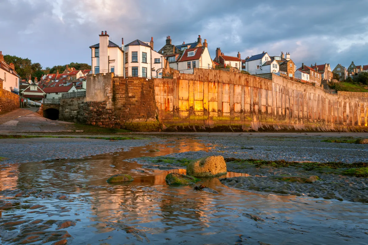
Day 13 – Glaisdale to Robin Hood’s Bay
18.5 miles (30km)
Drop into serpentine valleys, calling in at villages that hug the steep-sided, wooded banks of the River Esk and its tributaries. The crossing then ends as it began – with an exhilarating cliff-top walk. Triumphant, drop into charming Robin Hood’s Bay and dip your toes in the North Sea. It’s time to celebrate!
Overnight: North Ings B&B, Robin Hood’s Bay
Discover more walking inspiration
- It's closer to the Arctic Circle than London and completely unmarked – is this the UK's toughest long-distance walking trail?
- Divine spring walks: the best UK trails to enjoy right now
- Best summer walks in Britain
- Inspired by The Salt Path and want to walk the South West Coast Path? Here’s everything you need to know
Photos: Amy Bateman (unless stated otherwise)