Just 20 miles from Manchester city centre, the precipitous Tegg’s Nose Country Park represents an abrupt end to the Cheshire Plain, with flat fields replaced by a whole new, wild landscape of steep, craggy hills, open moors and dense, impenetrable forest.
It’s here where the imagination can run wild as you trek along the woodland paths, with nearby place names such as Wildboarclough giving a clue to the beasts that once roamed here. Various stories link the name Tegg’s Nose back to early Norse settlers, while others connect it to the word teg, a name for a two-year-old sheep, with the nose moniker easily linked to the promontory at the southern end of the ridge.
As befits such a wild area, this route is steep in places, crossing a rich mix of habitats offering the chance to spot an equally diverse range of wildlife. Over the meadows, look for buzzards circling overhead, scanning the fields for carrion, and listen for the unmistakable cronking of garrulous ravens, as well as the piping trill of skylarks as they soar upwards.
Between May and August, the meadows are covered with a carpet of yellow mountain pansies, interspersed with common spotted orchids and yellowy green clusters of flowers atop lady’s mantle.
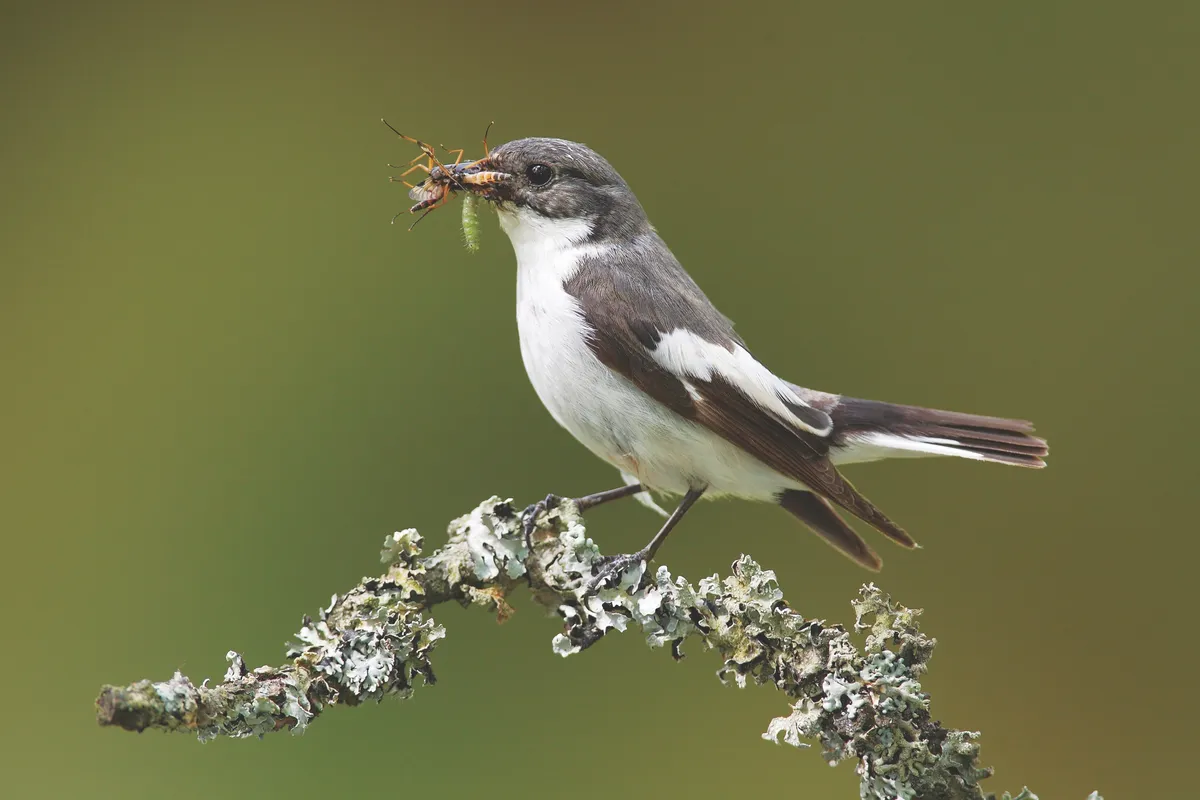
In the woods, you can spot crossbills flitting among the pine trees, along with pied flycatchers and redstarts, and you may even see one of the small herds of red deer that still roam among the trees.
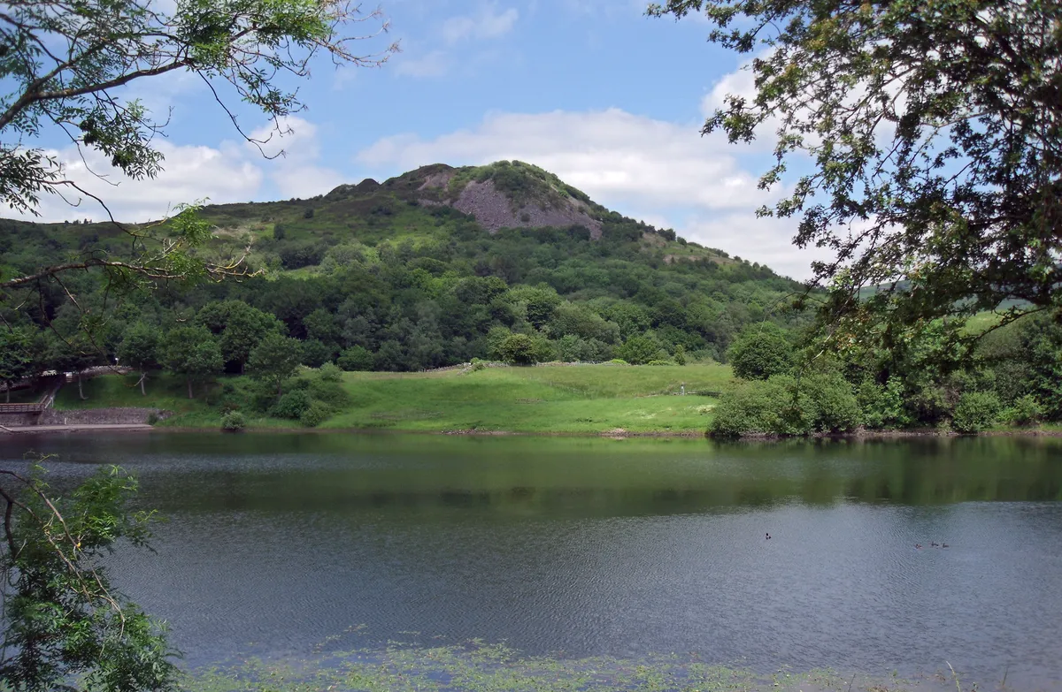
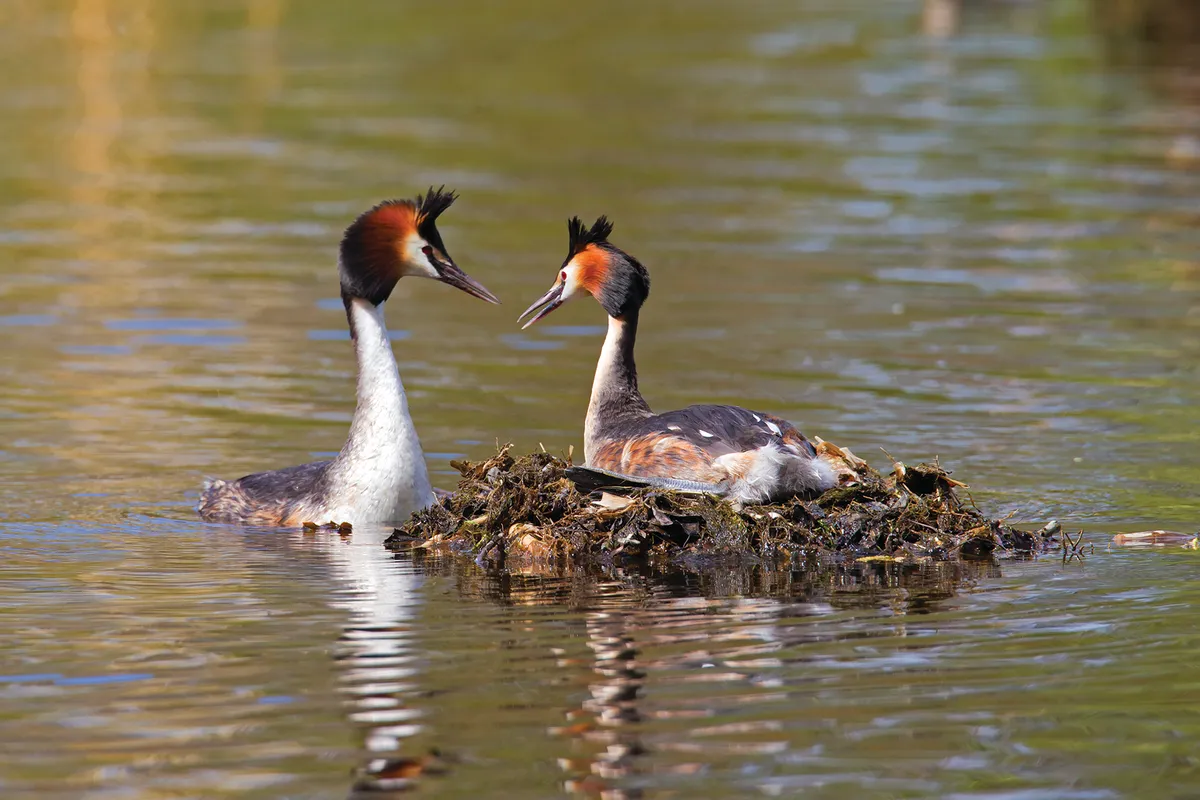
Ridgegate is one of a series of reservoirs on the fringes of Macclesfield Forest that attract great crested grebes, cormorants and a host of wildfowl, while common sandpipers enjoy rich pickings along the muddy shoreline.
Tegg's Nose walk
7.5 miles | 4 hours | moderate
1. Sadler's Way
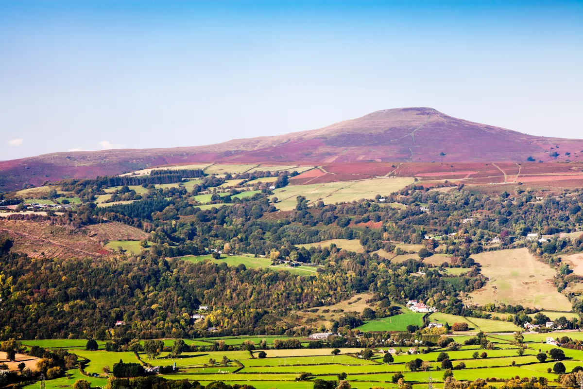
From the visitor centre, take the steep downhill path signposted ‘Sadler’s Way’. The wilds of the Peak District spread out to your left, with its lattice work of drystone walls and the odd isolated farmhouse, left marooned and clinging to the hillside. Beyond lies the spiky treeline of Macclesfield Forest, while in the distance Shutlingsloe, the ‘Matterhorn of Cheshire’, juts out skywards.
2. Winding track
Continue downhill through a gate and along the tarmacked road, following the path to the left above Clough House farm, signed Macclesfield Forest and Shutlingsloe. When the road peters out, continue along the path over a small ford before swinging left to carry on uphill. Stop for a breather to enjoy great views back to the looming ridge of Tegg’s Nose.
At the top of the hill, follow the path to the left between a drystone wall and grassy bank until you reach Hardingland House. Turn right on to Hacked Way Lane and, where the road bends, duck through a gate into the forest proper.
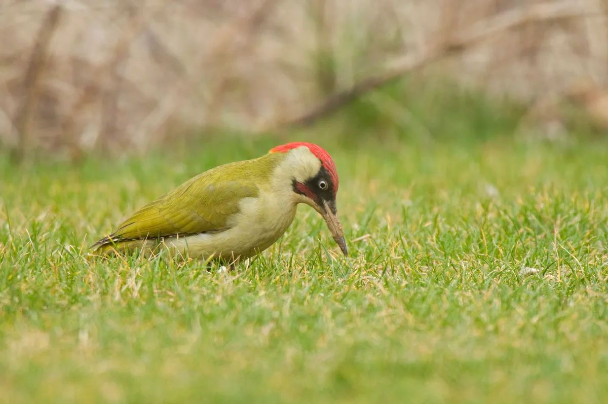
Wildlife highlight: green woodpecker
Look out for this colourful, handsome bird as it forages for ants among the heather, probing with a long sticky tongue. Our largest resident woodpecker, it’s famous for its distinctive laughing call, or yaffle.
3. Into the woods
Follow the path through the trees, with a steep slope dropping down to your right. Enjoy the silence as the dark, dense forest begins to envelop you. At a ruined house, continue downhill taking the track towards Langley, but don’t miss the small, touching memorial to Walter Whiston Bullock, a casualty of the First World War who once lived here.
The track eventually ends up at a gate leading to Quiet Lane, which you follow to the right, down to the Leather’s Smithy pub.
4. On to Nessit Hill
Here you have a choice. You can ether cut the walk short and follow the road to Langley, where you can pick up the walk at number seven, or extend the adventure into the forest and up to impressive views on Nessit Hill.
To reach Nessit Hill, take the path opposite the pub, walking anticlockwise around Ridgegate Reservoir. At a fork, follow the lower left-hand path, gradually climbing up away from the water.
5. Forest trek
When the path ends, cross the road, passing through a gate and then taking the steep, right-hand forest track up the hill. At the top, start following signs to Shutlingsloe, continuing up the track past huge pine trees, felled by recent storms, until you reach a junction of three paths. Here, double back on yourself, then continue up the steep path, with Shutlingsloe now behind you.
6. Private viewing
At the summit of Nessit Hill, enjoy the solitude and take in the stunning views back over the reservoirs towards Tegg’s Nose. Follow the track back down the hill, turning left at the bottom on to Langley Road and re-entering the forest after about 100m. Retrace your steps back around the reservoir to Leather’s Smithy pub, turning left to continue along the road to Langley.
7. Steep climb
Look out for a signposted path on the right that takes you up off the road to Bottoms Reservoir. Follow the path around, crossing a small bridge and then climbing some steps before picking up signs to Tegg’s Nose Country Park.
Now, take a deep breath and prepare yourself for one final climb. Taking the left-hand path, follow signs for the Gritstone Trail, a 56km footpath through Cheshire’s Peak District. Reaching the top of Tegg’s Nose is tough going up a steep slope dotted with gorse, but reaching the summit rewards you with spectacular views. On a clear day, looking westwards, you can see the Welsh hills across the flat, low-lying Cheshire Plain.
8. Millstone Grit
Follow the signs for the Gritstone Trail back to the visitor centre, looking out for various historic tools and machines that tell the story of the area’s 500-year history as a quarry, where the famous millstone grit was hacked and blasted from the landscape.
As you drop down from the summit, civilisation returns, with the sprawl of Macclesfield before you and the familiar distant roar of traffic. Back at the car park, enjoy a well-earned cuppa at the Tegg’s Nose tearoom.
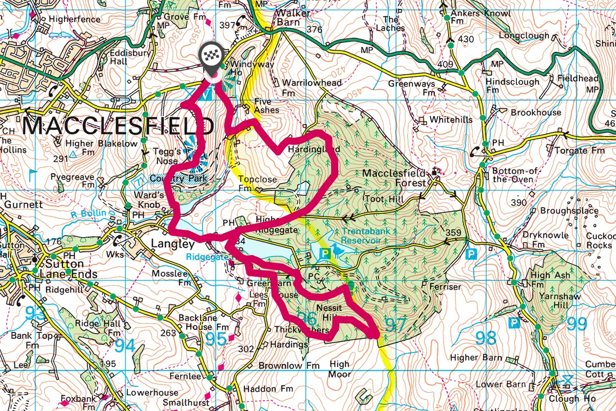
Tegg's Nose and Macclesfield Forest map
Tegg's Nose walking route and map