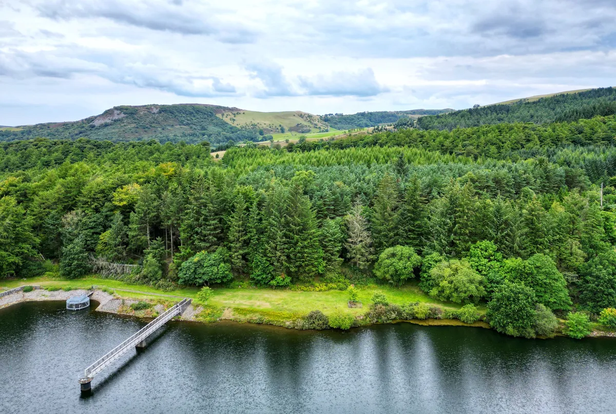
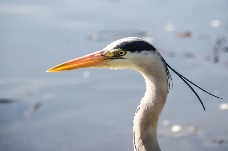
They’re an ungainly sight, nesting herons. At Cheshire’s largest heronry, noisy parents tend to their broods in nests at the top of tall firs bordering Trentabank Reservoir, sheltered below craggy gritstone snouts at the western fringe of the Peak District.
Spring is the perfect time to explore the remnants of the Norman hunting forest high above Macclesfield, where an abundance of birds and woodland flowers, including bluebells, will remain in the memory.
Firm tracks and paths draw you upwards through mixed fir and broadleaf woods to moorland edge pasture, generously endowed with views to nearby Shutlingsloe and the great ridge, topped by Cheshire’s highest point, Shining Tor.
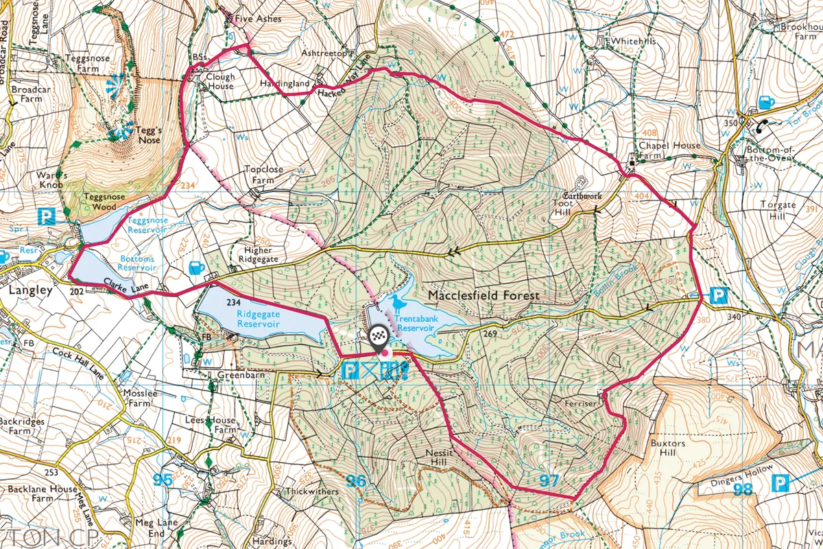
Macclesfield Forest walk
6 miles/9.6km | 343m accent | 4 hours | moderate
1. tree top views
Ridgegate car park and ranger station are close to the reservoir. Cross the lane from the nearby heronry view layby, obeying signs for Shutlingsloe. Yellow topped, then red-topped signposts draw the path steadily uphill (head straight up over a cross-track). Eventually, keep left at a fork beyond a gate, then follow signs for the Standing Stone. The forestry road meanders through firwoods; at the left-bend beside a little sloping meadow, take the short, stepped path on the right.
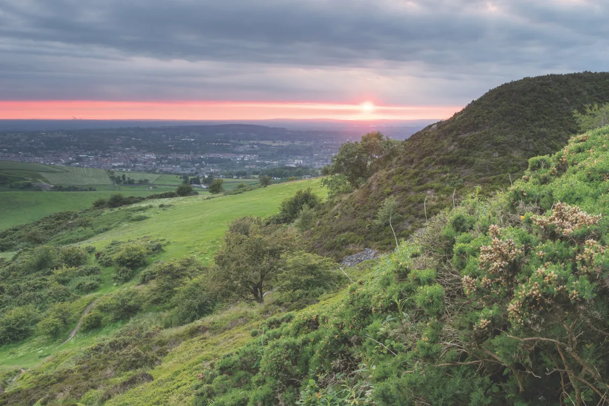
The way presently bursts from the trees, revealing extraordinary views to the Cat and Fiddle Inn (England’s second highest), the ridge leading to the 559m (1,834ft) Shining Tor and endless undulating hills.
Looking for a view?
The precipitous peak of Tegg’s Nose represents an abrupt end to the Cheshire Plain, with flat fields replaced by a whole new, wild landscape of steep, craggy hills, open moors and dense, impenetrable forest. A slight various to this Maccelsfield Forest walk takes you to the summit.
2. Standing stone
At Standing Stone, cross into the lane ahead for Forest Chapel, and stay with this high above Wildboarclough to a junction. Go left, uphill to reach the hamlet. Tiny St Stephen’s Church here has an arcane rush-bearing ceremony every August.
Your path is the track rising beside Toot Hill House; as it climbs, fine views towards Shutlingsloe emerge. At a gate, fork left on to a wooded path through some broadleaf woodland (where red deer browse) before dropping to a ruined barn. Keep ahead for Tegg’s Nose and then go left at a fork to reach a tarred lane.
3. trail of three reservoirs
Go left and remain with this path as it roughens, dropping all the way into the deep valley. At the junction just above Clough House, go left, heading for the Teggs Nose Trail and Langley car park. Now trace this track over stepping stones and through to Teggsnose and Bottoms reservoirs. Go left on the Gritstone Trail over Bottoms dam and left on the lane, rising to the Leather’s Smithy pub. Fork right alongside Ridgegate Reservoir; at the fork for Wildboarclough go left back to the nearby car park.
Macclesfield Forest map
Macclesfield walking route and map
Useful Information about Macclesfield Forest
How to get there
Macclesfield Forest is 3½ miles south-east of Macclesfield. Turn left for Sutton and Langley off the A523 Leek Road at the southern edge of Macclesfield (at The Albion Inn), then head towards Langley. Trentabank car park (pay and display) is 1½ miles beyond the village. Buses run between Macclesfield and Langley.
Find Out More
Macclesfield Tourist information centre
Town Hall, Market Place, Macclesfield SK10 1DX
01625 378123
www.cheshireeast.gov.uk

