The Wicklow Mountains are where I first fell in love with the outdoors. When I was six, my dad decided it would be a brilliant idea for our family of three to spend two weeks walking along the Irish coast from Wexford Town into County Wicklow, before hiking into the hills along Glenmalure.
Friends and family thought my parents were nuts for setting off on such an escapade with a child in tow, but my recollections of the adventure, fuzzy around the edges as they might be, are wonderful. It was August 1979 and we wild camped on the foreshore and in fields and forests. Grainy old photos show sun-splashed scenes of us stroking donkeys, swimming, and gazing out over the glens.
Decades later, while living in Dublin, I often cycled out around the more easily accessible summits that rise immediately south of the city, on the county border around Glencullen, exploring the evocative ruins of the 18th-century Hellfire Club on Montpelier Hill and pausing for fuel at Johnnie Fox’s famous pub. I took buses along the N11, venturing past the conical form of Great Sugar Loaf and through the Glen of the Downs into the wilds of Wicklow beyond ‘The Pale’ (an area around Dublin that was under the control of the English crown in the Middle Ages), where the proper peaks start to rear.
But what I didn’t realise until recently is that my family has a complicated history with these hills. One of them – albeit a much more modest mound than Lugnaquilla, the highest peak in the Wicklow Mountains – even bears our name. Croghan Kinsella, meaning ‘the little stack of the Kinsella family’, rises to 606 metres on the Wicklow–Wexford border. It was standing atop the Croghan, looking out at Lugnaquilla, that I realised I had to explore these mountains more, and the idea for a book was born.
Glen close
Despite their proximity to Dublin, the Wicklow Mountains get a fraction of the footfall that annually stomps all over the Scottish Highlands, let alone the Lake District fells and the summits of Eryri (Snowdonia). Ireland has a much smaller population than Scotland, England and Wales of course, and the Irish Sea means it’s more than a mere drive to the trailheads for most hillwalkers hailing from the British Isles.
These are not Ireland’s highest hills either (Éire’s real rooftop is MacGillycuddy’s Reeks in County Kerry, crowned by 1,039-metre Carrantuohill). But while Lugnaquilla is the lone Munro-stature mountain in Leinster, dozens of Wicklow’s peaks are included on the Arderin and Vandeleur-Lynam lists (classifications given to mountains standing over 500 and 600 metres tall, respectively – the Irish equivalent of Scotland’s Corbetts and Grahams, and the Nuttalls in England and Wales).
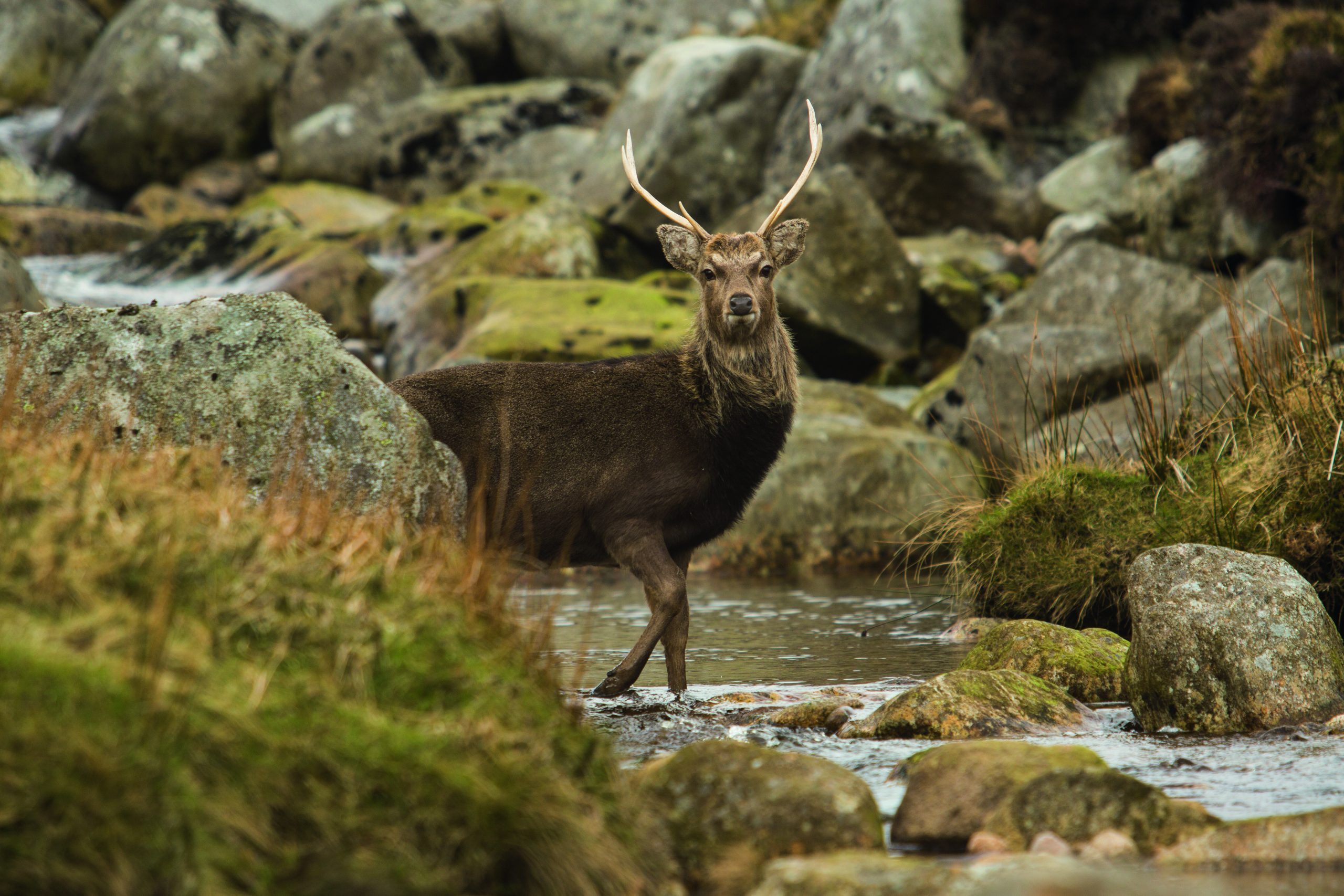
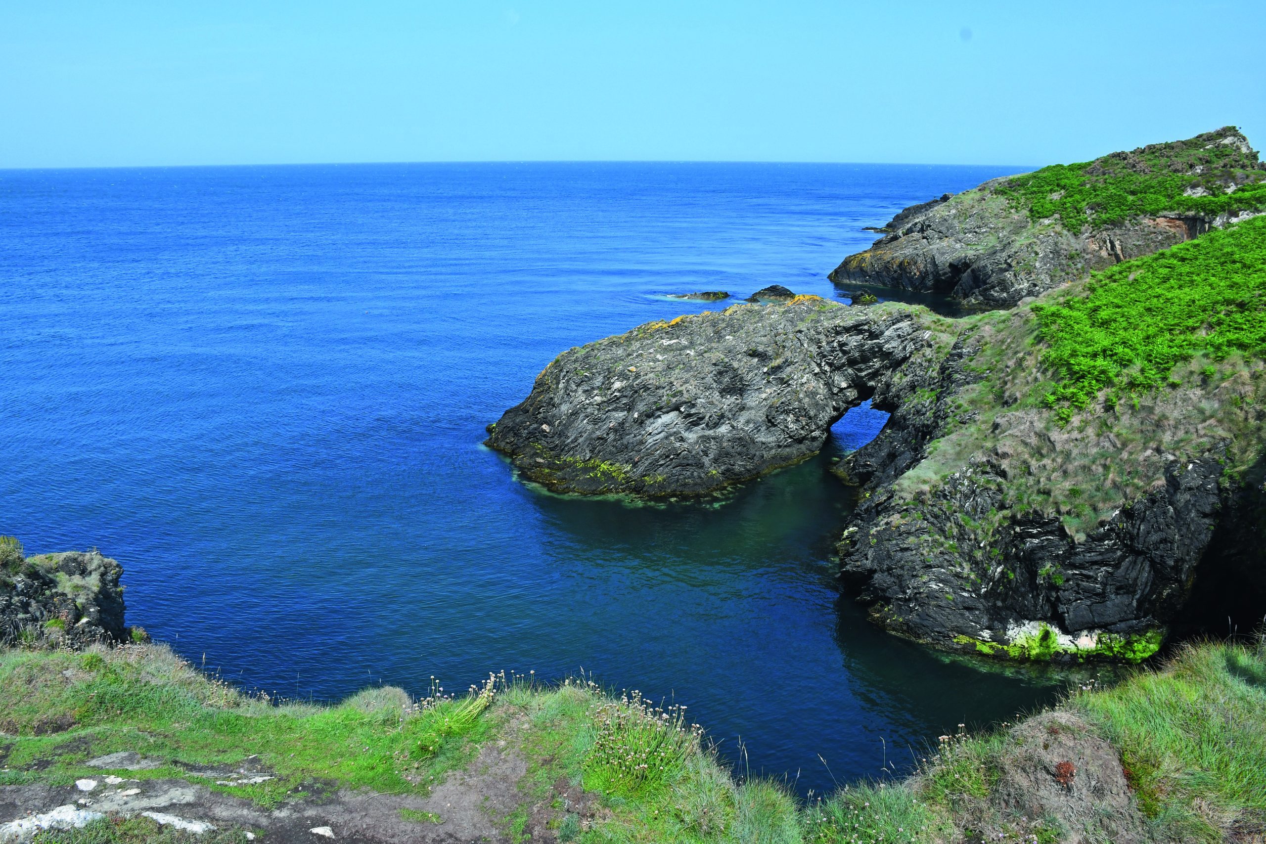
Covering over 200 km², Wicklow Mountains National Park offers myriad well-maintained hiking and mountain biking trails that cross terrific terrain featuring forests, heathland, rivers, loughs, glacial valleys, heather-covered peaks, peat bogs and glens where red deer roam and peregrine falcons soar.
Responsible wild camping is legal and after-dark star-gazing conditions are world-class. The storied landscape is layered in legend and littered with enigmatic remains, from prehistoric tombs to holy sites and memorials to people and places that played starring roles in the long fight for Irish freedom.
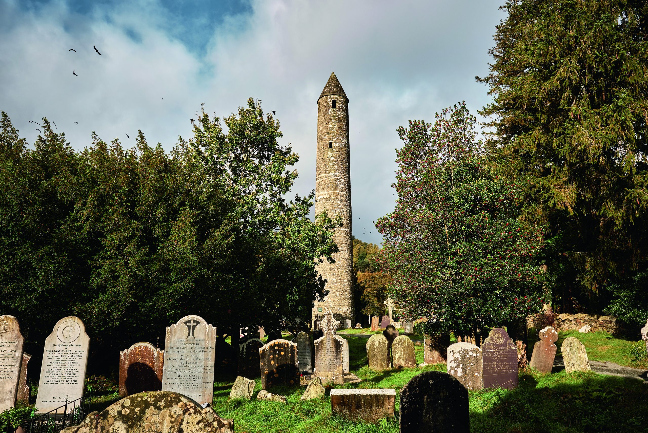
Some sites do attract crowds. Car parks above loughs like Tay and Bray, and viewing points at places such as the Wicklow Gap and Glenmacanass Waterfall get busy at weekends. Glendalough, a revered monastic site established in the sixth century by St Kevin, is popular and picturesque, and the area around the waterside settlement is often heaving – but even here, if you wander along the Miner’s Track leading around the Upper Lake, or venture along the spectacular Spinc ridge, you immediately escape the hordes. Much of the national park feels like a well-kept secret – one I half expect to have been blabbed about and ruined every time I return, only to find myself alone again on the hillsides.
Topping out
I attempt the ascent of Lugnaquilla on a sunny day and approach the peak via the Glen of Imaal. This involves negotiating a military firing range, but the warning flags are down and the guns are silent. A straight up-and-down, this path to the peak isn’t as visually spectacular as the Fraughan Rock Glen route, but it’s still a stunning walk.
The trailhead at Seskin is beside a pub, colloquially known as Fenton’s, but there’s no sign of life inside as I set out along the track, passing a memorial to Michael Dwyer, a local man who played a leading role in the Irish Rebellion of 1798 and captained a contingent of guerilla rebels in this glen during the subsequent conflict. The military road and barracks were originally built here by the British, as they attempted to capture Dwyer.
There’s more family history here too. In 1941, my granddad, Larry, who was serving in the Irish Defence Force, had to deal with the ghastly aftermath when an anti-tank mine exploded during a training exercise in the Glen of Imaal, killing 16 of his comrades. It was the biggest loss of life for the Irish armed forces since the country’s terrible Civil War in the 1920s and inflicted deep psychological wounds on the survivors. Many years later, during a family holiday, granddad couldn’t bring himself to go anywhere near this spot.
Contemplating this tragic tale, I take the warning signs about sticking to the path to avoid dangerous ordnance extra seriously as I pass the memorial and start climbing the flanks of Camarahill, with Ballineddan rising to the right and Lugnaquilla towering directly ahead. It’s a bright day, though, and the gorse glowing in the late-summer sun lifts my spirits.
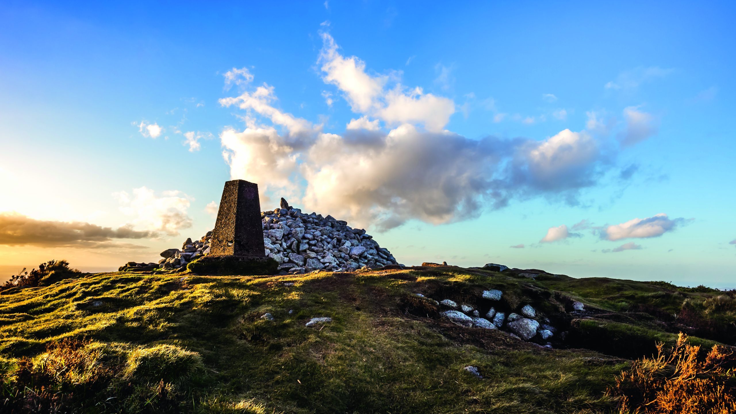
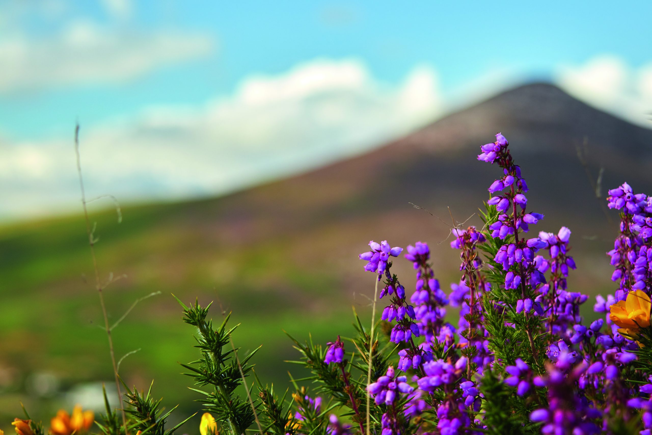
Pink and purple-flowering bell heather proliferates on either side of the path as I gain height, and all around me the peaks of the Wicklow Mountains tickle the belly of the blue sky. Slievemaan peers over my right shoulder, Leoh looms to my left, and there doesn’t seem to be a soul on any of them. I clamber over the craggy Corrig, cross a section of bouncy bog and scale a boulder-strewn slope to reach the summit plateau. The stone cairn and trig pillar are bathed in sunlight and the scene is completely unrecognisable from the one I’d experienced a few weeks earlier, while attempting this peak in mountain mist from Fraughan Rock Glen.
I can see the entirety of the range and the scale of the national park in all its wide and wild glory. Beyond, the built-up busyness of distant Dublin only serves to amplify the lonely tranquillity of the mountaintop. To the east, across the rolling blue blanket of the Irish Sea, I can make out the peak profile of Eryri National Park in Wales, where you can take a train to a café on the summit of Yr Wyddfa (Snowdon) and queue to stand on the highest point. It feels like another planet.
Now go there
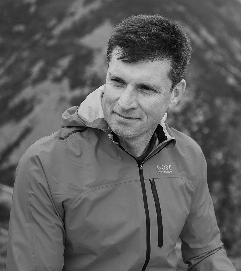
Patrick Kinsella on where to eat, drink and stay in the Wicklow Mountains
How to get there
The Wicklow Mountains start rising 12.5 miles south of central Dublin. You can be amongst the peaks in under an hour by driving along the N11/M11. Popular places such as Glendalough are well signed with plenty of car parks. St Kevin’s Bus runs to Glendalough from Dublin, departing daily from St Stephen’s Green (return fare €23, glendaloughbus.com). Bus Éireann and Dublin Bus also serve towns and villages such as Laragh.
Key landmarks
Glendalough
This must-visit site centres around an early medieval monastic settlement with a famous round tower, poised in a dramatic glacial valley surrounded by lakes and mountain peaks.
Powerscourt Estate
Located on the site of a 13th-century Norman castle, Powerscourt Estate claims Ireland’s highest cascade and offers landscaped gardens. Hiking routes around Djouce Wood and the eponymous mountain offer good views of the waterfall. powerscourt.com
Avondale House
Birthplace of Charles Stewart Parnell, a 19th-century politician and Irish hero, Avondale boasts beautiful grounds, wonderful woodland walks and riverside rambles along the Avon. beyondthetreesavondale.com/avondale-house
Accommodation
Chancery Hotel, Dublin
If you’re doing a day trip to Wicklow, this five-star hotel is behind Dublin Castle and boasts 150 stylish rooms, a gym and restaurant. thechanceryhotel.ie
Wicklow Way Camping, Oldbridge
While wild camping is allowed across most of the national park, this perfectly located site amid the mountains offers a range of pitches and facilities, including a firepit, hot showers and a sauna. wicklowwaycamping.com
Heather House, Laragh
Enjoy Irish hospitality at this upmarket B&B in the beautiful village of Laragh, near Glendalough. heatherhouse.ie
Food and drink
Johnnie Fox’s, Glencullen
This mountain inn on the border of County Dublin and Wicklow claims to be Ireland’s highest pub and offers live music, great Guinness and good food seven days a week. johnniefoxs.com
The Wicklow Heather, Laragh
Find fine food at this well-respected local restaurant in Laragh. wicklowheather.ie
Walking trails
For a one-day walk, it’s hard to beat the waymarked six-mile Spinc Loop (white trail) in Glendalough. The 81-mile Wicklow Way long-distance trail, meanwhile, starts in Dublin and finishes in Clonegal, County Carlow.
On screen
Netflix’s The House of Guinness recently dramatised the tale of Ireland’s brewing dynasty in the 19th century. The Guinness family’s ancestral home is Luggala, spectacularly located by Lough Tay.
Folk music spots
Few cities are as entwined with musical history than Dublin. Recommended pubs include The Cornerstone, O’Donoghue’s, The Brazen Head and Darkey Kelly’s.
Further information
The national parks website is excellent (nationalparks.ie/wicklow). The best topographical 1:25,000 scale maps for hiking in Wicklow are made by EastWest Mapping (eastwestmapping.ie).
Top image: Beautifully sunset at Ticknock hill in Wicklow mountains with pile of stones called Fairy Castle and stone landmark, Ireland. Credit: Getty Images