The Forest of Dean’s forested plateau spills into the Wye’s tortuous gorge via a string of scarps, wooded embayments and side-valleys turning amber and orange.
Exploring deer-rich Highmeadow Inclosure, this serene countryside is best seen towards sunset, when the views to the Black Mountains are breathtaking.
Follow our walking route of Highmeadow Woods in Gloucestershire.
Highmeadow Woods walk
3.7 miles/6km | 2 hours | easy
1. Panoramic vistas
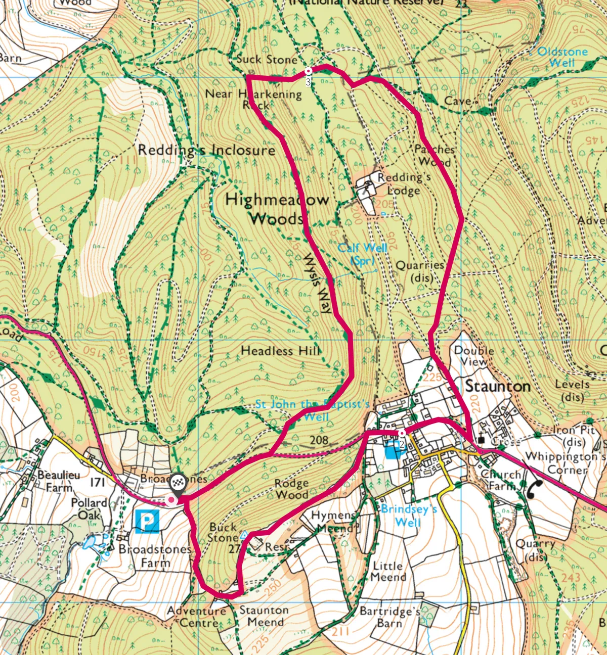
Join the narrow path by the Forest of Dean board above the layby and climb beside deer-fencing. At the fence corner, go straight over a cross-track and up the braided path until you can see a house at the edge of the woods. Before this, bear left on a distinct path that rises between boulders to a ridge-top wall. Turn left to the nearby trig pillar at the rocky outcrop of the Buckstone. This was a rocking stone until revellers in 1885 destroyed this balance. The panorama over south Herefordshire and the Vale of Gwent is inspiring, while to the east the Cotswolds form the horizon beyond the forest. Use the nearby hand-gate to put the wall on your left, and walk through to a lane at the edge of Staunton; turn left to the main road.
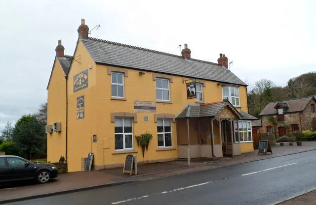
Having just walk a mile or so, now is a good time to drop into the White Horse Inn, a warm and cosy pub that welcomes walkers, mountain bikers, children and dogs.
2. Into the woods
Turn right through the village to reach All Saints Church, with a font hewn from a Roman altar. Turn sharp-left this side of the church on a grass-centred lane. Beyond the final house the lane becomes a woodland path; keep right at the fork to reach a wider path, turn left and drop to a major hub of paths. Turn half-right on the way which, in 65m, broadens to a wide rutted track and drops steeply to reach a major forestry road. Turn left. The peaceful route undulates through mature woodland; at deer-fencing, brief views stretch down into the wooded gorge of the Wye.
At the next area of deer-fencing (on your right as a fenced corner) ignore the steep, waymarked cross-path and remain with the forestry road; in 55m bend left with it to rise gently to a sharp fork to the right. Look carefully here for a path ahead into the trees, marked Highmeadow Trail.
This strikes through to the lip of the nearby crag, Near Hearkening Rock, so-called as it is said that hunters used the crag’s echo-gathering properties to locate deer by sound. On clear days there are memorable views across Monmouthshire to the beautiful mountains of south Wales.
3. Boar country
Turn right on the crag-edge path that shortly descends to the left. At a junction in 30 paces, go ahead (not sharp left) for 25m then fork left, dropping beneath an overhang to reach the huge rocky slab visible below. This is the Suckstone, said to be the largest fallen block of stone in England.
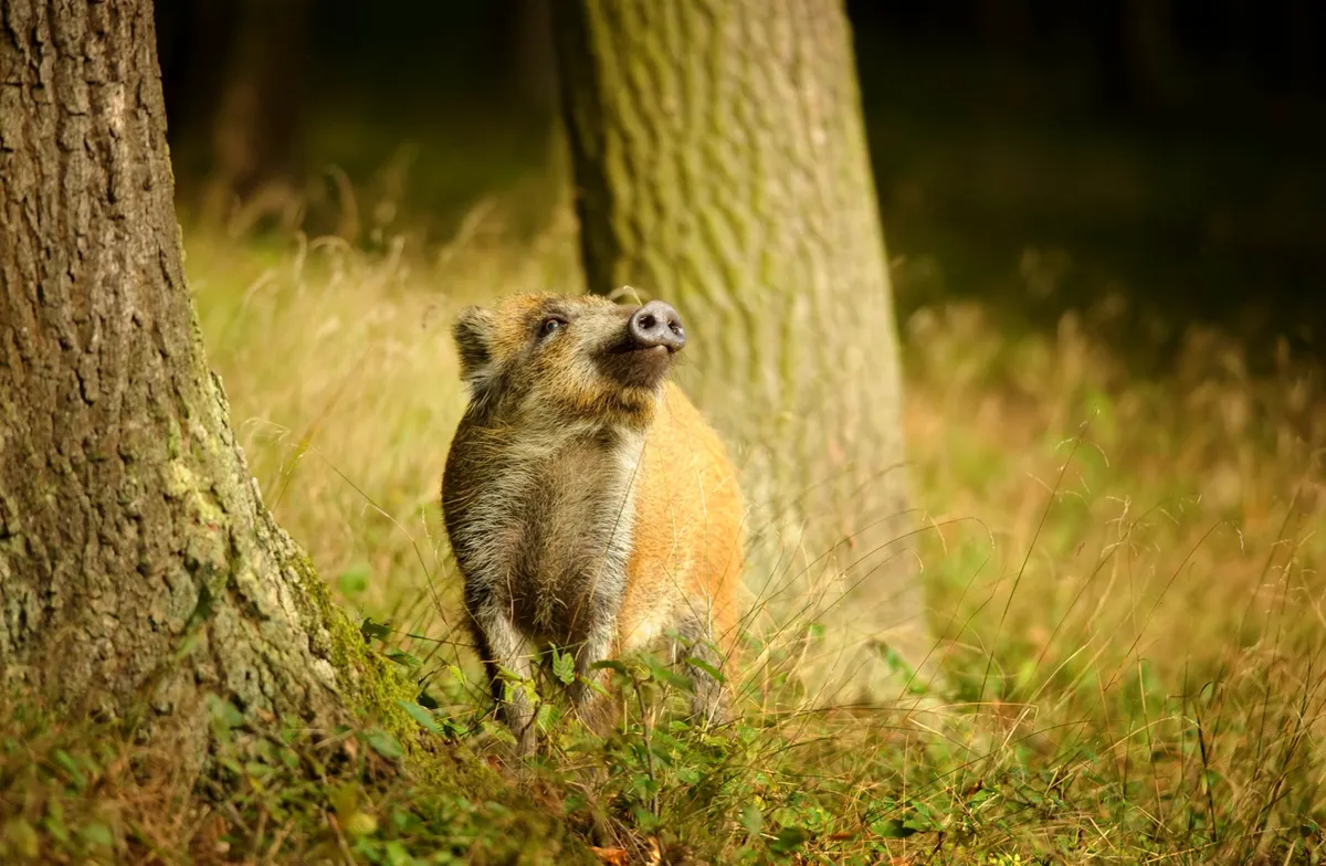
Find the wide forestry road below this and turn left. Look out for well-grubbed areas beside the track and within the trees; some are wallows where wild boar lie. There are also many fallow deer in these woods; look for the many narrow chutes beside the road, where deer cross en route to watering or scratching places. Skirting the head of a great wooded bowl, the road splits; bear left to rise to the main road.
The layby is 275m to the right.
Highmeadow Woods map
Highmeadow Woods walking route and map