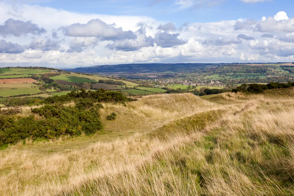
Not only is this spread of blustery heathland the highest point in Gloucestershire, it’s also the highest point in the whole of the Cotswolds. Cleeve Hill tops out at an altitude of 330 metres, a figure that sounds modest but belies the extraordinary vantage point it grants across Cheltenham (complete with famous racecourse), the Vale of Evesham and as far west as the Black Mountains.
This six-mile circular spends much of its time on Cleeve Common – which Cleeve Hill forms a part of – and makes good use of the Cotswold Way National Trail. The common itself is classed a Site of Special Scientific Interest, although part of it also plays home to a golf course, so keep your wits about you.
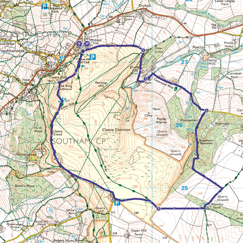
Cleeve Hill walk
6 miles / 9.7km | 3-4 hours | moderate/ strenuous | 308 metres ascent
1. Start
Leaving the Quarry Car Park, turn right to walk past the first tee, with a stone wall on your left. Looking over this wall, you’ll soon be treated to a glorious view of the town of Winchcombe, folded among green hills. Continue through a gate then, at a junction of different grassy paths, head downhill on the Cotswold Way (CW), towards a belt of woodland.
2. Postlip Hall
The next sections of the route represent the most fiddly parts, but the key thing to remember is that you’ll be staying on the CW, which has fairly consistent signage. You’ll soon be aware of the wall of Postlip Hall on your left. Stay on this path, passing through multiple gates and, briefly, a horse paddock. When signed, bear left to head straight through a small cluster of gates and farm buildings.
3. Postlip Hall Farm
Through a final gate, turn left to follow a stone wall, soon heading down to meet a driveway. Turn right up this driveway, passing Postlip Hall Farm B&B on your left, then heading straight through the agriculturally fragrant yard of the farm itself. Staying on the CW as it kinks right through a gate, then head downhill to reach a wooded stream. Follow path up through woods, with Winchcombe views eventually appearing to left. Turn right when meeting road, staying on CW.
4. Breakheart Plantation
Head past stable block on right, then keep on CW as it sidesteps left through a kissing gate to re-enter woods. Climb steeply, then follow field edge under cracking pylons. On reaching perpendicular path, turn right, leaving CW. When the track arrives at a ruined barn, turn right again, heading uphill, with distant radio masts soon appearing.
5. Cleeve Common
Returning to the common, walk straight ahead then follow Winchcombe Way sign towards masts. The rest of the route is straightforward, heading clockwise along the edge of the common. Look out for the so-called Single Beech, an iconic windswept tree on the skyline, before the views begin bellying out to your left and you rejoin the CW. Eventually the route snakes across part of the golf course to a trig point and toposcope, soon returning to the clubhouse and car park.
Cleeve Hill map
Cleeve Hill walking route and map
Useful information
Terrain
Some steep sections; unsuitable for wheelchair users; be aware that Cleeve Common is exposed and can be windy.
Starting point
Quarry Car Park (£2 for 24 hours) opposite Cleeve Hill Golf Clubhouse GL52 3PW.
Eat/drink
Flynn’s on the Hill, in the clubhouse, is open to all and serves meals and hot drinks. If you show parking ticket or receipt, the £2 parking charge will be deducted from any purchase you make.