Woodland predominates on this enjoyable Gloucestershire loop-walk, although the star attraction is the steep grassy slope encountered midway along the route. Cooper's Hill is best known for its Spring Bank Holiday shenanigans, when thrill-seekers hurtle down its banks in pursuit of a giant wheel of Double Gloucester cheese.
The eccentric custom, which dates back centuries, brings yearly commotion – and more than the occasional injury – to an otherwise peaceful swathe of wooded countryside.
On which note, the nearby village of Cranham, where this route begins and ends, is famed for its connections with Gustav Holst, who was inspired by a visit here to compose the tune that later became In The Bleak Midwinter.
Coopers Hill walk
3.7 miles / 6km | 2 hours | moderate/challenging | 228 metres ascent
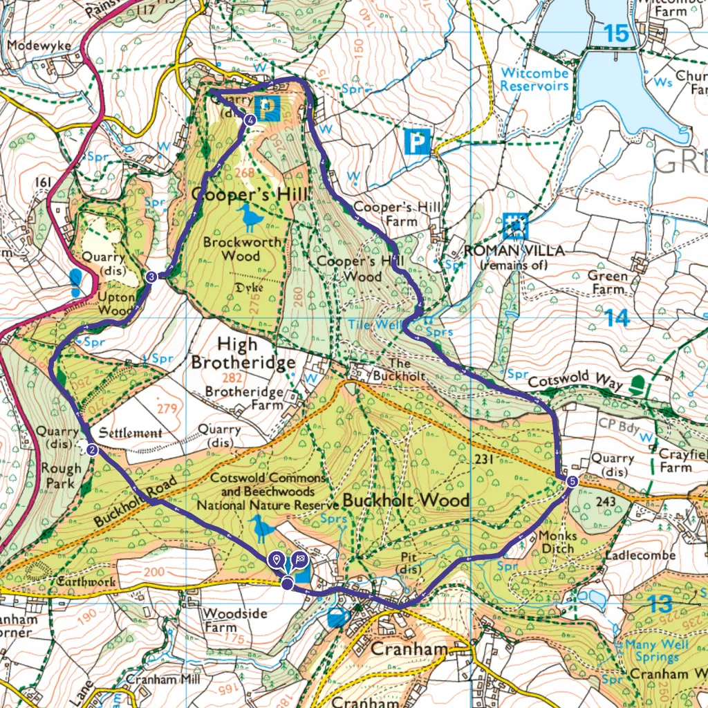
1. Start
From Witches Tump Car Park, just west of Cranham on Sanatorium Road, take the signed path into the hushed loveliness of Buckholt Wood, where leaf litter carpets the forest floor year-round. Follow the path as it winds upwards through the trees to reach Buckholt Road. Cross road, then continue to climb up into the woods.
2. Cotswold Way
Keep climbing until, when the ground levels out, signage appears for the Cotswold Way (CW). Joining this National Trail, follow the route downhill and stay with it as it swings right. At an open, flattish area where various paths meet, follow CW signage to head along an undulating stretch of track, with an open field to your right, soon passing a netted area of coppiced hazel.
3. Brockworth Wood
Reaching a kissing gate, pass through with pastures on either side. Stick on CW as it swings left then follow through woods. Around quarter of a mile later, look out for CW signage pointing hard right uphill. Follow this, and you’ll soon leave the woods to reach the top of a precipitous slope with a booming view. This is Coopers Hill.
4. Cooper's Hill
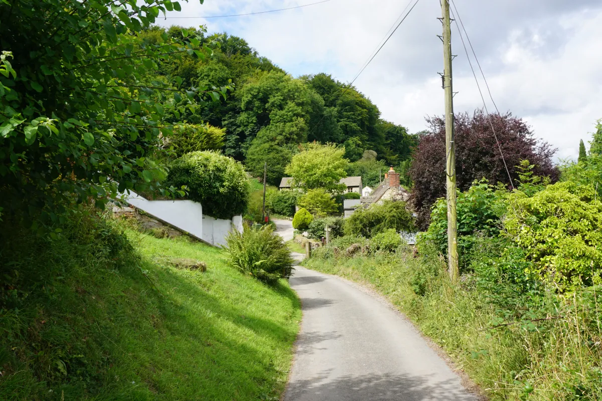
If you’re not chasing a Double Gloucester, enjoy the view then bear left to follow CW back into the woods. Descending through the trees, turn right at CW signage to find yourself at the foot of Cooper's Hill. Keep going to reach a minor road, then follow this past several houses, ignoring any turn-offs. The road eventually becomes a stony track just inside the woods. Stay on this path, sticking with CW signage, eventually meeting the drive of a large house named The Paddocks. Continue away from the house to reach Buckholt Road.
5. Cranham Common
Cross road and follow ‘Public Footpath’ sign into woods. This path bears left then, by a parking area, heads downhill on a sealed road. Pass villa on left, then later a fenced ancient beech on right, before reaching a gate engraved ‘Cranham Common’. Continue until road through village, then turn right and follow road back to Witches Tump Car Park.
Cooper's Hill map
Coopers Hill walking route and map
Useful information
Terrain
Sometimes steep, muddy and rutted. There are no stiles but the route is unsuitable for wheelchairs.
Starting point
Witches Tump car park (£3 voluntary charge) GL4 8HP.
Eat/drink
Cranham’s Black Horse Inn is temporarily closed, with a view to reopening as a community-owned pub. The nearest pubs are The Royal William on the A46 and The Butchers Arms in Sheepscombe.