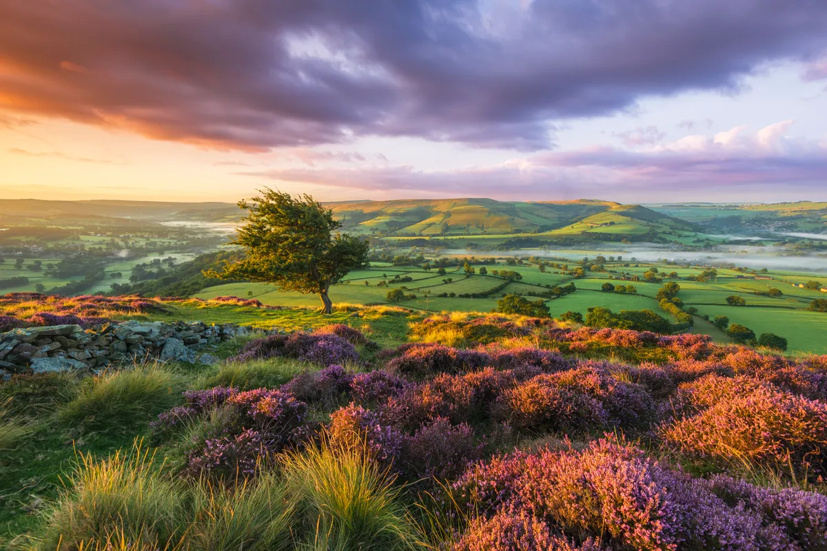
The enchanting Peak Forest Canal puts on a real show at Marple, in the south-east of Greater Manchester. It leaps over the River Goyt on an immense stone aqueduct, one of the wonders of the inland waterways, forges through a fabulous flight of 16 locks and contours cosily along a hillside terrace, with grand views to the nearby Peak District’s hills.
This figure-of-eight walk also includes tranquil stretches of the Goyt’s splendid, wooded gorge rich in industrial heritage.
Peak District walks
The Peak District National Park lies just a few miles from Marple. Hike over hills, moors and mountains, amble beside idyllic rivers and climb through deep gorges with our guide to the best Peak District walks.
Marple walk
6 miles/9.6km | 3.5 hours | moderate | 207m ascent
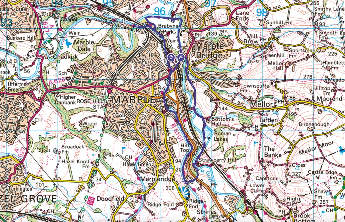
1. Marple station
Head downhill from Marple station (or car park) and, beyond the river bridge, turn right along Town Street in Marple Bridge.
At the junction (175m) fork right along initially cobbled Low Lea Road, rising over the hillcrest through to a woodland T-junction in 900m. The footings of the immense Mellor Mill, burnt-down in 1892, mark this spot.

2. River Goyt
Bear left along the potholed lane, then fork right along Lakes Road, for Roman Lakes. These huge mill-ponds are passed to your left. Stay with the old lane beside the River Goyt beneath the railway viaduct.
Reaching the driveway (left) for Strawberry Hill, turn right to cross the exquisite packhorse bridge across the Goyt. Accompany the widening path left and rise past secluded dwellings to the main road.
3. Peak Forest Canal
Cross into Plucksbridge Road, rising to the Peak Forest Canal towpath. Turn right (canal on your left) and amble this wildflower-rich contour-canal, with great views to the fringe of the Peak District.
Circle back over Bridge 19 and continue in the same direction (canal now right) to the junction with the Macclesfield Canal at Bridge 1. Cross this to descend beside the intriguing, uppermost nine locks of the Marple Flight.
4. Brabyns Park
At Lock 9, just beyond the converted warehouse, join the main road downhill, shortly passing Marple Station.
Opposite Brabyns Brow car park (another 100m), turn left along the tarred lane (Brabyns Park). In 75m, fork right to pass through small car park. Keep right of the gateway to join the riverside path downstream through Brabyns Park.

5. Marple Aqueduct
At the ornate iron bridge (don’t cross), jig left, then turn sharp-right beyond the house onto the continuing riverside path. Near the ultimate parkland corner, turn left below the woods and in 150m look for the steep path, right, up through the trees. Turn right at junction in 125m up steps to the canal towpath below Lock 2.
Divert right to the spectacular Marple Aqueduct (beyond railway bridge).
Return along the towpath, rising beside the locks to reach the bridge jostling Lock 9. Turn down the road to nearby station and car park.

Marple map
Useful information
Starting point
Marple (not Rose Hill Marple) Railway Station, on the Manchester to Sheffield line (daily trains). Regular daily buses 383/384 from Stockport to Marple Station. Large, free car park 100m downhill from station on right at Brabyns Brow [no barrier, SK6 5DT].
Terrain
Route is mostly gently undulating byways or towpath. Three short, modest climbs. Some steps. Not fully accessible to pushchairs or wheelchairs. Dog-friendly.
Map
OS Explorer OL1 (covers all but the Marple Aqueduct section).
Eat
Variety of cafés and pubs in Marple Bridge.
Stay
Oakfield Lodge Guest House, Marple SK6 7DB Tel: 0161 4271633