For those looking to make a day of their visit to Tintern Abbey, it's worth considering this gorgeous woodland and riverside walk that starts and ends near the Welsh ruin.
From Tintern’s old station (a mile up the road from the abbey), rise with the Wye Valley Walk through superb woods past magnificent viewpoints to reach secluded Cleddon.
Descend steeply past woodland waterfalls to the riverside village and pub of Llandogo. Upstream beside the Wye, cross elegant Bigsweir Bridge, then wander downstream on Offa’s Dyke Path through woods and buttercup meadows back to Tintern Abbey.
Looking for more walking inspiration? Check out our pick of great walks in the Brecon Beacons, magical riverside trails and the best woodlands to visit.

Tintern Abbey walk
8.9 miles/14.3km | 6 hours | moderate | 409m
1. Tintern Old Station
From Tintern Old Station, follow the old trackbed past the water tower to reach Brockweir Bridge up some steps.
Turn left to reach the main road; carefully cross to the right, following the Wye Valley Walk (WVW) fingerposted.
Rise steadily (WVW discs) to climb steps beside/past an old barn. Go diagonally (WVW) up over a crossing of tracks, soon advancing deeper into woods.
In 700m merge ahead on a wider track. In 200m keep right at a fork (WVW yellow-topped post), then left at the next split. Descend gently then at a track junction (500m) go ahead on narrower WVW path to a lane by ‘Hazel Grove’ bungalow. Turn right.
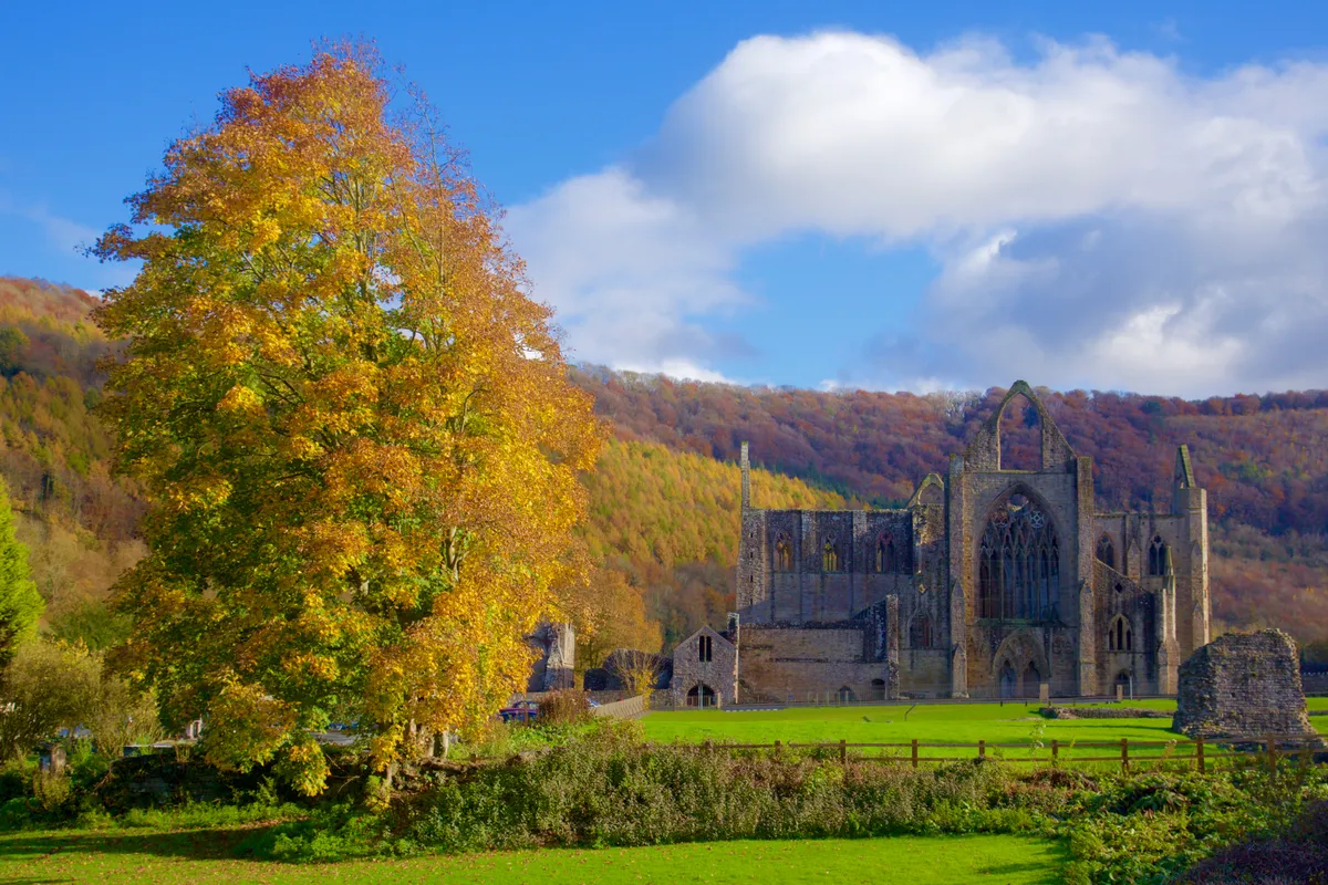
Tintern visitor's guide: places to stay and things to do
Escape into the Wye Valley for a mixture of rural tranquillity, mystical sights and historical intrigue. Here is our guide to Tintern in Monmouthshire with a selection of walks, unique places to stay and interesting things to do.
2. Whitestone Picnic Area
In 100m locate the WVW signed off the outdoor centre driveway. Advance beneath Douglas firs, then alongside meadow before drifting into mature broadleaf stands.
Step over two brooks, shortly reaching a tarred lane on a sharp bend. Cross directly into the continuing narrow path ahead.
A short rocky section finds a waymarked path junction. Keep ahead-right (red disc), then left at an unmarked fork (100m), soon reaching a wide forestry road above Whitestone Picnic Area.
3. Cleddon
Bear right and pass the multiple information boards, following purple waymarks (Duchess Ride). This good track passes three great viewpoints into the valley. Just beyond the third, turn right at the track T-junction (purple waymark) to a meeting of ways.
Advance on an old walled route (WVW); cross at the top of the waterfall to reach a tarred lane at a sharp bend, cottages and parking at Cleddon.

4. Llandogo
Select the dirt path directly behind a bench (leaving WVW). Beyond the boardwalk, turn sharp-right down the first of many zigzags. Much lower down is a ‘Path Closed’ sign on a left-zigzag. Turn right onto a good path across Cleddon Shoots brook, advancing to a split just before a modern house. Drop left (‘A466’) to a nearby tarred lane. Go sharp-left, then left of a gatepost, taking the steep path to a lower lane. Turn left, then fork right.
At the next crossroads, look right for a thin lane left of a millstone, down to The Sloop Inn in Llandogo.

5. Bigsweir Bridge
Directly behind the pub, a barn-side path leads to the Wye. Turn left.
As the dirt track leaves the riverbank in just under a mile, take the narrow waymarked path on the left below trees to the main road. Turn right (pavement) to and across Bigsweir Bridge. At the far side, walk down steps along the signed Offa’s Dyke Path (ODP) downstream.
Follow the well-marked path/bridleway (ODP) through riverside woods and meadows to Brockweir village. Cross the bridge, then turn left (steps) on a path back to Tintern Station.

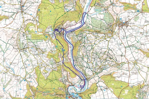
Tintern Abbey map
Tintern Abbey walking route and map
Useful information
Starting point
Tintern Old Station Picnic Area & Information (SO537006) [NP16 7NX], off A466 just north of Tintern village. Car park £4 for 7 hours. (NB the car park overflow locked at 4.30pm, rest remains open).
By bus, infrequent Phil Anslow Coaches service 69 links Chepstow and Monmouth Mon - Sat; request stop at the entrance to Tintern Old Station.
Terrain
One steady climb and one steep descent. Woodland paths and tracks, back lanes, riverside. Muddy stretches. Short main road section (with pavement).
Map
OS Explorer OL14
Eat
The Sloop Inn at Llandogo half-way round. Tearoom at Tintern Old Station open April-October 10-4.
Stay
Wye Valley Hotel, Tintern NP16 6SQ. More hotels, inns and B&B in Tintern.