The British landscape is criss-crossed by a vast network of waterways, ranging from trickling mountain streams to large meandering rivers. A great deal of these are accessible by public footpath, offering walkers the chance to enjoy miles and miles of waterside walking, no matter where you live.
The chances are there will be a river walk near you. To help you find the perfect riverside ramble, we've put together a list of our favourite river walks, from the chalk streams of Hampshire and the gentle flow of the Coquet in Northumberland to the turbulent torrents of Perthshire's River Bran and the Welsh Wye.
The British countryside is filled with charming rivers, rich in wildlife and history. Discover a river walk near you with our pick of the UK's best riverside trails.
We've gathered a selection of the best river walks in the UK, including a detailed route description map and wildlife highlights to spot.
Britain's best river walks near you

Best river walks in England
Smardale Gill, Cumbria
Distance: 7 miles | Duration: 4 hours | Difficulty: moderate

This magnificent, relatively unknown limestone landscape became a part of the Dales in the 2016 boundary extension. It oozes the character of a time long-gone. Enjoy a spectacular seven-mile walk through the gorge.
Smardale Gill walking route and map
Tarr Steps, Exmoor National Park
Distance: 7 miles | Duration: 4 hours | Difficulty: moderate

Tarr Steps is one of Exmoor’s true hidden treasures and a firm favourite with visitors – once you’ve discovered it you’ll find yourself drawn back time and time.
Tucked away down a narrow lane five miles from Dulverton, the steps are an ancient clapper bridge – large flat slabs of stone placed on stone supports – across the River Barle, which dates back to around 1000 BC. Local legend says the five-tonne slabs were placed here by the Devil to win a bet with a local giant (apparently Old Nick still has sunbathing rights on its stones).
Walk alongside a winding river through deep forests on a seven-mile loop from the magical Tarr Steps to the Somerset village of Withypool.
Tarr Steps walking route and map
Walking Britain's great rivers from source to sea
From walking the banks of the Sussex Ouse through pasture and downland, to following the length of the River Severn, Britain’s longest river, here are seven magical source-to-sea trails to inshrine your next adventure.

Chee Dale, Miller's Dale and Wye Dale, Derbyshire
Distance: 4 miles | Duration: 3 hours | Difficulty: moderate

Deep in the White Peak east of Buxton is a captivating area of countryside; a union of natural bounty and majestic engineering that together create a truly astounding landscape.
Although it may have its challenges, this four-mile walk is readily accessible to all with a measure of agility and a sense of adventure.
Chee Dale walking route and map
College Valley, Northumberland
Distance: 4.75 miles | Duration: 3 hours | Difficulty: moderate

Running through the base of this tranquil valley in the northern limits of Northumberland National Park is College burn, a winding river surrounded by moorland hills. Look out Cheviot Goats on the slopes near Hethpool Mill.
College Valley walking route and map
Cuckmere River, Sussex
Distance: 7 miles | Duration: 4 hours | Difficulty: moderate

Smallest and narrowest of the Sussex Wealden rivers flowing into the English Channel, the Cuckmere has never had a port at its outflow and remains the only undeveloped Sussex river mouth.
It retains much of its medieval character as it bends through an ancient land of sheep-grazed chalk downs, Norman churches, and verdant meadows.
Follow this seven-mile walk along the Cuckmere River, from the picturesque village of Alfriston to the monumental Seven Sisters chalk cliffs on the Sussex south coast.
Cuckmere walking route and map
Clean River swims
Wild swimming expert Daniel Start recommends the best clean upstream rivers around the UK.
Marshfield, South Gloucestershire
Distance: 7 miles | Duration: 4 hours | Difficulty: easy

The southern Cotswolds, just south of the M4, is a hidden marvel on the edge of Bath and Bristol – explore this secret of the British countryside with a seven-mile walk alongside rivers and through fields.
Marshfield walking route and map
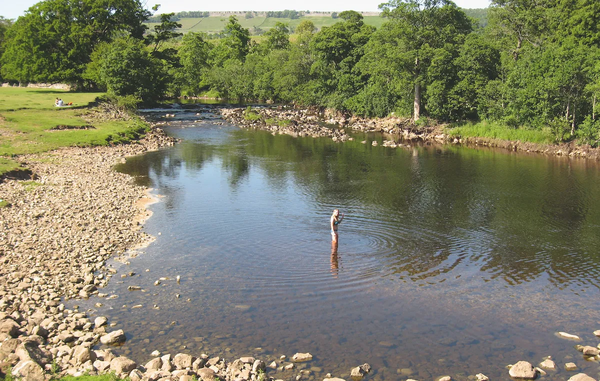
Upper Wharfedale, North Yorkshire
Distance: 7 miles | Duration: 4 hours | Difficulty: moderate

Upper Wharfedale is a charming little valley off the beaten track where the roads are too narrow for trucks and busses to navigate. It’s a bit of a bind to get to, but once you’ve found the dale, you’ll never forget it.
The limestone and peat uplands hereabouts are riven with steep-sided valleys and ghylls where water teems off the fells and tumbles over a series of waterfalls through the heart of the picturesque villages of Cray, Yockenthwaite and Hubberholme.
Follow this walking route in Upper Wharfedale in North Yorkshire with a plotted OS map.
Upper Wharfedale walking route and map
River Stour, Suffolk
Distance: 3 miles | Duration: 1.5 hours | Difficulty: easy
 beside the River Stour at Flatford Mill, East Bergholt, Suffolk UK - This house appears in a number of paintings by John Constable, notably The Hay Wain.")
The Stour in Suffolk could be the most celebrated river in the country after the Thames. Why? Because it features in one of Britain’s favourite artworks, The Hay Wain, painted by John Constable in 1821.
Remarkably, the same scene can be viewed today. Preserved (but not fossilised) by the National Trust, this is the apex of a much-loved river walk – a short walk along the marshy banks of the River Stour, running from the Suffolk town of Dedham to Flatford Mill.
River stour walking route and map
West Tanfield, North Yorkshire
5 miles/8km | 3 hours | moderate

West Tanfield sits at the eastern end of the dale alongside the River Ure, where a graceful arched stone bridge spans the water. The 15th-century Marmion Tower sits squarely next to the older church of St Nicholas. Now in the care of English Heritage, Marmion Tower is three storeys tall, features a beautiful oriel window and was once the imposing gatehouse to a long-vanished riverside manor house.
Follow the gentle meanders of the River Ure, where woodlands of yellow aconites and swaying hazel catkins lead to tiny Yorkshire hamlets and quiet country lanes.
West Tanfield walking route and map
River Liza, Cumbria
14.2 miles/22.9km | 8 hours | moderate-challenging

Just getting to the remote shores of Ennerdale Lake is something of an adventure. Navigating the winding, narrow roads requires some skill. Then, as you approach the lake, the road gives way to rubble tracks, which lead to rough-surfaced car parks. The lake shore can only be reached on foot. The result is that solitude and tranquility are more readily found in Ennerdale than in any other Cumbrian valley.
Footpaths completely circle the lake, and are accessible from either of the two car parks, Broadmoor Wood to the west and Bowness Knott – this walk starts at the latter.
River Liza walking route and map
East Lyn River, Devon
Distance: 6 miles | Duration: 4 hours | Difficulty: moderate

Rising high above Exmoor, the East Lyn River flows through the East Lyn Valley in Devon to the picturesque village of Lynmouth.
With its splashing brooks, tranquil waterfalls and leafy trails, it is hard to imagine the tragedy that occurred here on 15 August 1952: flash floods swept through the valley towards Lynmouth, washing away more than 100 homes and killing 34 people. The riverbanks were rebuilt after the disaster, and today this waterside walk is quietly poignant in its calm beauty.
This beautiful six-mile walk begins at Lynmouth in the Exmoor National Park and follows the East Lyn River upstream to Rockford before heading back to the coast.
East Lyn River walking route and map
Forge Valley Woods, North Yorkshire
Distance: 4.5 miles | Duration: 3 hours | Difficulty: moderate

Formed by meltwater from the retreating Ice Age glaciers, the deep Forge Valley is a woodland haven for plants and wildlife, and is easily explored on a riverside boardwalk that follows the course of the water.
In spring and summer there are many wildflowers to spot; autumn produces spectacular colour and winter highlights the structure of the trees. Take a walk through Forge Valley woods in North Yorkshire using our mapped walking route.
The beautiful nautre reserve on the banks of the River Derwent in the North York Moor National Park was once home to iron smelting. Today it's a peaceful spot – go quietly and you may see an otter.
Forge Valley walking route and map
Badgworthy Water, Devon/Somerset
Distance: 7 miles | Duration: 4 hours | Difficulty: moderate

Although not West Country born, R.D Blackmore spent much of his childhood in what has now become known as Doone Country, a peaceful corner of Exmoor.
This route takes you along the banks of Badgworthy Water, past Hoccombe and Lank Combe, both possible locations for the fictional home of Blackmore’s band of Scottish outlaws.
Badgworthy Water walking route and map
River Wharfe and Bolton Priory, North Yorkshire
Distance: 6 miles | Duration: 3 hours | Difficulty: moderate

The River Wharfe is a waterway of great contrasts and beauty, rising high up in the hills that separate Dentdale from Wharfedale as a busy little steam, burbling over a series of flat limestone ledges. It’s an area of peace and quiet and a good spot to sit and watch dippers diving for insect larvae.
Stroll along the sylvan banks of a Yorkshire river on this moderate six-mile walk. Enjoy sights ranging from the dramatic ruins of a 12th-century priory to the grandiose arch of an old stone bridge.
River Wharfe walking route and map
Marshcourt River, Hampshire

England is home to more than 85% of the world’s chalk streams, with Hampshire offering some of the finest examples. Follow creeping water rails, singing warblers and shimmering brown trout along this stretch of the Marshcourt River.
Walk Britain's Amazon: the River Dart

The River Dart runs through Devon from its source on wild Dartmoor to the sea at Dartmouth. Travel upriver by boat, train and on foot over three dreamy days with Ben Lerwill.
Best river walks in Northern Ireland
Tollymore Forest Park, County Down
Distance: 3 miles | Duration: 1.5 hours | Difficulty: easy

The River Shimna rises on the rutted slopes of the Mourne Mountains, gurgling over granite and heather before dropping into the shadowy depths of Tollymore Forest.
There are four waymarked trails in the forest, including the 750-metre Arboretum Path, which wends through one of Northern Ireland’s oldest arboreta, and the Mountain Trail, an 8.8km ramble along the Shimna, rising through conifer plantations with views across the tor-topped Mourne Mountains.
Glenariff Nature Reserve, County Antrim
Distance: 1.8 miles | Duration: 1 hours | Difficulty: easy/moderate

The Rivers Glenariff and Inver have cut right through this spectacular steep-sided gorge – the Queen of the Glens.
These rivers can be lively and dramatic as they tumble over boulders and a series of three impressive waterfalls. But then they become suddenly calm and tranquil, flowing lazily through oak and beech woodland, sunlight streaming through the fresh new leaves.
This humid and moist microclimate is home to rare ferns, mosses and liverworts, as well as spruce, fir, pine and larch.
This short circular gorge walk, abound with tumbling rivers and waterfalls, navigates through a lush reserve in Northern Ireland's County Antrim.
Glenariff walking route and map
Bet river walks in Scotland
Birks of Aberfeldy, Perthshire
2.7 miles/4.3km | 1.5 hours | moderate

When Robert Burns came to visit Aberfeldy in 1787, he was so impressed by the spectacular waterfalls and birch woods outside that he wrote a poem celebrating the area’s natural beauty.
Today, a 4½ mile circular path allows you to follow in his footsteps and be equally inspired by this amazing place.
Birks of Aberfeldy walking route and map
Nevis Gorge, Highland
Distance: 2 miles | Duration: 1.5 hours | Difficulty: easy/moderate

Tapering south from the Highland town of Fort William, gorgeous Glen Nevis is bounded by several high, rugged mountains, including the huge bulk of Ben Nevis, which, at 1,344m (4,409ft) above sea level, is the highest point in the British Isles.
Other iconic peaks include Sgurr a’ Mhaim and Stob Ban and the glen is a playground for mountaineers, mountain bikers and white-water rafters.
However, it is a low-level, two-mile walk through the dramatic Nevis Gorge that really packs a punch and provides an unforgettable aural and visual experience. Sections of the path can be rocky and slippery but with a little care this is a superb walk, suitable for almost everyone.
Glen Gorge walking route and map
Glen Sligachan, Isle of Skye
Distance: 11 miles | Duration: 5 hours | Difficulty: hard

Menacing yet darkly beautiful, the jagged Cuillin Mountains are your steady companion on this remote island walk through Glen Sligachan.
Winding through true wilderness country, you’ll feel a real sense of progression as you ford several rivers, moving from one loch to the next, past herds of red deer and the dramatically located Camasunary Bay, before arriving at the houses of Kirkibost. Save it for a fine September day after a spell of dry weather – the midges will be fewer, the burns lower – and you will have a memory to last a lifetime.
Glen Sligachan walking route and map
Falls of Bruar, Perth and Kinross
Distance: 1.5 miles | Duration: 1 hour | Difficulty: easy–moderate

The Bruar Water, just north of Blair Atholl, oozes from the soggy plateaux and moors of the great Atholl Deer Forest and flows gently down the empty miles of Glen Bruar before changing character completely.
As the ground falls away, the waters become increasingly agitated and turbulent, before crashing and thundering down a deep gorge. At the foot of the gorge the water roars over a series of falls and cascades, before surging through a natural arch in the rock and into the pools below.
Pull on your boots and step into the reclaimed forest, climbing through trees of golden larch, towering Scots pine and magnificent mountain ash in search of a roaring Cairngorms cascade.
Bruar Falls walking route and map
River Braan, Perthshire
Distance: 6 miles | Duration: 3 hours | Difficulty: moderate

Despite appearing natural, the woods surrounding the Perthshire town of Birnam were planned by the Dukes of Atholl in the 1700s. Cutting the forest in two are the gorgeously clear waters of the River Braan, where a series of cascades descend to Black Linn waterfall before flowing into the River Tay near Dunkeld.
Follow the white water of Scotland's River Braan through a fabled woodland of giant Douglas firs, fairy-tale bridges and an ancient oak immortalised by Shakespeare’s Macbeth.
River Braun walking route and map
Allan Water, Stirlingshire
Distance: 3 miles | Duration: 2 hours | Difficulty: easy

Home to salmon and trout and edged with lush ancient woodland, the gentle Allan Water is loved by Generations of walkers and fishermen. On a warm summer’s day, there are few rivers quite as idyllic as this.
The earthy scent of mosses, ferns and wild garlic are heavenly on this exquisite riverside 3-mile ramble, where fish leap, herons stalk and weirs rumble.
Allan Water walking route and map
Best river walks in Wales
River Wye, Monthmouthshire
Distance: 7 miles | Duration: 3.5 hours | Difficulty: moderate

South of its renowned horseshoe loop and Yat Rock, the Wye surges between looming shoulders of limestone into a magnificent wooded chasm.
The cottage-dotted slopes of Symonds Yat give way to yew, ash, beech and lime woods, cascading from fractured cliffs soaring more than 80m above the river, which is over 10m deep in places. Vast towers of dolomite glisten in the sunshine, contrasting with the verdant broadleaf forest. While above the gorge, reached by steep paths, are fabulous viewpoints and tantalising evidence of our distant forefathers.
Hike along a wooded bank past radiant wildflowers, foraging deer and a king’s cave on a seven-mile track beside the River Wye. The route passes from England into Wales and includes a crossing of the deluge on the Symonds Yat hand ferry.
River Wye walking route and map
Afon Ystwyth, Ceredigion
Distance: 8 miles | Duration: 4 hours | Difficulty: moderate

Appropriately, Ystwyth means ‘supple’ in English. The river’s shifting currents braid the silvery sands and its course changes often, never quite the same as when last seen. In spate, its levels fluctuate dramatically, and plants such as alpine pennycress take root and then vanish.
From its boggy source in the Cambrian Mountains to Aberystwyth, where it slips quietly into the Rheidol river, Afon Ystwyth is a secretive stream. It moves west from molinia-choked uplands through gorges, forests, mining villages and the Hafod Estate, following the rocky escarpment of the Ystwyth fault line.
Step off the beaten track on to the mossy banks of a hidden river in west Wales – overhanging trees, towering cliffs and a wealth of wildlife make this long, waterside walk well worth the effort.
Avon Ystwyth walking route and map
Waterfall Country, Powys
Distance: 3.5 miles | Duration: 2 hours | Difficulty: moderate

“I cannot call to mind a single valley that… comprises so much beautiful and picturesque scenery and so many interesting and special features.” With these words, Victorian naturalist Alfred Russel Wallace was describing neither the Amazon nor the Far East that he explored on his intrepid travels, but somewhere much closer to home: the Vale of Neath on the southern slopes of the Brecon Beacons.
Spilling water, mossy riverbeds and tree-shrouded caverns – Waterfall Country is a ramblers dream.
Waterfall Country walking route and map
River Marteg, Rhayader, Powys
Distance: 3 miles | Duration: 2 hours | Difficulty: easy/moderate

The River Marteg meets the River Wye at Pont Marteg, three miles north of Rhayader.
From the car park, a winding path traces this rocky river through Gilfach Farm Nature Reserve. For years, the farm has been worked traditionally and organically, creating a landscape rich in wildlife.
River Marteg walking route and map
Main image: Walking crossing a bridge over river/Credit: Getty


