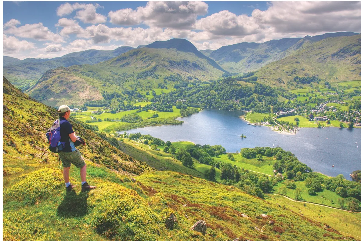
From the wooded shores of Ullswater where swans glide gracefully on Lakeland’s second largest body of water, to rocky mountains where peregrines chase down their prey with brutal efficiency, this walk takes in a massive range of habitats.
Wood pasture, high grassland, rugged fells and even a Victorian arboretum
are all reawakening after their winter dormancy.
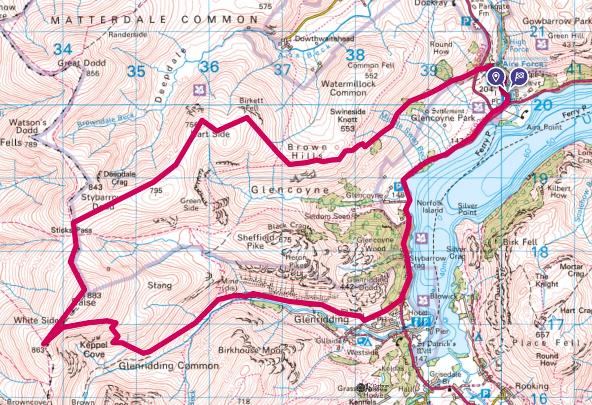
Aira Force to Raise walk
11.8 miles/19km | 8 hours | challenging
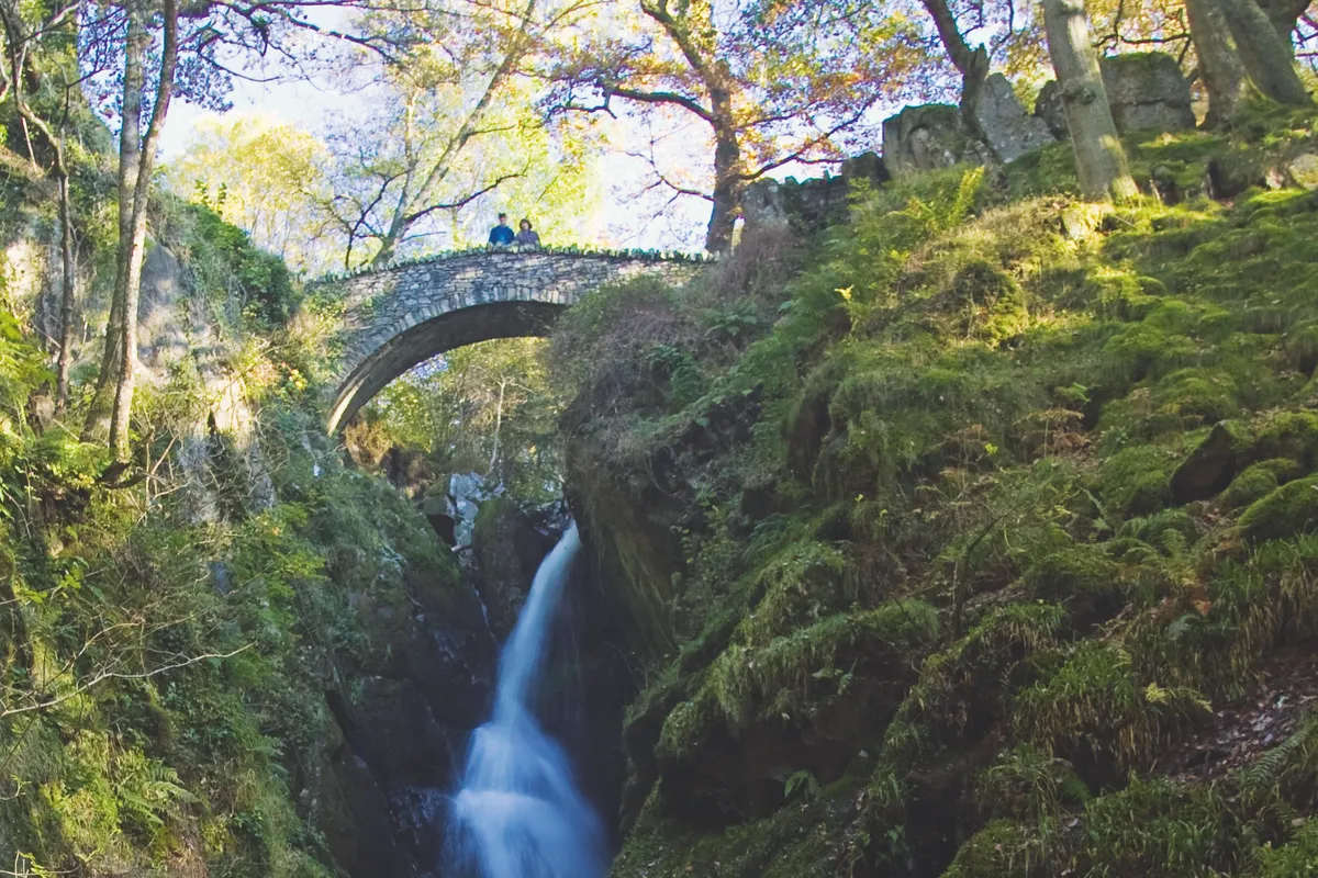
1. Waterfall view
From the top end of the National Trust’s Aira Force car park, follow the path up Aira Beck’s west bank, shaded by ancient yews and more exotic non-native conifers planted in the 19th century. After 550 yards, the route goes left at a signposted fork, although continuing straight on for two minutes will give you an exhilarating and exciting view of the waterfall.
2. Into the Woods
From Park Brow car park, cross the stile on the far side of the A5091 and ascend the wood pasture of Glencoyne Park. Finches, pied flycatchers and redstarts are among the birds flitting from the youthful green of springtime oaks to the snow-white hawthorn blossom. Listen, too, for the cuckoo calling as sparkling glimpses of Ullswater come and go through gaps between hazel, beech and wind-bent larch.
3. Fell forward
Beyond a gate marking the edge of the open fell, bear left. After a wall gap, turn right, climbing beside the wall.
4. Birkett’s legacy
At the top of the rise, head west, quickly passing Birkett Fell, with its cairn dedicated to Lord Birkett, whose 1960s campaigning prevented Ullswater from becoming a reservoir. Descend south-west from Hart Side and continue across moorland grasses – regaining verdancy after winter’s bleaching – to the main ridge below Stybarrow Dodd.
5. Across the ridge
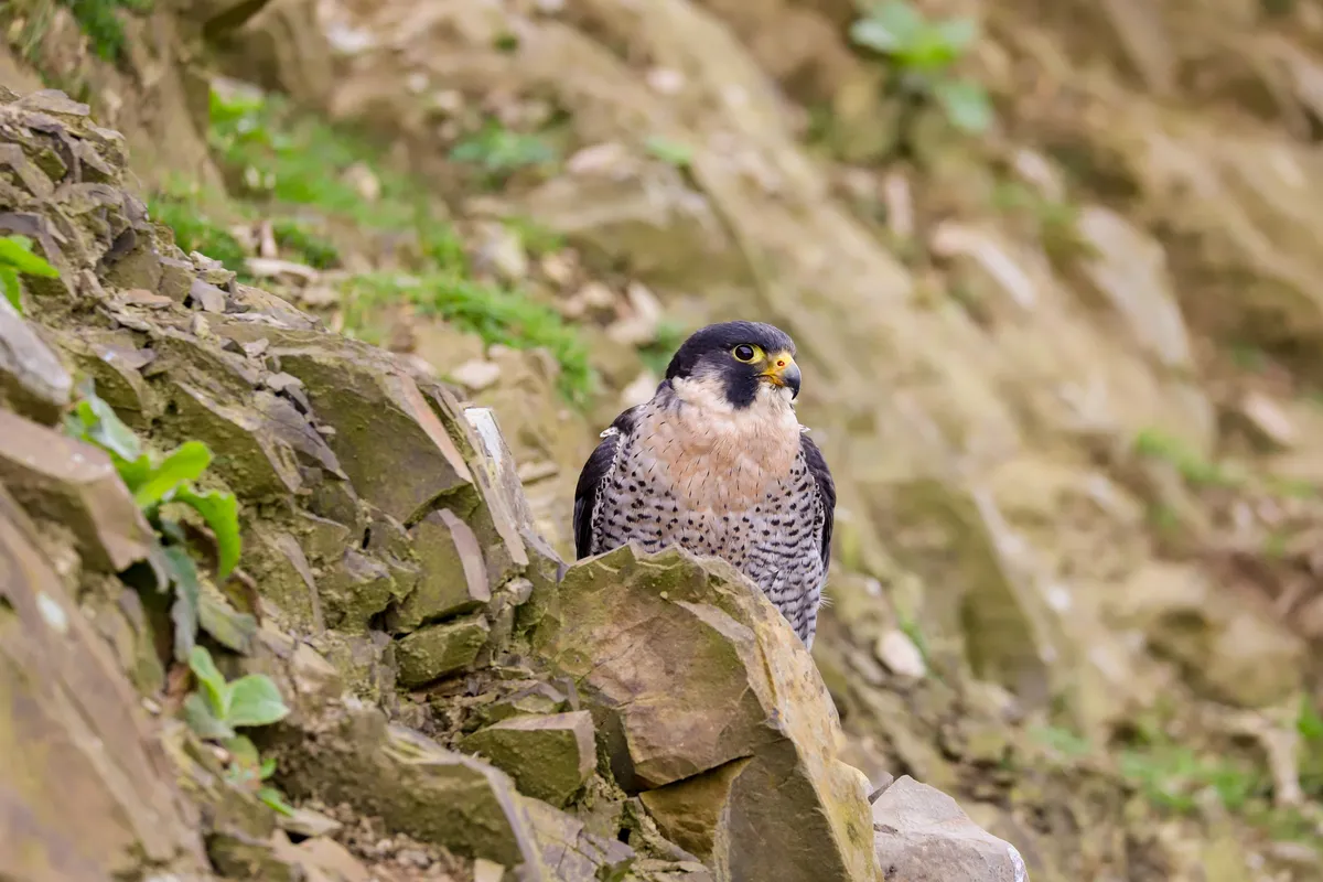
As you stride south along the ridge path, and grassy slopes give way to more muscular, rugged scenery, the ebullient song of the skylarks is replaced by the ravens’ harsh “krorp”. Peregrines and wheatears can also be spotted on these fells, just a stone’s throw now from Helvellyn. Beyond the top of Raise – at 883m, the walk’s highest point – descend south-west.
6. In the shadows
From the saddle between Raise and White Side, turn sharp left. Go left again along a valley track in the shadow of the pyramid-like Catstye Cam.
7. Beside the lake
About a mile beyond Greenside’s converted mine buildings, take the gravel lane on the left. Cross the A592 to locate Ullswater’s wooded shore path.
Walk north along this, briefly using the road as it passes beneath Stybarrow Crag.
8. Force finish
After three-quarters of a mile of lakeside walking, cross the A592 and join an off-road path parallel with the shore. Beyond a car park, this passes through the lower part of Glencoyne Park and later crosses the A5091.
The Aira Force Tea Room tempts weary walkers with coffee and cake before the path at the back of the building leads you to the car park.
Aira Force to Raise map
Aira Force to Raise walking route and map