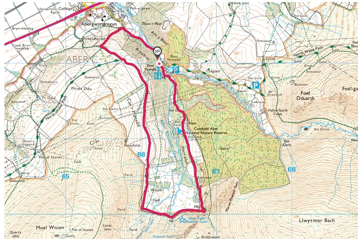
This 4-mile circular walk starts from Bont Newydd car park near the village of Abergwyngregyn on the north coast of Wales.
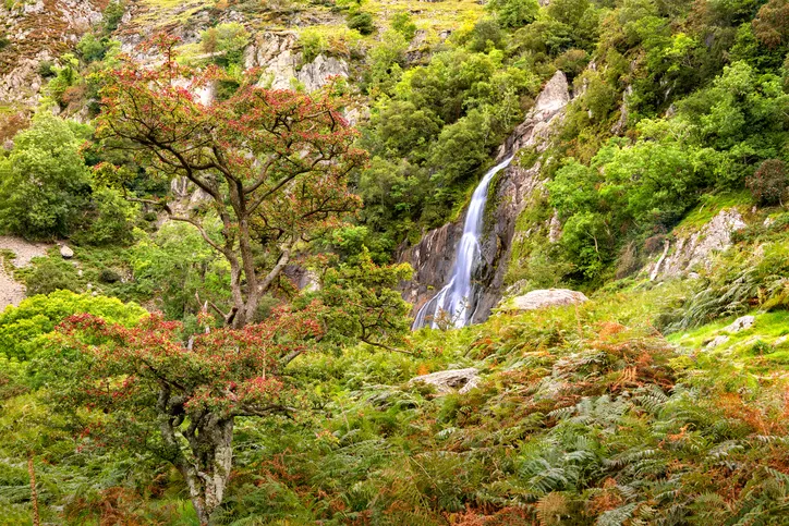
Follow a quiet country lane before crossing the Afon Rhaeadr Fawr river, then take a track alongside some beautiful ancient oak woodland up a verdant valley to the spectacular Aber Falls (Rhaeadr Fawr).
Explore the falls then turn right along the foothills of the Carneddau mountains for incredible views over the Menai Strait towards the Great Orme, Puffin Island and Anglesey before heading back, above the tree line, towards the village.
Aber Falls walk
4.2miles/6.7km | 296m accent | 3 hours | moderate
1. Woodland wander
Park at Bont Newydd (or on the edge of the village, if arriving after 9.30am in busy periods) and pass through the kissing gate into Coedydd Aber Nature Reserve. Follow the path beside Afon Rhaeadr-Fawr and look out for dippers bobbing on the boulders in the river. You soon arrive at a bench with carvings and mosaics illustrating some of the local wildlife.
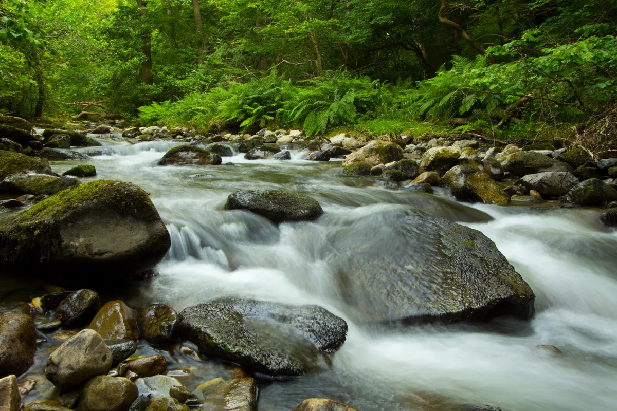
Further along the path, cross a footbridge and pass through a gate. Bear right alongside oak, birch and hazel woodlands – a good habitat for woodland birds, which are more easily spotted in the winter months when the trees have no leaves. At an information board, follow the track ahead.
After a steep section, there are glimpses of the waterfall at the head of the valley. Ignore a path on the left of you and you will soon reach the visitor centre.
Discover more great walks in Snowdonia
2. A steep incline
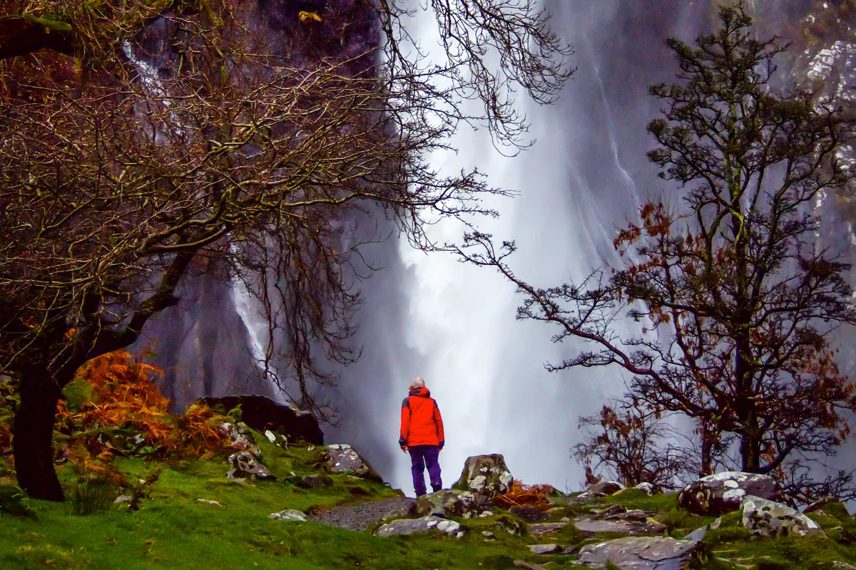
Continue along the track, passing a fenced off enclosure containing the foundations of a recently excavated Iron Age roundhouse. In the far corner are the remains of a more recent kiln and a standing stone. Pass below a scree-strewn hillside to the rocks below the 120ft-high Aber Falls, which are at their most impressive after heavy winter rains. The river boasts one of the steepest gradients from source to sea in England and Wales.
3. North Wales Path
From the falls, retrace your steps for a few metres and cross a footbridge over the river to take the path uphill to a spectacular viewpoint of the falls.
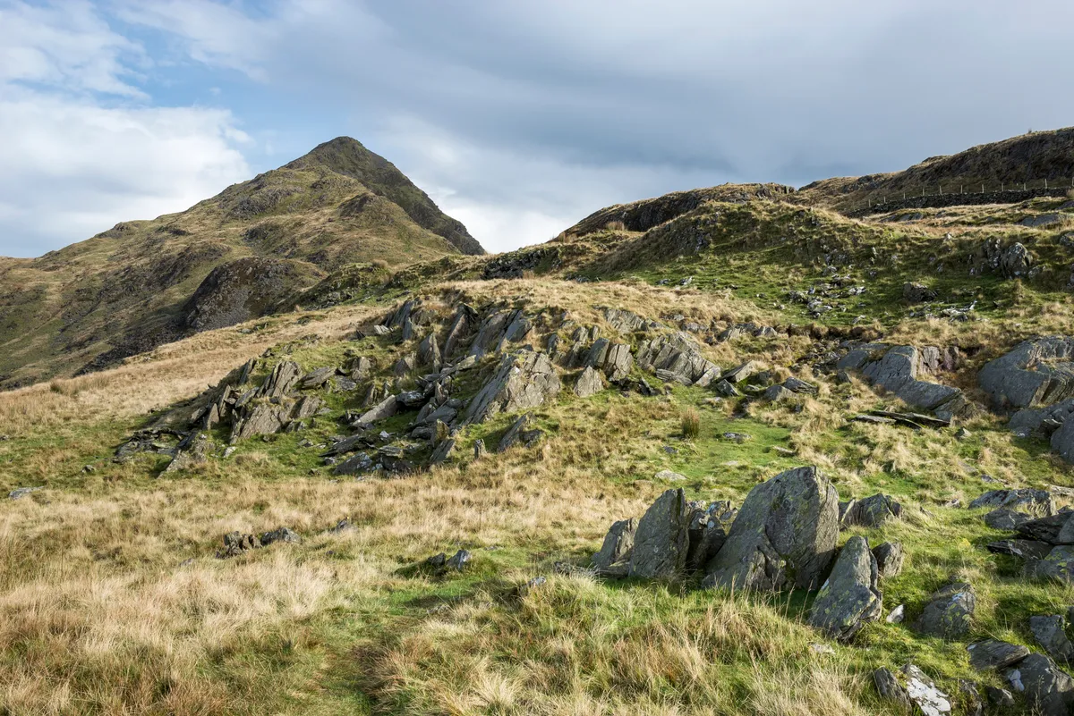
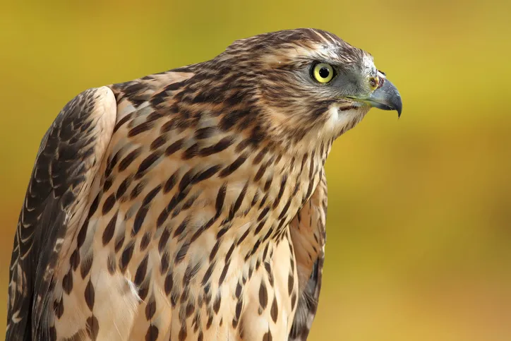
Walk back to the fence and climb a stile to continue along the North Wales Path. Look out for ravens, buzzards and peregrines in the skies above you. After crossing a footbridge at a lesser waterfall, the path veers north, crosses a few streams, then heads uphill to a great viewpoint. If you are lucky you may spot Carneddau ponies on the hillside.
These hardy, semi-wild Celtic ponies have lived on the rugged Carneddau mountain range for hundreds of years. During the winter months they graze lower down the mountainside, and you have more chance of spotting them.
Follow the clear path along the hillside and, at a waymark, take the path indicated to where it rejoins the wider path. Continue along it and you will pass a plantation and a metal farm building to reach a fork in the track.
4. Medieval mound
Leave the North Wales Path and take the right-hand, stony track downhill. Just before it enters trees, go right on a waymarked path and descend the steep hillside. Pause to look down at the village.
In a small field near houses you can see a conspicuous mound with a flat top. A wooden keep, built by either the Normans or one of the Welsh princes, once stood on this medieval motte. Llywelyn ap Iorwerth had a court here and his wife Joan, illegitimate daughter of King John of England, is said to have had an affair with the Marcher Lord William de Braose. Llywelyn hanged the lord on a nearby hill but when Joan died in 1237, she was buried at Llanfaes Priory on Anglesey.
At the bottom of the hill, pass through the gate on to a lane. Go right to the car park or, for refreshments, go left to Yr Hen Felin.
Aber Falls map
Aber Falls walking route and map
Further Information about Aber Falls
Aber Falls terrain
Woodland path, firm tracks and rough pasture. There are some stream crossings, so walking boots or wellies, warm clothing and waterproofs are essential.
How to get to Aber Falls
By car: Rhayader is northwest of Llandrindod Wells on the A483 and A44.
By public transport: A bus service runs regularly between Llandrindod Wells to Rhayader.
Access and parking at Aber Falls
There are only two small car parking areas at Bont Newydd (the start of this walk) affording parking for a total of 48 vehicles (£5 per vehicle - coins only). At weekends, public holidays, during school holidays and when there is fine summer weather, these parking areas tend to be full before 10.00 a.m.
The single narrow lane through the village to Bont Newydd is winding, has no pavement, and includes single-track stretches with few short passing places. There is plentiful free parking at the edge of the village just off the A55 junction, which adds a mere half-mile or so in each direction to the walk and would save much time and frustration to trippers arriving after 09.30 a.m.
In need of some fresh kit for the hills? Read our review of the best walking shoes.