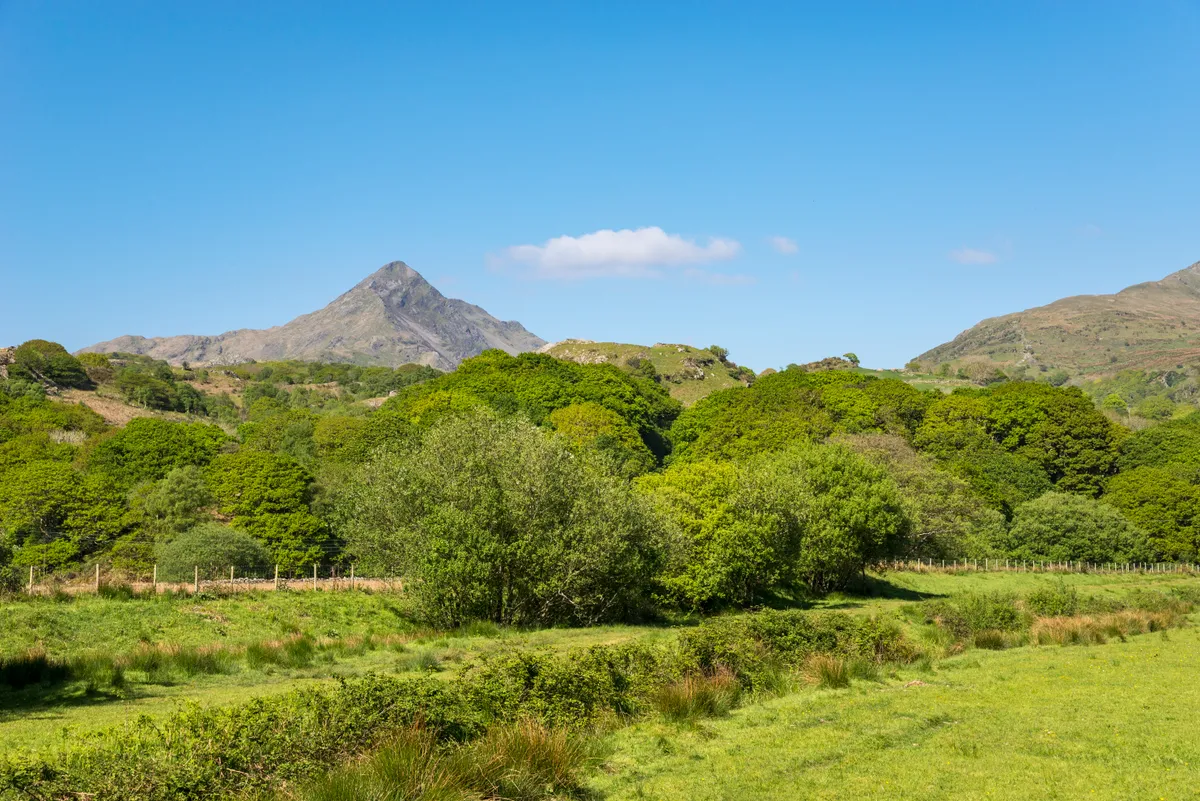
Soaring in poetic isolation among Eryri's (Snowdonia) famed mountains – Tryfan, Glyder Fawr and Carnedd Gwenllian – is Cnicht. Its name, the Anglo Saxon word for ‘knight’, was bestowed on it not by local Welsh people, but by medieval sailors who noted its resemblance when viewed from the sea to a 14th-century bassinet helmet.
Cnicht is so perilous and pointy among the meringue-like swoops and crests that surround it, that it is also known as ‘The Welsh Matterhorn’. At a sixth of the alpine peak’s height, it is rather more easy to climb.
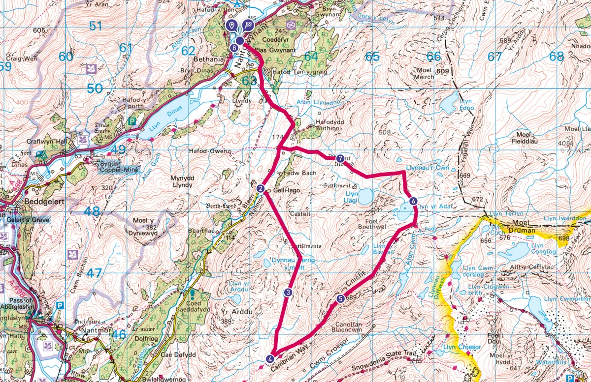
Explore the Moelwynion mountain range in Wales, climbing through a prehistoric landscape to the pyramidal zenith of mighty Cnicht with this 9-mile circular route starting and ending at Nantgwynant.
Discover more great walking routes
How high is Cnicht?
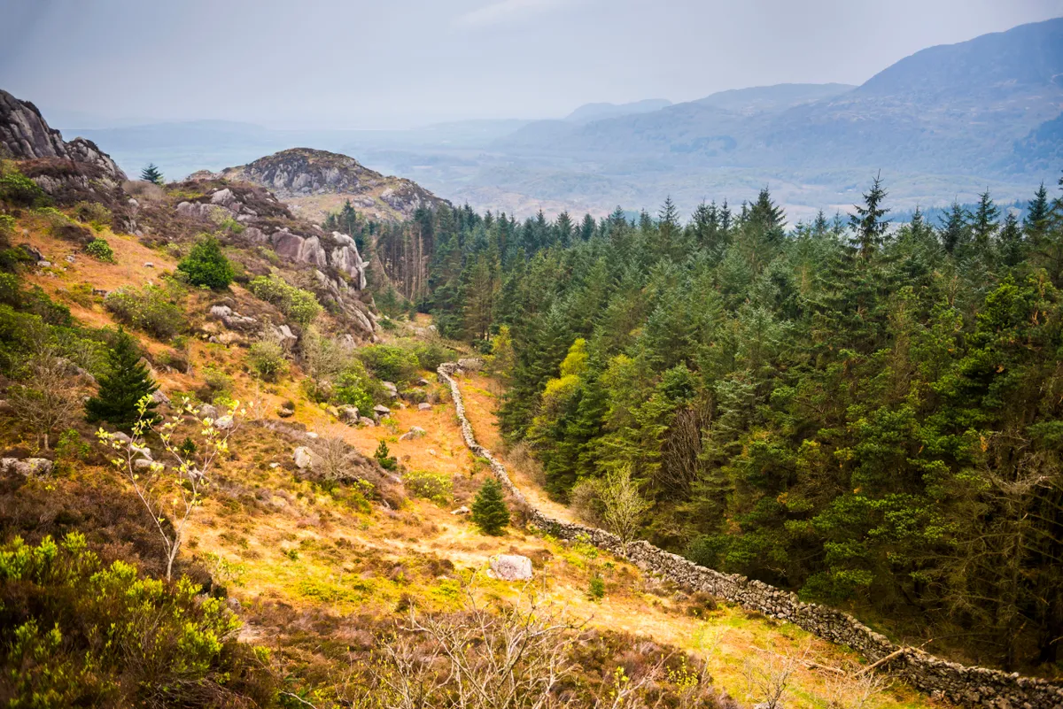
Cnicht is 689m high. The peak forms the pointy end of a ridge and is part of the Moelwynion – a range of craggy summits characterised by their boggy bottoms, moist hollows, disused slate quarries, llynau (lakes), and ffridd (the open habitat between wild upland and managed lowland).
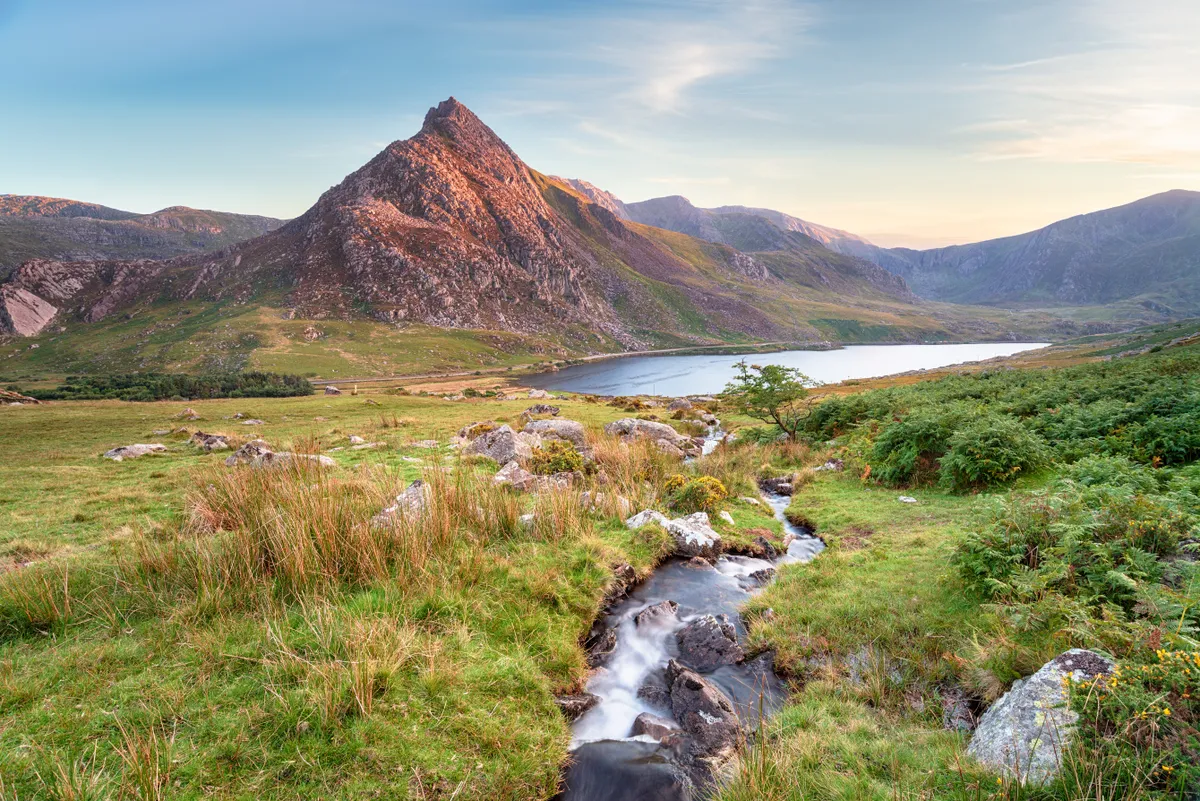
The peaks grant superb views north to the Yr Wyddfa (Snowdon) Massif, from which they are cleft by the Gwynant Valley and the A498.
Where is Cnicht?
Cnicht rises in the far west of the Moelwynion, facing the sea. Glittering llynau adorn its shoulders and throat, and oak woodlands mantle its feet.
A slew of prehistoric routes and settlements girdle its belly and a scatter of slate quarries scab its knees and toes. It is crowned with a few rocky knobs of igneous rhyolite and volcanic lavas, but its heart is all slate, formed when marine siltstones and mudstones were compressed, metamorphosed and folded during a powerful continental collision known as the Caledonian orogeny.
Cnicht walking options
The most popular way to its summit is a direct ascent from Croesor. But if you have the time and energy, this circular route from Nantgwynant offers a more varied landscape.
It is worth considering the excellent Sherpa buses – Eryri's roads are narrow and tortuous – and be sure to take the usual mountain-climbing precautions – the route is hard to navigate in cloud, the rocks are slippery when wet, and the weather shifts quickly.
Looking for more walks in Eryri (Snowdonia)?
Cnicht walk – from Nantgwynant
9.1 miles/14.7km | 789m accent | 6 hours | challenging
1. Navigate the slate
From the Sherpa bus stop at Pont Bethania in Nantgwynant, follow the path behind Plas Gwynant. Step across Afon Llynedno by a footbridge to reach a narrow lane between lichened stone walls and sheep-grazed fields, and follow it to a disused slate quarry and a small parking bay (if you are driving). Cross the stream to Gelli-Iago Farm, home to the Nantmor Mountain Centre.
2. Path to prehistory
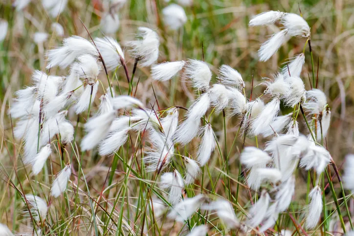
Take the marked path upstream over stepping stones and ladder stiles. Look back to see Yr Wyddfa (Snowdon), Moel Hebog and the Glyderau. The stream peters out near prehistoric settlements and an old fort. The north face of Cnicht rises ahead with flanks of shining slate scree. Step over a drystone wall to reach the boggy pass of Bwlch y Battel, aquiver with cottongrass and cranberries overlooking a sheltered llyn.
3. Mule trail
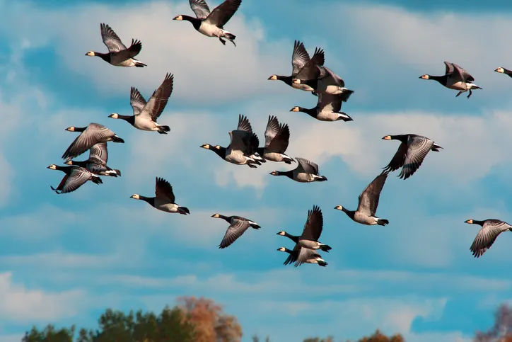
In winter, Canada and barnacle geese compete for space on the quiet llyn and, during the summer months, ospreys nest far below in the Glaslyn Valley. Beyond is the magnificent estuarine vista of Tremadog Bay. Skirt the lake on either side, then follow the brown stream downhill, passing a sheep enclosure, to reach a small cwm (valley).
From here, you can see your route up the Cnicht ridge. But first, pause to appreciate the disused slate relics and the plateau where, in a milder climate, prehistoric hut-dwellers once lived.
This path joins an ancient route between Croesor and Nantmor known as the Roman Road. Strings of mules were led over it in WWII by Rawalpindi Muslim muleteers who had been evacuated here from Dunkirk having lost their animals to the Germans. Supplied with fresh mules from the USA, the muleteers undertook three months of mountain warfare training at the Nantmor Camp, over which calls to prayer and the smell of chapattis drifted.
4. Hands-on climbing
Follow the Cnicht finger post on to the ridge path, taking a moment to peer into Cwm Croesor. The quarries here produced slate for roofs, slabs, chimneys, floors and snooker tables. Moelwyn Mawr glowers darkly across the deep valley. From here, the summit of Cnicht looks rather terrifying.
The climb up the rocky path is steady and soon levels out to a small plateau. In cinematic light, the views to the Snowdon Massif are transmogrified. Take the stony path right, hugging the rock face to rejoin the ridge. Just below the summit is a small oasis of grass, graced with a cairn. The final climb from here is a bit of a scramble with a steep drop into Cwm Croesor. You will need to use your hands occasionally and be sure of your feet to reach the top.
5. Up on the roof
The views from the summit are epic; Yr Wyddfa (Snowdon) and the Glyderau to the north, the coast west, and Cwm Croesor and Moelwyn Mawr to the south. While among the surrounding Moelwynion, steely blue llynau gleam among a vast hinterland of rolling moor.
Continue across the dolerite ridge overlooking Llyn y Biswail to your left, and descend over purple moor grass to the sheltered north-east bank of Llyn yr Adar.
6. Mirror views
From here onwards the path is hard to find. Head north-east to negotiate the steep descent over the cliffs, glancing up at the secret and steely, cliff-sheltered Llyn Llagi, brooding dark like an antique mirror.
7. Tree and stone
The path is vague, but passes Burnt Mound, possibly the cooking site of prehistoric shepherds. Keep the stream in sight as you leave the uplands for the ffridd, walking among boulders and hawthorns and Llwynyrhwch’s gentle groves of oaks. If your car is at Gelli-Iago, turn left. Otherwise, return to Nantgwynant.
Wait for your bus on the lush banks of Llyn Gwynant or rest at Caffi Gwynant, a renovated Calvinistic Methodist chapel. Once the hallowed haunt of quarrymen, it’s now the lair of hungry locals and mountain conquerors alike.
Cnicht map