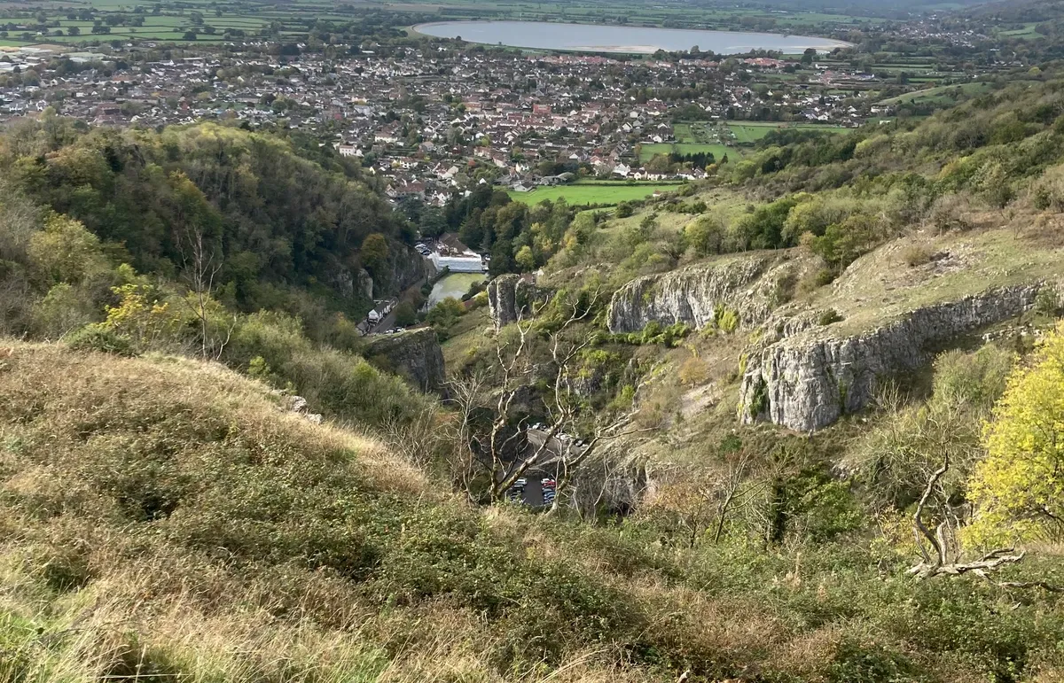
Meandering for three miles and with spectacularly precipitous cliffs plunging more than 120m (400ft), Cheddar Gorge is the largest in Britain. This stunning natural landmark was shaped during the last ice age, as glacial meltwater formed a river that, over time, carved out the deep chasm we see today.
Designated an SSSI and part of the Mendip Hills AONB, the gorge and its surrounding grasslands are a haven for wildlife. Feral goats and Soay sheep graze the shrubland, while peregrines, kestrels and ravens command the skies. A diversity of plantlife, including the rare Cheddar pink, endemic to the Mendips, supports an array of bees and butterflies.
You can experience the drama of the gorge via a two-hour circular walk that takes you up and along the north side and then the south, with a mid-way stop in Cheddar town. The trail is steep, uneven and slippery in places, but is an incredibly satisfying stomp that rewards with utterly breathtaking views.
Discover more walks in Somerset
Cheddar Gorge walk
3.5 miles/5.6km | 330m accent | 2 hours | moderate
1. Setting off
You’ll start by climbing the north side of the gorge. Park at Black Rock on the B3135 (essentially two large lay-bys). Go through the gate on the right-hand side of the road into the National Trust reserve and follow the track. After 100m or so, take the path on the left, signposted ‘Gorge Walk Cheddar 2.7km’.

2. Up through trees
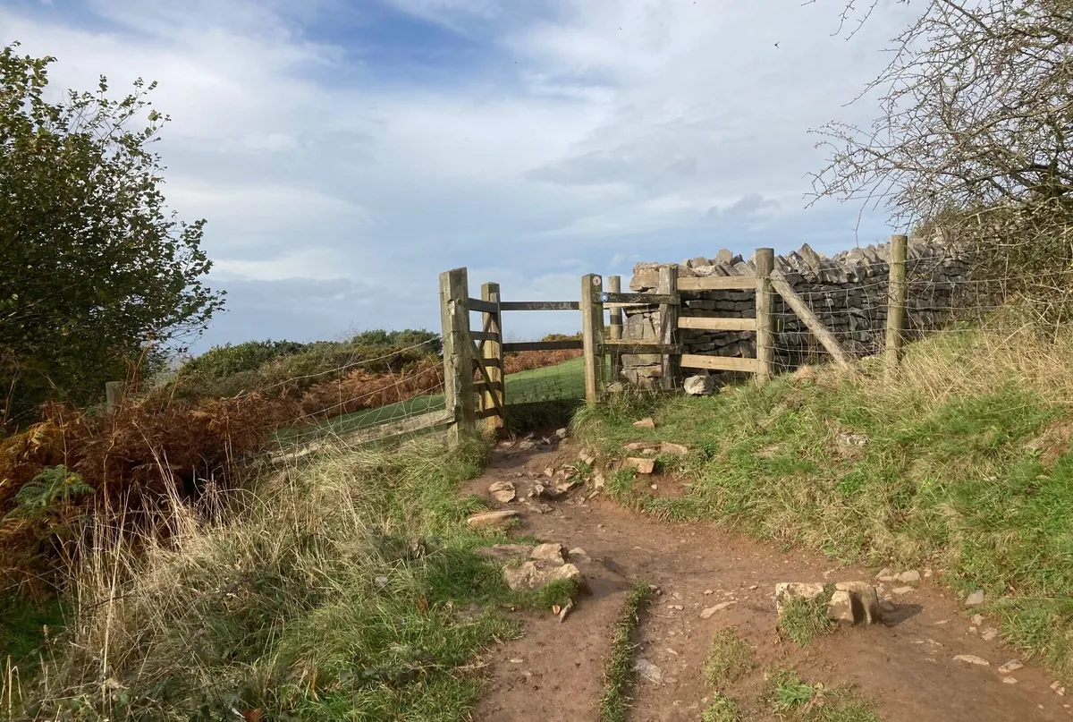
Follow the steep ascent through the area of mixed woodland and bracken for 10-15 minutes. When the hillside opens up on your right, bear left through the trees. Head down a short slope and through the kissing gate in the stone wall, signposted ‘Gorge Walk Cheddar 2.4km’. Turn right.

3. Flight of steps
Ahead of you is a steep flight of steps through a swathe of bracken. Climb these to bring you to the clifftop and you’ll be rewarded with your first views of the gorge, and of Cheddar and the landscape beyond. Follow the path through a kissing gate and continue on, enjoying the views of Cheddar Reservoir and Brent Knoll.
4. Gentle descent
The path gradually starts to descend, bringing you to a large grassy area to your right. If you’ve got a picnic with you, this makes a nice place to stop. It takes about 40-45 minutes to get to this point. Head diagonally across the grass, which is bordered at the bottom by a stone wall. With the former permissive path down to Lion’s Rock now permanently closed, follow the waymarker that leads to a gap in the stone wall, and take a sharp left through the metal gate.

5. Down through trees
Make the steep descent down through the woodland. In autumn, look out for interesting fungi sprouting from the trees. Pass through another metal gate and a final kissing gate. You are now in Cheddar.

6. Into Cheddar
Follow the path through the houses, keeping the view of the reservoir ahead, and you’ll join a track. Follow this for 100m or so to where it meets Tuttors Hill, and turn left. Turn left again onto Birch Hill, and after 100m, pick up the footpath that drops you down onto Daghole, then onto the High Street. You are now half-way around.
Take the chance to refuel in one of Cheddar’s many cafes, pubs, sweet shops or ice cream parlours. If you want to make a day of it, Gough’s Cave, with its excellent audio tour, is worth a visit (entry is included on a ‘Day Explorer’ ticket to various attractions in Cheddar).

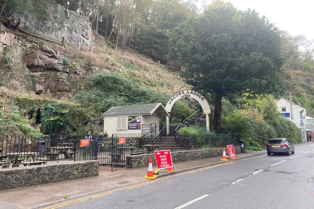
7. To the lookout
To summit the south side, either ascend the 274 steps of Jacob’s Ladder, off the High Street (entry is included on the Day Explorer ticket) or turn left off the High Street onto The Lippiatt and again onto Lynch Lane, picking up the footpath. Both routes lead up to the 48-step Lookout Tower on the clifftop, which opened in 1908.
8. Tower-top views
You can climb the 48 steps of the Lookout Tower if you wish. After enjoying the views, pass through the tall kissing gate ahead to pick up the cliff path. After a few minutes, pause for views and photos at Pulpit’s Rock. Continue along the trail, enjoying the spectacular views of the gorge to your left and of the landscape to your right. This stretch of the walk encompasses the highest point of the gorge, known as The Pinnacles.
After 25-30 minutes, you’ll see a stile on your right, leading into a fenced-off field and signposted ‘West Mendip Way’. Don’t cross this; keep the fence to your right and stay on the path. Take care here - you are not far from the edge. Look out for a peculiar windswept tree, close to the path on your left-hand side. The path soon starts to descend.
9. Back to Black Rock
Continue along the path as it descends, weaving down through pretty swathes of bracken, which are a lovely rainbow of colours in autumn, and through a kissing gate. Pass through another kissing gate, signposted Shipham, and make the final, ten-minute descent back down to Black Rock.

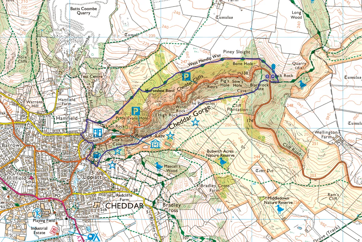
Cheddar Gorge map
Cheddar Gorge walking route and map