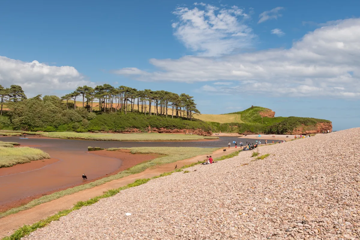
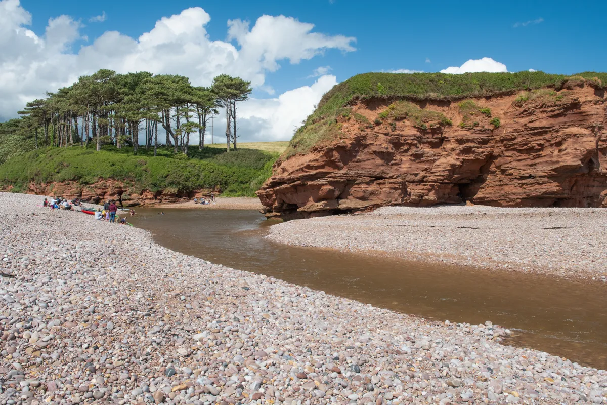
River views, sea views, even beaver views if you arrive at dusk, this walk has them all, but the hero view comes at just 62 metres above sea level as you top Brandy Head on the Jurassic Coast to gaze across Lyme Bay over the shingle beach of Budleigh Salterton and its fabulous red cliffs.
Wander past breeding birds on the saltmarsh of the Otter Estuary, enjoy Devon lanes and rolling patchwork fields, then emerge onto the South West Coast Path for views towards Portland and Torbay.
There have been mills along the River Otter since the time of the Domesday Book but the history of this fascinating area doesn’t stop there. Budleigh Salterton is so named because of its salt panners. Smuggling was also a way of life here for centuries and up on the cliffs it’s easy to see why. It’s also easy to see why Brandy Head was chosen as the location for a military observation post.
Today you can enjoy the views and history from its sheltered benches or even stay the night if you choose.
Budleigh Salterton walk
1. River Otter
Leave the car park to follow the South West Coast Path inland along the course of the River Otter. The information boards will help you identify the abundant birdlife.
2. Clamour Bridge
Carry on up the river for about 2 miles to cross at the Clamour Bridge footbridge. Not named for its modern metallic sound, this bridge would have originally been a Devon ‘clammer’ or stone slab.
Climb to the lane to spot two stone pillars, then turn right to walk away from them.
Devon walks
Devon comprises two national parks – Dartmoor and Exmoor – along with a host of other beautiful landscapes. Explore this glorious county on foot with our pick of the best walks in Devon.
3. Colliver Cross
Follow the bridle way signs carefully to enter the green lane that will take you to Colliver Cross.
At the top of the lane turn right then left down the unmetalled road.
4. Jurassic Coast
After about 300 metres you’ll see a permissive path link to the coast path on the right. Take this and continue round past the water works. You’ll start to spot the red cliffs of the Jurassic Coast to your left as you continue.
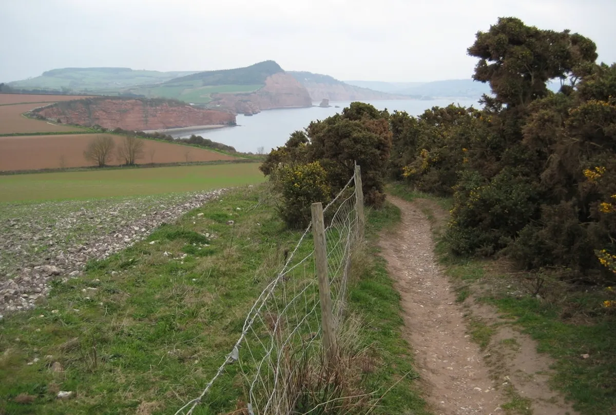
5. Brandy Head
When you reach the coast path, turn right towards Budleigh Salterton. Looking ahead you’ll see Brandy Head Observation Post. This is one of the few steep climbs on this walk but the benches, information and vistas when you get there are worth it. On a clear day you can see all the way round the eastern coast of Lyme Bay to the wedge-shaped mass of the Portland peninsula.
As you reach the high point just before Brandy Head, the views towards Budleigh Salterton and beyond to the western reaches of Lyme Bay reveal themselves and are worth lingering for. You can tell from the disappearing fence line here, how quickly this part of the coast is receding.
6. Danger Point
You’ll get plenty more time to admire the view as you head down towards Danger Point and Otterton Ledge. There is no safe access across the River Otter to Budleigh Salterton here, so you’ll need to follow the coast path up the river.

7. South Farm Court
After some fields and a boardwalk, cross the Otter at the bridge by South Farm Court. Then turn left to head back the way you came along the river path to the car park.
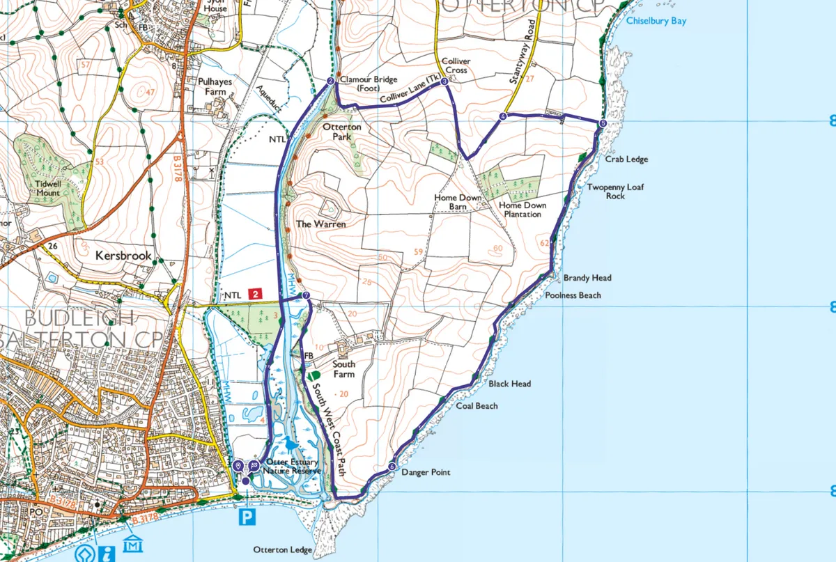
Budleigh Salterton map
Budleigh Salterton - OS Maps walking route
Useful information
Starting point
This walk starts at Lime Kiln car park in Budleigh Salterton (charges apply), which also gives you access to Budleigh’s lovely shingle beach as well as a play park and skate park. 1 Granary Ln, Budleigh Salterton EX9 6JD.
Buses with train connections are available from Exeter Bus Station. There are public toilets just along the seafront.
Terrain
At present this walk is not wheelchair or pushchair friendly but as paths reopen, there will be good access around the Otter estuary area. Mostly on unpaved footpaths and lanes, with one short, steep section of coast path, this walk offers great views for relatively little climb but includes sections of unfenced cliff.
Eat and drink
Pynes farm shop at South Farm sells local food and is just off this walking route.
Alternatively, you could extend your walk up the Otter Estuary to Otterton Mill where you’ll find a café and a working mill. Please note, the Otterton Mill car park is not available for walkers. For beachside refreshments, you’ll find Fifty Degrees North a short walk along the beach.
Stay
Basic dog-friendly camping with sea views is available at South Farm Camping but for an unusual walking experience (there’s no vehicle access) why not stay a few nights on the South West Coast Path at Brandy Head Observation Post.
Lower Otter Restoration Project
The Lower Otter Restoration Project is nearing completion in 2023. Aiming to protect local facilities and popular walking routes at the same time as increasing biodiversity, this fascinating project is working to adapt and enhance the downstream part of the River Otter. Work is proceeding well but some footpath diversions may be in place.
With sensitive wildlife, livestock and open cliff tops, you’ll need to keep your dog on a lead for most of this walk.