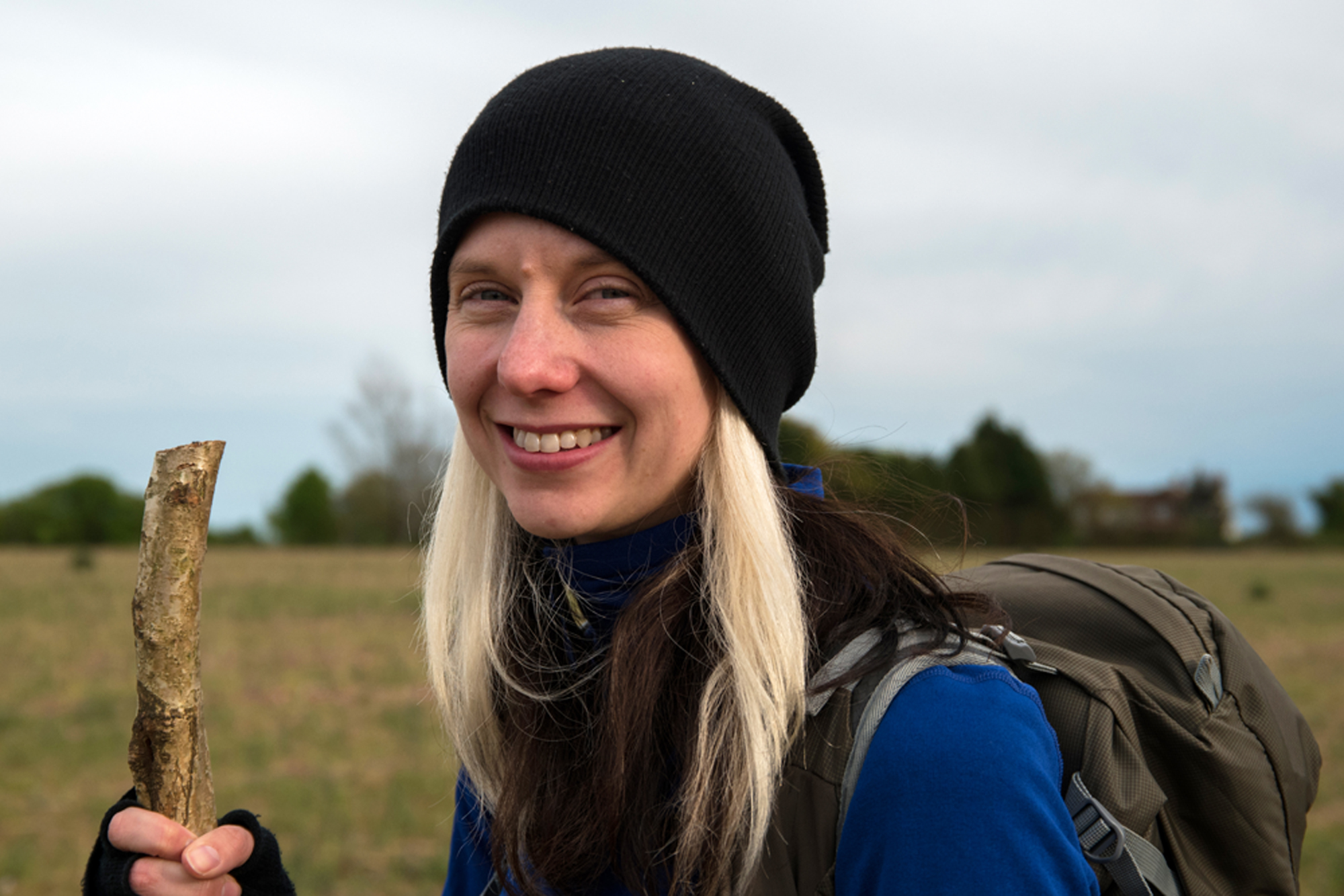
Cleaved in the side of the volcanic rock that makes up the Lake District fell of Dove Crag, near Patterdale, is a naturally formed cavern known as Priest's Hole.
For geologists it may be classed as a ‘fault’, caused by ancient earth movements, but to generations of climbers, wild campers and intrepid walkers, it offers one of the best shelters in Cumbria. It’s known as Priest’s Hole Cave, though history suggests it could perhaps have once been a hermit cell.
Nowadays its fame in the outdoor world precedes it – it even has its own visitors book – and you’ll be lucky to get it to yourself. But it doesn’t matter, the main draw is its views, a 180-degree panorama of the northern Lake District.
Looking for more walks nearby? Check out our walking guides to Tarn Hows, Scafell Pike and Helvellyn.
Lake District walks
Of all the national parks in Britain, the Lake District in North England is arguably the most celebrated – discover the area's fells, rivers, waters and towns with our guide to the best walks in the Lake District National Park.

Priest’s Hole Cave walk
5.4 miles / 8.7km | 4 hours | challenging | 550m ascent (return)
1. Start
Leave the car park using the gate in the south-west corner, passing underneath the trees and alongside the shoreline of Brothers Water. Continue on the easy path to Hartsop Hall – a working farm whose main building boasts Priest’s Holes of its own.

2. Gill Crag
As you walk past the buildings the path in front of you forks. Take the fainter of the two, which climbs uphill on the right. There are several stiles and gates to pass through and the path gets rough and often muddy. Keep going, passing through the trees, until you reach open fellside.
3. Dovedale Beck
Here the route runs parallel to Dovedale Beck. Don’t be tempted to cross over to the south side of the water, instead keep headed uphill with the river to your left.
Things become increasingly rocky and you will notice a few ruins of old buildings. In clear weather, if you look left towards the crags near the mountain top, you can spy the cave already. It appears as a dark, tear-shaped shadow, running diagonally across Dove Crag’s flanks.
The ground becomes steeper for a while before flattening out and becoming grassy. You should see a large boulder; head to it.
Easy UK mountains and peaks for beginners
Sometimes, the prospect of climbing to the top of a mountain can be a little intimidating, but it doesn't have to be. Discover some of Britain’s best mountains and peaks in our guide to the top easy climbs for beginner hikers.
4. Dove Crag
Facing uphill at the boulder, look left to make out a faint sheep trail, which curves around the rocks uphill, almost following the faultline. Follow this towards the rocks and make your way up to the cave. You will need to use your hands a couple of times to steady yourself, but in about five mins you will reach the entrance.

5. Priest’s Hole
The first thing you’ll notice is the manmade wall that has been erected over the years by those bivvying inside to help keep the wind and rain out.
At the back there’s a natural ‘shelf’ that people often leave camping cups or gas on for others. I always like to have a quick clean up of any rubbish when visiting. It’s an incredible place to sit and eat lunch, spend the night, or simply feel as though you are, for a few minutes, part of a great Lakeland fell.
When you’ve taken enough photos and absorbed the scene, simply retrace your steps back to the start.

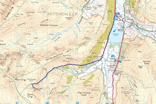
Priest’s Hole Cave map
Priest’s Hole Cave walking route and map
Useful information
Starting point
Cowbridge Car Park (CA11 0NZ) next to Brothers Water is free, with a suggested £3 donation for the day. In summer (Easter to Oct) bus 508, which runs between Penrith and Windermere train stations, stops at Cowbridge and the Brotherswater Inn. In winter you can only get as far as Patterdale on the same service (5km away).
Terrain
The path is a mix of farm tracks, rocky, muddy trails, and boulders, becoming steeper as you climb higher towards Dove Crag. The way to the cave is faint and you will need to use your hands to access it for just a couple of moves.
Map
OS Explorer OL5
Cave access
Priest’s Hole is a naturally formed cavity on the side of a fell, which has been utilised by climbers for shelter for years. Check out the visitor book inside and be sure to record your visit.
Eat/drink
Nearest place is Brotherswater Inn which offers takeaway breakfast baps from the campsite shop, lunches on the weekend and evening meals from 5.30pm everyday. Local produce and beers are sourced wherever possible.