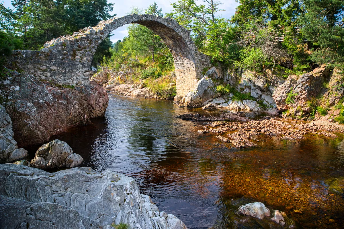
Causey Arch was built between 1725 and 1726 and claims to be the oldest surviving single-arched railway bridge.
It carried a waggonway connecting Tanfield Colliery with the River Tyne, although its use was short lived and it closed in 1786.
Alongside, on operating days, the steam locomotives of the Tanfield Railway can be heard working hard through the woodland.

Discover this wealth of industrial heritage on a 4.6-mile walk.
Looking for more walking inspiration? Check out our guides to the best autumn walks, riverside walks and hill walks.
Guide to rural bridges in Britain
Rural bridges can be found all across the countryside in the UK. There are many different types of bridges, ranging from hump-backed bascules and suspension bridges to ancient clappers. Our guide explores some of Britain’s most interesting traditional bridge designs, and points you in the direction of the best ones to visit.
Causey Arch walk
4.6 miles / 7.4 km | 3 hours | moderate | 201m ascent
1. Causey Woods
Follow the signposted route from the car park into Causey Woods down into the gorge. Turn right to cross a footbridge. Turn left to follow Causey Burn and cross at the second footbridge. The path follows the burn through woodland to approach Causey Arch. Cross another footbridge to climb up to Causey Arch. Cross the arch to view one of the replica 18th-century waggons.
Return back over Causey Arch and then turn left to follow a path at a high level above Causey Burn and the gorge. This path eventually descends to the burn.

2. Oxpasture Hill
Cross another footbridge to double back left. Rise with the path to meet and then cross (with care) the railway line at a footpath crossing.
Continue on a path across Oxpasture Hill and cross the A6076. Head immediately down steps to run outside the boundary of Causey Hall Farm. Continue down what can be a muddy path to cross Causey Burn and then climb up again to a stile onto Beamishburn Road.

3. Beamish Burn
Turn right to follow the lane downhill to the road junction at Planetree. Cross Beamish Burn and climb up the road.
4. Hellhole Wood
Turn left through an archway in a wall into Carrickshill Wood for a delightful woodland walk. Follow the clear path through to Hellhole Wood.
Turn left and head over the golf course to arrive at Home Farm, part of the Beamish Museum estate.
5. Beamish Hall hotel
From the farm climb a stone step stile in the wall to emerge by the pig pens. Join the lane and turn left to follow this between the museum grounds and the golf course to the entrance to Beamish Hall hotel.
Most magical forests to visit in the UK
Discover a woodland near you with our guide to the most spectacular forests to visit in England, Wales, Scotland and Northern Ireland.
6. Copy Wood
From the hotel entrance, turn right along a rough track to pass the cottages at Coppy. The track deteriorates as you head through Coppy Wood to climb Ridley Hill.
There are good views over rolling County Durham scenery. Continue on Coppy Lane, a rough and occasionally muddy track. Branch left towards the entrance to Park Head farm and continue on a thin path to emerge by the old schoolhouse and on to a lane at Causey.
Turn briefly left along the lane and at a fingerpost turn right over a stile. You will see the Tanfield Railway line ahead and if you can’t see them, you will certainly hear the steam trains.
Head down the left-hand side of a field to another stile and then drop down to the A6076. Cross straight over (with care) and under a very low bridge under the railway to reach the car park.
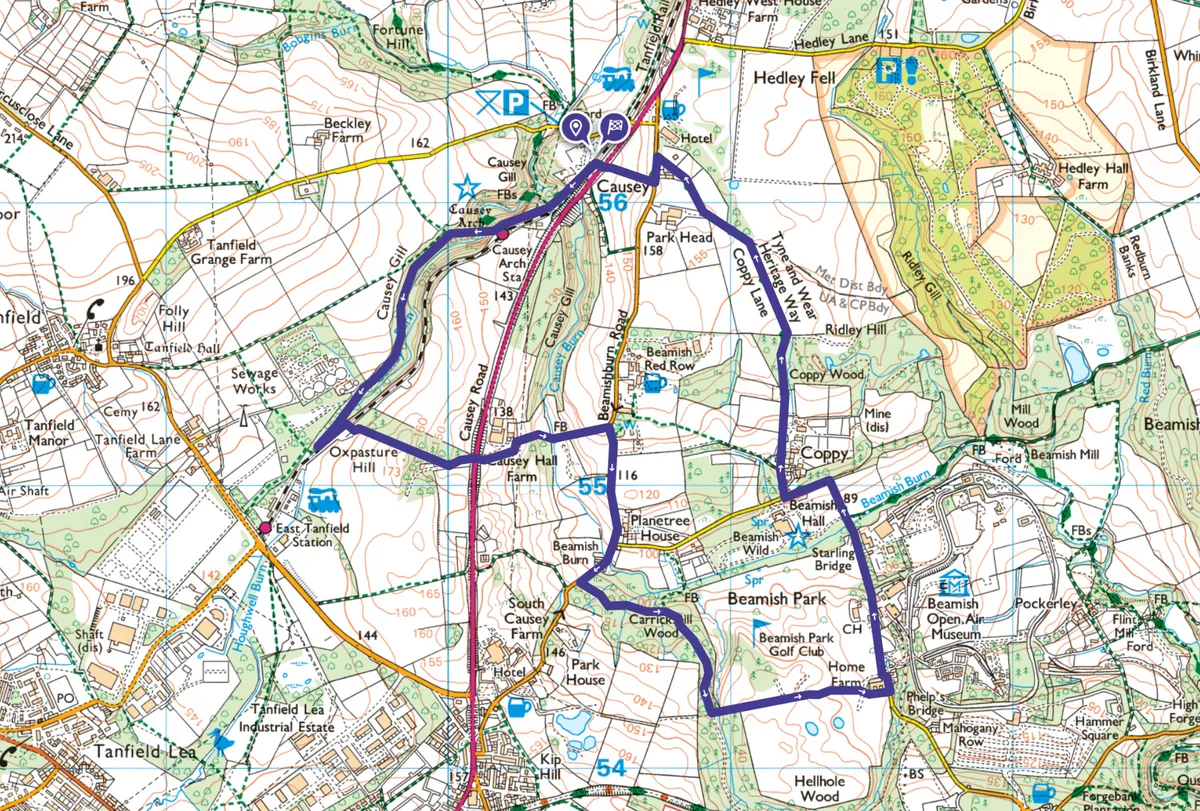
Causey Arch map
Causey Arch walking route and map
Useful information
Starting point
Start the walk at the free Causey Arch car park (NE16 5EJ), served by Go North East X30 and X31 buses (not Sundays) from Newcastle.
Terrain
The terrain is a mix of well surfaced riverside path and then woodland paths which can be muddy in parts after heavy rain. It would not be suitable for wheelchairs or pushchairs.
Map
OS Explorer 308
Eat
The Causey House tearoom (Thursday to Sunday, cash only) and South Causey Inn offer great places to eat.
The adjacent Tanfield Railway and nearby Living Museum of the North at Beamish make for great add-on options before or after your walk.