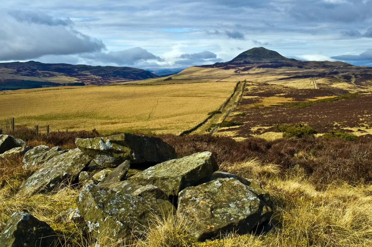
West Lomond is Fife’s highest point. At just 522m, it’s a tiddler by Scottish standards, but with nothing else of similar stature for miles around, standing on this volcanic plug feels like standing atop a much mightier mountain.
To the south-east, the distinctive Bass Rock sits out in the Firth of Forth; to the west are the Ochil Hills; further north, wistful outlines of Highland peaks are visible.
Add in fascinating geological features, some history and a touch of folklore, and you’ve got all the ingredients for a great walk.
Looking for more walks in Scotland? Check out our guides to the best walks in the Cairngorms and the best walks in Loch Lomond and the Trossachs.
West Lomond walk
5.7 miles/9.2km | 4 hours | challenging | 432m ascent
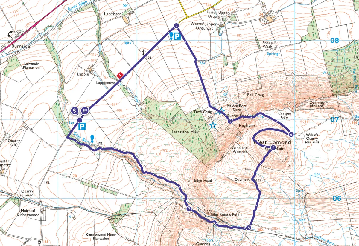
1. Bunnet Stane parking
Walk north-east along the road for 1 mile, as far as the Bunnet Stane parking.
2. Bunnet Stane
Take the grassy track immediately after the layby and then make for the sandstone formations in the field ahead.
The Bunnet Stane is suspended above the main outcrop on a slender pedestal in mushroom-like fashion. Beneath it is a man-made cave, once a shepherds’ bothy, although local legend tells a more fanciful story involving star-crossed teenage lovers, an angry father and a murder. Whichever is true, our route continues to the field’s south-east corner, then follows the field boundary uphill.
3. Hoglayers
At the fence corner, a rough path heads left. An old, surprisingly broad path soon finds a weak spot in West Lomond’s defences beneath the crags of Hoglayers, climbing across a grassy bowl in the otherwise steep scarp. Keep to the clearest path.
4. West Lomond summit
On reaching a clearer path, turn right. Keep left as this curves around the western side of the hill to reach the trig pillar and prehistoric burial cairn on the summit. As well as the distant views, you’re now looking across the moorland to West Lomond’s imaginatively named twin, East Lomond.
5. West Lomond descent
Take the trail dropping south-west. After a stile, continue in the same direction for 350 yards – across one area of bare ground. At a second area devoid of vegetation, head roughly south to join a path through the heather.
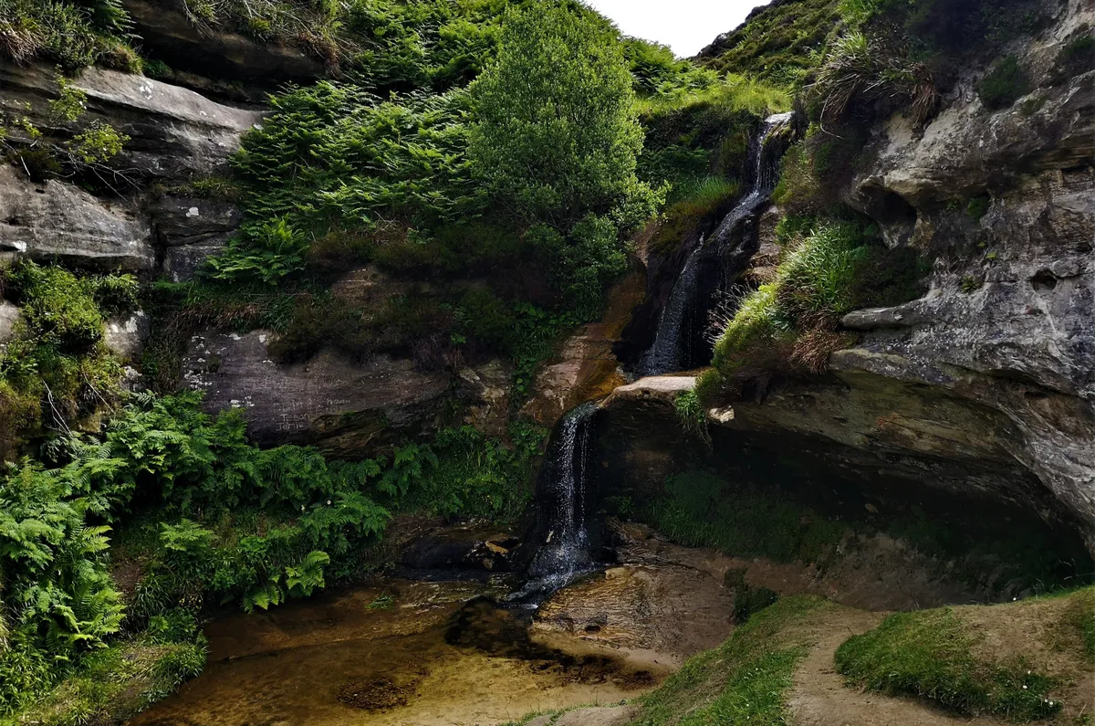
6. Glen Vale
Turn right at the Glen Vale path. On the burn’s far side, the elements have created a cave and carved the sandstone into a natural amphitheatre, known as John Knox’s Pulpit.
It’s not known whether the Protestant reformer himself preached here, but 17th-century covenanters definitely used the site for clandestine religious services.
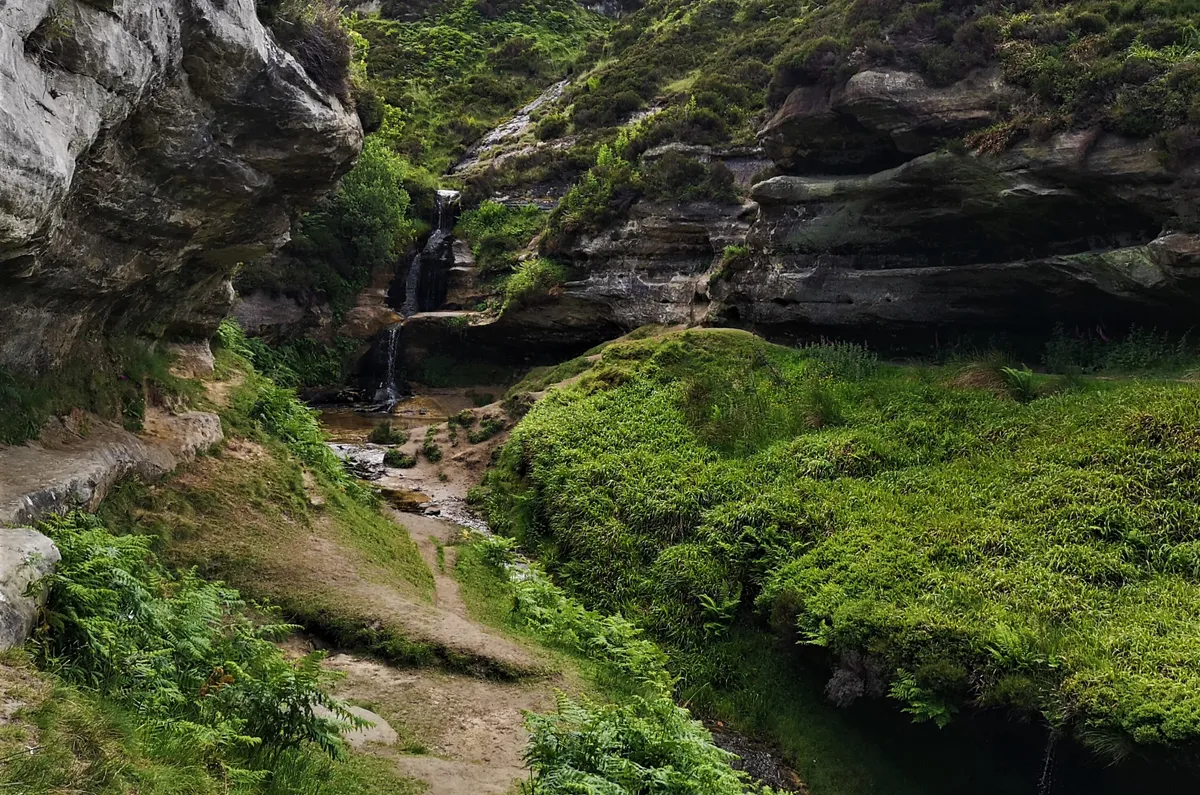
7. Glen Burn
After ½ mile, bear right to cross Glen Burn. Continue downstream, later passing through woodland sporting the youthful green of early summer.
Turning right at the road, the car park is on right in 280 yards.
West Lomond map
West Lomond - OS Maps walking route
Useful information
Starting point
Glen Vale car park, Dryside Road, Fife KY14 7RP (grid ref NO172069), 3½ miles south-west of Strathmiglo. No public transport.
Terrain
Mostly good paths on open hill, but briefly pathless. Some stiles. Short road section.
Map
OS Explorer 370
Eat and drink
Campbell’s Coffee House and Eatery in Falkland, about 7 miles from walk’s start point (01337 858738).
Stay
Historic Falkland has a range of hotels and B&Bs.