Loch Lomond and the Trossachs National Park lies just 30 minutes from Scotland's most populated city, Glasgow. Yet in parts of the national park it often feels like you're the most isolated person in the country.
Loch Lomond and the Trossachs is known for its great walks, fascinating history, placid lakes and rugged mountains. Discover this spectacular landscape with our pick of the best walks in the national park.
Find out more about Britain's national parks
What is a national park, how many national parks are there in the UK, and where is the nearest one to you? Our guide to the UK's 15 spectacular national parks looks at the history of each, how to visit them, the best walking routes, and local wildlife to spot.

Loch Lomond and the Trossachs walks
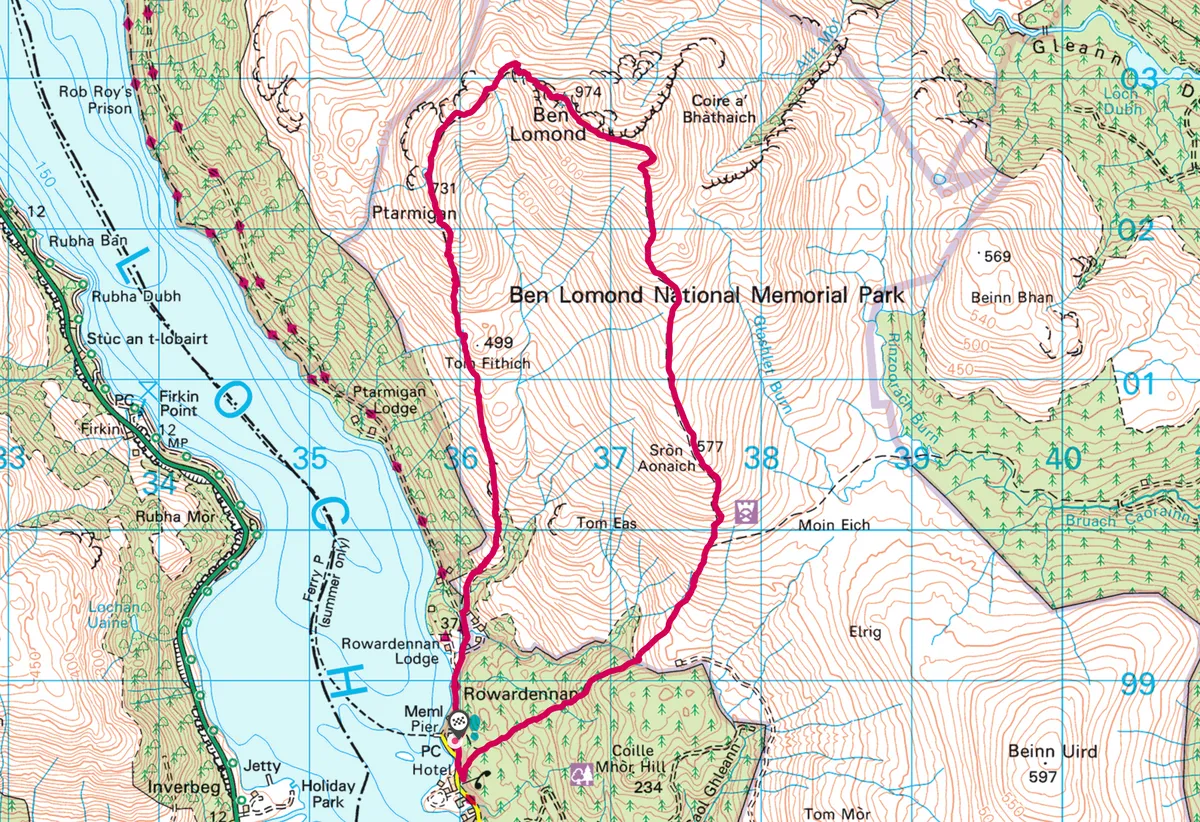
Ben Lomond, Argll and Bute
7.6 miles | 5 hours | challenging

Ben Lomond is the most climbed of the Scottish Munros, with a direct ascent of 974m to its summit. Climb north up the tourist path from Rowardennan, then either retrace your ascent route or take the rougher return along Ptarmigan Ridge to the west.
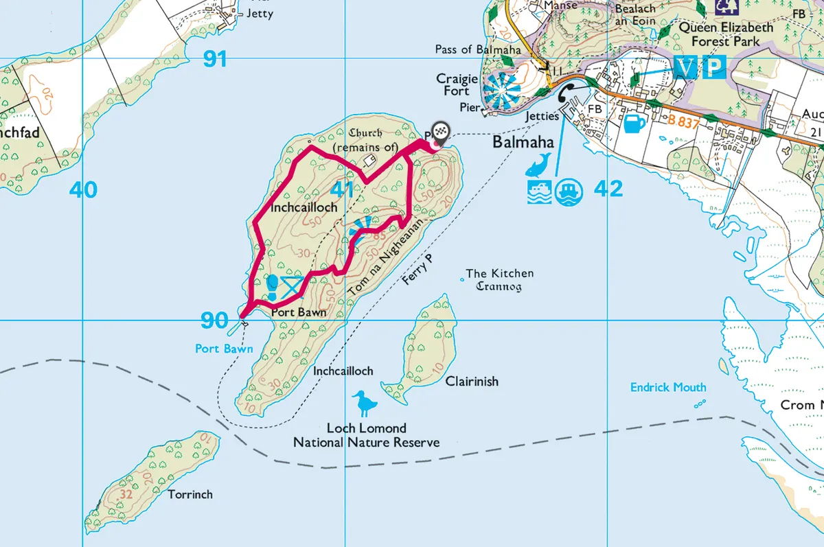
Inchcailloch, Loch Lomond, Stirlingshire

Soft white sands, a delectable swim and a mini mountain await on the enchanted island of Inchcailloch, part of the Loch Lomond National Nature Reserve.
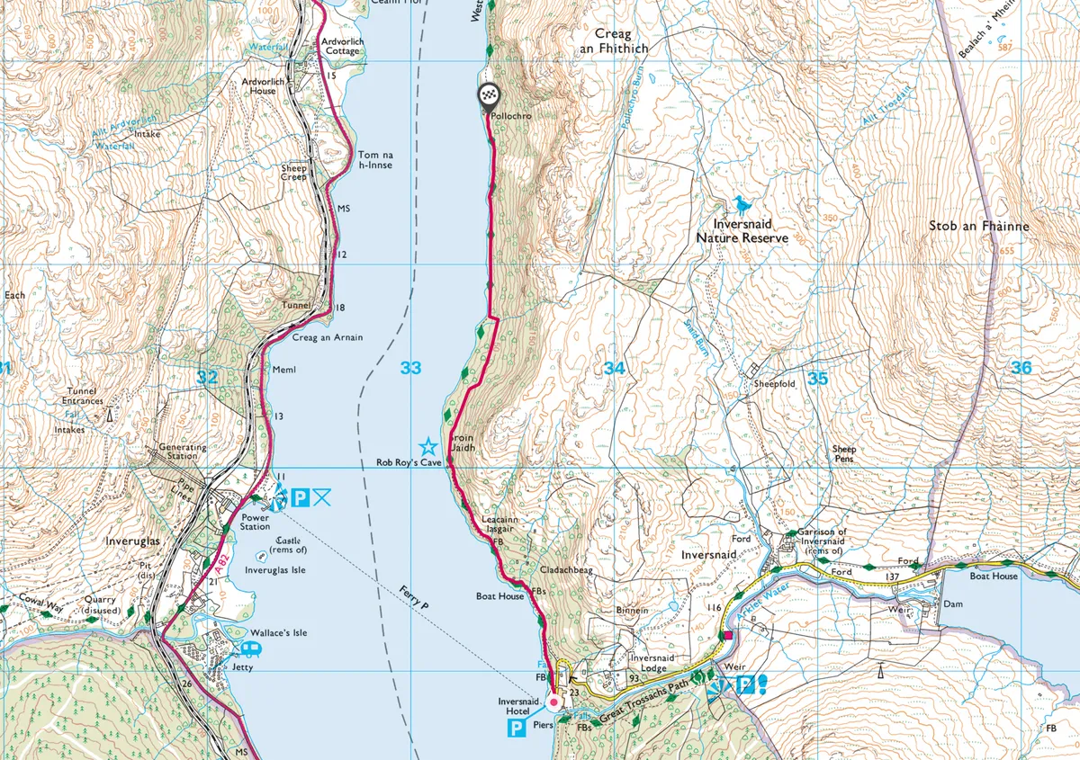
Inversnaid, Loch Lomond

What better place to explore the Loch Lomond and the Trossachs National Park than the magical loch itself? Inversnaid overlooks Loch Lomond’s upper eastern side. For wildlife and wild land enthusiasts, this is a perfect place for a short but energetic walk to recharge your batteries after the long winter.
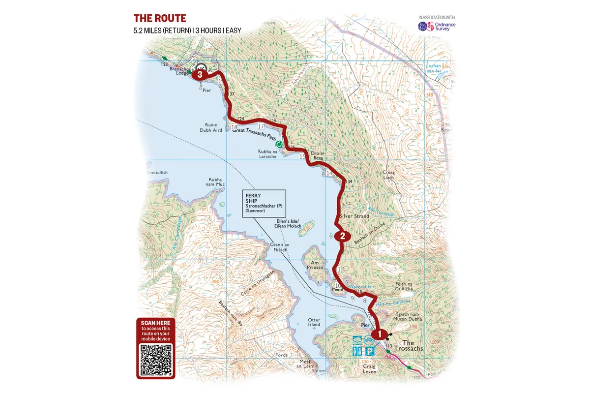
Loch Katrine, Stirlingshire
5.2 miles | 3 hours | easy–moderate

Loch Katrine is a large freshwater loch in the Highland region of Scotland. The eight-mile long waterbody has wooed artists and poets for centuries – the Wordsworths and Coleridge, to name a few. And for good reason: extending through miles of remote Scottish country and overlooked by craggy hills at its southern end, it’s a place of great beauty.
You can experience Loch Katrine in the beautiful Loch Lomond and the Trossachs National Park with a cruise on board the Sir Walter Scott Steamship, but for those with a bit more energy, a tranquil five-mile walk runs along the eastern shoreline. It's the perfect way to spend a morning or afternoon, no matter what the weather
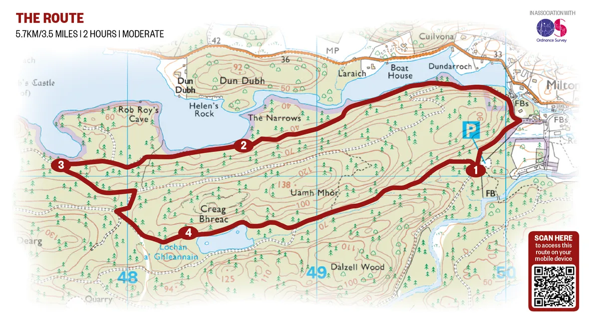
Loch Ard Forest, Stirlingshire
3.5 miles | 2 hours | easy

Prepare to have your senses heightened on this engaging sculpture trail through stands of towering conifers and alongside a mesmeric loch shore.
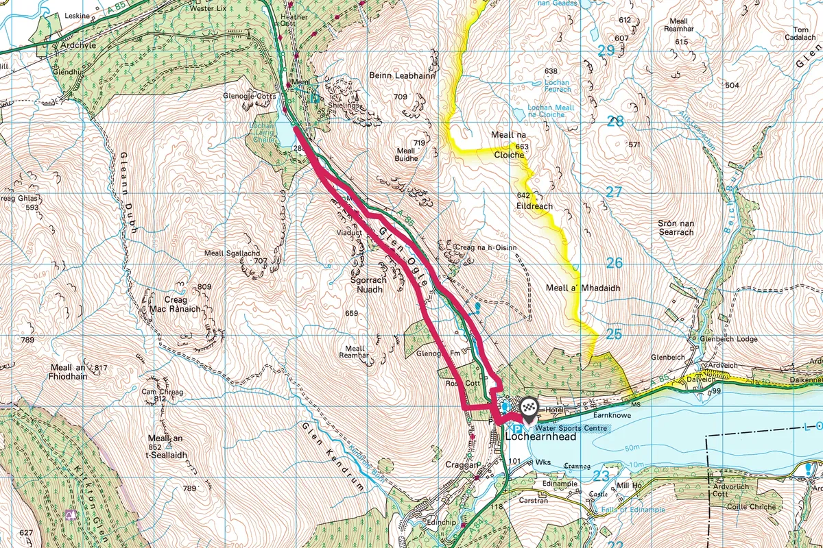
Glen Ogle, Stirlingshire
7.2 miles | 4 hours | moderate

At the north-eastern edge of this 720 square mile national park lies Glen Ogle. For centuries this steep glen has provided a through route for travellers and cattle herders, or drovers. Today it’s as important as ever and it carries an important trunk road. The best way to appreciate the glen though is, as in the days of yore, on foot.
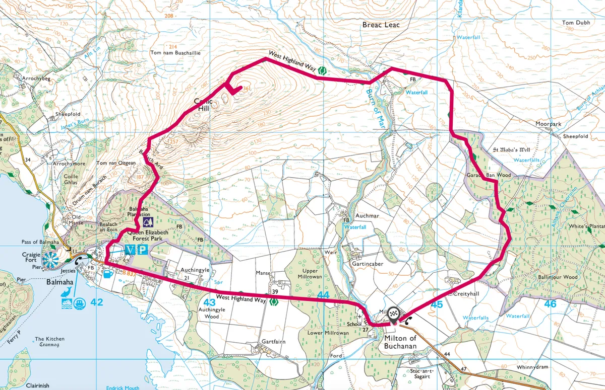
Conic Hill, Stirlingshire
6.4 miles | 4 hours | moderate–challenging

Climb an iconic Scottish hill, pausing for a picnic at the summit with views across beautiful Loch Lomond and the Trossachs National Park.