This walk is not as terrifying or arduous as the name suggests. It is thought that the name ‘Devil’s Staircase’ was coined early in the 18th century.
When the Highlanders rose up against the English in the Jacobite rebellion of 1715, the English troops found the lack of roads in the region a real problem. General Wade was given the task of building new military roads and, following the second Jacobite uprising of 1745, the road system was extended from Glen Coe to Fort William.
Building the road out of Glen Coe must have been desperately hard work, and it was then that the soldiers named it the Devil’s Staircase.
Devil's Staircase walk
5.2 miles/8.5km | 4 hours | challenging (one way)
1. Zig-zag climb
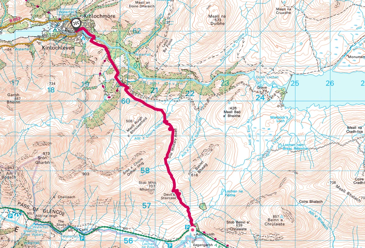
The walk starts at Altnafeadh car park on the A82 at the foot of Buachaille Etive Mòr.
Over the road is a house in a screen of trees; a path leads to the left of this, across a footbridge over a stream and then continues straight on alongside a small, clear burn.
At first the gradient is quite gentle, but as the hillside steepens, the track goes into a series of ever-more extravagant zig-zags. These would have been essential for the vehicles that carried military supplies over this old military road.
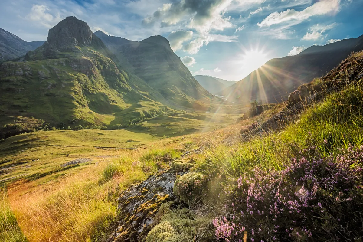
The summit of this section of the track is marked by a small cairn. From here one can look back for a magnificent view of the mountains of Glen Coe, before walking on to the saddle between two peaks.
2. High saddle
Now a whole new vista opens up, of the mountains to the north, with the unmistakable hunched up shoulder of Ben Nevis. Even in autumn, there will be patches of snow lurking in the corries.
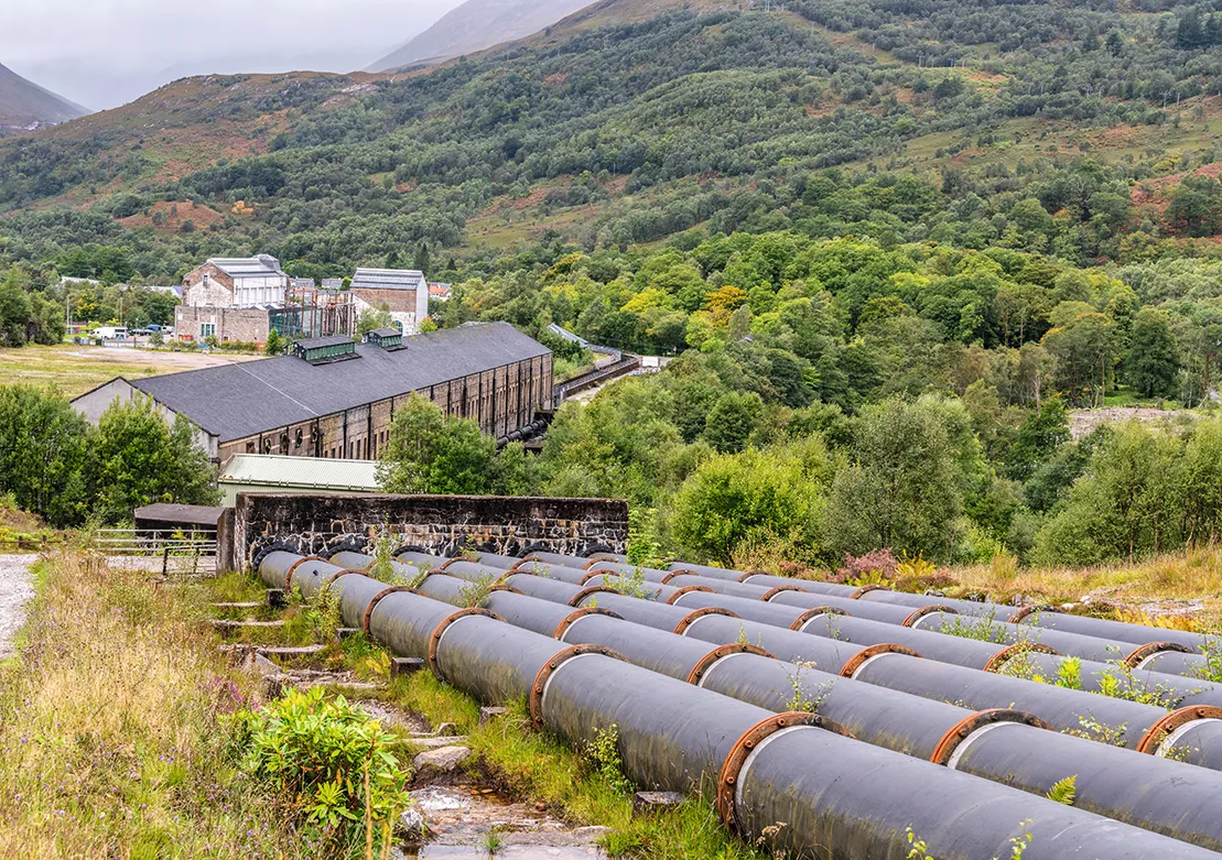
The path then begins a long slow descent to Kinlochleven, passing close to the Blackwater Reservoir, built between 1905 and 1909 for a hydroelectric plant in the valley. The path runs briefly along a rock ledge on the side of the hill to a footbridge over a burn.
The pipes from the reservoir come into view and the route winds through woodland dominated by slender silver birch, alive with birdsong. The way crosses a stone bridge over a rocky gorge and the high wall of the reservoir dam can be seen a little way upstream.
Head directly downhill close to the pipeline to emerge by the former aluminium smelting plant, now an outdoor activity centre and microbrewery. To power generators that provide electricity for the works and the surrounding area, 14 turbines were installed here.
3. Over the river
At the works, turn right to cross the bridge over the River Leven to take the riverside road and path into Kinlochleven, where there are shops, pubs and cafés.
Walkers now have three options to return to the parking area at Altnafeadh: retrace their steps, get picked up, or use a bus and/or a taxi.
Devil's Staircase map
Devil's Staircase walking route and map