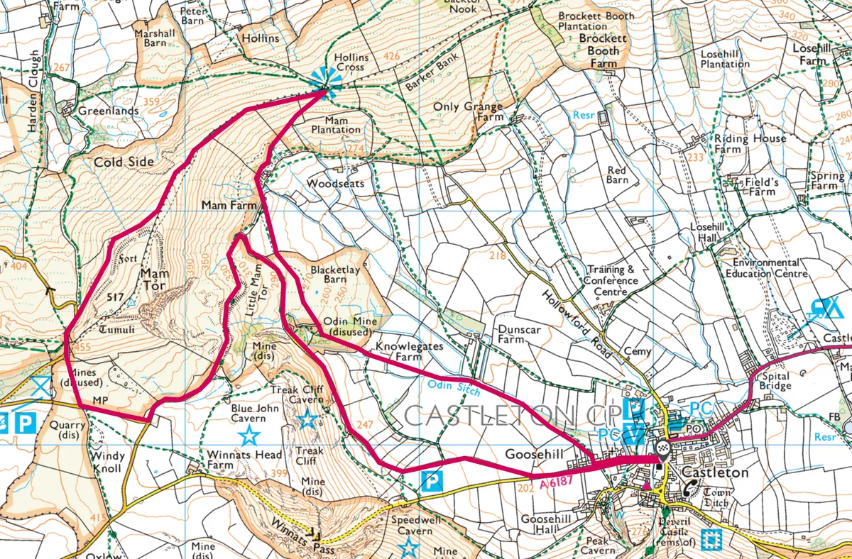
Enjoy a 8.5km walk from Castleton to the summits of Hollins Cross and Mam Tor in the Peak District National Park.
1.Coffin Road
From Castleton – says outdoors writer Helen Moat – I cross pastures alongside the Odin Sitch stream until I meet the ‘Coffin Road’, used by mourners from Edale, who – before their own churchyard was consecrated – made the difficult journey over the ridge to the parish church at Castleton.

2. Hollins Cross
I head up the stony track to Hollins Cross, the lowest point on the Great Ridge. The burial procession would pause at this crossroads to offer prayers; I linger for the views. Eastwards, the Great Ridge dips and rises to Lose Hill, to the north, the Kinder Massif fills the skyline, while drystone walls criss-cross the flat-bottomed valley back towards Castleton.

3. Shivering Mountain
Continuing westward to Mam Tor, I drop down to the abandoned road that once took traffic across the base of the hill. Also known as the ‘Shivering Mountain’, the notorious landslip of Mam Tor was a foolish routeing for the highway. After several attempts to stabilise the road, a new route was forged through the spectacular Winnats Pass in 1979. I marvel at the cracked and broken sections of asphalt, dropping several feet in a couple of places. The road leads back to Castleton, its Blue John jewellers and cafés.

I stop by the recently renovated visitor centre for a much-needed cuppa, taking time to look at the Historical Society’s museum exhibits and interpretation boards.
Map
Click on the map below for an interactive version of the route.