Nature has a wonderful habit of popping up where you least expect it. Concrete is no match for a determined seedling, and birds can find a home in even the most built-up of environments.
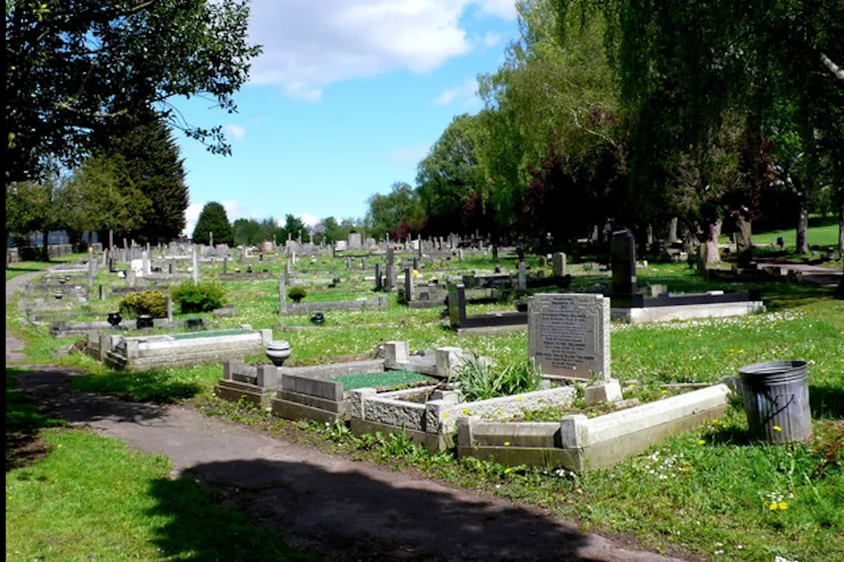
This walk in the city of Bristol is a prime example of nature reclaiming space. It starts among the overgrown gravestones and dove-inhabited chapel of Greenbank Cemetery, before crossing an old railway viaduct that is now a nature reserve. The walk then loops through a patchwork of colourful allotments, under the viaduct and back to the start.
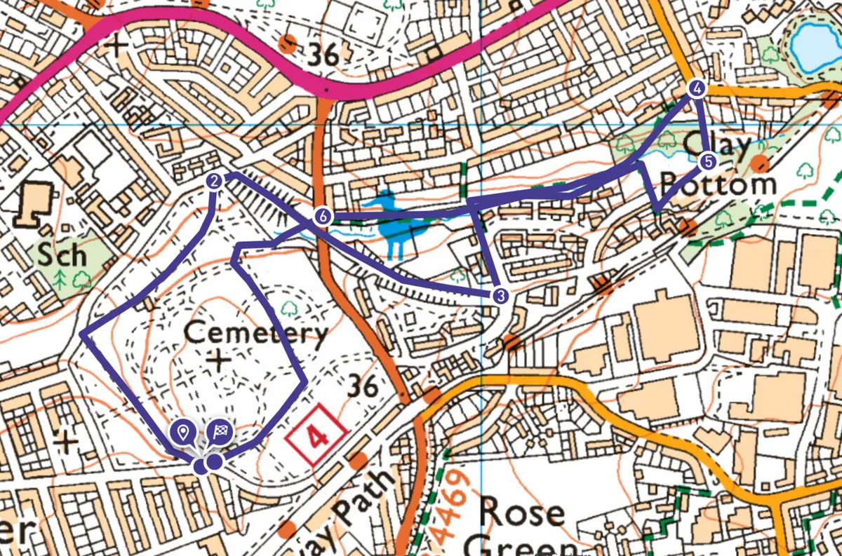
Greenbank Cemetery and Clay Bottom walk
1.7 miles/2.8km | 1 hour | easy
1. Start
The walk begins beside the gates at the southern entrance of Greenbank Cemetery (parking on Greenbank Road). These are the main access gates, and they tend to close in the evenings, so make sure you’re out before it’s dark (if not, there are one or two additional access points that remain open all the time).
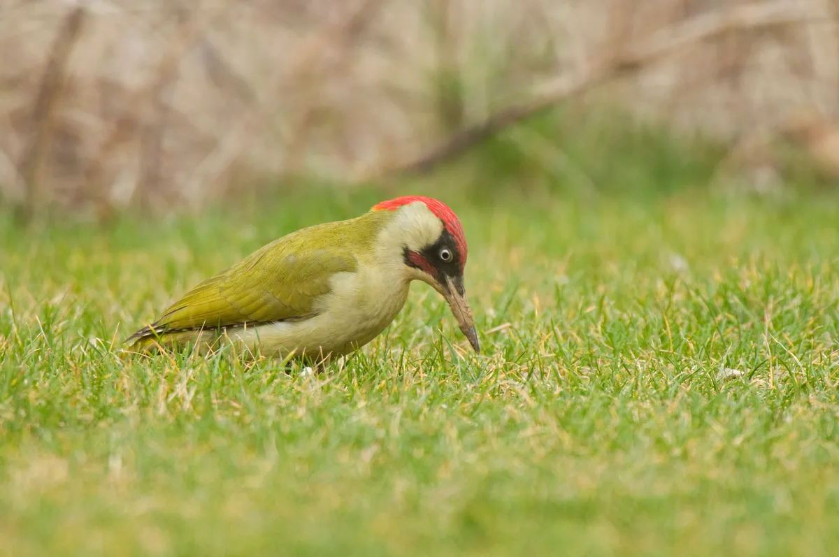
As you pass through the gates, veer left. After a few metres, head right, dropping away from the cemetery walls between gravestones. Continue through an avenue of large evergreen trees, turning right as you meet the north-west boundary of the cemetery. Another avenue of trees – this time deciduous fruit trees – leads to the northern corner of the cemetery. You’ll often see green woodpeckers flying from tree to tree, pausing every now and then on the gravestones. Jays are another charismatic bird that can often be seen.
2. Viaduct reserve
Once in the northern corner of the cemetery, look for a small gap in the boundary trees at the top of the path. Go through the gap and climb the steps into Royate Hill Nature Reserve.
This is certainly one of Bristol’s more unusual nature reserves, situated on top of an old railway viaduct, built in 1870 as part of the Clifton Extension Railway. As you walk along the embankment among mature trees and colourful wildflowers, look for gaps among the foliage where you can gaze out cross the city.
3. Clay Bottom
After about 300m the path leaves the nature reserve and meets a residential street. Turn left and walk down the street. As the road veers right, look for a signposted footpath on the left. This leads down to Combe Brook and Clay Bottom Allotments. Turn right, keeping the allotments on your left and the houses on your right. The path soon heads into woodland, meeting the brook momentarily before climbing broad steps to the corner of Ridgeway Road.
4. Allotment alley
Don’t join the road, but instead turn sharp right, staying on the footpath as it bends downhill between gardens and allotments before merging onto Dubbers Lane.
5. Vegetable valley
Turn right, then after 50m turn right again into Dubbers Lane Allotments. Walk downhill through the vegetable patches to return to the path beside Coombe Brook. Here, turn left, retracing your steps for 300m. Ignore the turning to your left from your outbound route, instead continuing straight on with allotments on either side.
6. Back among the graves
You’ll soon meet a busy road. Take care as you cross straight over, passing between a stone wall into woodland, then beneath the viaduct and Royate Hill Nature Reserve. You’ll spot Coombe Brook to your left before emerging once more into Greenbank Cemetery. Turn left, looking for a tarmac footpath. Now it’s simply a case of picking your own route back through the trees and gravestones to the start.
Greenbank Cemetery and Clay Bottom map
Greenbank Cemetery and Clay Bottom walking route and map