If you’re after the pristine and pretty, then this isn’t the walk for you. Boat yards and warehouses flank the waterside, and near Hoo St Werburgh the cube of the decommissioned Kingsnorth power station looms on the horizon. Nevertheless, with its shipwrecks, forts and secret beach, this part of the Kent coast feels fantastically off the beaten track. London may be a stone’s throw away, yet sometimes the only sound here is the river on the shore.
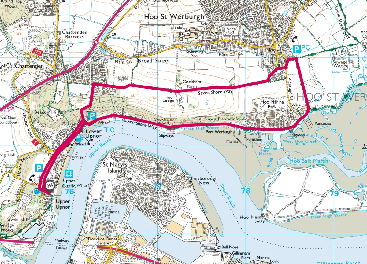
With the pleasant, weather-boarded houses of cobbled Upper Upnor High Street behind you, follow the signs for the Saxon Shore Way as it skirts the brick wall of Upnor Castle (closed in winter). Built on the orders of Elizabeth I to defend Chatham Dockyard, this impressive fortress was also painted by JMW Turner.

Upnor and Medway River walk
5.1 miles/8.3km | 3 hours | moderate
1. Forts and dockyards
Beyond The Ship and The Pier inns stand the London Stones, erected to mark the boundary of the City of London’s jurisdiction over the Medway. Then it’s onto the beach, a narrow shingle strip exposed only at low tide. Towards the end of this section you’ll find the red brick ruins of Cockham Wood Fort, its feet barely above the water. Built in 1669 following a raid on Chatham Dockyard, it originally held 48 guns, but fell into disuse within a century.
2. Saxon Way
Follow the footpath through Hoo Ness Boat Yard, then the signs for the Saxon Shore Way. At the last of the warehouses, where the path rejoins the river, you’ll find an eerie graveyard for Thames barges. Look to your right across the water and there’s another ruin: Hoo Fort, built (along with neighbouring Darnet Fort) in the 1870s in anticipation of a French invasion.

3. Hoo St Werburgh
The path now splits: head inland and you’ll reach the southern edge of Hoo St Werburgh. This village was mentioned in the Domesday Book, with the surrounding land providing gravel and materials for brick and pottery-making in the late 19th and early 20th centuries. Follow the footpath and you’ll pass the 14th century church, named for an Anglo-Saxon miracle-working princess and whose visitors have included the artist William Hogarth, who in 1793 embarked on a walking tour of the area.
4. Back to Upper Upnor
Picking up the Saxon Shore Way once more, pass through open fields above the Medway. A steep descent through woodland then returns you to the London Stones, from where you can retrace your steps to Upper Upnor.
Upnor and Medway River map
Upnor and Medway River walking route and map