From the dales town of Pateley Bridge, sample a highlight of the Nidderdale Way before exploring Guisecliff Wood with its secluded tarn.
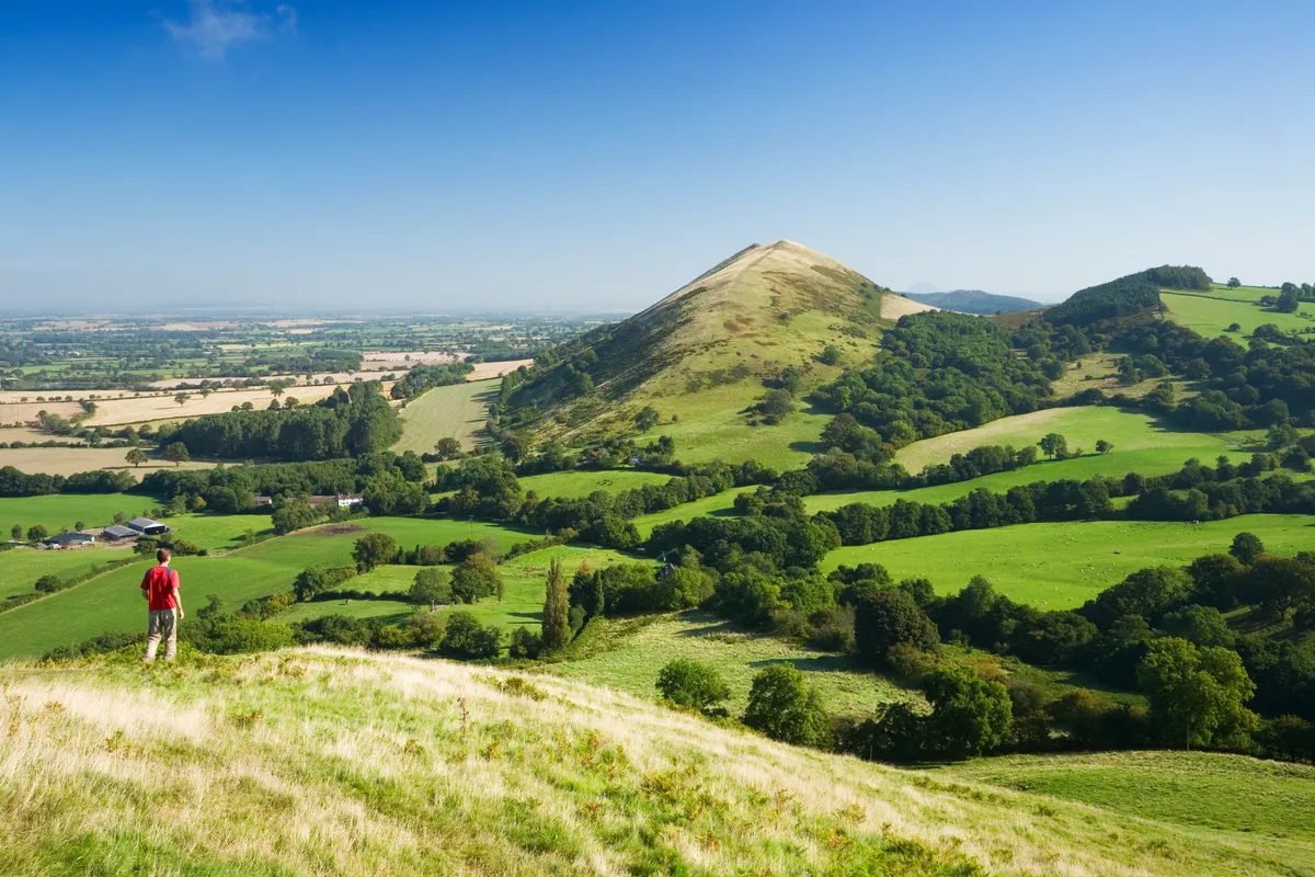
Climb to the gritstone cliff to enjoy stunning views of Upper Nidderdale, an area of outstanding natural beauty. Although outside the Yorkshire Dales National Park boundary, this is every inch a Yorkshire dale.
The return route visits the 18th-century Yorke’s Folly and 15th-century Bewerley Grange chapel.
North Yorkshire walks
Hike over rugged hills in the North York Moors and beside wild tarns in the Yorkshire Dales with our pick of the best walks in North Yorkshire.
Pateley Bridge walk
4.7 miles / 6.9km | 3 hours | moderate | 248m ascent
1. Pateley Bridge
Start from the foot of High Street in Pateley Bridge and turn into Nidd Walk to join the Nidderdale Way. This continues on below a car park occupying the side of the old railway station which closed in 1964 and immediately joins the banks of the River Nidd.
Remain with the river until you reach a weir where the path runs on between a mill race and mill pond to a lane on the edge of Glasshouses.
2. Glasshouses Bridge
Turn right to cross the River Nidd on Glasshouses Bridge.
As the road swings right, turn left on a track and then take the first right, still following Nidderdale Way signs. This track leads on past Hollin Farm and past Bobbin Mill Cottage until it narrows to reach a stone stepped stile into Parker Wood.
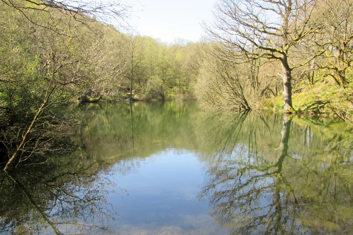
Follow the main path up through trees, ignoring any lesser paths until you reach a main path junction. Turn briefly right and then head left, still with the Nidderdale Way until you reach the shore of Guisecliff Tarn, embowered in the trees of Guisecliff Wood.
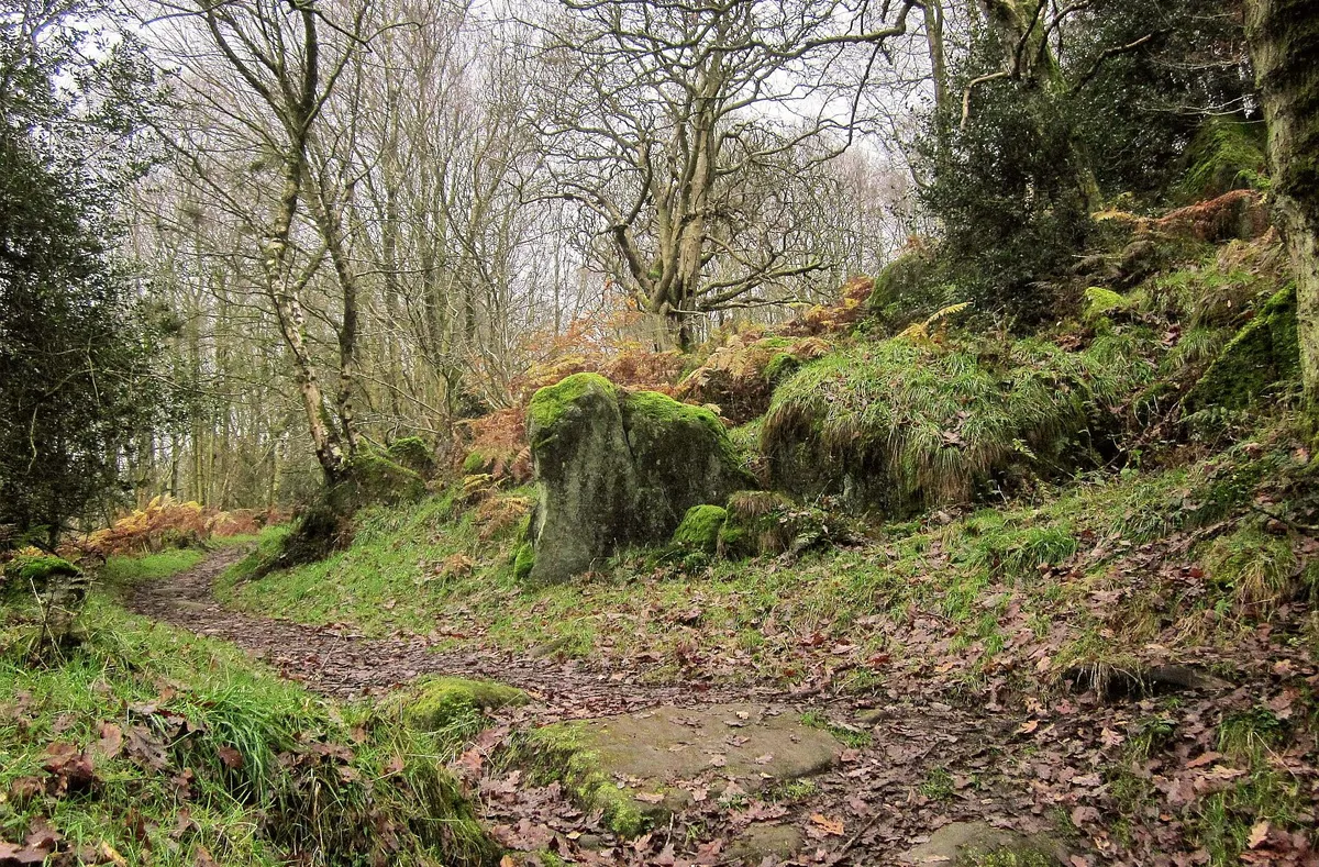
3. Guisecliff Tarn
Continue climbing beyond the tarn, maintaining a line in the direction of the cliff and then swing left with the main path to follow a largely level course on its winding journey through the woods to emerge from trees.
Take the right-hand path at a fork and continue climbing as the path winds to the right and climbs more steeply through bracken. Pause a moment and look back to enjoy a stunning Nidderdale view from Glasshouses to Brimham Rocks on the skyline to the north-east.
4. Guise Cliff
Before you reach the telecoms mast on Abraham Crags, take the right fork that continues climbing to run below the mast to the top corner where a stile deposits you onto a permissive path along the top of Guise Cliff.
This path runs along with silver birch and gritstone crags to your right and a drystone wall to the left. From time to time there are opportunities to head right onto some of the gritstone outcrops to savour the views to Upper Nidderdale. Take great care there – the signs do warn you of the crevasses.
A stile takes you outside the trees and onto the edge of heather moorland with the drystone wall now on your right. Follow the clear path alongside the wall until the path leads you down to a gate in the wall.
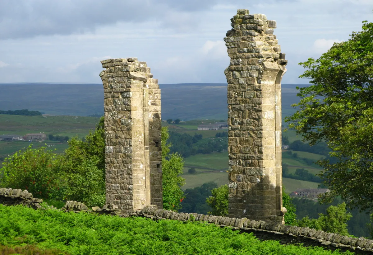
Ahead are great views to Greenhow Hill and through the gate you encounter the twin columns of Yorke’s Folly, built in 1779 to occupy unemployed local workers. There used to be three until a storm in 1893 and they are known locally as ‘Two Stoops’.
Follow the clear path away from the folly through a mix of bracken and heather heading steadily downhill until you reach a bend in the road on Nought Moor.
5. Skrikes Wood
Cross straight over the road to head through a gate to follow the Nidderdale Way down through an attractive corner with heather, bracken, rowan and silver birch adding foreground interest to long views across Pateley Bridge to Upper Nidderdale.
The path heads down into Skrikes Wood and continues downhill through trees to a stile into a large field. Drop down the field to a stile back onto Nought Bank Road. Follow the road with care and turn left over Fosse Gill on Turner Bridge to follow the road into Bewerley.
Hill walks
Discover the most beautiful ridges, tors, pikes and crags in the UK with our pick of Britain's best hill walks.
6. Bewerley
Follow the footway through Bewerley, noting the 15th-century Bewerley Grange chapel across the road.
As the road forks on the edge of Bewerley, head right, crossing over to join the other footway as you continue above the livestock market to reach the B6265 at Bridgehouse Gate. Cross over the road and turn right down the footway to re-enter Pateley Bridge.
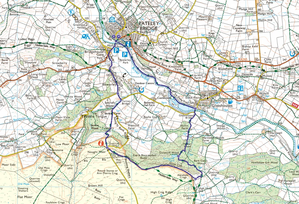
Pateley Bridge map
Pateley Bridge – OS Maps walking route
Useful information
Starting point
Start the walk at Pateley Bridge (HG3 5NA), served by the No.24 bus from Harrogate and with a large car park in Nidd Walk.
Other car parks are available at Southlands and just over the river bridge and all incur small charges.
Terrain
Map
Eat and drink
Stay
Pateley Bridge is a popular walking centre and offers a range of accommodation options.