Holy Mountain, Sacred Hill, Ysgyryd Fawr in Welsh – ‘ysgyryd’ meaning shattered or split – or simply The Skirrid, this mini mount goes by many names, hinting at its extensive and intriguing past.
The land surrounding the hill has long been considered holy and fertile – according to one ancient legend, a powerful landslide hit it the moment Christ was crucified on the cross – and religious pilgrimages have been made to the summit for centuries. Enjoy a 5km circular walk to the summit of this spooky hill, which offers dramatic views across the surrounding countryside with the Blorenge hill in the distance.
The Skirrid stands at 486m, but the route’s relatively short distance means the journey can be done in a morning. Stop for lunch at the equally notorious Skirrid Mountain Inn, the site of many a ghostly encounter. You can also stay a night, if you dare.
The Skirrid Mountain Inn
For those seeking refreshments at the end of an energetic walk, pay a visit to The Skirrid Mountain Inn at nearby Llanvihangel Crucorney. Reputed to be Wales’ oldest and most haunted public house, the inn has a bloodthirsty history. Dating back more than 900 years to the Norman Conquest in the 11th century, the inn was once used as a courthouse and execution place, with the original hanging beam still remaining. The last hanging was thought to have taken place at the inn by order of Oliver Cromwell for the crime of sheep stealing. Many ghost stories surround the inn, but today you’re more likely to be greeted with a roaring fire, a selection of local ales and hearty pub grub.
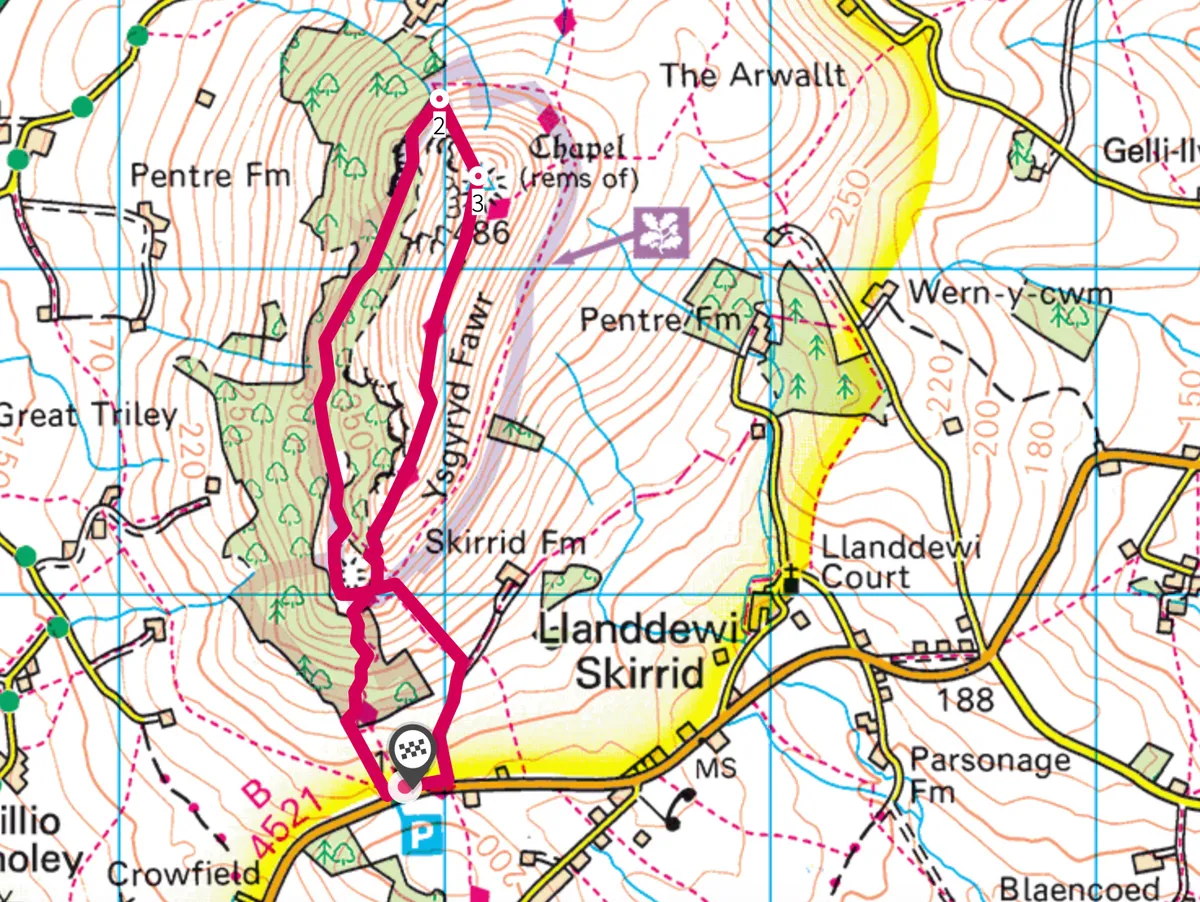
Skirrid walk
3.5 miles | 2.5 hours | moderate
1. Fort for thought
Starting at the car park on the B4521, head along a signposted footpath towards Caer Wood. Keep going to pass over a stile at the top of the gravel track. Continue on the path uphill through Skirrid Wood to reach a gate at the far side of the trees. Turn left here and follow the more open hillside footpath clockwise, passing the ruins of an Iron-Age hill fort.
2. Distant mounts
As you reach the end of the ridge, take a grassy footpath to the right and begin the steep ascent to the summit trig point, passing the remains of St Michael’s Chapel, which dates to the medieval era. Sugar Loaf and Blorenge can be viewed from the peak, along with the market town of Abergavenny.

3. Ridge return
Descend on a footpath on the eastern side of the ridge. After 1.5km you’ll reach a signpost directing you back along the opposite side of Caer Wood to return to the car park.
Skirrid map