As we caught our breath at the top of the ridge, the fog slowly began to clear, revealing the glassy surface of Llyn y Fan Fawr far below. Set in a valley fringed with forest and distant mountain peaks, it became clear why this lake, and indeed much of the Brecon Beacons, is such an enticing place to explore on foot, especially at pace.
Perhaps it’s natural that many runners swap the pavements of cities and towns for wild places by taking up trail running. Jogging on undulating woodland tracks, coastal paths and mountain ridges evokes a sense of freedom far more than road running.
However, if you’re used to a quick loop around the block, like me, then heading for the hills can be a little intimidating. That’s why I signed up for a beginner’s trail running and navigation lesson with seasoned runner and mountain instructor Jake Thompsett, jtexpeditions.co.uk
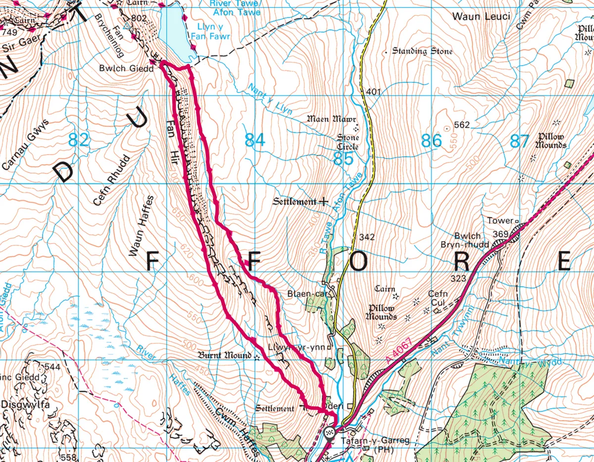
1. A Running Start
Start at Tafarn-y-Garreg car park and join the Beacons Way, ascending north.
2. Northbound
The route runs along the bottom of the steep ridge of Fan Hir and Fan Brycheiniog.
3. River crossings
Continue along the muddy path, keeping the ridge to your left and crossing streams, until you reach Llyn y Fan Fach lake.
4. Rain and Snow
You are now at the flanks of Fan Brycheiniog, at 802m the highest peak in the Black Mountain range. The summit towers above the lake and rolling, green hills blanket the valleys below.
Hike up the narrow and sometimes invisible track. To help with navigation, tick off natural waymarkers like streams and lakes to make sure you are following the right route.

Try using a technique known as handrailing, noting bigger features such distant roads, lakes and mountain peaks to maintain orientation, a great tip for newcomers to trail running.
Skirt the edge of Llyn y Fan Fawr, its waters deep and icy, then climb to the top of Fan Hir. Follow the the long, flat ridge south, jumping over streams and splashing through bog back to the start.
5. Back to the pub
The Tafarn-y-Garreg pub – a welcome sight after a 6.5m hill run through the Brecon Beacons – soon came into view, marking the end of our adventure. I was mud-splashed and exhausted, but exhilarated.
Map
Click on the map below for an interactive version of the route.