The Grey Mare’s Tail Nature Reserve lies on the eastern edge of Dumfries and Galloway, near the boundary with the Scottish Borders. Nearby Moffat, 10 miles to the west, was the first ‘Walkers are Welcome’ town in Scotland and makes the perfect base for year-round exploration of the peaks and valleys of the Southern Uplands.
This easy-to-follow path from the car park 200m up the side of the Grey Mare’s Tail waterfall to Loch Skeen at 500m is an excellent introduction to the Moffat Hills, especially in the colder months when the chances are you might have it all to yourself.
It’s full of geological, wildlife and archaeological interest and delivers superb views. Check the forecast before setting out and take care on the path – it’s narrow in parts and the drops are precipitous. Sheep and feral goats graze the hillsides so dogs are best kept on leads.
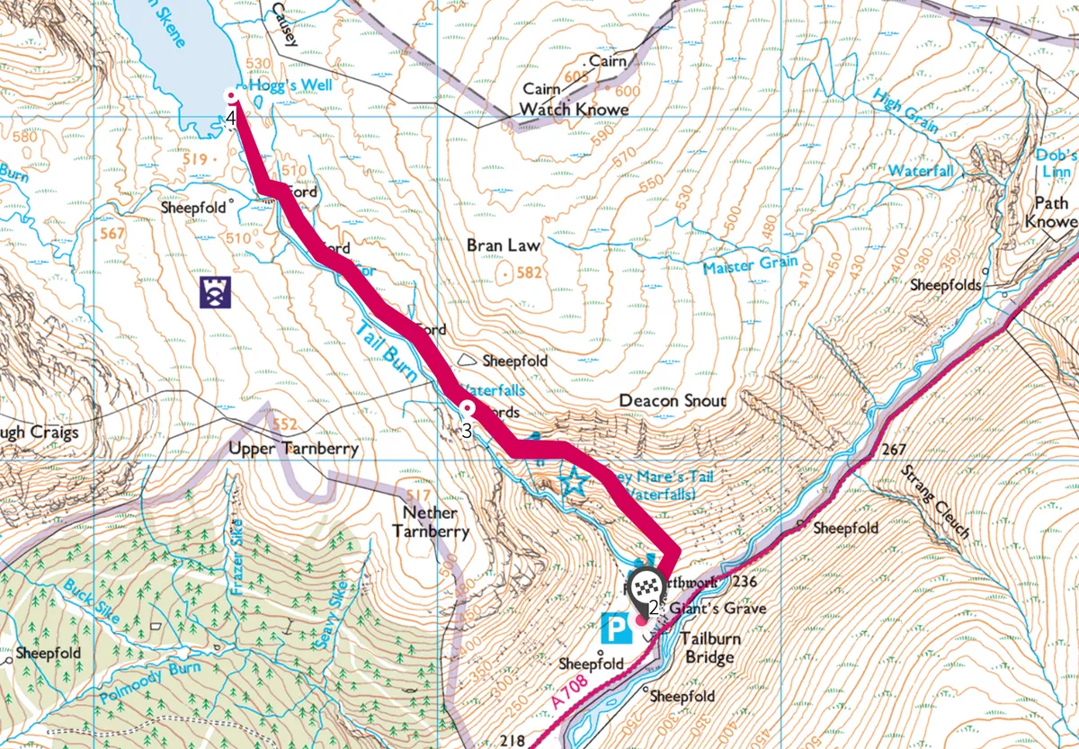
Grey Mare’s Tail walk
2.7 miles | 2 hours | moderate
1. Frozen falls
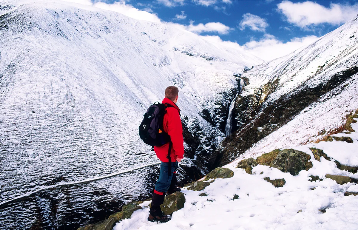
Park at the Grey Mare’s Tail car park, where there is a small information trailer run by the National Trust for Scotland. Leave the parking area on the west side of Tail Burn, sticking to the main path for 50 metres to reach a wooden footbridge. On the eastern bank of the river, a viewpoint – built within the walls of an old sheepfold –offers you a glimpse of the upper falls, as well as information about the surrounding Moffat Hills.
The falls are iconic, especially for the ice climbers who come to scale them when the cascades freeze (the last time, in 2010, temperatures reached -22°C). To have a go yourself you need Mountain Instructor accreditation, but the hillside path makes a good vantage point for watching the climber’s daring deeds.
The view also inspired Sir Walter Scott to pen these lines:
Where deep deep down
and far within
Toils with the rocks
the roaring linn
Then issuing forth
one foamy wave
And wheeling round
the giant’s grave
White as the snowy charger’s tail
Drives down the pass
of Moffatdale.
Behind the viewing area lies a prehistoric bank popularly known as the Giant’s Grave. Constructed around 2,000 years ago, it may once have served as a defence or a site for rituals. Climb the steps next to the viewing area and follow the path as it ascends beyond the top of the waterfall.
This is a great place to spot peregrine falcons swooping through the valley. A herd of wild mountain goats roams the hills, and can often be smelt before they are seen.
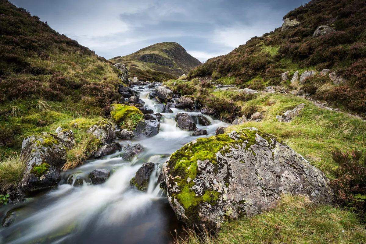
After about half a mile and 25 minutes of climbing, the gradient relents, and you reach a series of pools and waterfalls.
2. Tail Burn
Once the path rounds the hillside it enters the wide hanging valley of Tail Burn. Follow a good path along the right side of the burn. On your left is the rounded top of White Coomb and in front the rounded ridge of Mid Craig. To its right is the near-vertical wall of Lochcraig Head.
3. Loch stop
After ½ mile, you reach the shore of hidden Loch Skene, whose dark waters are encircled by almost sheer cliffs. The loch contains a thriving population of vendace, Britain’s rarest freshwater fish, which has all but died out in UK waters.
Beyond this point, the landscape is largely pathless and much wilder. If you’re carrying on into the hills you should have a map, compass, waterproofs and solid boots. Otherwise, the loch makes for a perfect picnic spot, with the added relief of a downhill return.
4. New perspective
Once back across the river at the base of the gorge, a detour – less than one-mile return – veers off to the right. Flat at the first, the trail soon rises on well-graded steps to reach a barrier. Do not proceed beyond this as the slopes beyond are covered in scree and prone to collapsed. Return to the car park the way you came.
Grey Mare's Tail map
Grey Mare's Tail walking route and map