The latest calculations from UK mapping agency, Ordnance Survey show that Scotland’s most famous Munro, Ben Nevis, is officially 1,345m and not 1,344m. The change will be displayed on all new OS digital and paper maps.
According to Ordnance Survey, the increase in height is the result of advances in technology, rather than geological movement. The mountain was re-measured following the restoration of the trig pillar.
Last measured in 1949 by a team of seven surveyors, it took 20 nights to calculate the height of the mountain as they only had three clear nights to take the reading. In contrast, the new measurement was obtained in two hours using a geodetic survey grade GPS receiver at the summit. This allowed the team access to constant data communication with satellites orbiting the earth.
Mark Greaves, Ordnance Survey’s Geodetic Consultant, was the first person to discover Ben Nevis had grown. He said: “The new height relates to the highest natural point on the summit and was measured as 1344.527m. I double checked everything and asked others to do so too.
“What is amazing is how close the surveyors in 1949 were. The measured height has changed by centimetres, but those centimetres mean we now need to round up rather than down. So that’s why Ben Nevis will now be officially known as 1,345m.”
Photo credit: iStock
Field Surveyor Angus Hemmings was one of three surveyors who climbed Ben Nevis to take a new measurement. He added: “We were asked to check if the recent repair work to the cairn had affected the position of the trig pillar, and this provided us with a sensible opportunity to resurvey the summit.
“It was raining, sleeting and snowing at the summit, but harsh weather doesn’t affect our equipment or readings. What it did do though, was give me a greater sense of respect for the 1949 surveyors. Each day they hauled 200lbs of equipment up Ben Nevis and its surrounding mountains. They also had to wait till night, because strong lights were shone from the trig pillars of the other mountains onto Ben Nevis’, which enabled them to collect their data.
“It took the surveyors 20 nights, because they only had three clear nights in that period to get it right. To do the best possible job it had to be run with military precision, everything they did had to be timed to perfection. Their effort and accuracy is remarkable.”
Video: See how Ben Nevis’s height was re-calculated
OS Marketing Director, Nick Giles, said: “In reclassifying the height of Ben Nevis our map becomes even more precise. Now it’s officially taller, I wonder how many will feel tempted to revisit its summit.”
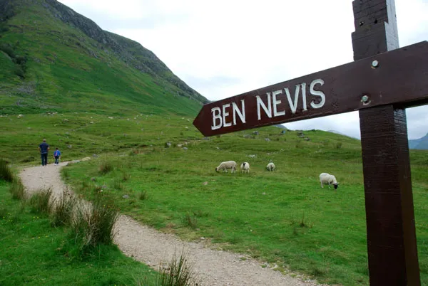
Photo credit: iStock
For further information on Ben Nevis, visit: www.os.uk/bennevis