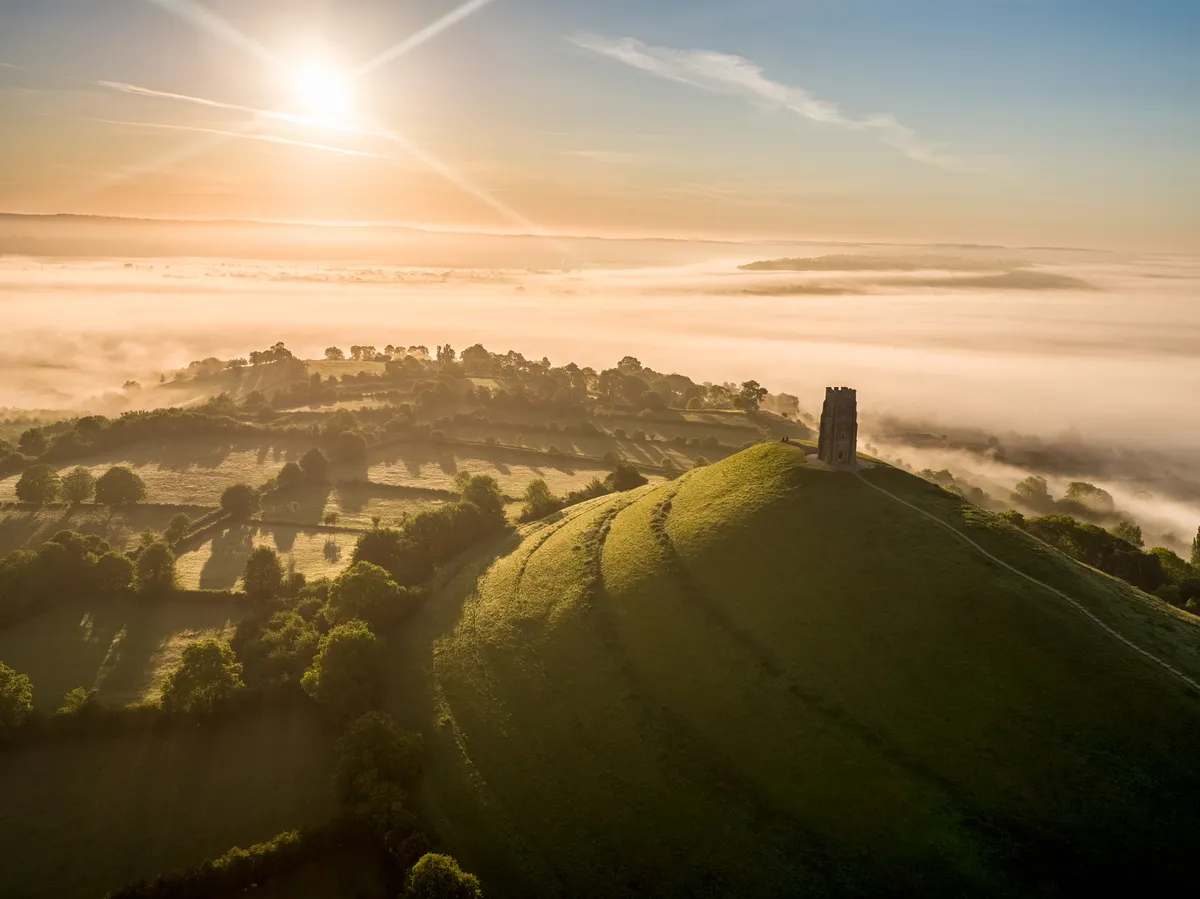
Glastonbury Tor is a place steeped in history, folklore and pilgrimage. Topped with St Michael’s Tower, the summit offers spectacular views and the chance to walk in the footsteps of King Arthur.
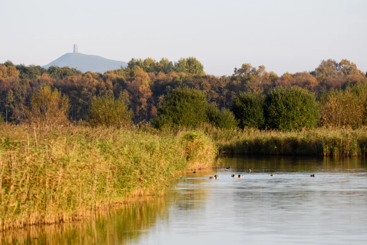
If the spirits are on your side (and you're visiting in autumn or winter), you may even spy a murmuration of starlings as they head to nearby Ham Wall Nature Reserve. Your short voyage complete, head back into Glastonbury to enjoy its uniquely eclectic array of shops and cafés.
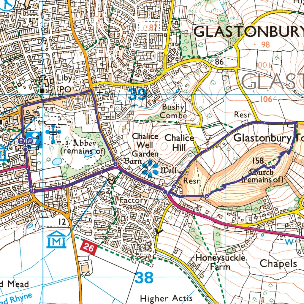
Glastonbury Tor walk
2.7 miles / 4.3km | 1.5 hours | moderate | 144m ascent
1. Start
Your starting point is St Dunstan’s car and coach park. With Glastonbury Abbey to your back, exit the car park and turn left down Magdalene Street, keeping Abbey Park on your left.
2. Bere Lane
Turn left when you reach Bere Lane. Cross over the road at the roundabout and follow it round to the right. You will see a blue sign pointing to The Tor and Chalice Well Gardens and will shortly pass Chalice Well (£5 for adults) still a favoured destination for Pagan pilgrims in search of divine feminine inspiration. Glastonbury Tor is said to be the masculine equivalent.
3. Wellhouse Lane
Turn left down Wellhouse Lane and then following the path immediately on your right, a stone at ground level points the way, “To The Tor.” Head up a flight of steps and through a gate opening out into a field. Continue uphill then pass through a second gate.
4. St Michael’s Church
Follow the steps/path up the tor until you reach the top. At the summit stands the iconic tower, the only remains of St Michael’s Church. Built in the 14th century it replaced the previous church destroyed by an earthquake in 1275. It is rumoured that both Jesus and King Arthur visited this site (separately).
5. Mendip Hills
Exit via the opposite side of the tower, taking in the views of Mendip Hills to the north and the Quantock Hills and Bristol Channel to the west. When you are done, follow the path as it winds down the north east bank of the tor. Head through a gate at the bottom and follow the path until it reaches Stone Down Lane, turn left.
6. Chilkwell Street
This brings you back to Wellhouse Lane. Turn right at the bottom, and this time continue straight over the roundabout along Chilkwell Street.
7. Glastonbury
Carry on down Chilkwell Street, turning left as you reach the High Street, the ideal place for a bite to eat. Follow this road until it merges into Magdalene Street and you arrive back at the car park.
Glastonbury Tor map
Glastonbury Tor walking route and map
Useful information
Starting Point
St Dunstan’s Car Park (fee) – BA6 9EH. The car park is shut on Tuesdays for the weekly market.
To get to Glastonbury by public transport, catch the; 376 bus from Bristol; 29 bus from Wells; 75 bus from Bridgwater; 77 bus from Yeovil
Terrain
Pavement, paths and steps – quite steep, may be slippery at this time of year.
Map
OS Map 141
Eat/drink/stay
We recommend the Hundred Monkeys Café serving food using vegetables that have been freshly-picked and meat from local farms (52 High Street).