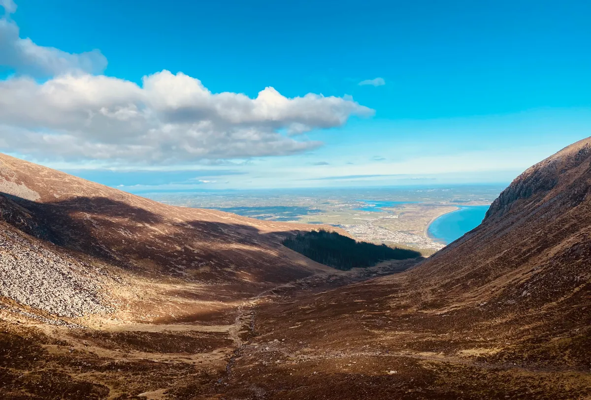
At 850m, the summit of Slieve Donard is the highest point in Northern Ireland. It is also a supreme viewpoint on a clear day, with the Isle of Man, Wales and Scotland all visible on the skyline.
Much of its charm stems from its location; the Irish Sea hugs the mountain’s eastern base, while the charismatic peaks of the Mourne Mountains lie clustered to the west. No wonder it’s a magnet for hikers, and the classic hill walk in the province.
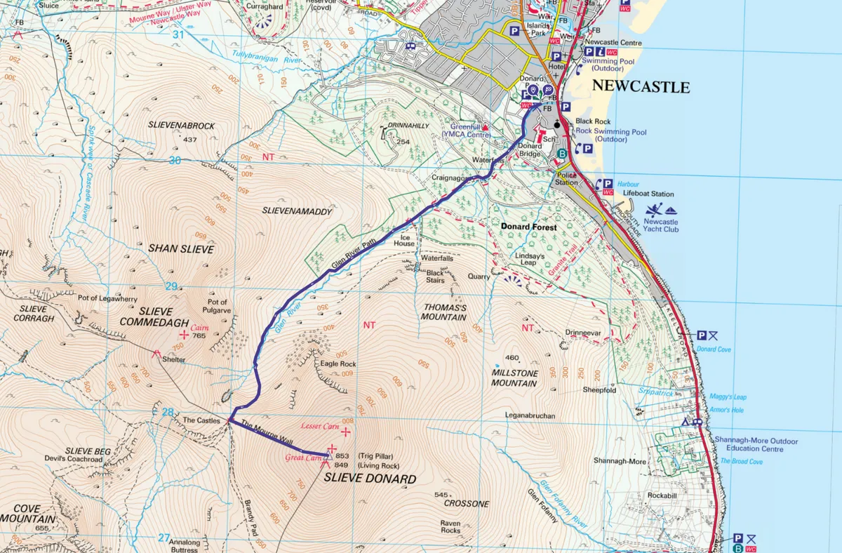
This route describes the most popular and straightforward approach to the summit: an out-and-back ascent via the Glen River Track.
There’s a rough mountain path all the way, but don’t underestimate the seriousness of the challenge. Bring full hillwalking gear, food and OSNI 1:50,000 map sheet 29.
Looking for more routes to do in the area? Checking out our walking guides to Slieve Binnian, Slieve Bearnagh and Murlough National Nature Reserve.
Slieve Donard walk
5.8 miles/9.3km | 4.5 hours | challenging | 827m ascent
1. Donard Wood
Join a paved path in the southwest corner of the car park. Follow this past the grassy expanse of Donard Park, then plunge into the beautiful deciduous and pine trees of Donard Wood.
The path climbs alongside the tumbling falls of Glen River. You pass several bridges along the way; cross the river at the first two bridges, then stay on the right bank at the third.
Northern Ireland walks
Northern Ireland's countryside is a walker's paradise. From the drama of the Causeway Coast and County Down's Mourne Mountains to the serenity of Glenariff Forest Park and Belfast Caslte, here are our pick of Northern Ireland's best walks.
2. Commedagh col
A gate and stile marks the upper boundary of Donard Wood. Beyond this you emerge onto open mountainside, with Slieve Donard rearing ahead to the left.
Look out for a conspicuous stone beehive structure on the opposite bank of the stream. This building was used as an ice house by the Slieve Donard Hotel before the advent of refrigeration.
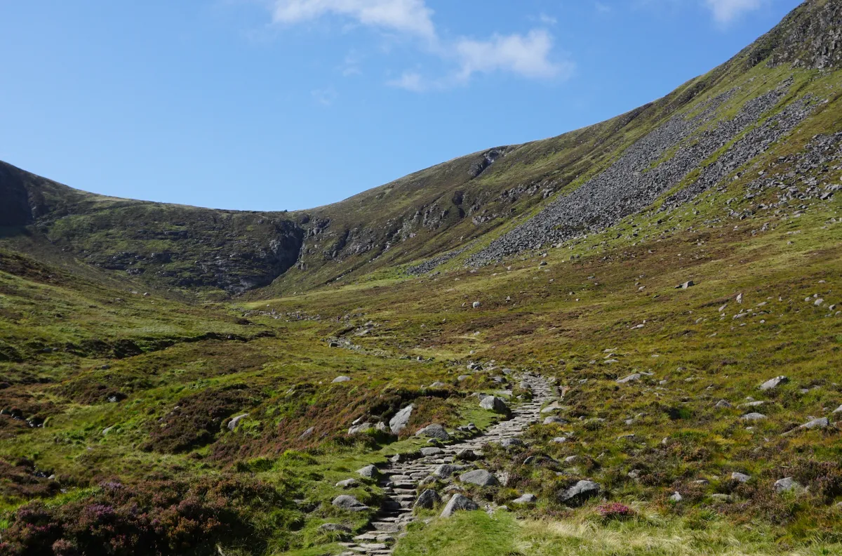
The path is partially paved with stone slabs, which become steeper as you gain height.
Climb for a further 2km to reach the col between Slieve Donard and Commedagh.
3. Mourne Wall
The col is bisected by the Mourne Wall, a twenty-mile long granite structure that took 20 years to complete in the early 1900s.
Turn left in front of the wall, and follow the path up the final slope to the summit. The ascent is steep and unrelenting, but ever-improving views reward your effort.
4. Slieve Donard
The summit itself is marked by a tower and trig point, and a fabulous 360° panorama of mountain and coast. The large stone cairn, and a smaller one about 100m north, have been here since early Christian times.
Take time to appreciate the scenery, then reverse your outward journey back to the start.
Slieve Donard map
Slieve Donard – OS Maps walking route
Useful Information
Starting Point
The large parking area for Donard Park, at the southern end of Newcastle town (GPS: 54.205863, -5.894409).
Terrain
Steep, rough mountain path with 850m vertical ascent.
Map
OS Mournes Activity Map
Eat and Drink
In the many fine pubs and restaurants located a short walk from Donard car park, in Newcastle town.
Stay
The namesake Slieve Donard Hotel, a luxurious Victorian pile overlooking the sea in Newcastle.