Winter is the most evocative season to scale Northern Ireland’s Mourne Mountains, because winter is when this landscape was created. The entire range owes its form to the scouring movements of vast ice sheets, which only began to melt some 13,000 years ago.
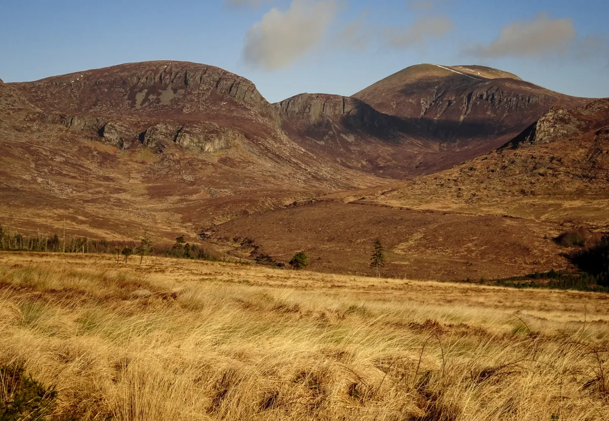
Yet not all the peaks were covered by ice; the very highest summits protruded above the frozen wasteland. Slieve Binnian was one such landmark, and the massive, frost-shattered tors that erupt from its tip were once nunataks, lonely towers of rock that withstood the elements above the icy expanse.
Standing today at Binnian’s 747m summit, with snow crunching underfoot, it’s easy to imagine the mountain shrouded beneath its former glacial cloak. And as the Mournes receive roughly 35 days of snow each winter – the highest snowfall in Northern Ireland – such conditions are not hard to find.
Slieve Binnian wildlife
The scenic splendour of these mountains is well known. After all, this is the landscape that inspired CS Lewis to create Narnia. It’s also worth watching out for winter wildlife. The most commonly spotted wild mammal is the Irish hare, which can reach up to 48kph in full sprint. During particularly snowy winters, some upland hares change to a white or partially white coat.
Numbers of peregrine falcons swell in winter, when the burgeoning Northern Irish population of 100 breeding pairs is augmented by migrants. Keep an eye open too for the endearing snow bunting, most of which breed in the Arctic in summer, then come south to more temperate climates from October to April. Common enough to have been given a Gaelic name – gealóg shneachta – they have been recorded on exposed winter summits in the Mournes.
Slieve Binnian walk
6 miles | 4.5 hours | challenging
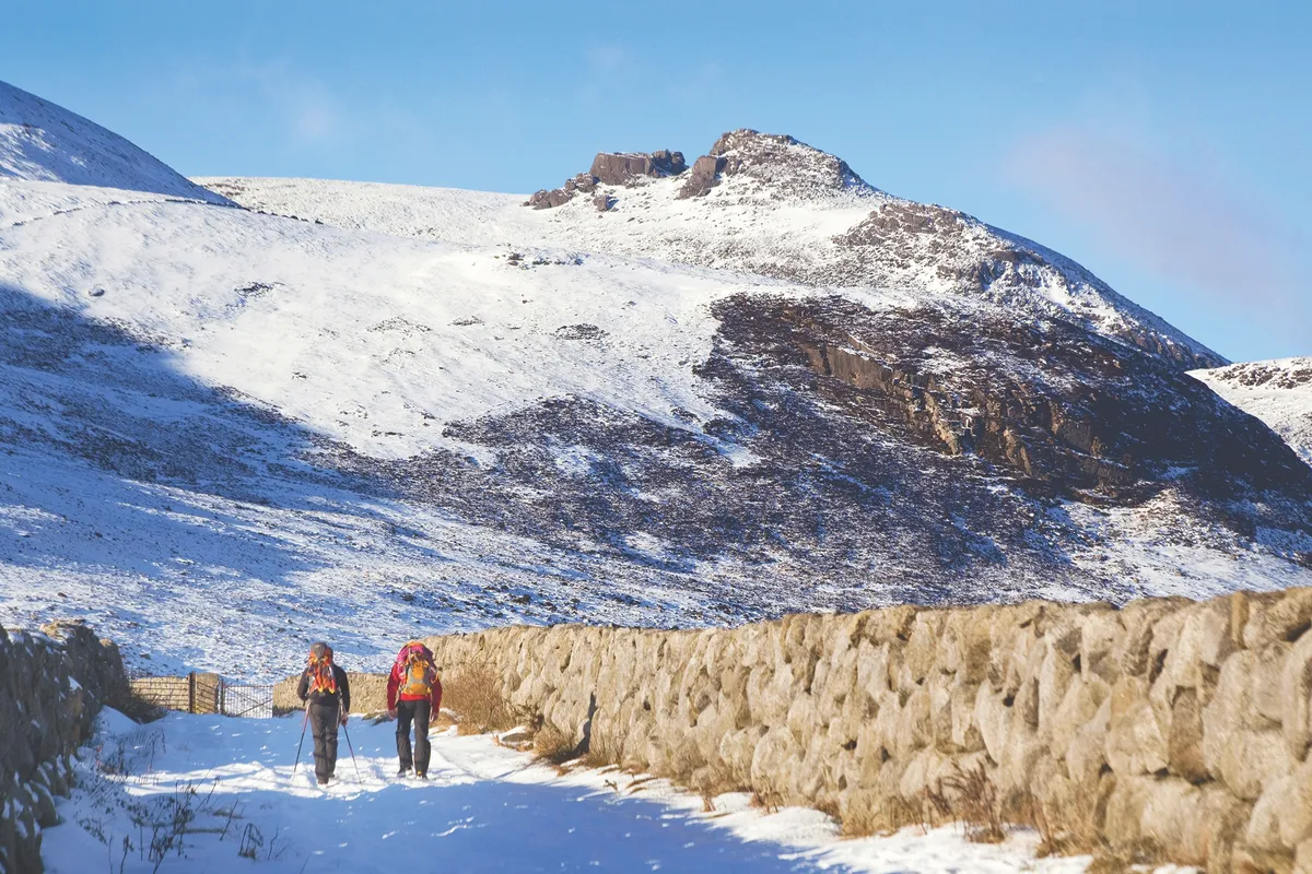
The walk that lets you explore all this is just four hours long, but involves 600m of ascent, so demands hillwalking experience and mountain equipment, such as walking poles, as a prerequisite. Route-finding is not overly tricky, but it’s best to wait for a clear day to make the most of the fabulous views. And having completed the route, it’s just a short drive down to the pubs in Annalong, where you can thaw out slowly.
1. Droving Track
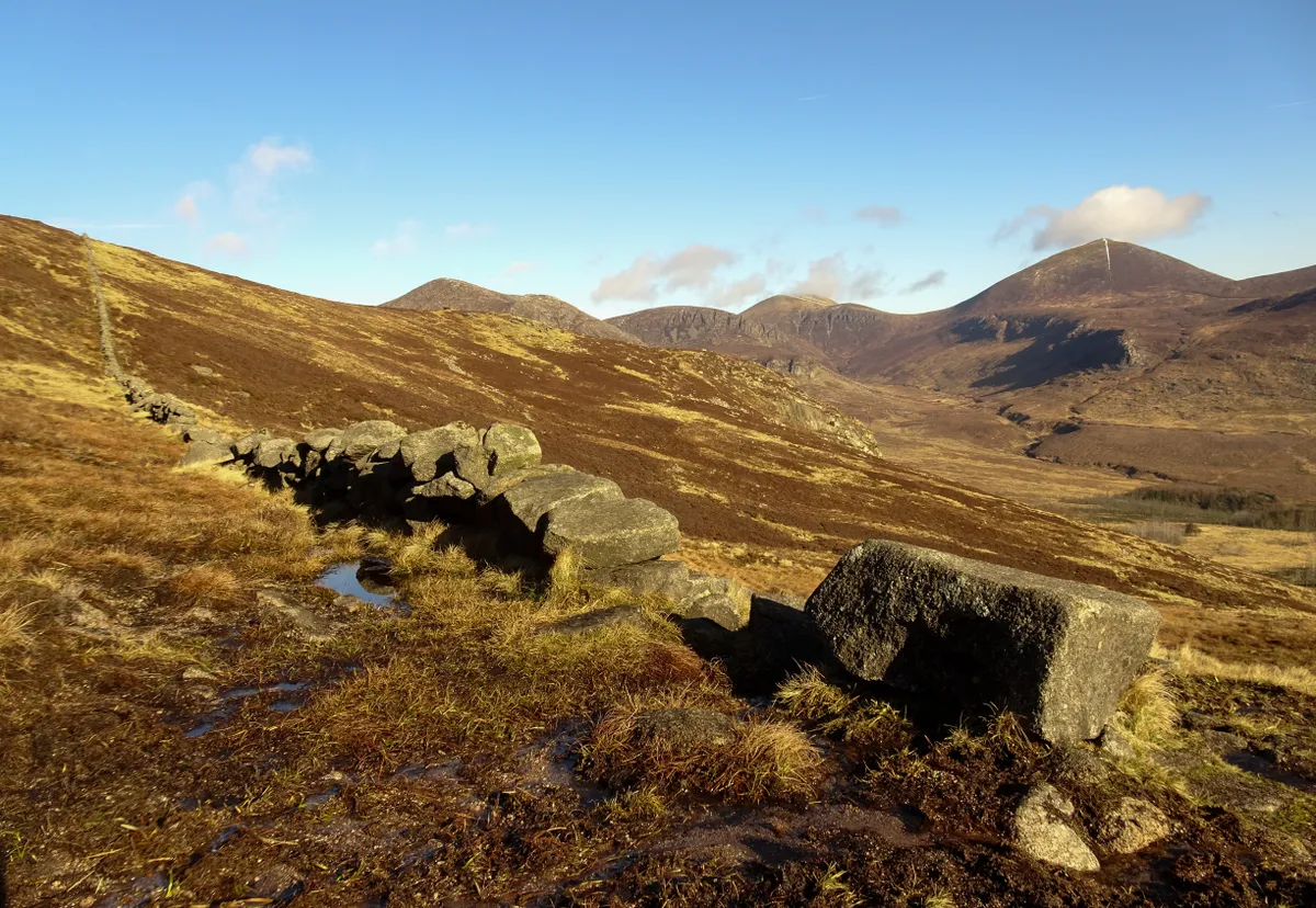
Begin at Carrick Little car park, 4km west of Annalong village. Join the track beside the car park, and follow it north towards the mountains. After 350m, an alternative, private car park offers more secure parking for £3. Continue along the track, which originated as an old droving road with cattle driven this way twice a year to access summer pastures in the mountains. After roughly 1km, you arrive at the solid stone structure of the Mourne Wall, cut here by a gate and wooden stile.
2. Mourne Wall
Cross the wall, then turn immediately left, following an informal path up the slopes to the north-west. This wall is one of the defining features of the Mourne Mountains, running for 35.5km (22 miles) across 15 summits, and encircling the water catchment area of the Silent Valley. Building it was such a laborious undertaking that, after work started in 1904, it took some 18 years to complete.
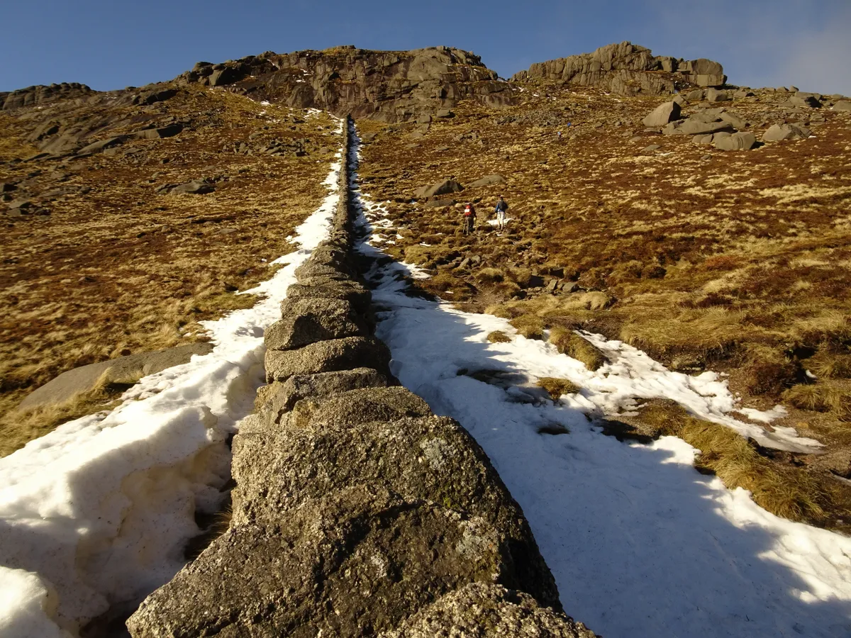
Follow the wall uphill, ignoring several subsidiary walls that cross your path. The ascent is continuous, and becomes steeper as you gain height. Improving views across the County Down coastline compensate for the effort expended. Eventually, the wall runs into the base of a sheer granite outcrop. You need to veer right here, and climb through a cleft in the rock to reach the summit plateau.
3. Summit Tors
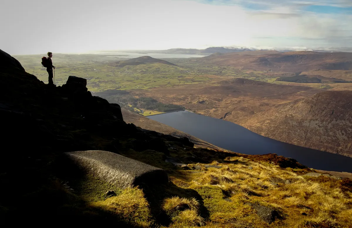
As you emerge on to the plateau, an expansive view is revealed to the west. The Silent Valley Reservoir lies far below, surrounded by the rough summits of the high Mournes. It’s an incredible 360° vista, extending to Wicklow and the Isle of Man on a clear day.
You are still slightly north of Slieve Binnian’s true summit, which lies among the granite tors to your left. These distinctive crags are well worth exploring, though a few scrambling manoeuvres are required to reach the summit cairn, which sits atop the highest outcrop.
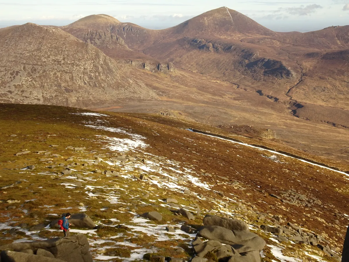
From the summit tor, follow a path north along a broad ridge, descending gently towards several smaller tors amid the otherwise featureless terrain. These are known as the Back Castles, and the path skirts across the rocky base of the largest outcrop. Again, the view across the Mournes is superb from here, encompassing virtually every peak in the range.

4. North Tor
Beyond the Back Castles, the path descends to a broad col, then contours 400m north-east to North Tor, another looming hulk of granite. Skirt around the western side of this, then begin the main descent.
4. Blue Lough
As you descend, keep to the apex of Binnian’s north ridge, with the ridgeline narrowing as you near the col beneath Slievelamagan. Roughly 250m before the col, a rocky platform on the left provides one of the most spectacular vantage points in the range, with Ben Crom Reservoir directly below.
At the col, turn right on to a path that descends south-east, past Blue Lough. The path becomes a track as you approach Annalong Wood, then turns into a laneway. Continue straight ahead at all junctions to arrive back at Carrick Little car park.
Slieve Binnian map

Words: Helen Fairbairn