Comprising 260 square miles of undulating chalk downland, dry valleys and huge coastal cliffs, the South Downs National Park is one of Britain's most precious landscapes.
From the Seven Sisters and the River Cuckmere to stunning Firle Beacon and the epic 100-mile South Downs Way, our round-up of the South Down's best walks includes routes from across the national park, each with its own walk description and map.
Looking for more walks in southern England? Check out our guides to best walks in Kent, Dorset and Wiltshire.

South Downs walks
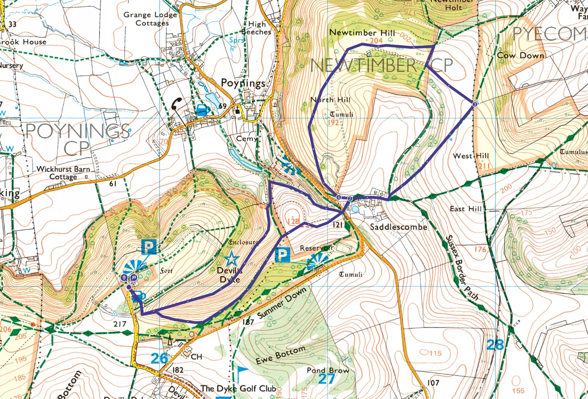
Devil’s Dyke, Sussex
4.3 miles | 2–3 hours | moderate
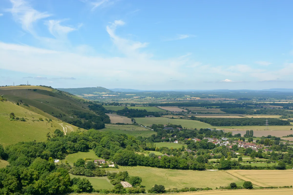
Explore a rare chalk grassland – as rich in myth and legend as it is in wildlife and far-reaching views – on this 4.3-mile circular walk through Devil's Dyke in the South Downs.
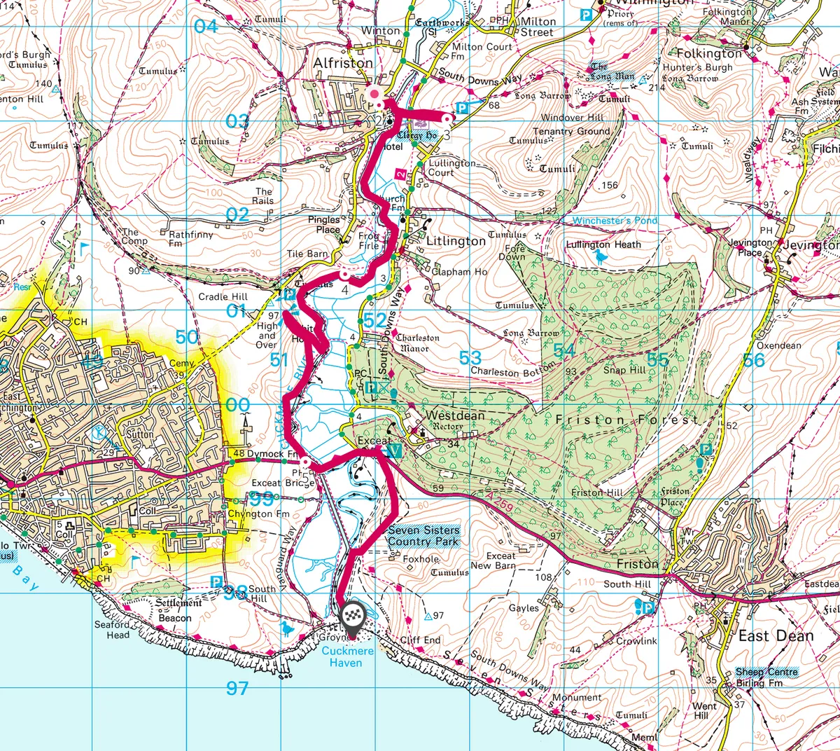
Cuckmere River, Sussex
6.7 miles | 4 hours | moderate
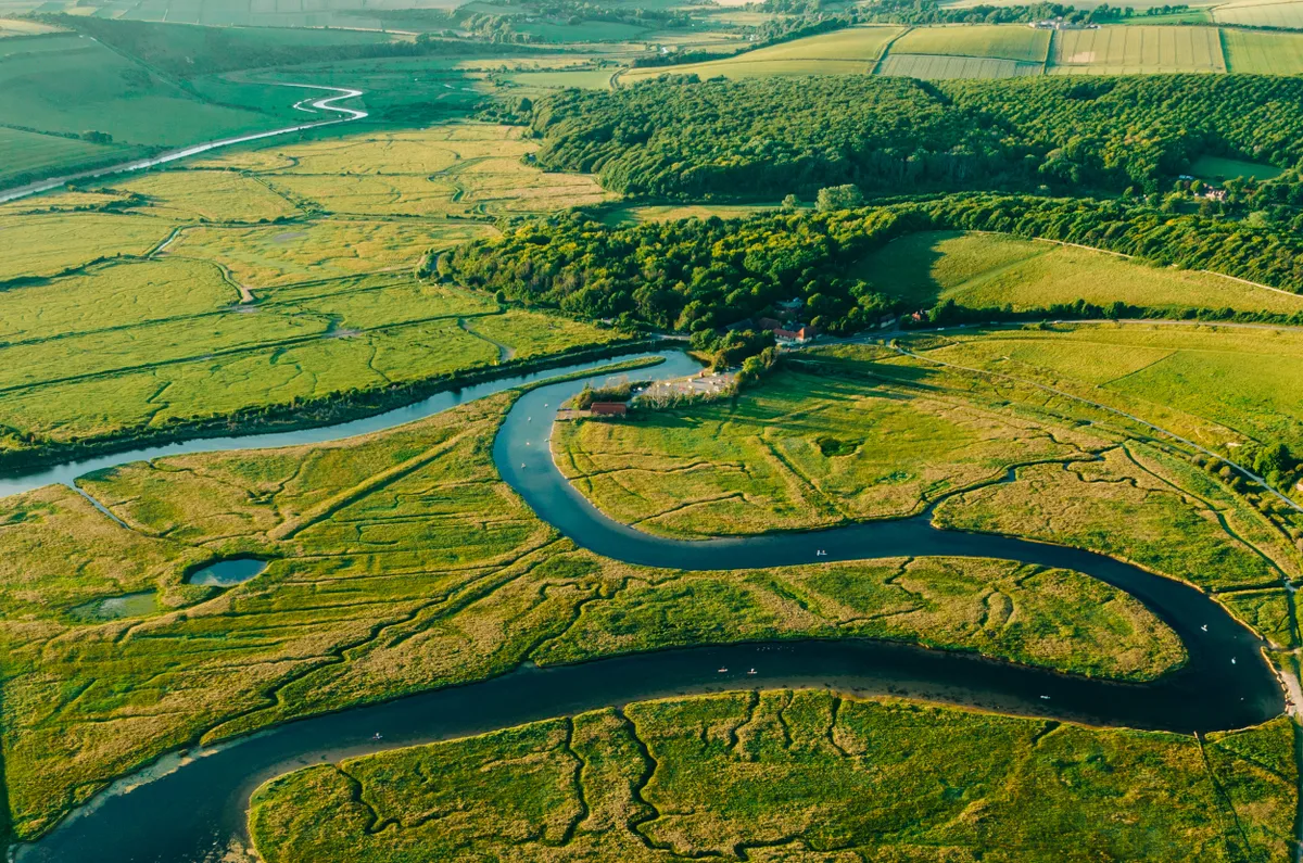
The smallest and narrowest of the Sussex Wealden rivers flowing into the English Channel, the Cuckmere has never had a port at its outflow and remains the only undeveloped Sussex river mouth.
It retains much of its medieval character as it bends through an ancient land of sheep-grazed chalk downs, Norman churches, and verdant meadows.
Follow this seven-mile walk along the Cuckmere River, from the picturesque village of Alfriston to the monumental Seven Sisters chalk cliffs on the Sussex south coast.
Ditchling Beacon, East Sussex
9.7 miles/15.7km | 5 hours | moderate
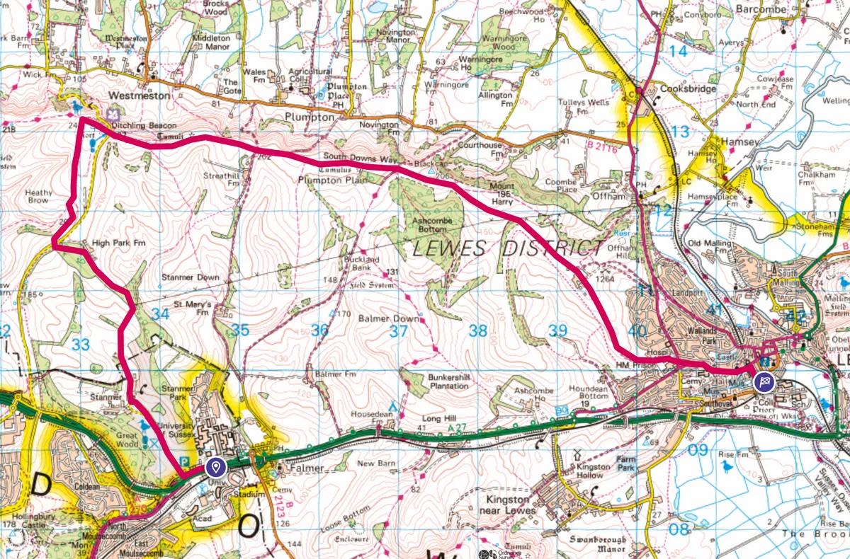
There are lots of great options in and around Brighton, and this hike from Falmer to Lewes via Ditchling Beacon is one of the best.
It starts at Falmer train station beside the AMEX stadium, then heads north through glorious Stammer Park. A stiff climb up to the Ditchling Beacon summit offers views of the contorted crevices of the Downs to the east and west.
From here it is a straight path east to Lewes, past trig points, National Trust plaques down into Lewes.
Stanmer Park, East Sussex
5 miles | 3 hours | moderate

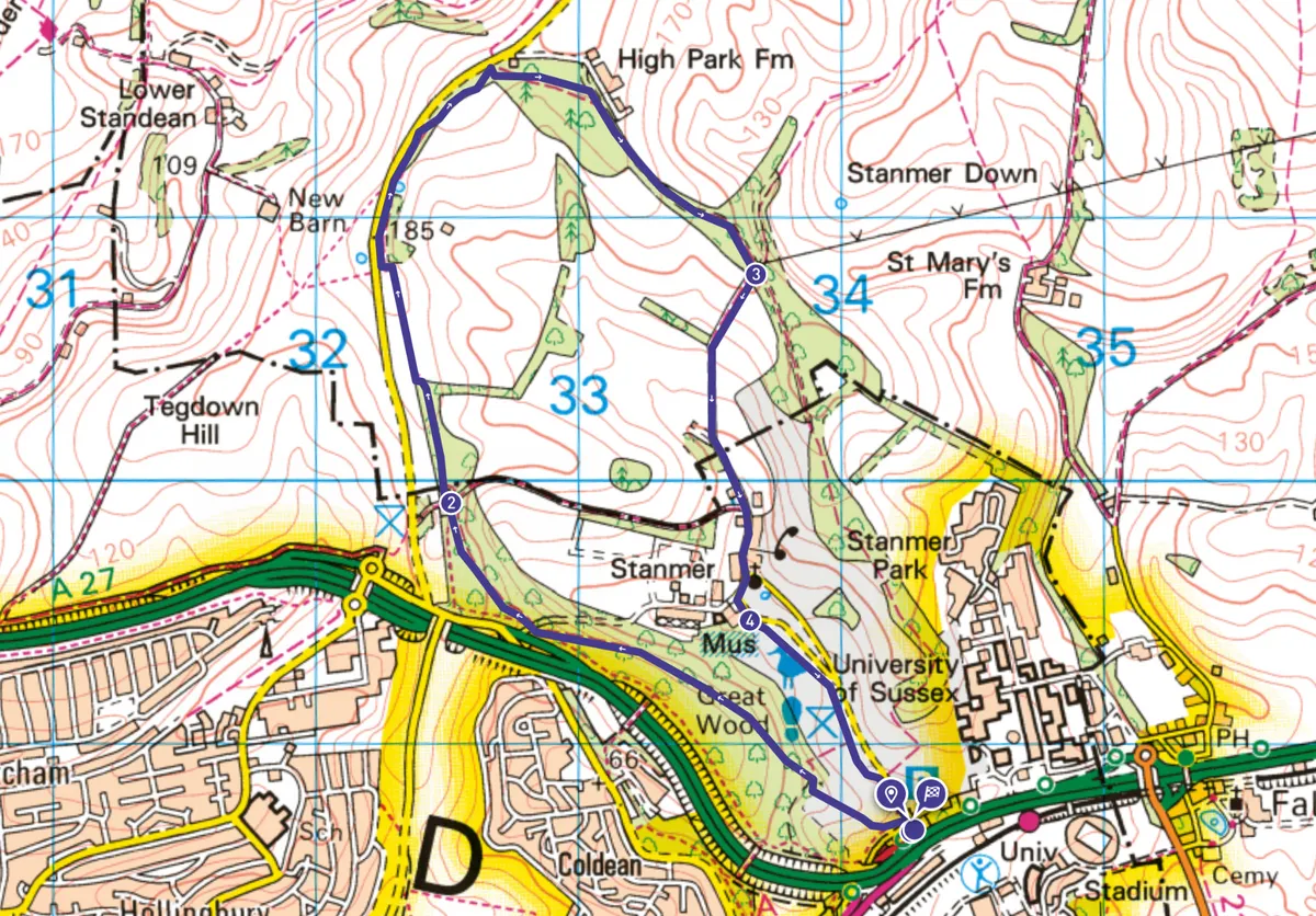
Stanmer Park offers 495 acres of woodland, chalky grasslands and historical intrigue. Situated on the very edge of Brighton, it is a popular gateway to the South Downs National Park.
Enjoy leafy glimpses and uninterrupted views of the chalk valley that runs through the heart of the park, as well as further views of the rolling hills of the vast South Downs. Finish by ambling through the idyllic Stanmer village.
North Marden to East Marden, West Sussex
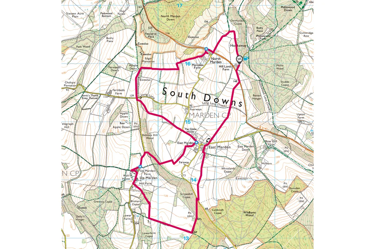
7 miles | 4 hours | moderate

Walk through a tranquil landscape of ancient field patterns, Norman churches and wooded hills in the South Downs National Park.
Firle Beacon, East Sussex
12.2 miles | 7.5 hours | challenging
Mount Caburn and Firle Beacon are two high points on the ancient downland east of the River Ouse, facing each other over the picturesque villages of Firle and Glynde. This is a fairly long route, and an early start is recommended.
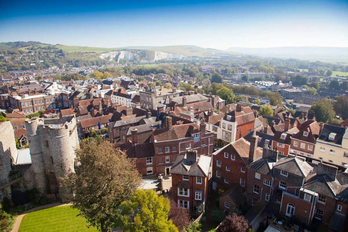
Follow this long and invigorating walk in the South Downs National Park from the lively town of Lewes, via the impressive Mount Caburn, Firle Beacon and Itford Hill, to the historic village of Rodmell.
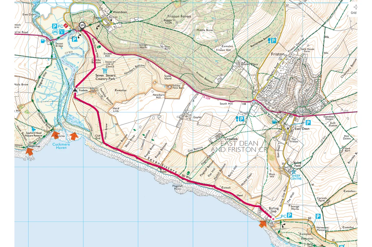
Seven Sisters, East Sussex
3.7 miles | 2 hours | moderate
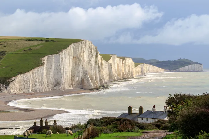
At the National Trust hamlet of Birling Gap, the sea’s aroma sits strong in the air. From the top of the steps above the beach and its numerous rockpools, the views of the Seven Sisters and Seaford Head are excellent.
Walk atop the magnificent chalky cliffs of the Seven Sisters in the South Downs, where kittiwakes and fulmars can be seen alongside Brimstone butterflies and flowering cowslips.
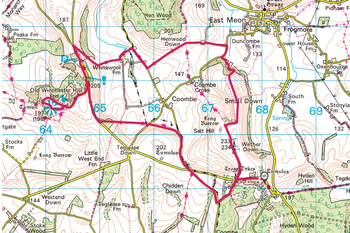
Meon Valley, Hampshire
9.3 miles | 5-6 hours | moderate
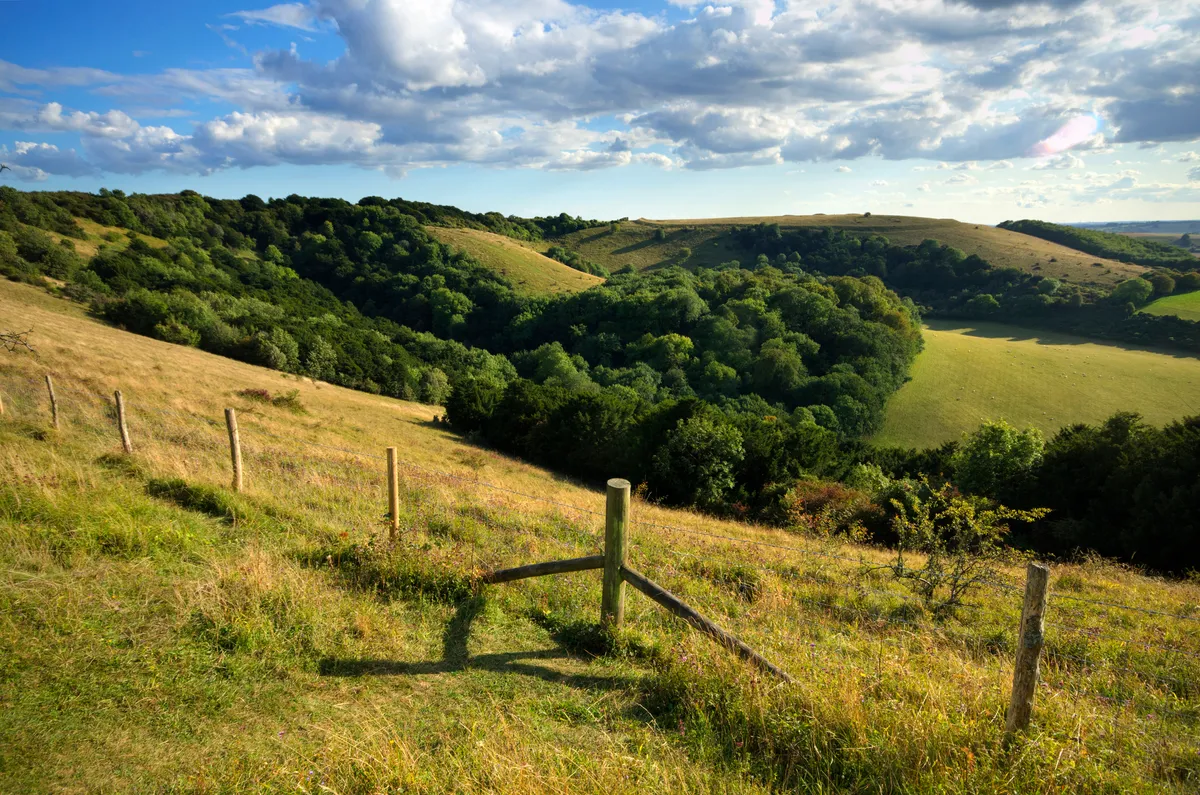
Discover a landscape shaped by man and nature over 6,000 years on a walk that enters the heart of the South Downs National Park in Hampshire.
This easy route offers a perfect blend of impressive natural wonders and interesting historical sites.
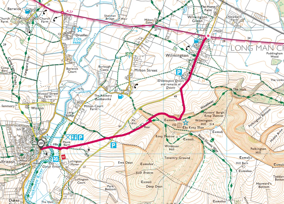
Wilmington to Alfriston, East Sussex
2.4 miles | 1.5 hours | easy–moderate (one way)
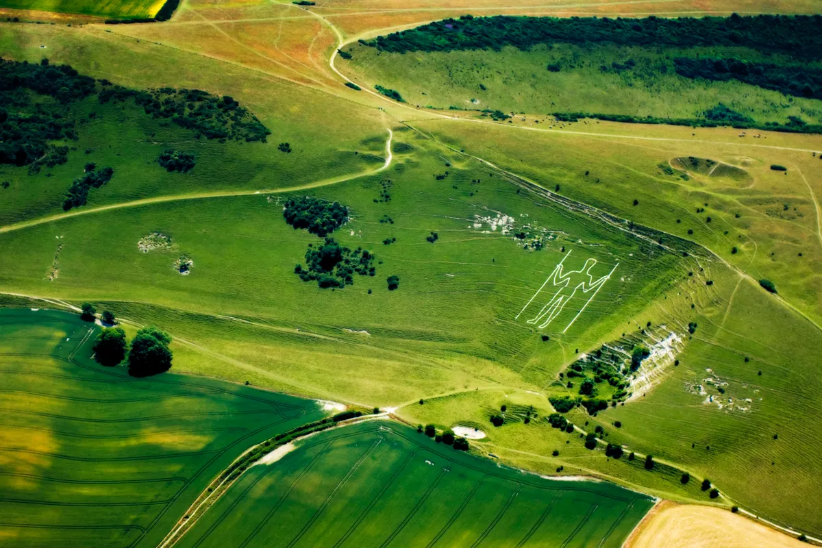
The Long Man of Wilmington is an imposing and decidedly enigmatic chalk figure on the South Downs – at 235 feet high, the tallest chalk figure in the UK.
There are various theories on his origins. Some suggest that he dates from Anglo-Saxon times, or earlier; others that his form was marked out by a Benedictine monk. More colourfully, legend tells that he was a giant, killed when another giant threw a rock at him from a nearby hill.
This short walk takes you straight to the Long Man of Wilmington.
Ouse Valley, East Sussex
3.5 miles | 2 hours | moderate
Navigate the meandering banks of the River Ouse, discover Virginia Woolf's 17th-century country retreat and climb to the summit of Firle Beacon with a walk through the Ouse Valley in East Sussex.
Cissbury Ring, Sussex
3 miles | 2 hours | easy
Discover the 5,000-year-long history of Cissbury Ring, the largest hill fort in Sussex.


