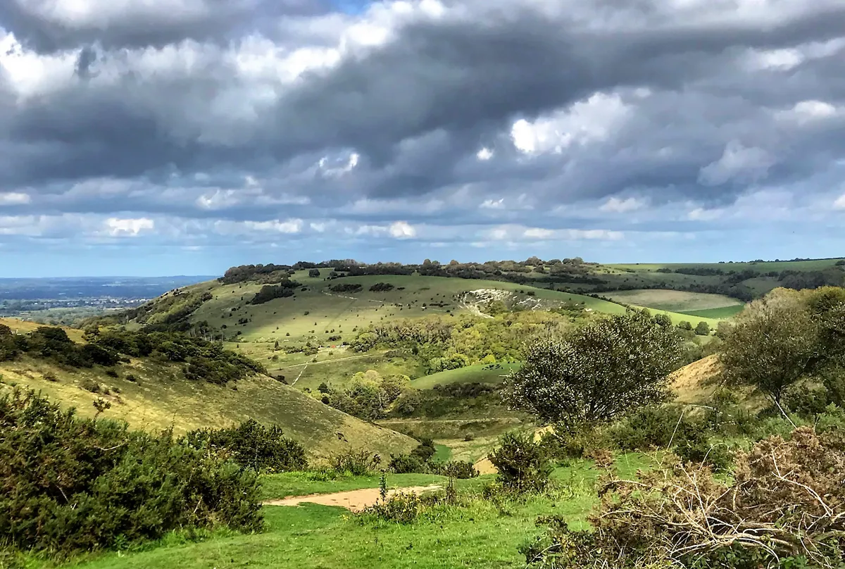
At the depths of the longest and deepest dry valley in the UK, you’ll find the Devil and his wife buried side by side, keeping watch for trespassers. Old folktales such as this put pep in your step as you wander through Devil’s Dyke, but there are many more reasons to visit this legendary corner of the South Downs.
Watch kestrels fly high above the rolling chalk hills then adjust your focus and gaze south to the distant Isle of Wight. In spring, birdsong fills the valley and cowslips carpet the slopes, while summer delivers banks for pink mountain time.
This walk through the chalk downland is under five miles and will take between two and three hours to complete.
South Downs walks
From the Seven Sisters and the River Cuckmere to stunning Firle Beacon, our round-up of the national park’s best walks includes routes from across the national park, each with its own walk description and map.
Devil's Dyke walk
4.3 miles/6.9km | 271m accent | 2–3 hours | moderate
1. Devil’s valley
Start at the National Trust Devil’s Dyke car park and head straight through the valley (east then north-east), skirting around the left-hand side of a small hill to reach Saddlescombe Campsite and Farm, where you can stop for locally produced, seasonal refreshments.
2. West Hill climb
Continue through Saddlescombe, turning left (north-east) on a steady incline through sheep-grazed pasture around the flanks of West Hill. This is an amazing place to break and catch your breath while doing some birdwatching.
3. Newtimber to North
On reaching a boundary at the top of the hill, turn left (north-west) and walk across the field to a gate. Turn right then shortly after left passing through cow-grazed fields up to the top of Newtimber Hill, which then leads on to North Hill. Be careful not to head too far east as you descend the hill as there is a sharp drop off the edge showing evidence of an old quarry.
Walk downhill back to Saddlescombe Farm.
Discover more walks in the South Downs
4. Valley to the pub
Walk through the farm then skirt the left side of the small hill (opposite side to your outbound route) to meet a clearer path. This contours the left edge (south) of Devil’s Dyke back to the car park where a roast in The Devil's Dyke pub awaits.
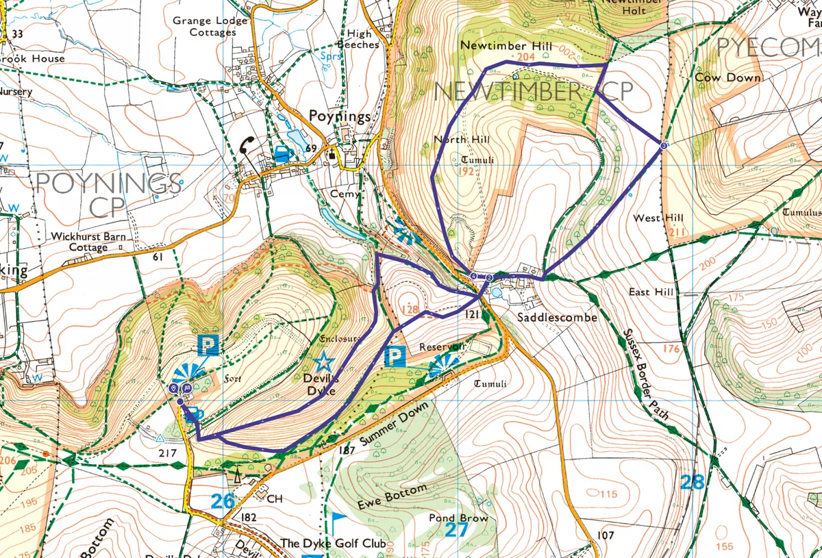
Devil's Dyke map
Devil's Dyke walking route and map