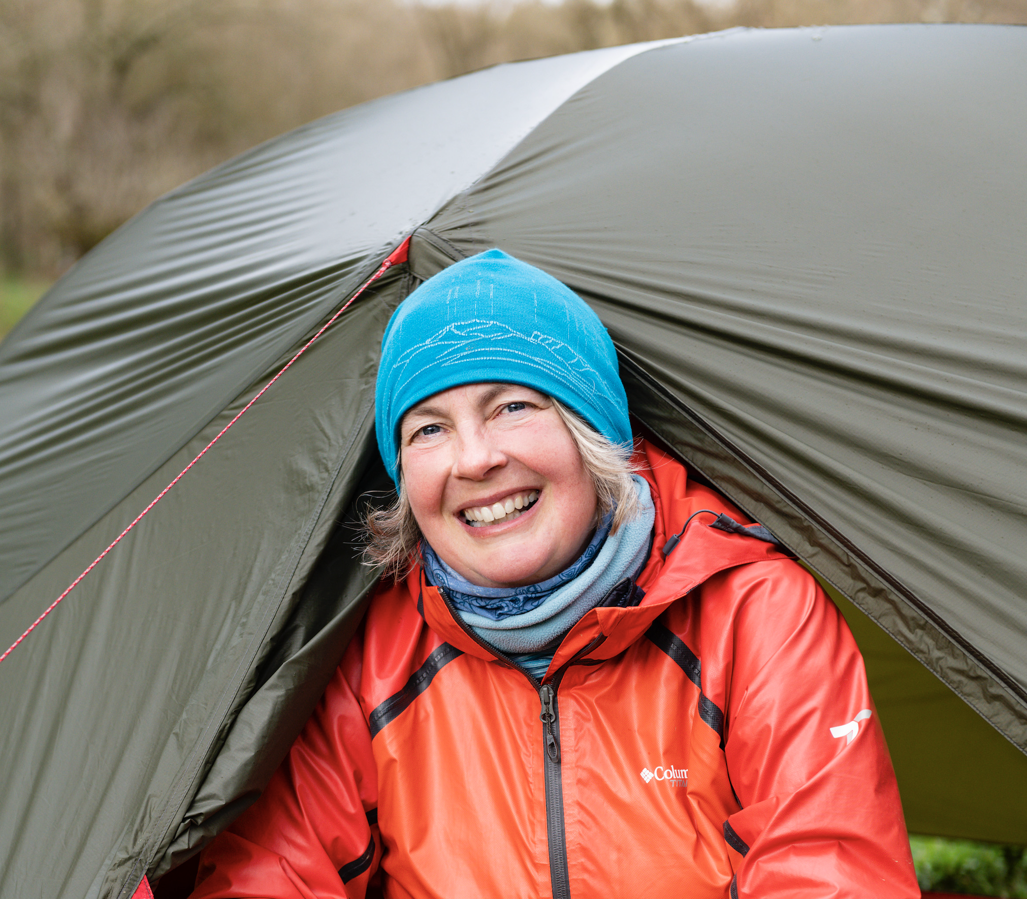
Taking in 108 miles of ancient drove roads, wooded valleys and some of Dartmoor’s most beautiful towns and villages, the newly waymarked Dartmoor Way is one of the UK’s more achievable long-distance walking routes. For those used to high moorland walking, this circumnavigation of the national park is a completely different way to experience Dartmoor life.
The Dartmoor Way can be hiked in either direction or as a figure of eight utilising the additional High Moor Link. It has been split into 10 main sections, each between eight and 13 miles.
With poor-visibility alternatives for moorland sections and plenty of access to local cafés and pubs, the trail can be enjoyed at any time of year. Stroll through quintessential Dartmoor villages such as North Bovey in winter; discover early snowdrops at Parke and late-spring bluebells in Houndtor Wood; take in the optional High Moor Link to hear summer skylarks, and relish autumn changes alongside the wooded River Walkham.
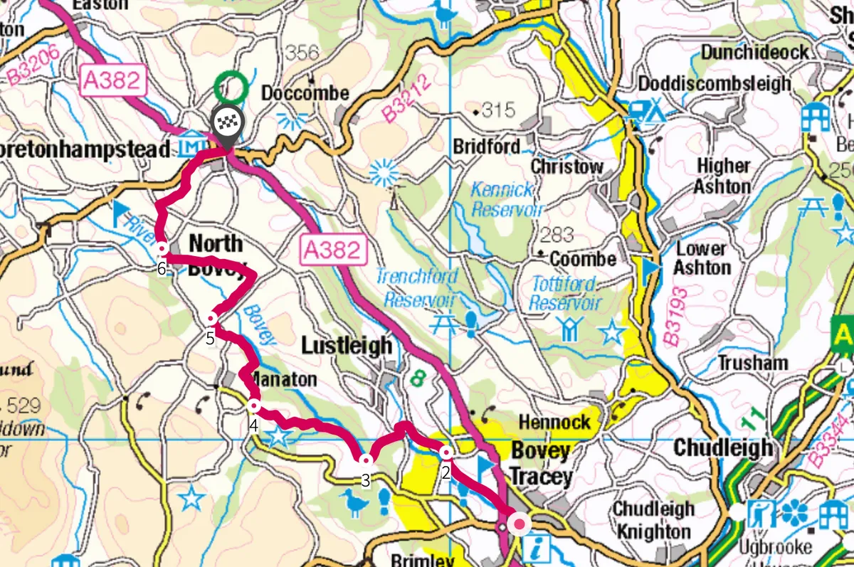
The 10-mile, anticlockwise section from Bovey Tracey to Moretonhampstead is especially beautiful and an ideal taster for anyone considering walking the whole route.

Bovey Tracey to Moretonhampstead walk
10.4 miles/16.7km | 7–8 hours | moderate/challenging
1. River and rail
Leave the car park at Bovey Tracey and cross the road. Follow the River Bovey through Mill Marsh Park, then pass under the A382 and on to the disused railway. Follow the railway until you meet the lane. Enjoy the flat track, the trees and the sound of the river below you.
2. Old lanes
After just over a mile, leave the railway line through the gate and continue in the same direction up the lane. At the ‘give way’ sign, turn left and follow the lane downhill to Drakeford Bridge. Turn right into Pullabrook Wood then follow the higher path until you come to a gate and lane – this is the old Manaton road.

3. To the inn
Turn right and follow the lane through Houndtor Wood for one mile. Halfway down, take a quick diversion through the gate to admire the beautiful Hisley Bridge. Crossing Becka Brook, go through the gate and start the steep climb towards Manaton. Join the lane as the track levels out and continue for 500m.
At the fork, go right to continue or veer left for an optional detour to the delightful Kestor Inn. To avoid the next section, which includes a steep downhill path, take the lanes to Manaton then Neadon.
4. Plantation path
Follow the lane then the bridleway past the thatched cottage. At the junction, turn left into the woods, passing a wood store on your right. Continue through Letchole Plantation for half a mile.
At Horsham, pass through the metal gates and turn left at the cottage. Follow the footpath round and into Neadon Cleave. Continue steeply downhill through the woods, then on to the lane to Neadon (just over a mile).

5. Stone lady
Turn right through the tiny hamlet of Neadon. Look out for the historic Neadon Upper Hall and a reclining stone lady. At the junction turn right again. Don’t miss the left turn at Barnecourt.
Follow the lane into North Bovey, stopping to admire the stepping stones and ford just before you reach the village. A refreshment opportunity awaits here at the thatched Ring of Bells pub.
6. Down to town
As you leave North Bovey, turn right up the hill. At the rock take the left fork and continue until you reach a stile into a field on the right. Follow the Dartmoor Way signs across the field system. You will soon see Moretonhampstead ahead of you. Keep an eye out for markers as you head past
the stables, down the hill and on to the track at Wadley Brook. Continue into Moretonhampstead, turning right on to the B3212 – take care on this busier road.
Map
Bovey Tracey to Moretonhampstead walking route and map
Words: Fi Darby