This there-and-back again route through Boyton and Hollesley Marshes on the Suffolk coast is easy to follow and almost flat, with the added bonus of some wonderful wildlife and expansive marshland views along the way.
The Marsh Barn Café at Hollesley is conveniently placed halfway along the route at the turn-around point, making it the perfect place to break to lunch before returning to Boyton Marshes.
Boyton Marshes to Hollesley Marshes walk
6.8 miles/11km | 4 hours | easy | 12.5m ascent
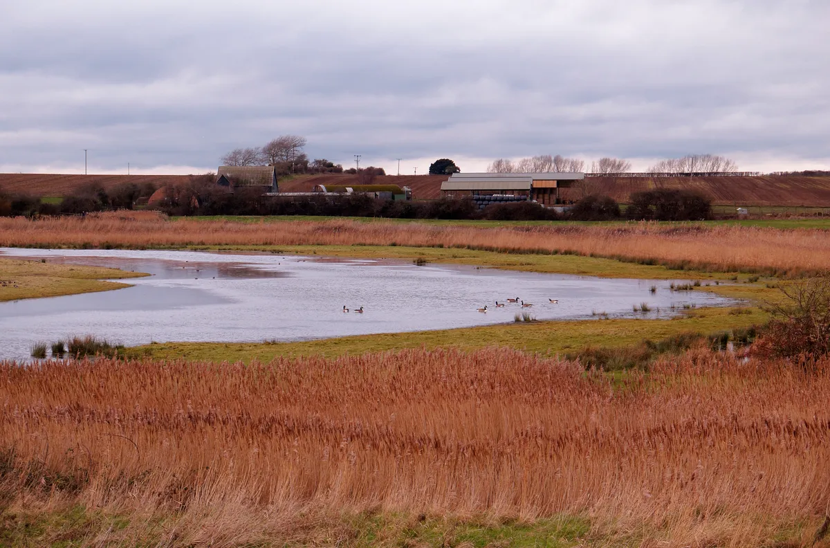
1. Boyton Marshes
Start the walk at Boyton Marshes RSPB reserve where there is parking for around 10 cars at Banters Farm at the end of the lane, which is accessed from Boyton-Capel St Andrew Road. Here you can scan the bushes for small birds such as finches and, recently, a couple of firecrests.
Thereafter, as you continue down the track you will enter the reserve proper. There is no visitor centre to welcome you. Instead, there will be a freshwater flash on your left usually replete with waterfowl and, in the reedbeds, bearded reedlings and singing reed warblers. The grazing marshes on the right are the winter home of numerous geese and lapwings.
Follow the track onto the Butley River path with great views across the water towards Gedgrave Marshes, Orford village and derelict WWII buildings on Orford Ness. Here, look for marsh harriers and hovering kestrels.
Suffolk walks
Discover Sutton Hoo, Herringfleet Mill and the River Stour with our guide to best walks in Suffolk.
2. River Ore
Leave the reedbed behind to pass Boyton Dock. Here, head east and then south along the path that is now alongside and level with the River Ore. You may see seals hauled up on the mudbanks at low tide.
As you continue walking, on the right-hand side you will see a grazing marsh. The track continues towards Hollesley, passing the southern end of Havergate Island and the southern spit of Orford Ness. You will be alongside a channel along which you can scan for a variety of shorebirds including the famous, avocet. In the vegetation adjacent to the track, keep a beady eye out for meadow pipits and skylarks, too.
3. Hollesley Marshes
As you near Hollesley, the RSPB reserve at Hollesley Marshes will come into view on the right. You will be greeted by another grazing marsh and a rather exciting flooded lagoon, dotted with islands. The lagoon can sometimes be thronging with birds, ranging from gulls, ducks and geese to raptors, such as marsh harriers and peregrines.
As you continue south and approach the river mouth, you will see the buildings of Shingle Street and the cranes at Felixstowe Docks. There’s also a large cormorant colony here.
When you eventually reach the derelict WWII pillboxes, turn right inland towards Hollesley village passing by more flooded fields that, during the summer, could yield yellow wagtails.
The path will lead you to a viewing screen where you can get great views over the reserve’s lagoons and scrapes.
4. Marsh Barn Café
After filling your boots with nature, you can end the first half of the walk by filling your boots with well-deserved tea and cakes at the Marsh Barn Café alongside the Hollesley Marshes RSPB car park, which is open seven days a week.
Return to Boyton Marshes the way you came.
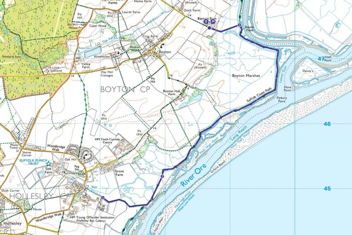
Boyton Marshes to Hollesley Marshes map
Boyton Marshes to Hollesley Marshes – OS Maps walking route
Useful information
Starting point
You can start at Boyton Marshes, but equally, the route can be done in reverse.
Terrain
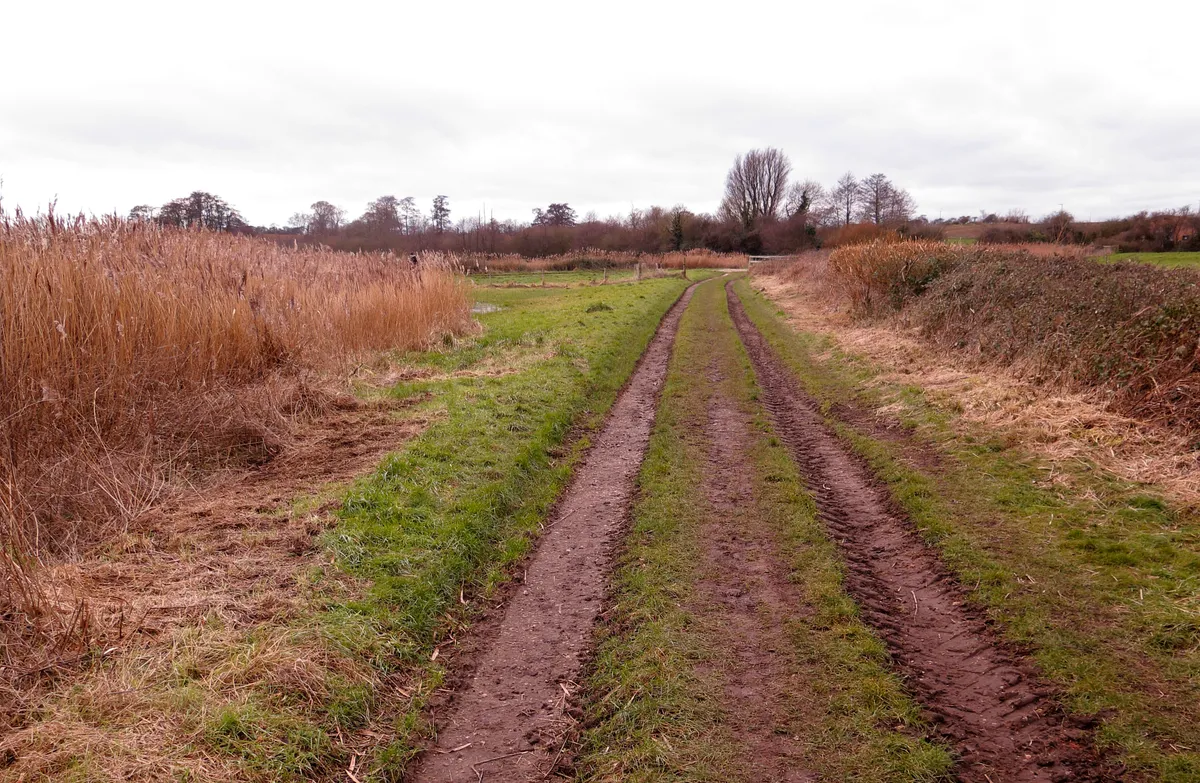
All paths and tracks are passable, well marked but can be a little muddy in times of heavy rainfall. The terrain is flat with some stiles at boundary edges. Not wheelchair friendly.
Map
OS Explorer 197
Eat and drink
The Marsh Barn Café is the only eatery on the route.