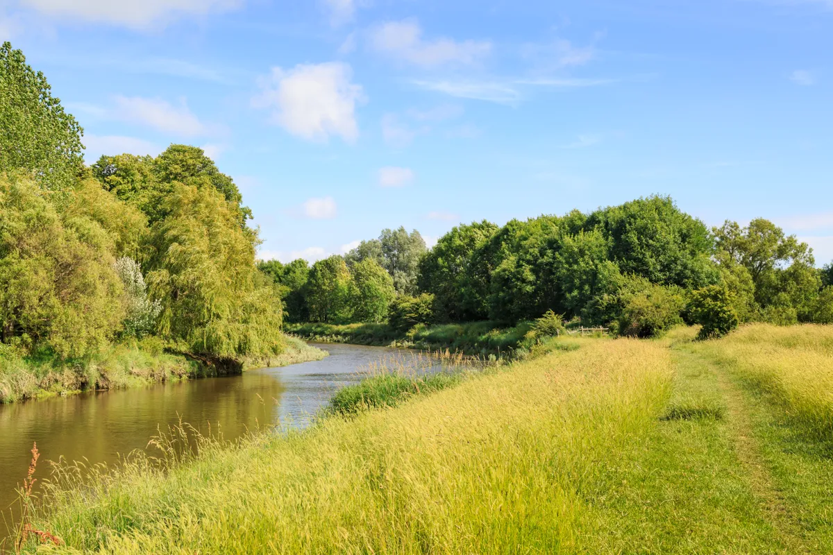
What better way to get to know a river than to follow its course – from bubbling spring to seashore – looking out for stalking herons, elusive otters, and tiny river fish as you go?
Here in Britain we have the great luxury of being able to trace some of our most beautiful rivers via waymarked walking trails. Many of these routes pass through lush rolling countryside, and include the chance to break at pretty waterside towns and villages, where you can rest your head for the night and stock up on supplies before re-joing the river trail.
From walking the banks of the Sussex Ouse through pasture and downland, to following the length of the River Severn, Britain's longest river, here are seven magical source-to-sea trails to inshrine your next adventure.
The British landscape is criss-crossed by a vast network of waterways, ranging from trickling mountain streams to large meandering rivers. A great deal of these are accessible by public footpath, offering walkers the chance to enjoy miles and miles of waterside walking, no matter where you live.
Seven great long-distance river walks - from source to sea
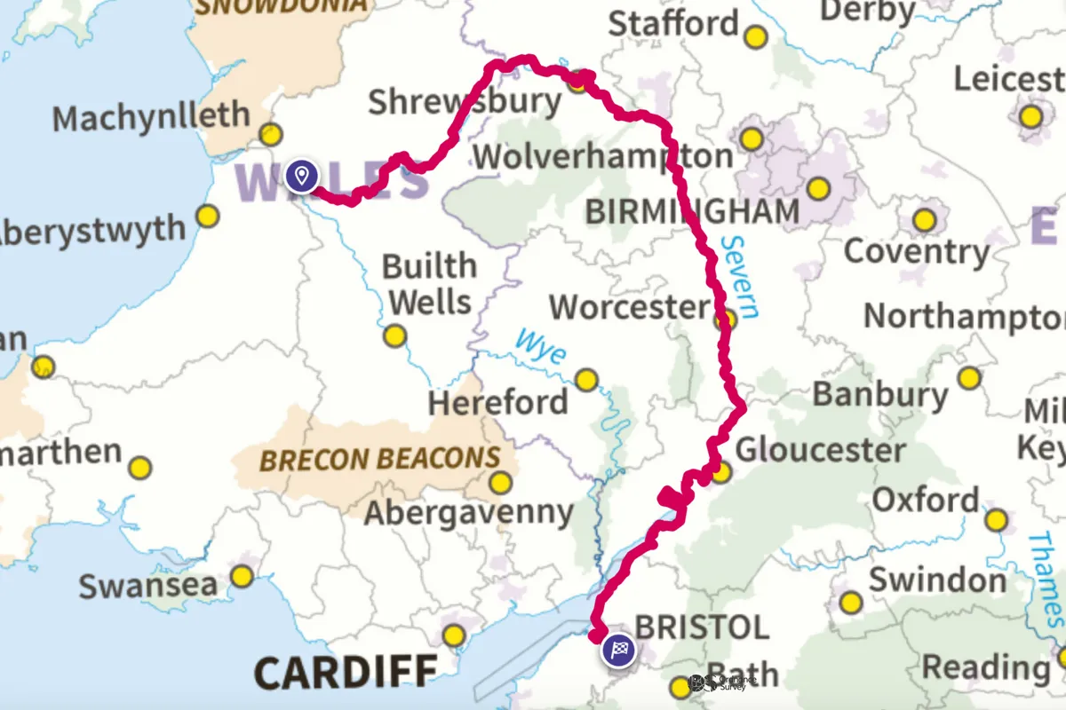
Severn Way
220 miles
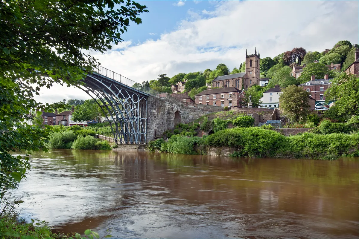
The big one. Britain’s longest river curls round in a mighty arc from mid-Wales into the west midlands of England. Rising up on the heather-clad flanks of Plynlimon – the highest of the Cambrian Mountains – it flows into the Bristol Channel at Severn Beach in Gloucestershire. The Severn Way is a challenging hike of 210 miles across some glorious hilly countryside, along the Montgomeryshire Canal and through the Severn Gorge. The river’s influence on the Industrial Revolution can be experienced at the Ironbridge Gorge World Heritage Site where you can also stay in an excellent YHA hostel.
Severn Way walking route and map
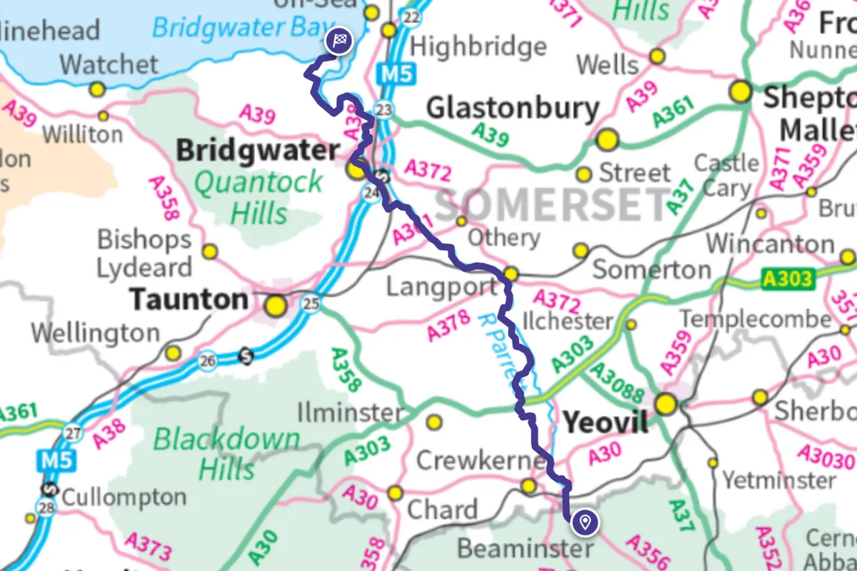
River Parrett Trail
50 miles
Created by a consortium of arts and government bodies, this pathway along the length of the Parrett from Chedington in Dorset to Bridgwater Bay in Somerset is lined with artworks. Heading roughly north-west for 50 miles, walkers will also enjoy picture-postcard villages, stunning moorland, the Somerset Levels and bird-rich wetland before they arrive at the historic market town of Bridgwater. Journey into the past at Muchelney Abbey, spot Civil War battle sites and stop in at the Langport Arms Hotel – built in 1420 – where you’ll also be well victualled and quartered.
River Parrett Trail walking route and map
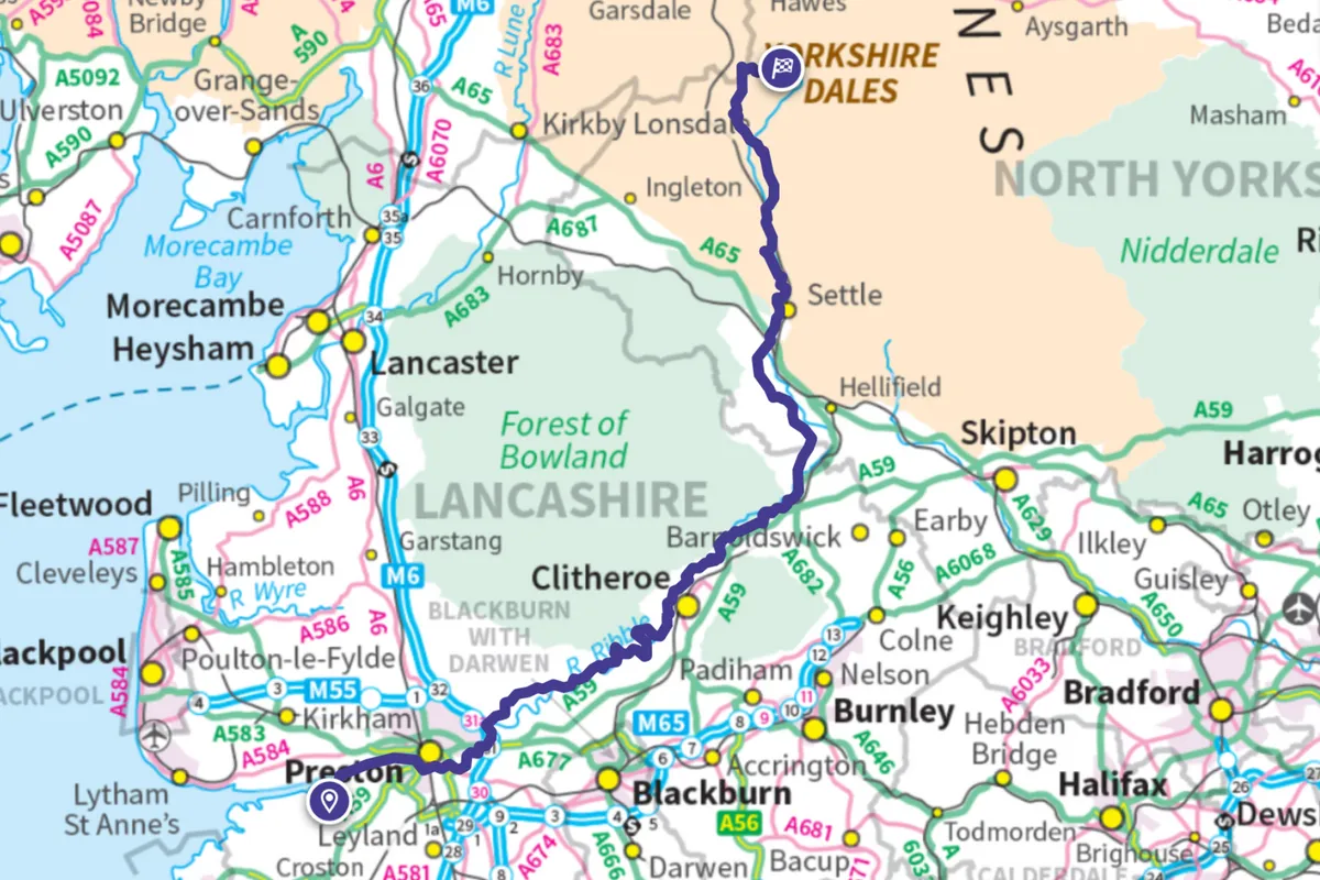
Ribble Way
71 miles
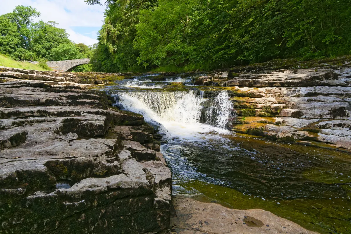
Popularly walked from sea to source, this roughly 71-mile (no one seems to know the exact length) waymarked trail begins in tidal marshes near the village of Longton. Climbing slowly, it slips past Preston and through Ribchester – a village founded in the Bronze Age – and on to Clitheroe with its fine castle. Refreshment can be had in Settle and Horton-in-Ribblesdale, where you can also stay at the cosy Three Peaks Bunkroom. Finally, the path heads up on to Gayle Moor, where the River Ribble emerges from the rocky Pennine soil in the shadow of the famous Yorkshire Three Peaks.
Ribble Way walking route and map
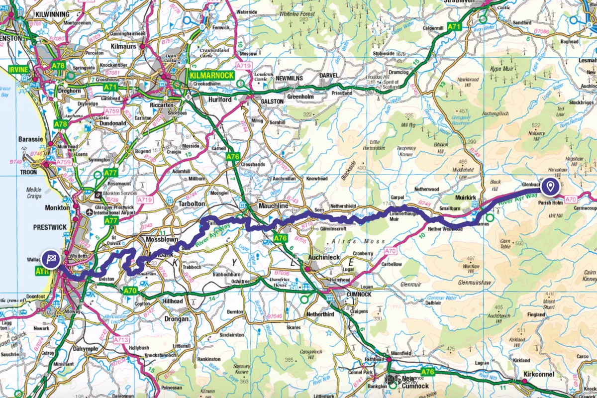
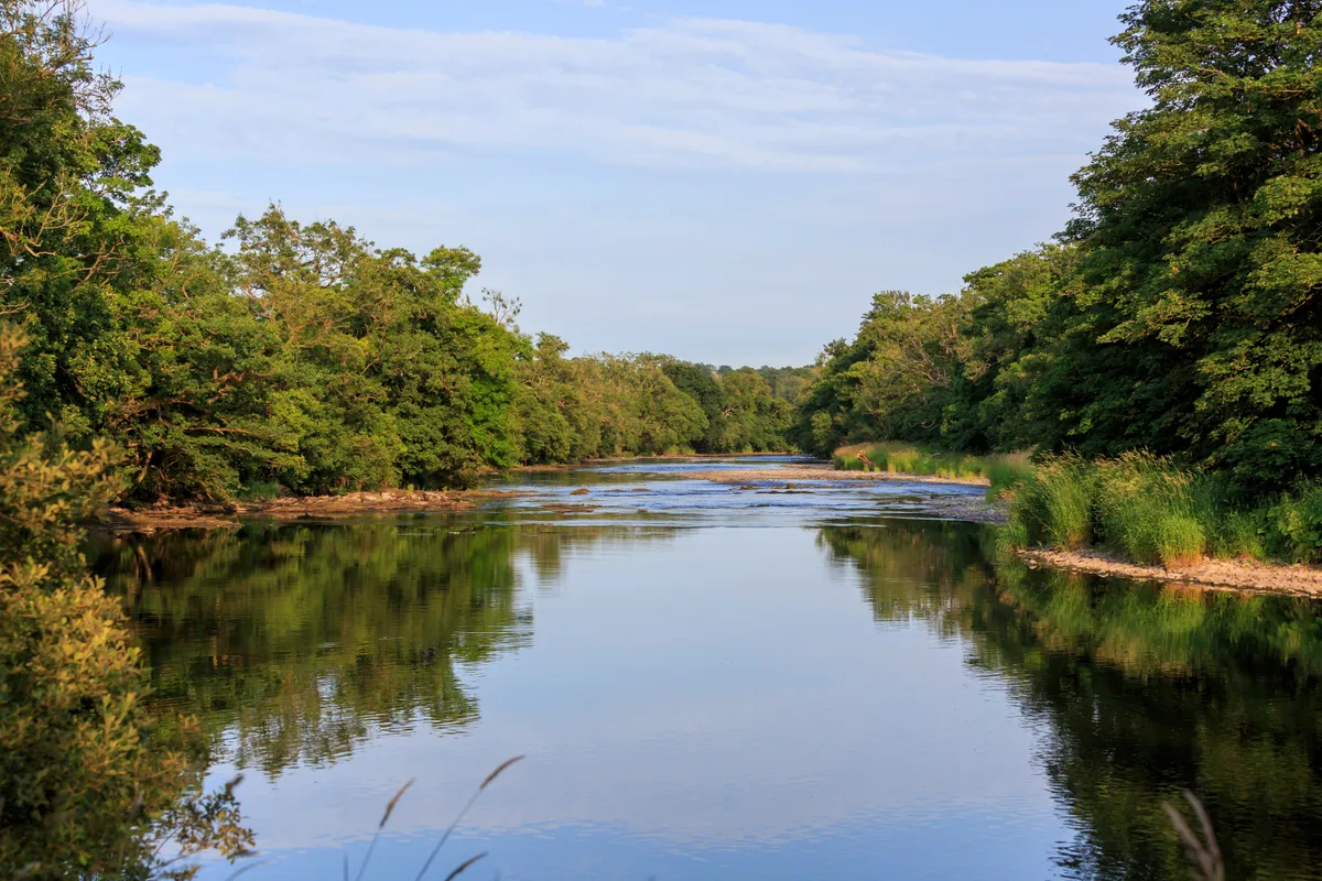
River Ayr Way
41 miles
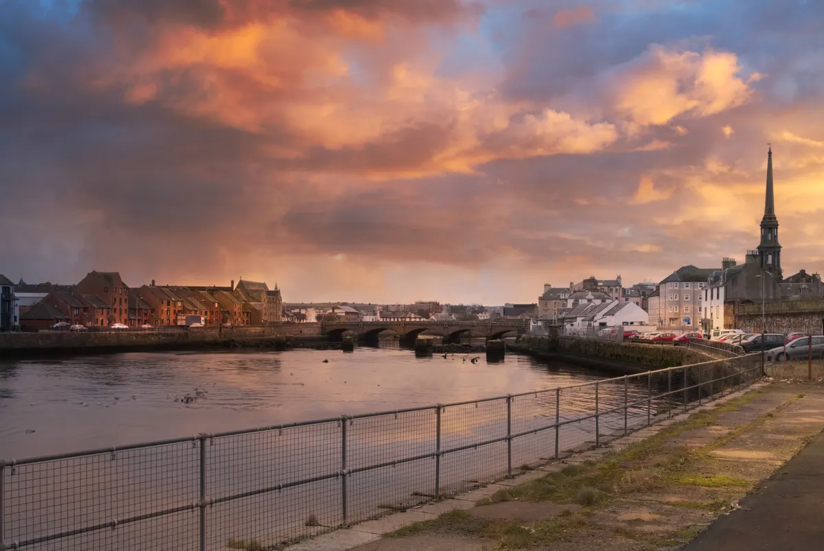
At just 41 miles in length and offering some easy walking through gentle countryside, this path is a good beginners’ source-to-sea route before taking on the more challenging riverside trails. From its picturesque genesis at Glenbuck Loch in South Lanarkshire, the footpath begins by piggybacking a disused railway. It passes through a landscape of untamed moorland, sandstone gorges and open farmland well known to Robert Burns, before reaching the sea at the county town of Ayr. En route, the Fairburn Hotel at Mauchline makes for very comfortable lodgings to rest your limbs.
River Ayr Way walking route and map
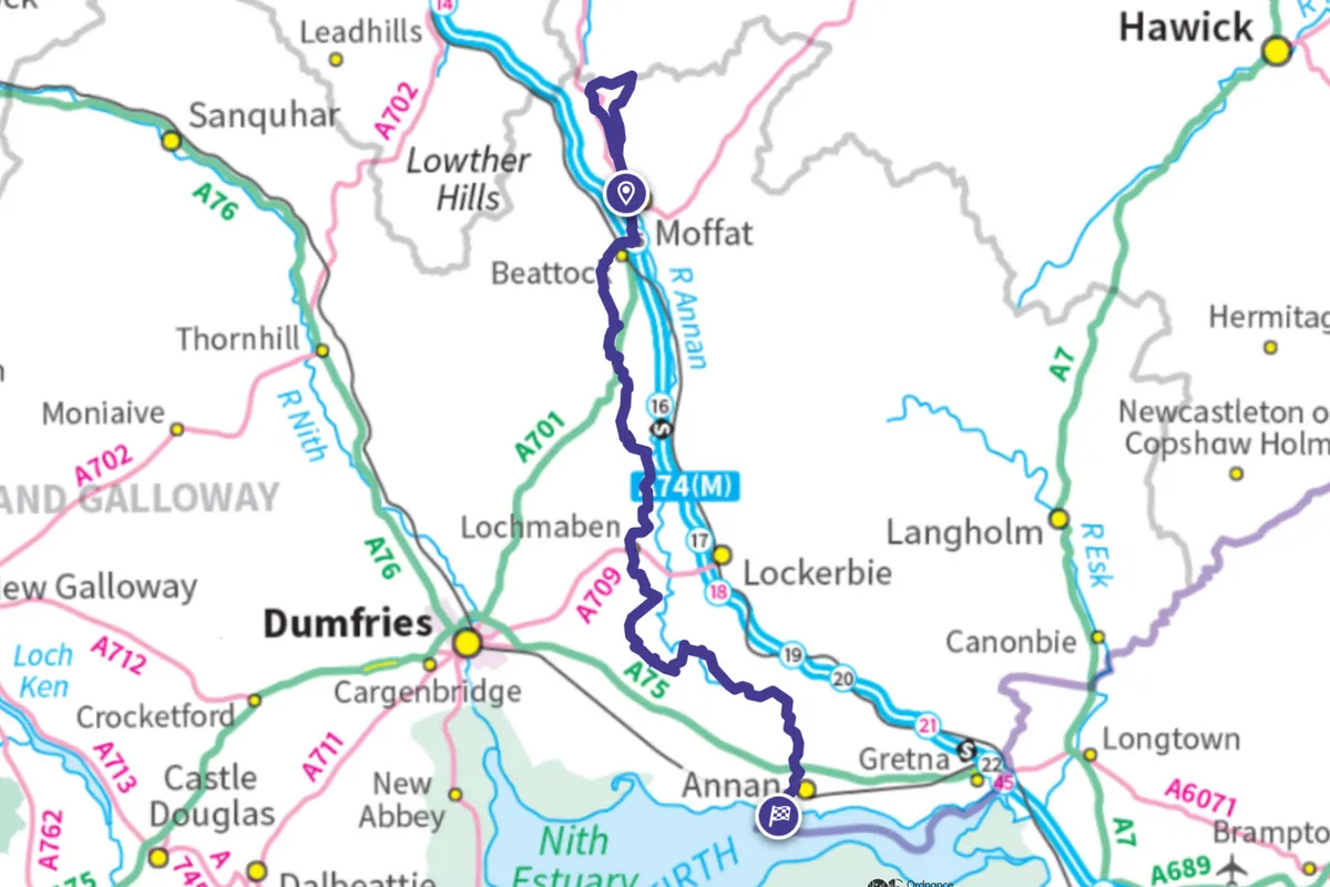
Annandale Way
55 miles
The evocatively named Devil’s Beef Tub, a spectacular hollow in Dumfries and Galloway’s Moffat Hills, provides not one but two sources for the River Annan. At just 55 miles in length, the waymarked river path can be walked in four or five days, stopping at conveniently located little communities along the way, such as Johnstonebridge, Lochmaben, Lockerbie and Annan – where The Old Rectory is a firm favourite with travellers. Look out for the trail’s many ‘Voice of the River’ information boards covering the history, ecology and wildlife of the Annan. Journey’s end is the Solway Firth at Gretna Green, right on the border with England.
Annadale Way walking route and map
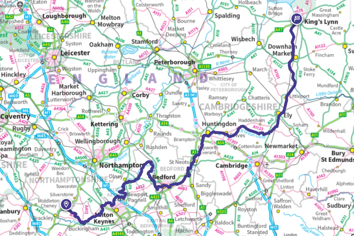
Ouse Valley Way
150 miles
Not to be confused with its Sussex or Yorkshire counterparts, this 150-mile trail follows the entire River Great Ouse from near Syresham in Northamptonshire to Norfolk’s Kings Lynn where the waterway flows into The Wash. County-baggers will also chalk up Buckinghamshire, Bedfordshire and Cambridgeshire, and take in Stowe Park, the 800-year-old market town of Huntingdon, Ely Cathedral and the big skies of the Fens. While in Ely, do drop in at Peacocks, a gorgeous wisteria-clad tearoom and B&B that’s just a stone’s throw from the river.
Ouse Valley Way walking route and map
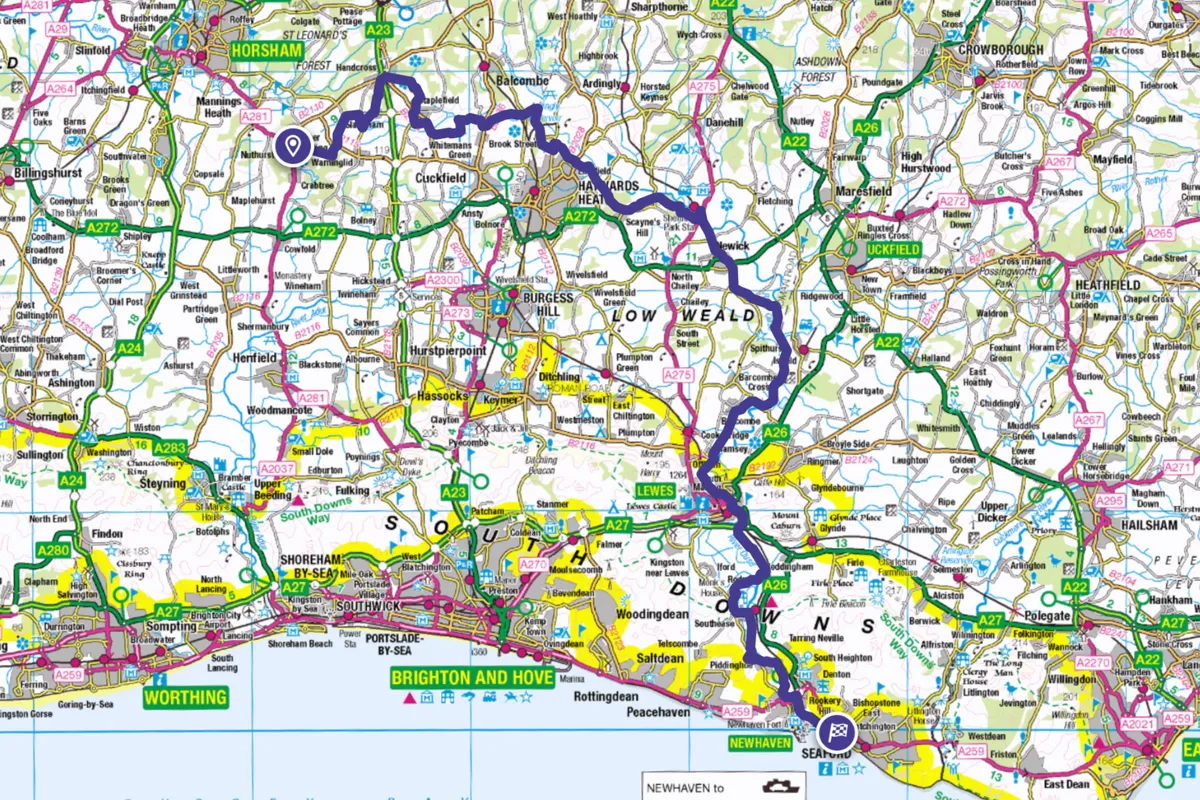
Sussex Ouse Valley Way
42 miles
The 42-mile Sussex Ouse Valley Way (so called to distinguish it from Britain’s other Ouses) opened in 2005, the brainchild of slow-travel enthusiasts Terry Owen and Peter Anderson. They’ve done a fine job too, for the route rarely strays long from the river. From Lower Beeding near Horsham in West Sussex, pass woods, farms, the 450m-long Ouse Valley Viaduct and the heritage Bluebell Railway before weaving through the South Downs and following the Ouse as it flows boldly into the sea at Newhaven.
Sussex Ouse Valley Way walking route and map